Ruine Hirschstein: A Medieval Hilltop Castle Ruin in Germany


Site at a Glance
- Rating
- 4.7
- Popularity
- Very Low
- Country
- Germany
- Primary era
- Medieval
- Eras represented
- Medieval
- Civilizations
- Holy Roman Empire
- Site type
- Military
- Remains
- Castle
On this page6 sections
History
Ruine Hirschstein is a medieval hilltop castle ruin in Germany, located on the Großer Kornberg in the Fichtelgebirge of Bavaria. The castle is documented from 1223, while ceramic finds indicate occupation during the thirteenth and fourteenth centuries. Its elevated position belonged to a high castle, a fortified site built on raised ground, often using a rocky summit or outcrop for defense.
The castle and the von Hirschberg family
In 1317, Count Berthold von Henneberg formally granted five brothers of the von Hirschberg family, a medieval German noble family, several properties. Heinrich, Friedrich, Arnold, Eberhart, and Heymann received, among other holdings, the “house” on the Kornberg. This grant placed the castle within the family’s possessions and obligations through an enfeoffment, the medieval practice of granting property or rights in return for service and allegiance.
Ruine Hirschstein was destroyed around the middle of the fourteenth century, probably during action by the Nuremberg burgrave against its inhabitants. A burgrave was a military and administrative governor with authority over a fortified town or territory. In 1361, Burgrave Friedrich of Nuremberg permitted the Hirschberg family to rebuild the castle. Despite several permissions to reconstruct it, Hirschstein remained a ruin, and the family transferred its residence to Grünstein Castle.
Later use and historical memory
After its destruction, the ruin served as a lookout post. During the Thirty Years’ War, the major European conflict fought mainly from 1618 to 1648 amid religious, dynastic, and political struggles, local people used the remains and the former castle’s vaults as a refuge. In the eighteenth century, a margrave ordered the vaults to be filled because people described in period wording with an outdated and derogatory term, along with others called “disreputable,” had taken shelter there.
The legend of the “Griffin Castle” probably refers to Hirschstein. The ruin was sketched and surveyed in 1783 by Johann Christoph Stierlein, an eighteenth-century surveyor and cartographer. Johann Theodor Benjamin Helfrecht, a writer on the history and antiquities of the Fichtelgebirge, also described the site.
A boundary stone known as the Markgrafenstein dates from 1742. It marked the boundary between the margravial territory of Friedrich of Brandenburg-Bayreuth and Kirchenlamitz, preserving evidence of the territorial divisions around the former castle.
Remains
Rocky hilltop masonry
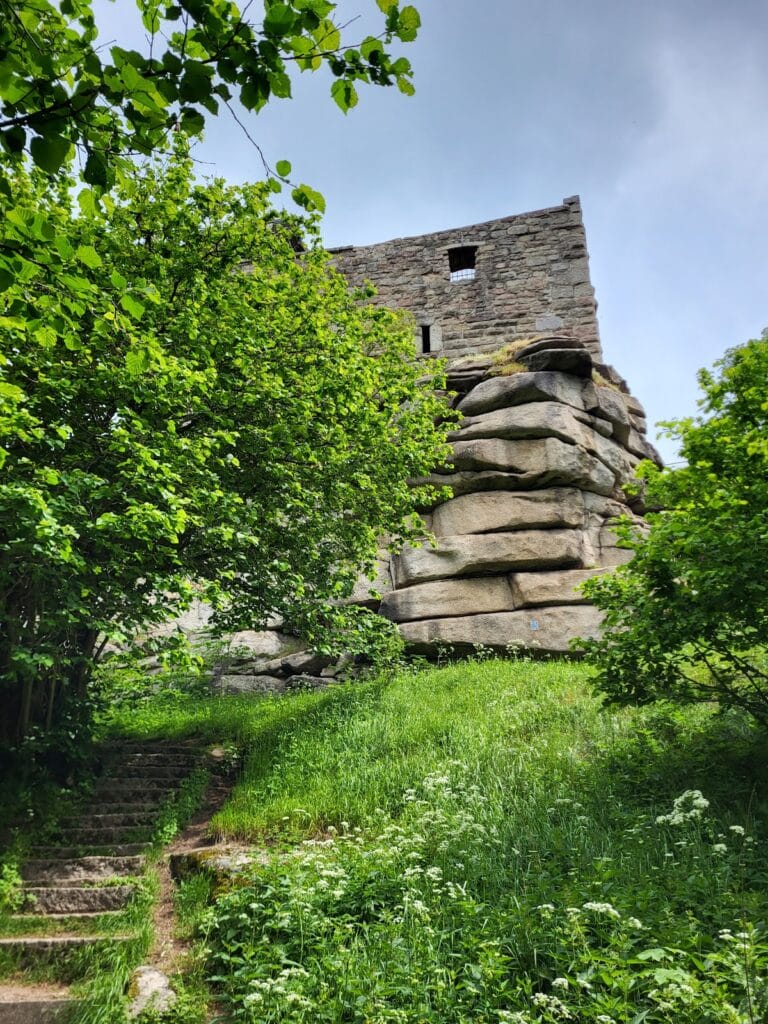
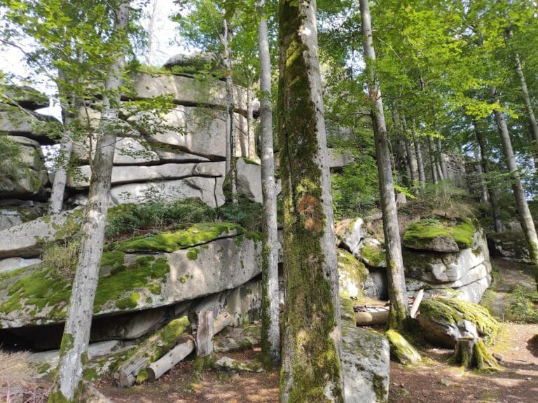
Ruine Hirschstein occupies a rocky outcrop at approximately 744 metres above sea level on the Großer Kornberg, within the urban area of Schwarzenbach an der Saale in Bavaria. The surviving castle fabric consists of ruined walls and other fragments of masonry. The main wall was built from roughly dressed granite blocks laid without mortar, a construction method suited to the granite formations of the Fichtelgebirge.
A surviving section of the former main building extends for 12 metres, turns at a right angle, and continues for another 6 metres. The wall stands up to 4 metres high. Additional wall remains are visible across the ruin, together with indications of the foundation of a square tower. These fragments preserve parts of the castle’s former building arrangement on the rocky summit.
Markgrafenstein
The Markgrafenstein is a surviving boundary stone positioned 250 metres north of the ruin beside a hiking path. Dating from 1742, it marks the former boundary between the territory of Friedrich of Brandenburg-Bayreuth and Kirchenlamitz, linking the physical remains around Hirschstein with the eighteenth-century political landscape.
Nearby sites