Roman Aqueducts of Zaghouan-Carthage: Carthage’s Roman Water-Supply System



Site at a Glance
- Rating
- 4.6
- Popularity
- Very Low
- Country
- Tunisia
- Primary era
- Classical
- Eras represented
- Classical, Medieval, Modern
- Civilizations
- Hafsid, Roman
- Site type
- Infrastructure
- Remains
- Aqueduct
On this page14 sections
History
The Roman Aqueducts of Zaghouan-Carthage in Tunisia are a Roman water-supply system that carried spring water from the Zaghouan region to ancient Carthage. Generally placed in the first half of the second century AD, the aqueduct extended for 132 kilometres with its tributary channels and ranks among the longest aqueducts of the Roman Empire. It supplied the city through a carefully controlled gravity-fed route and remained important through Roman, medieval, and modern periods.
Construction and Roman expansion
The precise date of construction is uncertain. One possible stimulus was a five-year drought that ended during Emperor Hadrian’s visit to the region in AD 128. Hadrian ruled the Roman Empire from AD 117 to 138, and the drought may have shown the limits of Carthage’s dependence on stored rainwater. Another possible stimulus was the opening of the Baths of Antoninus in Carthage in AD 162. The large bathing complex, associated with the emperor Antoninus Pius, required a reliable and abundant water supply.
The main source lay at Djebel Zaghouan, about 60 kilometres south of Carthage, where the Romans built a major sacred fountain over the spring. Several springs were connected to the system at different times. During the Severan period, the late second- and early third-century rule of the Severan dynasty, a second source in the Djouggar region joined the network. Its branch reached the main aqueduct at Moghrane and measured 33 kilometres, while the complete system, including its tributary channels, reached 132 kilometres.
Destruction and restoration
The aqueduct suffered repeated destruction during major political and military upheavals. It was damaged during the Vandal siege of Carthage in 439, during the Eastern Roman reconquest under Emperor Justinian, and again when Arab forces captured Carthage in 698. Justinian ruled from AD 527 to 565, during a period when the Eastern Roman Empire recovered parts of the former Western Roman Empire. The water system was restored after each of these destructions.
In the thirteenth century, a Hafsid ruler added a branch serving his palace in the Manouba plain and used it to irrigate the palace gardens. The Hafsids were a medieval Muslim dynasty that ruled Ifriqiya, including the region of Tunis, from the thirteenth to the sixteenth century. From the sixteenth century onward, the aqueduct deteriorated rapidly, and its masonry was also quarried for building stone.
Modern water supply and natural habitat
In 1859, a French engineer was commissioned to restore the water supply of Tunis. Ground-level sections could largely be reused, but the elevated portions carried on pillars had been mostly destroyed. These sections were replaced with a modern pressurized-pipe system, which entered service in 1862. The restored system remains in use, supplying an average of about 12 million litres of water per day in winter and 3 million litres per day in summer.
The surviving cavities and openings in the aqueduct’s pillars and arches also support nesting and roosting birds. A 40-hectare strip along the structure near the Miliane River is classified as an Important Bird Area, a site identified as important for conserving bird populations or habitats. The strip lies among cereal fields and a hunting reserve and regularly supports about 30 pairs of lesser kestrels, a species of global conservation concern.
Remains
The surviving aqueduct combines spring sanctuaries, covered water channels, low ground-level sections, large arcades, bridges, and reservoirs associated with Carthage’s water supply. Its construction used Roman concrete, masonry, waterproof mortar, vaults, and carefully graded channels. The route descended continuously from the Zaghouan springs toward Carthage, allowing gravity to carry the water over more than 90 kilometres with only 264 metres of total fall.
The Zaghouan spring sanctuary
The principal spring sanctuary at Djebel Zaghouan occupied an artificial terrace and opened toward the north. Its southern side enclosed an open space within a crescent-shaped portico, a covered colonnade about four metres wide. A central cella, the main chamber of a sanctuary, stood within the portico, with the principal spring emerging beneath it.
The sanctuary’s outer wall had a core of Roman concrete, known as opus caementitium, faced with roughly projecting limestone blocks. The wall extended from the ends of the crescent-shaped portico and was divided into 26 sections by engaged columns, which were columns partly attached to the wall. Every second section held a statue niche. The statues have not survived, although fragments from the side niches are now in the Bardo Museum in Tunis.
Full columns stood opposite the engaged columns and supported a vaulted peristyle, a space enclosed by columns. The vaults were made from porous travertine faced with marble, while the columns were sandstone. Their outer surfaces were sealed with opus signinum, a waterproof Roman mortar used in water channels and tanks. The portico floor carried mosaic decoration, and the limestone cella was clad in marble.
Five springs emerged within the sanctuary. Their original underground channels continued beneath the artificial terrace, and the water collected in a basin below. This basin both fed the aqueduct and helped clarify the water by allowing impurities to settle before it entered the conduit.
Conduit and elevated crossings
From Zaghouan to Carthage, the aqueduct followed a continuous but uneven decline. The first six kilometres to Moghrane accounted for 130 metres of the total descent, while the average gradient beyond Moghrane was about 0.15 percent. Wherever possible, the channel lay on or just below the ground and followed hill contours to preserve its elevation. Water moved entirely by gravity.
The covered channel measured about 90 centimetres wide and 130 centimetres high. Its walls consisted of Roman concrete faced with sandstone bossage, masonry whose blocks have deliberately projecting or roughly finished outer faces. Several layers of opus signinum lined the water-bearing surface, providing waterproofing and helping regulate the gradient. Small square roof openings supplied ventilation, while regularly spaced circular depressions in the floor collected sediment and debris for inspection and cleaning.
Oued Miliane arcades
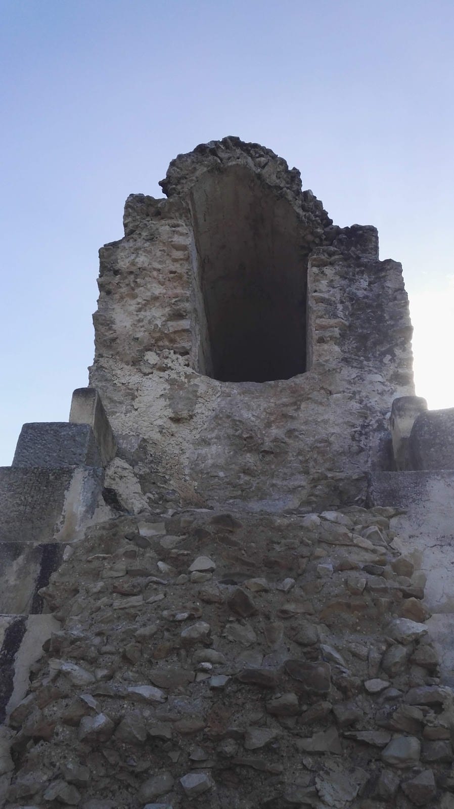
The most substantial elevated section lay in the plain of Oued Miliane near Oudna and Mohamedia. It extended for five kilometres and included a bridge of roughly 125 metres over the Miliane River. The bridge stood on a double arcade, a row of arches, that reached 33 metres in height. This Oudna and Mohamedia section is the best-preserved part of the aqueduct. The river bridge itself was demolished in 1859 so that its stone could be reused in a new bridge.
Oued Ellil and La Soukra
A second elevated section crossed Oued Ellil for two kilometres, with arcades reaching 20 metres. Before Carthage, the aqueduct crossed the plain of La Soukra on another elevated section ten kilometres long, where the arcades also reached 20 metres. These raised structures carried the channel across low ground while maintaining the gradual fall required for gravity flow.
Water flow and the Carthage end
The aqueduct carried between 200 and 370 litres per second, equivalent to about 17 to 32 million litres per day. Depending on the gradient, water traveled at approximately 3.5 to 5.5 kilometres per hour and took about one and a half to two days to reach Carthage from Zaghouan. The final arrangement within the city remains uncertain. The channel appears to have discharged into two cisterns, or water-storage reservoirs, from which water was redistributed, but excavations have not securely established the discharge connections.
Very little standing masonry survives in the Carthage section. Much of it was destroyed from the seventeenth century onward, and fragments of the aqueduct cross the airfield of Tunis airport. The surviving evidence nevertheless links the long rural conduit with the reservoirs that managed water within the ancient city.
Carthage reservoirs
La Malga cisterns
The cisterns of La Malga are among the largest surviving cisterns of the ancient world, with a capacity of approximately 51 million litres. Their mortar places them in the first century AD, before the aqueduct was built. Their original purpose remains unclear, because their enormous capacity could not have been filled by rainfall alone. They form an important part of the water-storage landscape associated with ancient Carthage.
Bordj Djedid cistern
The cistern of Bordj Djedid consists of 18 parallel basins covered by barrel vaults and held approximately 25 to 30 million litres. Its construction date is unknown, but alterations connected with the construction of the Baths of Antoninus show that it predates the baths. The cistern supplied the bathing complex and lies within the grounds of the presidential palace.
Wildlife in the surviving masonry
Cavities and holes in the remaining pillars and arches provide nesting and roosting places for lesser kestrels, Lanner falcons, common kestrels, European rollers, rock sparrows, spotless starlings, and common ravens. These spaces, formed within the surviving masonry, are part of the aqueduct’s present physical and ecological character.