Baelo Claudia: A Roman Town and Maritime Port in Spain



Site at a Glance
- Rating
- 4.6
- Popularity
- High
- Country
- Spain
- Primary era
- Classical
- External website
- Open
- Eras represented
- Iron Age, Classical
- Civilizations
- Carthaginian, Phoenician, Roman
- Site type
- City
On this page15 sections
History
Baelo Claudia is a Roman town in Spain, founded at the end of the second century BC on or near an earlier Phoenician, Carthaginian, and Bastulo-Punic settlement. Located at Ensenada de Bolonia on the northern shore of the Strait of Gibraltar, it developed as a maritime port linking the Iberian Peninsula with Tangier and North Africa.
Foundation and commercial growth
The earlier settlement was associated with the names Bailo and Baelokun. Under Roman rule, Baelo Claudia became closely connected with the seasonal movement of tuna between the Atlantic Ocean and the Mediterranean. Tuna fishing, fish salting, and the manufacture of garum, a fermented fish sauce made with salt, formed the principal basis of the town’s wealth. Its position also points to possible administrative functions.
Baelo Claudia prospered most between the first century BC and the second century AD. Fish-salting and garum production brought seasonal workers to the town during the summer, affecting the use of some buildings. Amphorae found at the site, together with Hispanic amphorae recorded in imperial deposits at Rome, demonstrate intensive trade. Preserved fish products were shipped to major Mediterranean ports.
Municipal status and later decline
Emperor Claudius granted Baelo Claudia the status of a municipium, a Roman municipal community with defined civic rights and local government within the Roman administrative system. The town’s name later seems to have changed to Belona, then Balonia, before giving rise to the modern place-name Bolonia.
Decline began during the middle or later part of the second century. A major seismic disaster damaged or destroyed much of the town and was associated with a tsunami or sea surge. Later crises and incursions by Germanic and North African or Mauritanian groups further worsened its condition. The settlement experienced a limited revival, and commercial relations continued into the fifth century, but Baelo Claudia was ultimately abandoned by the seventh century.
Rediscovery and archaeological study
Scholars and travelers rediscovered the ruins during the eighteenth century. Excavations began in 1917 and continued alongside research into the town’s history, with Jorge Bonsor playing an important role in recovering the archaeological site. Baelo Claudia was declared a national monument in 1925 and later received cultural-heritage protection as an archaeological zone. It is now included within El Estrecho Natural Park.
Archaeological work by the University of Cádiz has produced discoveries including a copy of Polykleitos’ Doryphoros, described as the only copy of this statue found in Hispania, and a tomb identified as belonging to a noblewoman. A museum has formed part of the archaeological complex’s institutional headquarters and visitor center since 2007. Designed by Guillermo Vázquez Consuegra, it accompanies the ruins without replacing their archaeological character. Between 2010 and 2013, a landscape-conservation project addressed the wider Bay of Bolonia. Together, the remains preserve the most complete surviving view of Roman urbanism in the Iberian Peninsula.
Remains
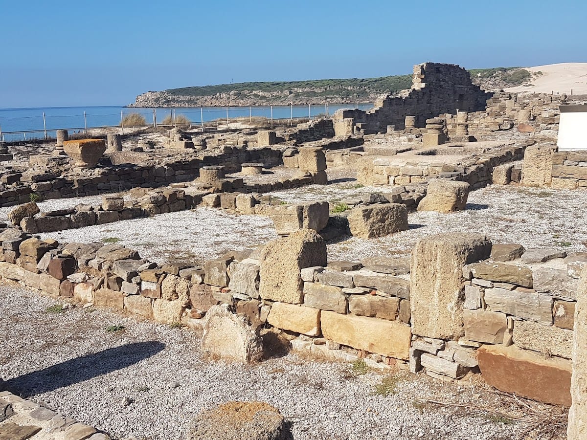
The archaeological complex covers approximately 10 hectares between the sea and the mountain ranges of La Plata and San Bartolomé. Its streets follow an orthogonal plan, with straight lines crossing at right angles. The east-west decumanus maximus and north-south cardo maximus formed the principal avenues, and the forum stood close to their intersection. The city was enclosed by a wall that adapted to the ground and to two streams supplying fresh water. Four aqueducts, streets, sewers, industrial installations, and several monumental gates formed part of the urban infrastructure.
Urban enclosure and streets
The city wall was built under Augustus and reinforced under Nero. Relatively thin construction suggests that it primarily defined and organized the urban area rather than serving as a major military defense. Approximately forty towers marked its circuit. The decumanus maximus extended toward entrances at both ends, including the East Gate, also known as the Gate of Carteia. Other documented entrances were the west gate toward Gades and the north Asido Gate. The enclosure is also described as having five monumental gates.
Forum and religious buildings
The forum occupied about 3,750 square metres near the crossing of the two main streets. Its open plaza made up roughly one-third of the complex. Established under Augustus and given its surviving form during the reigns of Claudius and Nero, it is the best-preserved forum in the Iberian Peninsula. Porticoes opened the space toward the decumanus maximus on the east and west, while shops stood to the east, administrative buildings to the west, the basilica to the south, and a monumental fountain to the north. Original Tarifa stone paving slabs from the first century remain in the square.
Capitolium
The Capitolium occupied the north side of the forum on higher ground. Built between AD 50 and 70, it consisted of three temples dedicated to Jupiter, Juno, and Minerva, the three chief gods of Rome’s state religion. Jupiter’s temple stood in the center. Each temple had nearly identical dimensions, its own podium and stairway, narrow passages separating it from the others, and a four-column façade. Statues of the deities stood inside, while worship took place at small altars outside.
Temple of Isis
At the forum’s northeast corner are the remains of a temple to Isis, an Egyptian goddess whose cult spread throughout the Roman Mediterranean. The building measured approximately 29.85 by 17.70 metres and was constructed around AD 70. Its public area contained the cella, or principal shrine room, while a private section served the priests. Two plaques on the access staircase attest to its dedication.
Basilica
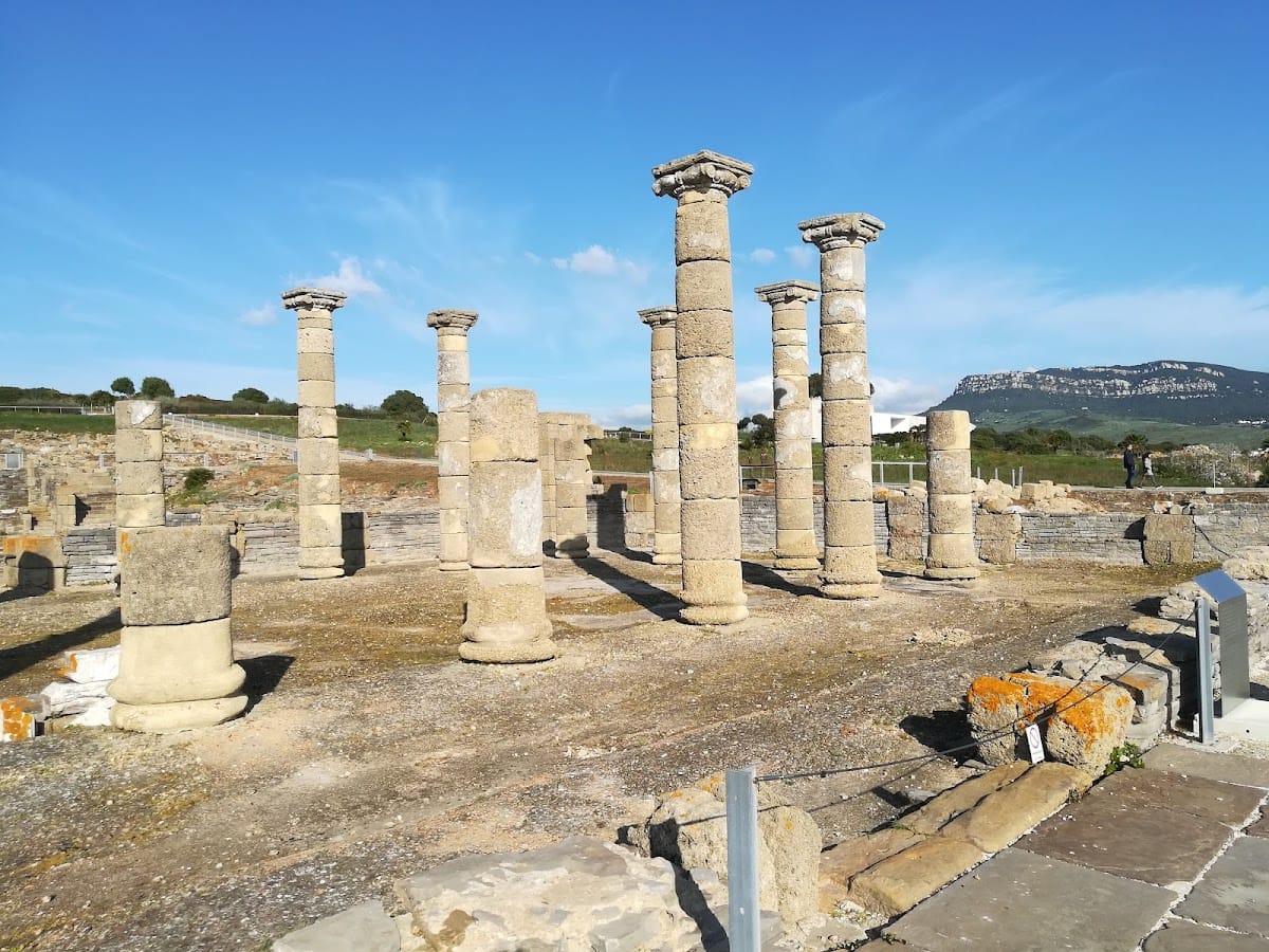
The basilica stood on the south side of the forum, opposite the temples. Built between AD 50 and 70, it covered nearly 600 square metres and had a rectangular plan measuring approximately 19.5 by 35.5 metres. This large public building served chiefly as a courthouse, while also accommodating imperial worship, commercial exchanges, and meetings. Painted stucco decorated its walls. A large columned courtyard had twenty columns arranged on two levels, of which the lower level survives. A statue of Emperor Trajan, more than three metres high, presided over the building.
Macellum and administrative buildings
During the first century AD, the forum became primarily institutional rather than commercial. This change led to the construction of a separate macellum, a purpose-built Roman food market, southwest of the forum. The market had a porticoed layout on two levels, fourteen small shops, and an inner courtyard. Goods were displayed outside the shops, which could be closed at night. A central chapel probably held a statue of Mercury. Only the foundations of the porticoed structure survive. The forum’s administrative quarter included the curia, or local senate house, and a municipal archive.
Industrial quarter and coastal production
Three fish-salting workshops survive in the industrial quarter immediately beside the sea. They were used chiefly for salting tuna and preparing garum. The best-preserved workshop retains workrooms, a freshwater well, and basins sunk into the floor. Fish flesh was cut into cubes and placed in successive layers with salt in the basins for about twenty days, allowing fermentation to finish. The product was then stored in amphorae for transport. Large porticoed residences nearby probably belonged to workshop owners or served as related buildings.
Theater and baths
Theater
The theater stood west of the town near the wall, with the slope of a hill supporting its seating. Built at the end of the first century, it could accommodate approximately 2,000 spectators. Its theatrical use appears to have ended at the close of the second century, after which the building was reused as a necropolis, a designated cemetery or “city of the dead.” Seven entrance passages remain beneath the partly preserved seating, along with the lower portions of the stage façade. That stage wall measured about 67 metres in length and 15 metres in height. Male actors performed both male and female roles, using masks suited to their characters.
Baths
The baths were constructed between the end of the first century and the beginning of the second century and remained in use until the end of the fourth century. Located southeast of the archaeological area beside the decumanus maximus and the city wall, they have been only partly excavated. Their rooms included a caldarium, or hot room, a tepidarium, or warm room, and a frigidarium, or cold room. Their identification as the town’s principal public baths remains uncertain, since they may instead have belonged to the residence of a member of the local oligarchy.