Kodak Fortress: A Polish-Cossack Stronghold in Ukraine
Site at a Glance
- Rating
- 4.7
- Popularity
- Medium
- Country
- Ukraine
- Primary era
- Early Modern
- External website
- Open
- Eras represented
- Early Modern
- Civilizations
- Polish–Lithuanian Commonwealth
- Site type
- Military
- Remains
- Fort
On this page10 sections
History
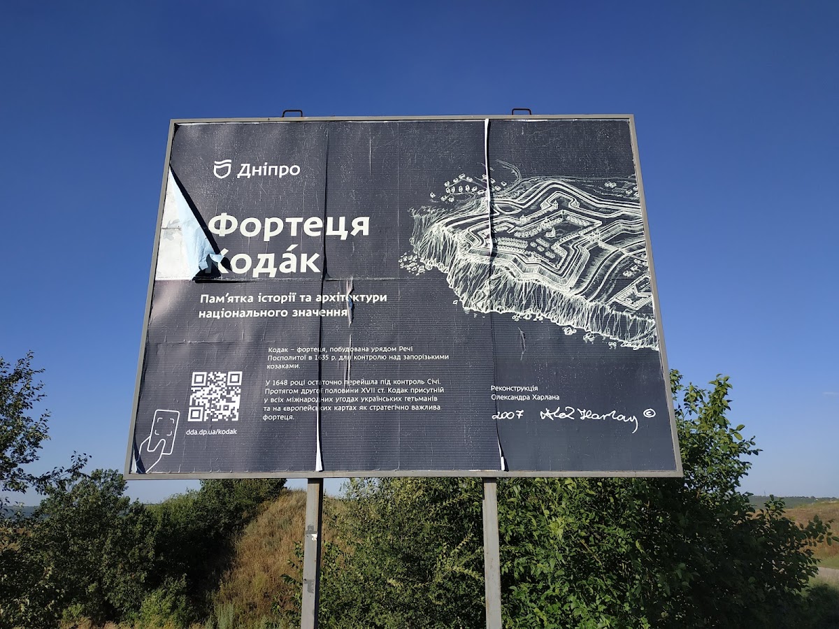
Kodak Fortress is a ruined early-modern Polish fortress in Ukraine, founded in July 1635 on the rocky right bank of the Dnieper near present-day Old Kodaks. Built after the Polish–Moscow peace treaty of 1634, it was intended to control the Zaporizhzhian Cossacks, isolate the Zaporizhzhian Sich, restrict movement toward the Black Sea, discourage peasants and other commoners from fleeing to the Cossack territory, and help guard against Tatar raids. Contemporaries called it the “key to Zaporizhzhia.”
Foundation and first destruction
Crown Hetman Stanislaw Koniecpolski, a senior military commander of the Polish Crown, initiated the project, and the Polish Sejm, the representative assembly of the Polish–Lithuanian Commonwealth, approved 100,000 Polish zlotys for its construction. The French military engineer Guillaume Le Vasseur de Beauplan directed the first fort, which received a garrison of 200 German mercenary dragoons. Dragoons were mounted soldiers trained to fight on horseback and on foot. Their commander was the French officer Jean Marion.
On the night of 17–18 August 1635, Zaporizhzhian Cossacks led by Ivan Sulima captured Kodak. Marion was executed, the fort was partly destroyed, and most of the garrison was killed. Fifteen dragoons survived because they were away on reconnaissance when the attack took place.
Reconstruction and expansion
The Polish Sejm ordered the fortress rebuilt in 1636, but financial difficulties delayed completion until August 1639. The enlarged complex was constructed under Friedrich Getkant, an engineer described as German or Swedish. In 1638, supervision had been entrusted to Daniel Chaplinski. The rebuilt fortress was nearly three times the size of the first fort and followed the New Dutch fortification system, an early-modern approach based on low earthen ramparts, projecting bastions, and broad ditches.
The new garrison contained 600 mercenaries and had stronger artillery. A watchtower stood three kilometres away. About sixty houses and a market formed a settlement beside the fortress, which also included a Catholic church and monastery and an Orthodox church. Jan Zholtovsky served as governor, while Adam Koniecpolski, the founder’s nephew, became commandant. A tradition says that when Stanislaw Koniecpolski asked Bohdan Khmelnytsky whether the fortress was truly impregnable, Khmelnytsky replied in Latin that anything made by human hands could also be destroyed by human hands.
Cossack capture and later military use
During the Khmelnytsky Uprising, a major Cossack-led revolt against Polish–Lithuanian rule that began in 1648, Kodak was taken on 1 October of that year after a four-month siege. The operation was conducted under Bohdan Khmelnytsky’s orders by Cossack forces commanded by the colonels Maksym Nesterenko and Prokop Shumeyko, with Yakiv Vovchenko also associated with the campaign. Kodak then became a strongpoint and rear base for the Ukrainian Cossack army.
The hetmans later administered Kodak directly. It served as a rear military base with a garrison of about 400 men, and around 1656 it passed into the possession of the Zaporizhzhian Sich, the principal fortified political and military centre of the Zaporizhzhian Cossacks. A field church dedicated to Saint Michael the Archangel was transferred there from Mezhyhirsky Monastery, and a guild of Dnieper pilots developed nearby. The settlement was later treated as a town and had a permanent wooden church dedicated to Saint Michael.
Kodak also gathered Russian and Cossack forces and served as a rear base during the Russo-Turkish wars. From 1707 until spring 1708, the Don Cossack leader Kondraty Bulavin stayed there with a detachment. The Zaporizhzhian Sich allowed him to admit rebels, despite Hetman Ivan Mazepa’s order that Bulavin be arrested and taken to Baturyn. Under Mazepa, Kodak itself functioned as a watch post directed against the Sich.
Destruction and settlement history
The Treaty of Pruth, the 1711 settlement that ended a Russo-Turkish war and required Russia to dismantle or surrender southern fortifications, led to Kodak’s destruction in 1711. People continued living beside the ruins, and the fortress was partly restored in the early eighteenth century. Tatars captured it in the 1720s, burned the town, and scattered its population. Kodak was never restored as a fortress.
From 1734 to 1775, the site was a Cossack settlement and the centre of the Kodak palanka, a territorial and administrative district within the Zaporizhzhian Host. The ecclesiastical administration of Old Kodak was transferred there in 1760. After the New Sich was destroyed in 1775, many former Zaporizhzhian Cossacks settled in the area, and by the end of the eighteenth century the settlement had been renamed Old Kodaks.
A permanent community of Dnieper pilots was later established near the former fortress. By order of Grigory Potemkin, 121 people were initially supported to transport boats through the rapids and were exempted from taxes and conscription. Their number later rose to 673 in Old Kodaks and Kamenka. Established in 1787 under Catherine II, the pilots formed a self-governing unit attached to the Russian Ministry of Communications until 1879, when responsibility passed to local institutions.
Archaeology and modern preservation
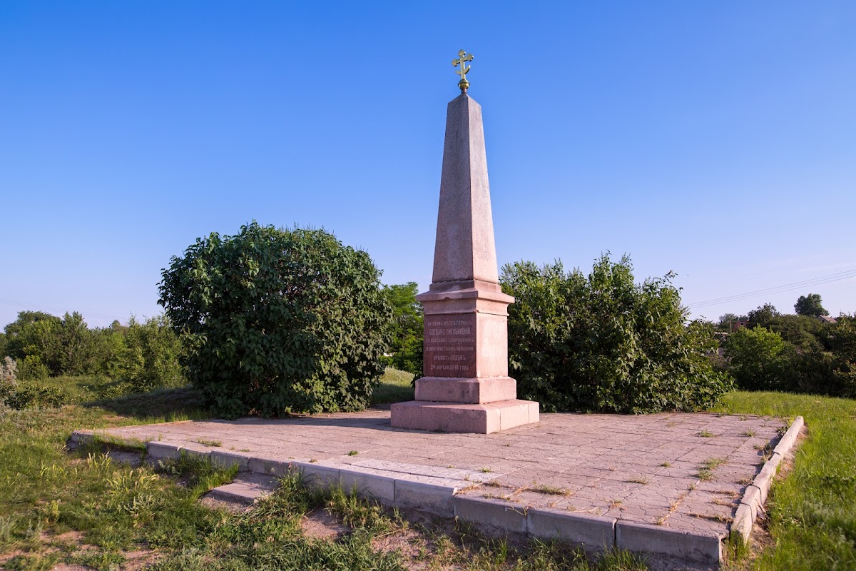
The Ukrainian historian and archaeologist Dmitry Yavornytsky carried out the first archaeological surveys at Kodak in the early twentieth century and initiated a memorial sign in 1910. A granite quarry began destroying the fortress around 1940. Appeals to protect the site in 1938, 1959, and 1970 were disregarded, and quarrying ultimately removed most of the fortress.
In 1990, an expedition from Dnipropetrovsk State University led by Professor I. F. Kovalova excavated the surviving fortress area and its settlement, identifying a Cossack-period cultural layer. Archaeological work resumed in late 2011, although uncontrolled construction had almost entirely destroyed the cultural layer near the fortress. The investigations nevertheless uncovered remains of the Saint Michael the Archangel Church, which had been destroyed in 1937.
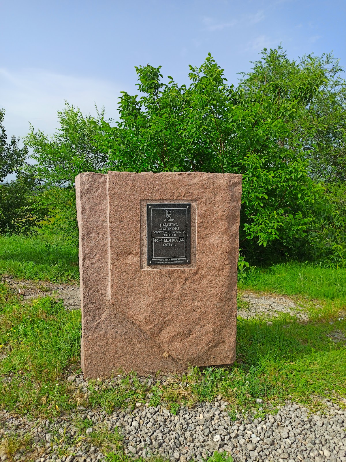
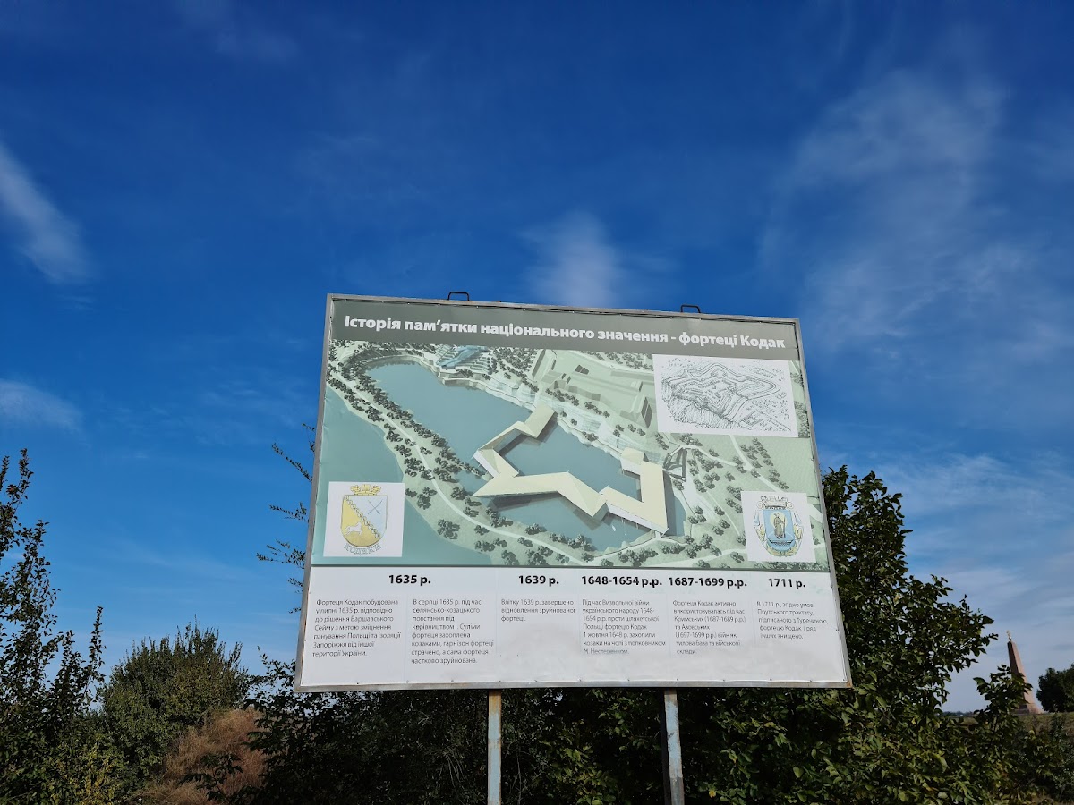
A proposal announced in 2013 called for a museum and cultural complex covering 33 hectares, including nearly 3 hectares occupied by the fortress. It envisaged archaeological examination, clearing and restoration of surviving ramparts and ditches, partial reconstruction of wooden elements, and a museum built on piles over the quarry lake to represent the lost contours along the Dnieper. The proposal remained an interpretation and partial reconstruction rather than a completed rebuilding. Kodak Fortress is listed in Ukraine’s State Register of Immovable Monuments as a cultural-heritage monument of national significance.
Remains
Fortifications and landscape
Kodak stood on the right bank of the Dnieper opposite the Kodak Rapids, below the mouth of the Samara River. Steep river bluffs protected its fourth side, while an earthen rampart and a broad dry ditch defended the other three. The original 1635 fort was a small quadrilateral earthwork with two semi-bastions on its southern side. A semi-bastion was a projecting half-bastion used to strengthen a fort’s defensive fire.
The 1639 fortress formed a square with sides of approximately 112.5 metres. Its outer rampart was about 24 metres wide at the base and 7 metres high, with projecting five-sided bastions and two rows of wooden palisades along the top. A palisade was a defensive barrier made from upright wooden stakes. The ditch measured approximately 11 metres deep and 16 metres wide, and a watchtower stood three kilometres from the main fortress.
Settlement and religious buildings
The rebuilt complex included artillery installations, a Catholic church and monastery, and an Orthodox church. The neighbouring settlement contained about sixty houses and a market. A field church dedicated to Saint Michael the Archangel was later transferred to Kodak, where a permanent wooden church with the same dedication also served the community.
Surviving features and archaeological evidence
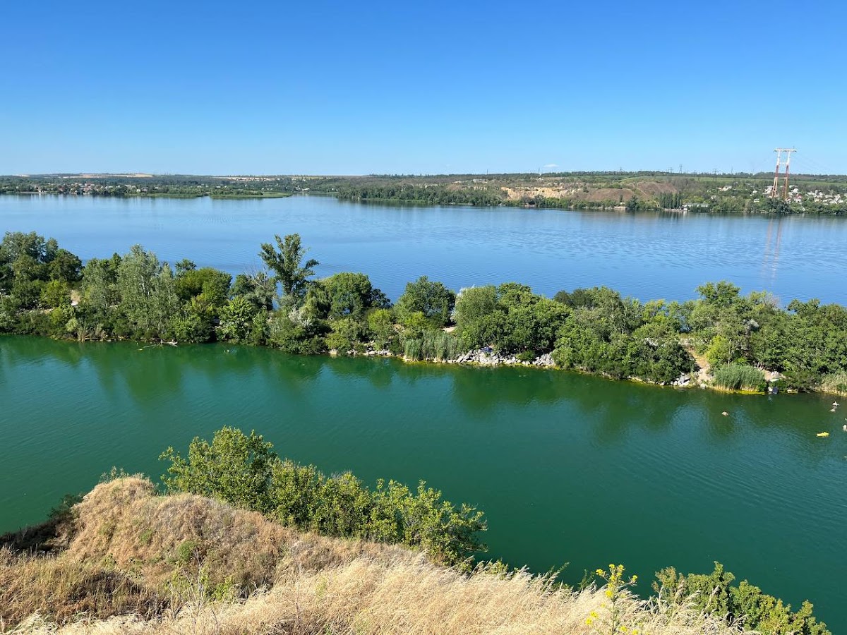
Quarrying destroyed much of the former fortress area, and flooding created a lake in the quarry. Portions of the earthen ramparts survive, with the northern ramparts and the lake forming the principal visible remains. A memorial sign erected in 1910 commemorates the fortress and its capture by Cossack forces associated with Bohdan Khmelnytsky. The site also retains a plan of the former fortress and an accompanying protective information board.
Excavations identified a Cossack-period cultural layer in the surviving fortress and settlement areas. Work in 2011 uncovered the remains of the Saint Michael the Archangel Church, destroyed in 1937. These remains, together with the earthworks and the altered quarry landscape, preserve evidence of Kodak’s changing military, religious, and settlement functions.