Castleshaw Roman Fort: Guarding a Pennine Road
Site at a Glance
- Popularity
- Medium
- Country
- United Kingdom
- Primary era
- Classical
- Eras represented
- Classical
- Civilizations
- Roman
- Site type
- Military
- Remains
- Fort
On this page11 sections
History
Roman military phases
Castleshaw Roman fort is a Roman military site at Castleshaw in the United Kingdom, built around AD 79 in Britannia, the Roman province covering much of Britain. It guarded the road between Deva Victrix (Chester) and Eboracum (York), which crossed the Pennines through the pass at Standedge. The fort probably housed an auxiliary cohort, a unit of soldiers recruited from people without Roman citizenship, numbering about 500.
The fort was abandoned in the mid-AD 90s. Its defences were intentionally taken apart so that potential enemies could not turn them against Rome. Around AD 105, a smaller military installation, or fortlet, was established on the same site. It had a second building phase around AD 120 and was abandoned in the mid-120s. The forts at Manchester and Slack then took over its role in the area, and the nearby civilian settlement was abandoned around the same time. The fortlet’s defences were designed to resist raids or delay an attack until reinforcements arrived, rather than withstand a determined assault.
Settlement and army connections
A vicus, a civilian settlement associated with a Roman military site, grew beside the fortlet in the early second century. It may have housed traders and others who relied on the garrison. The fortlet’s barracks held 48 soldiers, and its whole garrison, including officers and administrative staff, probably numbered fewer than 100. Since so small a force was unlikely to support a settlement by itself, the fortlet has been interpreted as a possible administrative and supply centre. Soldiers may have come there periodically to collect pay and orders.
Stamps on two roof tiles made at the Roman tileworks at Grimescar Wood suggest that Cohors III Bracaraugustanorum supplied the fortlet. This unit, associated with Pannonia, a Roman province in central Europe, may also have served as its garrison at some point. Similar tile stamps at Manchester, Slack and Ebchester point to connections among those military sites. The second-century geographer Ptolemy named a settlement of the Brigantes, a people of northern Britain, called Rigodunum, meaning “royal fort,” in this area. Castleshaw has been proposed as its location, but the identification is not supported by evidence.
Rediscovery and archaeological work
Thomas Percival rediscovered the site in 1752 and drew a plan of its remains. He described it as a double Roman camp and praised the Roman road east of Manchester for its condition. Ploughing damaged the site during the eighteenth and nineteenth centuries, aided by the area’s good drainage. In 1897, local antiquarian and poet Ammon Wrigley dug several trenches without recording the results; intermittent undocumented digging continued until 1907.
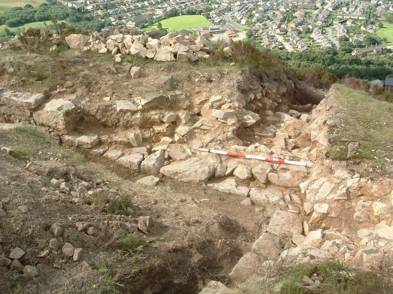
The site was acquired in 1907 for organized excavation and survey. Francis Bruton supervised work in 1907–08, after which spoil heaps were left unlevelled and created misleading earthworks within the site. The University of Manchester led further excavations in 1957–61 and 1963–64. From 1984 to 1988, the Greater Manchester Archaeological Unit carried out excavation and restoration, coordinated by a group led by Professor Barri Jones. The landowner at the time, North West Water, ensured the site would not be used for agriculture. Excavations outside the fort in 1995–96 located the civilian settlement south of it. Castleshaw is protected as a scheduled monument, a legally protected archaeological or historic site; that protection also constrains excavation of the fort itself.
Remains
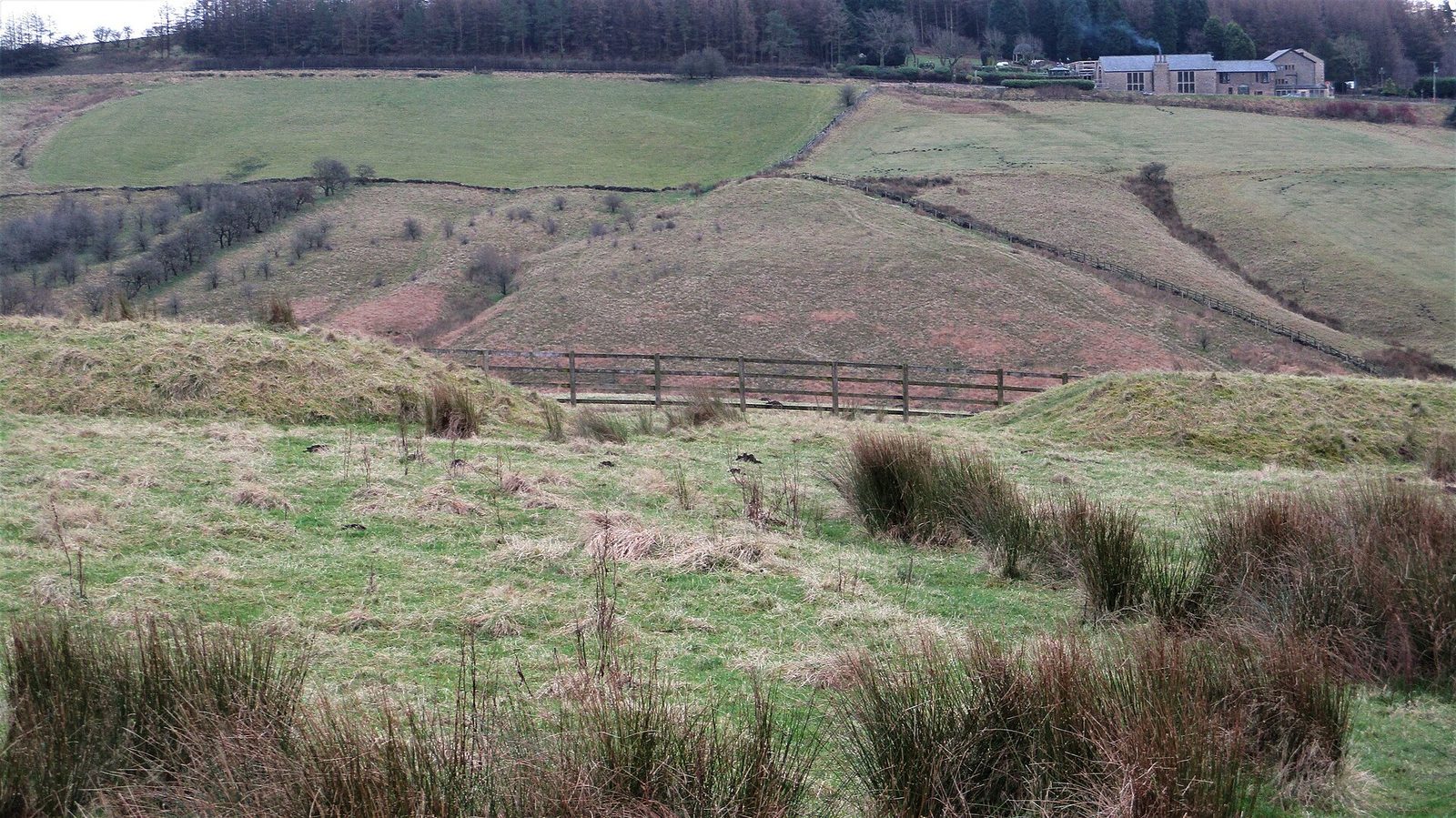
The site occupies raised ground on the eastern side of Castleshaw Valley, below Standedge in the Pennines. It lies on Grindslow shale, overlooks the valley and stands lower than the surrounding heights. The fort and later fortlet occupy the edge of Castleshaw in Greater Manchester, beside the Roman road through the narrow pass at Standedge. Mamucium, near Manchester, lay about 26 km to the west, while Slack was about 13 km to the east.
The original fort
The first fort was a rectangular turf-and-timber enclosure measuring about 115 by 100 m and covering approximately 1.2 hectares. Its two construction phases have been identified. The barracks stood on the east side, the granary to the north, and the headquarters building and commander’s residence in the southwest. The granary, stables and these principal buildings have been located, along with six long, narrow structures that may have been workshops or storerooms.
The fortlet
The later fortlet was rectangular, about 50 by 40 m in size, and covered approximately 1,950 square metres. It lay over the southern part of the earlier fort, concealing some of its remains, but did not reuse the fort’s foundation trenches. The fortlet had two building phases, with the first arranged on the same lines as the second.
Defences and gateways
Two defensive ditches, each with an asymmetrical V-shaped profile, surrounded the fortlet, with a strip of ground about 2 m wide between them. The inner ditch was about 3.9 m wide and 1.3 m deep; the outer was about 2.5 m wide and 0.9 m deep. Their outer faces sloped at about 27 degrees and their inner faces at about 69 degrees. The earthen rampart survives to a maximum height of about 0.5 m. It was built of turf over sandy clay on a rubble foundation. Along the south side, it was laid over the dismantled rampart of the original fort. The fortlet had northern and southern gateways. A single posthole provides limited evidence for possible corner towers, and the north and east corners are the best-preserved.
Buildings and internal features
Features associated with the fortlet’s second phase include barracks, a granary, a commander’s house, a courtyard building, a workshop, an oven, a well and an underfloor heating system. A latrine may also have stood there. These remains provide evidence for the buildings and facilities within the smaller military enclosure.
The civilian settlement
The vicus lay south of the fortlet’s defences and had a roughly triangular plan. Its full extent is uncertain. Test pits suggest that it reached about 12 m from east to west and extended 25–35 m southward.
Visible earthworks
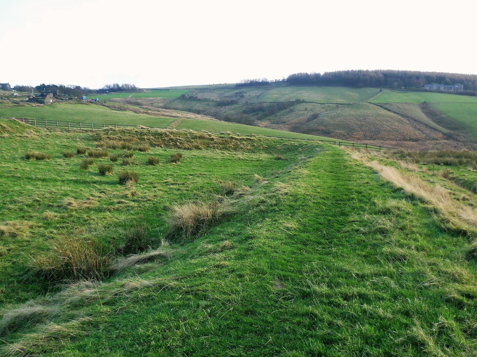
Restoration between 1984 and 1988 marked the outlines of the fort and fortlet with low mounds. Unlevelled spoil from the 1907–08 excavation also survives as earthworks inside the site, where it can give a misleading impression of the original ground layout.