Ganj Dareh: A Neolithic Settlement in Iran
Site at a Glance
- Popularity
- Very High
- Country
- Iran
- Primary era
- Stone Age
- Eras represented
- Stone Age
- Civilizations
- Unclassified
- Site type
- Settlement
- Remains
- Village
On this page13 sections
History
Ganj Dareh is a Neolithic settlement in Iran’s central Zagros Mountains, in the Gamas-Ab Valley of eastern Kermanshah Province. The Neolithic was a period when communities increasingly relied on farming and managed animals. Evidence places occupation here in the ninth millennium BC. Charcoal analysis points to settlement by about 8500 BC, while the oldest settlement remains date to about 8200 BC. Abandonment is placed around 7600 BC; a later interpretation of the excavated sequence estimates that it represents roughly 200 to 300 years of occupation.
Occupation and subsistence
Ganj Dareh’s inhabitants practiced early farming and animal management. The site has yielded the earliest evidence yet identified for domestic goat-keeping, including finds dated to about 10,200 years ago. Philip E. L. Smith interpreted goat footprints impressed in building clay as evidence that goats were domesticated, while sheep were still wild and hunted. Two-row barley is the only domesticated crop identified at the settlement and may have been grown to feed goats.
Excavation and later interpretation
Canadian archaeologist Philip E. L. Smith discovered the site in 1965 and led four excavation campaigns beginning that year and continuing into the 1970s. The work exposed about one-fifth of the site, and restoration is dated to 1965 to 1969. Iranian-Danish archaeologists revisited Ganj Dareh in 2017 or 2018. Later analysis of the excavated layers refined the interpretation of the settlement’s sequence.
Ganj Dareh is registered as one of Iran’s national monuments. Farming and illicit digging continue to threaten the archaeological area.
Remains
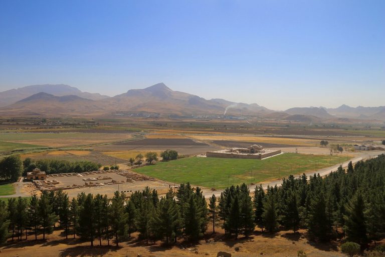
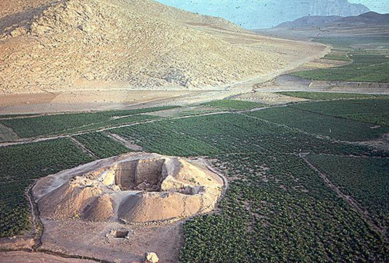
The settlement forms a tell, a mound built up from successive periods of occupation, with a conical profile and oval outline. It stands between two hills at an elevation of about 1,300 to 1,400 metres. The mound is around 5 metres high and measures up to 40 metres across; it covers roughly 1,300 square metres within a wider archaeological area of nearly one hectare.
Mound and architecture
Occupation layers
Excavators divided the mound’s roughly 7 metres of deposits into five levels, labelled from E at the bottom to A at the top. Later analysis separated these into 14 layers. The main occupation level, D, was further divided into 11 recorded units representing successive floors, deposits from fires, and fills. Level E contains at least 30 hearths and pits, many probably used to roast pistachios and almonds.
Rooms and storage
The architectural remains include lower portions of small, irregularly square or rectangular rooms, alongside hearths and numerous storage installations. Builders used mud, sun-dried mudbrick, and wood; some walls were made from irregular pieces of worked mud. Stone played a limited role in construction despite nearby limestone.
Objects and subsistence remains
Tools and ceramics
Stone objects include hand-held axes, axes designed to be fitted to handles, arrowheads, cutting tools, and implements for pounding and crushing grain. The arrowheads indicate familiarity with bows and arrows. Bone objects were also recovered. Pottery includes coarse, thick-walled vessels with uneven firing, as well as jars, bowls, beads, and ornaments. Later vessels were kiln-fired and sometimes decorated with patterns.
Clay figurines and small geometric forms, including cones and disks, date to about 7300 to 6900 BC. Another pottery-making approach, forming vessels from successive slabs of clay, developed around 7300 BC from the use of clay in mud-walled buildings. Small, headless figurines from upper levels have been interpreted as images of a mother goddess, a female deity associated with motherhood.
Animal and plant remains
Goat bones are abundant in every level. Other animal remains include sheep, wild boar, hare, deer, aurochs, several kinds of birds, and the house mouse. Crab, crayfish, and land snails also formed part of the food remains. The house mouse has been taken as evidence that people occupied the settlement throughout the year.
Plant remains include pistachios, almonds, and lentils, whose wild or cultivated status is uncertain. Two-row barley is the identified domesticated crop and may have served as goat fodder.
Burials and human remains
Skeletal evidence
Human remains have been counted as 41 individuals in Smith’s work and 116 in later research. Their general health has been assessed as good, although some show dental cavities and cranial hyperostosis, or abnormal thickening of skull bone. Possible brucellosis associated with close contact with goats has been proposed as an explanation for the thickening. Some individuals also had altered skull shapes.
Genetic findings
In 1971, a woman designated GD13a was found in level C, in burial chamber 13 with two other people. She was estimated to have been about 40 years old. Researchers sequenced DNA from her petrous bone, the dense part of the skull’s temporal bone. Her mitochondrial haplogroup, a genetic lineage inherited through the maternal line, was X, probably subgroup X2. Analysis indicated dark hair, brown eyes, lactose intolerance, and a SLC24A5 gene variant associated with lighter skin.
Genetic analysis placed GD13a’s population apart from Neolithic Anatolian farmers and closest to ancient Caucasus hunter-gatherers among the groups compared. The comparisons also indicated affinities with ancient steppe populations and with present-day Baloch, Makran Baloch, and Brahui populations. Most sampled Neolithic individuals from Ganj Dareh were assigned to paternal haplogroup R2a, a lineage traced through the Y chromosome. The oldest known R2a sample came from the site’s human remains and is dated to about 10,162 years ago; another Neolithic sample, I1671, belongs to haplogroup G2a.
Farming has incorporated parts of the archaeological area into fields, and much of the land remains privately owned. Human activity has removed part of the mound, while illicit excavation has caused further damage, including a tunnel dug into the site.