Tongoni Ruins: A Swahili Trading Town in Tanzania
Site at a Glance
- Popularity
- Medium
- Country
- Tanzania
- Primary era
- Medieval
- Eras represented
- Medieval, Early Modern
- Civilizations
- Swahili
- Site type
- Settlement
- Remains
- Town
On this page15 sections
History
Tongoni Ruins are the remains of a Swahili trading town on the southwest side of Kilole Bay in Tanzania. Its foundation may date to around the tenth century, although archaeological evidence indicates occupation from the late fourteenth or early fifteenth century through the seventeenth century. The surviving architecture is associated with Swahili and Islamic traditions. Tongoni became a prosperous coastal center with its own sultan and a place in Indian Ocean trade.
Origins and Swahili prosperity
The town’s beginnings remain uncertain. A tradition credits its foundation to the Shirazi, a coastal identity traditionally associated with Persian origins. Other claims say that the Wadebuli, believed to have come from Dabhol on India’s west coast, once dominated the settlement. Dabhol was a port of the Bahmani Sultanate, a state on India’s Deccan plateau that had extensive trade relations with Kilwa, a major East African trading center. Finds from Tongoni and other low-lying settlements in the Pangani region have also been interpreted as evidence of regional settlement development by about AD 1250.
Tongoni flourished particularly in the fifteenth century, when it was regarded as a prosperous and respected Swahili town. In the later Swahili period, it and villages on Tanga Island developed into prominent towns. Portuguese navigator Vasco da Gama visited Tongoni in April 1498 and returned the following year, staying for fifteen days. During the first voyage, his ship São Rafael ran aground on nearby shoals but was refloated. Portuguese charts later named the shoals after the vessel.
Pressure, decline, and renewed settlement
After about 1550, many communities along the western Indian Ocean coast lost population or influence. Tongoni faced Portuguese incursions, pressure on climate and resources during the Little Ice Age, a period of cooler conditions conventionally dated to about 1500–1750, and conflicts over control of the hinterland. Changes at the settlement have been interpreted as evidence of adaptation and increased contact with inland communities. Healing and divination may also have become more important amid these pressures.
Tongoni declined by the first half of the eighteenth century as established trade networks were disrupted by Portuguese activity and the fall of Mombasa. Its fortunes briefly revived late in the century when Shirazi refugees arrived from Kilwa, but the town later declined again. During the nineteenth century, the expansion of the slave and ivory trades, along with Omani and European plantation agriculture, added to pressures across the region.
Archaeology and continuing use
An early small-scale excavation produced a site plan. Archaeologist Richard Gramly carried out excavation work in 1981, and further test excavations and modern survey mapping followed in 2006. Tongoni is registered as a National Historic Site under the name Tongoni Historic Site. The Tanzanian government owns the site, which is managed by the Antiquities Division under the Ministry of Natural Resources and Tourism. Local people continue to worship there and bury family members south of the historic tombs.
Remains
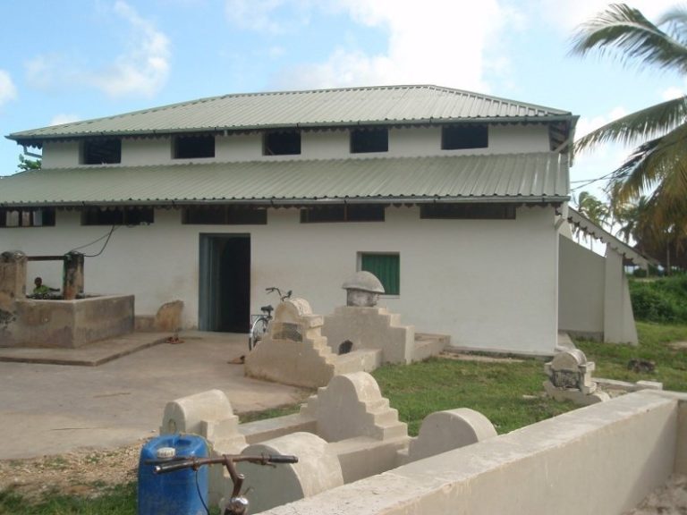
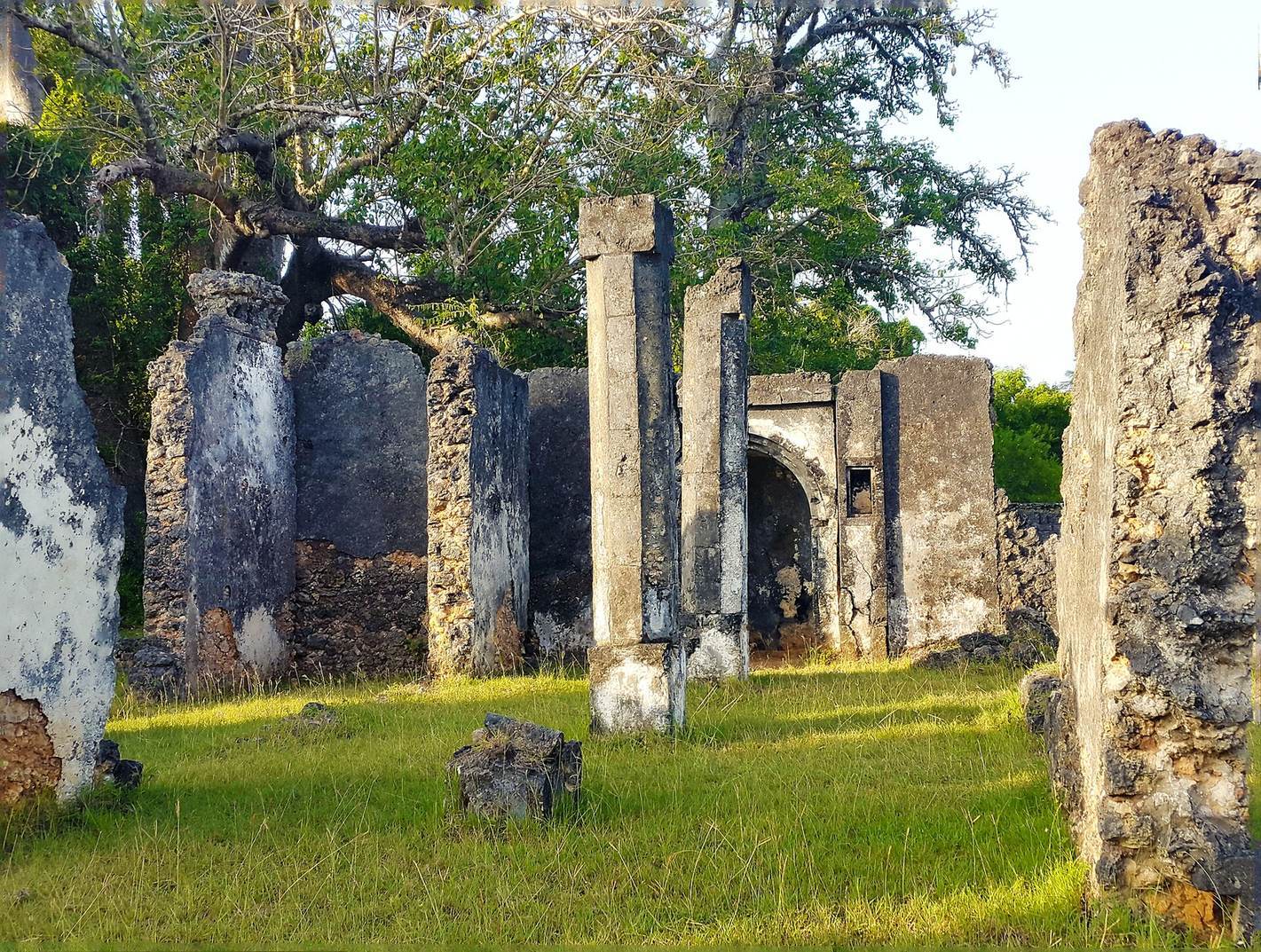
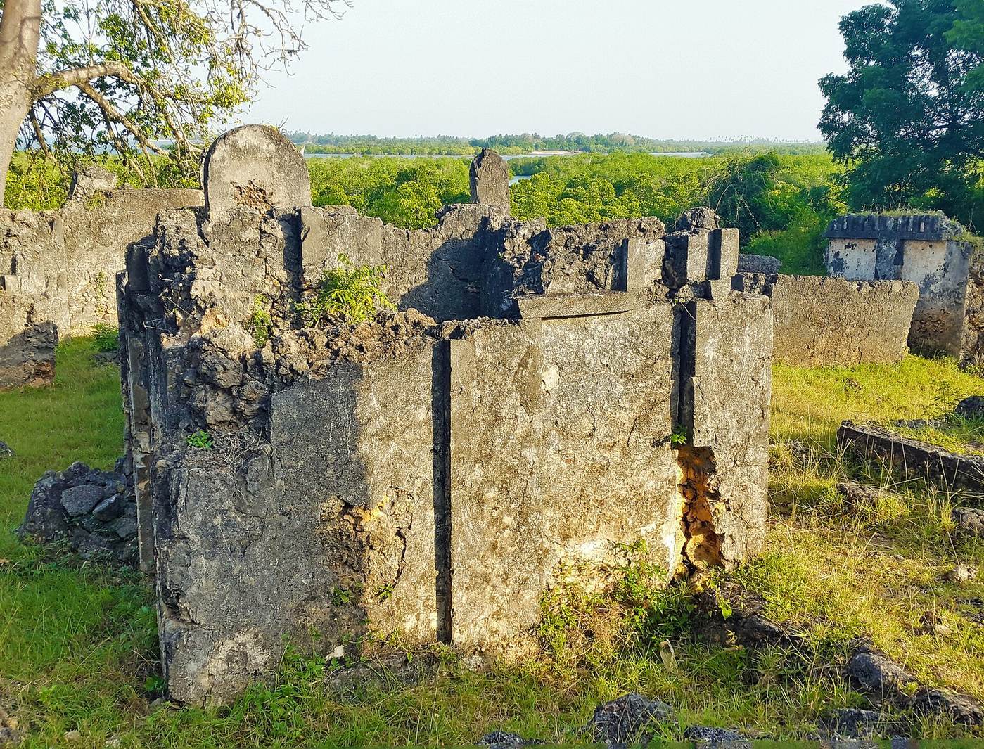
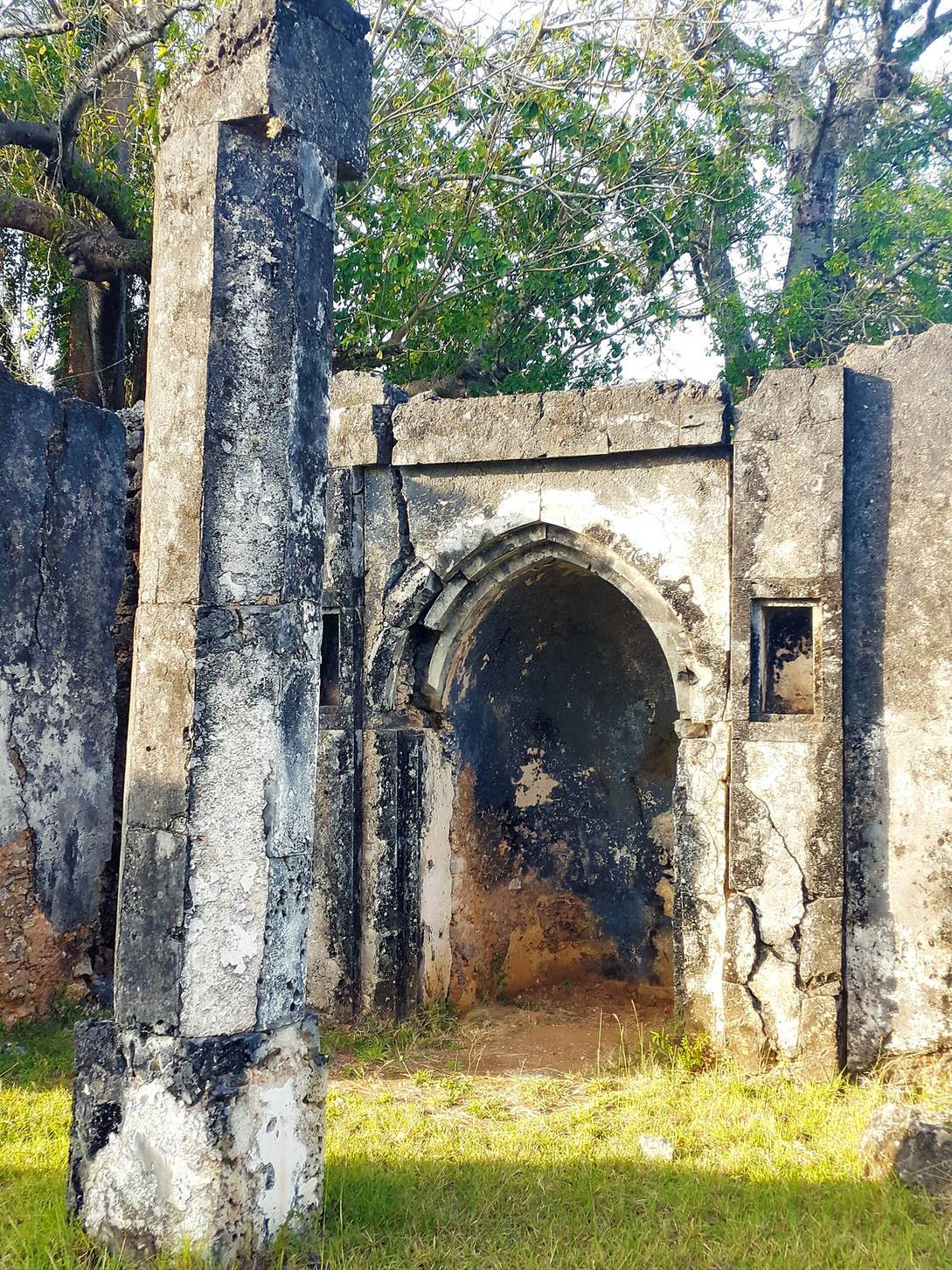
The ruins cover about one-third of a hectare on a low embankment beside Kilole Bay, overlooking Mtangata Bay. Peninsulas shelter the bay from strong monsoon winds, and mangroves line the shore. The site includes a Friday mosque, a congregational mosque for Friday prayers, about forty standing tombs, and traces of residential areas beyond the coral-built structures.
Built settlement
Friday mosque
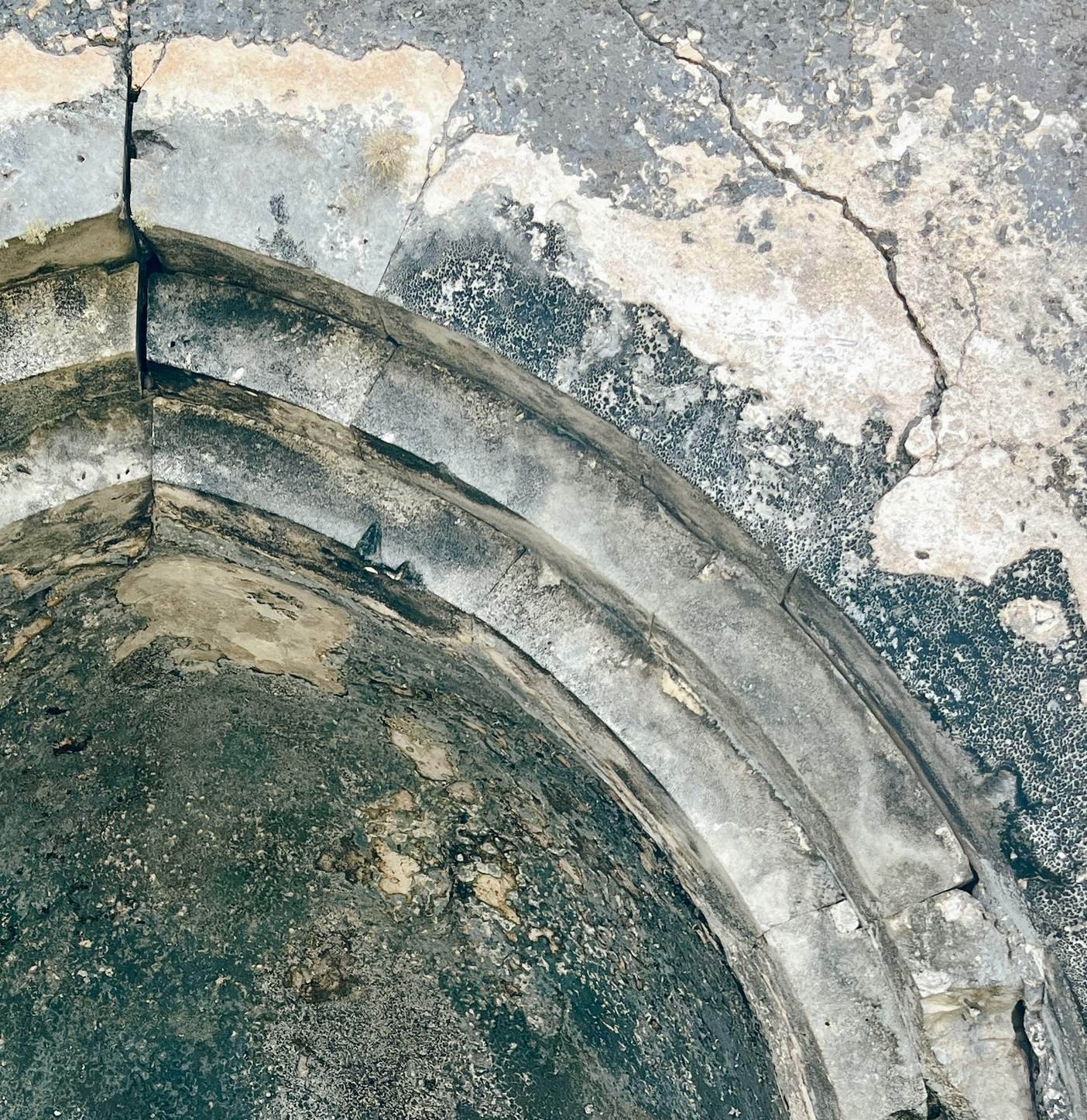
The mosque is a ruin built of coral rag, a limestone formed from coral, and is identified with the northern Swahili architectural style. It stands among the principal coral structures of the settlement.
Tombs
About forty standing tombs survive at Tongoni. They are identified as Shirazi pillar tombs and, like the mosque, are associated with the site’s coral construction and Islamic architecture.
Residential areas
For much of the town’s occupation, residents lived west and northwest of the main coral structures in houses built using wattle-and-daub, a woven framework coated with mud or clay. These domestic areas form part of a settlement whose ruins remain largely unexcavated.
Ceramic evidence
Local pottery
About 7,000 locally made pottery fragments have been recorded, of which 10.7 percent were classified as diagnostic, meaning their features help identify or date the pottery. Some vessels have punctures or stamped dots along or below the neck. Their surfaces are usually brown or black, with a few orange examples; the gritty clay bodies are generally dark brown, black, or grey. The clay includes two to four percent quartz temper, grains of quartz mixed into the clay. Other finds include a fragment linked to later TIW ware, an archaeological pottery classification dating after AD 900, Group D pottery with raised dots, and pottery with rouletted decoration. Group D examples are also known from the East Usambara Mountains and date to the middle or later second millennium; the rouletted tradition probably originated in western Tanzania.
Imported ceramics and beads
Foreign pottery makes up about 1.2 percent of the excavated sherds, represented by roughly eighty pieces. Most are blue-green Islamic monochromes or other Middle Eastern wares; Chinese celadon and blue-and-white pottery also occur. These types date from the fourteenth to seventeenth centuries. A small amount of European pottery from the late eighteenth to early nineteenth century comes from upper layers. A test at Vumbani yielded Indian pottery, Chinese celadon, blue-green Islamic monochrome ware, and glass beads made by coiling and drawing the glass. Between Mtangata and Vumbani, surface finds include dozens of beads and several coins dated to the late eighteenth century.
Other finds and food remains
Objects and possible healing practices
Finds include a gneiss grindstone made from stone available in nearby mountains, two smoothed sharpening stones, coral fragments partly surrounding an ash pit, large decorated local pottery fragments, glass beads, a faceted carnelian bead, and oyster-nut seeds. Excavation Unit 3 also yielded a human face engraved on a parrotfish jaw, a bone hairpin, an ash lens, large shells including conchs, a piece of slag, a cow vertebra, an ivory bead, and a stone with an unidentified red stain.
Local residents have interpreted a group of Unit 3 finds, including the carved face, carnelian bead, oyster-nut seeds, conch shells, and red-stained stone, as possible signs that a healer or another respected community member lived there. The carnelian bead has been associated with beads worn by Zigua healers; the Zigua are an ethnic group in northeastern Tanzania. The seeds have been linked to connections with the hinterland and river areas. Healing traditions associated with these finds combine Indian Ocean and mainland African influences.
Animal remains and shellfish
Changes in pottery forms, fish and other animal bones, shellfish, and particular artifact types reflect shifts in food and material practices over time. Shellfish remains increase in areas beyond the coral buildings, including excavation areas 2 and 3. This pattern has been interpreted as possible evidence that some non-Muslim rural Africans moved into less monumental parts of the town, since orthodox Muslims avoid shellfish. Mud-whelk remains occur among later coastal food remains. Their consumption may reflect food shortages and population growth, or limits on local food production under plantation enslavement.