Poitiers Amphitheatre: A Roman Arena in France
Site at a Glance
- Popularity
- Medium
- Country
- France
- Primary era
- Classical
- Eras represented
- Classical
- Civilizations
- Roman
- Site type
- Entertainment
- Remains
- Amphitheatre
On this page9 sections
History
Roman foundation and dating
The Poitiers amphitheatre was a Roman arena in modern Poitiers, France, built south of Limonum, the Roman city that served as the chief town of the Pictons, a Gallic people. Its date is disputed. An 1844 assessment by Antonin Bourgnon de Layre placed it around the beginning of the second century, under Hadrian or Antoninus; later, Jean Hiérnard and Jean-Claude Golvin judged the first half of the first century more likely, based on comparisons with securely dated amphitheatres such as the one at Saintes. This earlier date falls within the Julio-Claudian period, Rome’s first imperial dynasty.
Late antiquity
The Visigoths may have converted the building into a citadel. Invasions during the fifth century may also have hastened its decline, which continued toward the end of that century. The amphitheatre had fallen out of use by the end of antiquity.
Medieval and modern transformation
As the structure was dismantled or absorbed into later buildings, its seating stone was reused for construction. By at least the fourteenth century, houses and private gardens occupied the site, including houses built in the arena. In the Middle Ages, the monument was called the Arènes de Poitiers and the Palais Gallien de Poitiers. Records from 1624 describe numerous arcades and vaulted passages; in 1757, monks from Noaillé Abbey noted three arcades.
In 1857, the Poitiers hospices, which had held a long-term lease from 1757 and later owned the amphitheatre, disposed of its remains. Concerns that the ruin attracted prostitution and theft were cited in support of clearing the site. A covered market and other buildings were planned, while residential buildings were soon erected there. The remains received historic-monument designation in 1840, with later designations covering surviving fabric in 1935 and some underground remains in 1962.
Remains
The amphitheatre had an elliptical masonry plan organized around an arena slightly recessed into the ground. Entrances aligned with its principal axes, while galleries and internal stairs connected the seating levels. Its former footprint is also reflected in the pattern of streets crossing the modern city.
Plan and scale
The long axis measured about 155.8 metres and the shorter one about 130.5 metres, placing the building among the largest amphitheatres in Gaul. Its scale was comparable to those at Tours and Autun. The long axis ran from north-northeast to south-southwest, following the general orientation of the Roman town’s main north-south streets. Limonum occupied a spur overlooking a bend in the Clain valley where the Boivre joins it. The amphitheatre may have reached 35 metres in height from arena level to the top. Capacity estimates range from about 22,000, a figure attributed to Captain Charles Mangon de La Lande, to 30,000.
Entrances and internal circulation
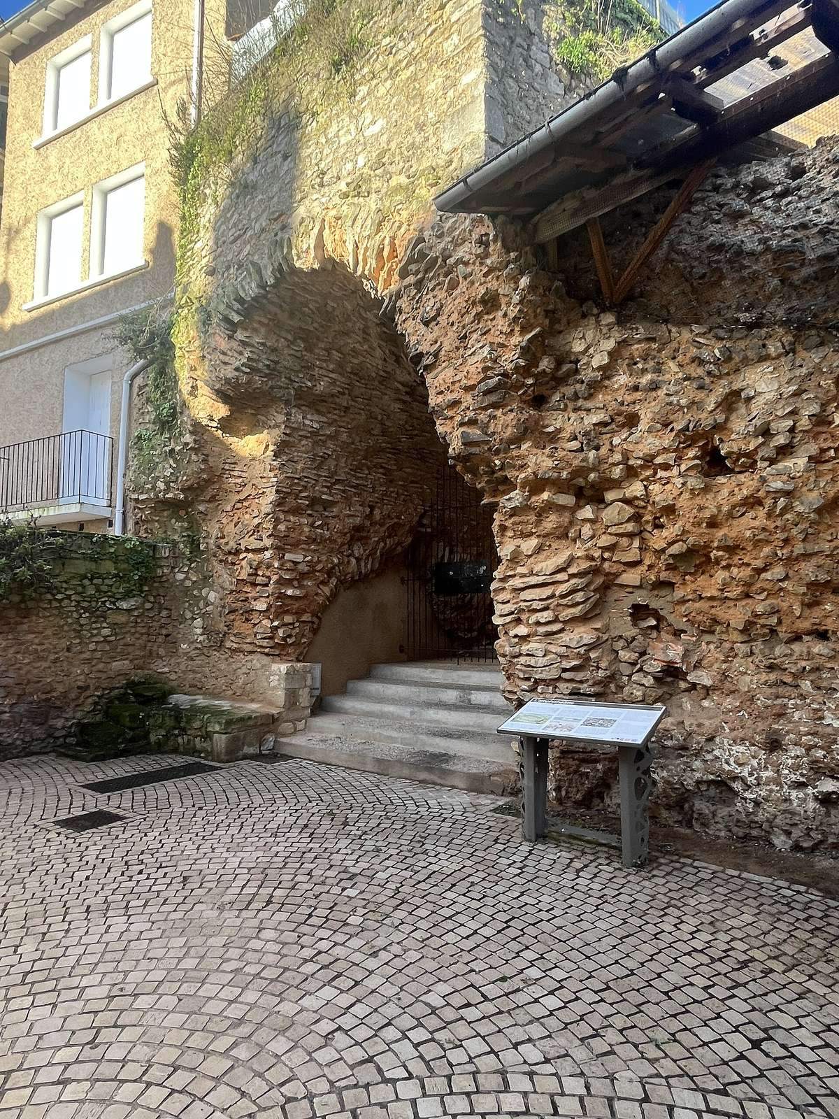
A large, sloping vaulted passage at each end of the north-south axis led to the sunken arena, and two smaller entrances lay on the east-west axis. The exterior was arranged in two levels, each with 64 arches. Galleries on several levels provided access to the seating, linked by internal stairways.
Construction
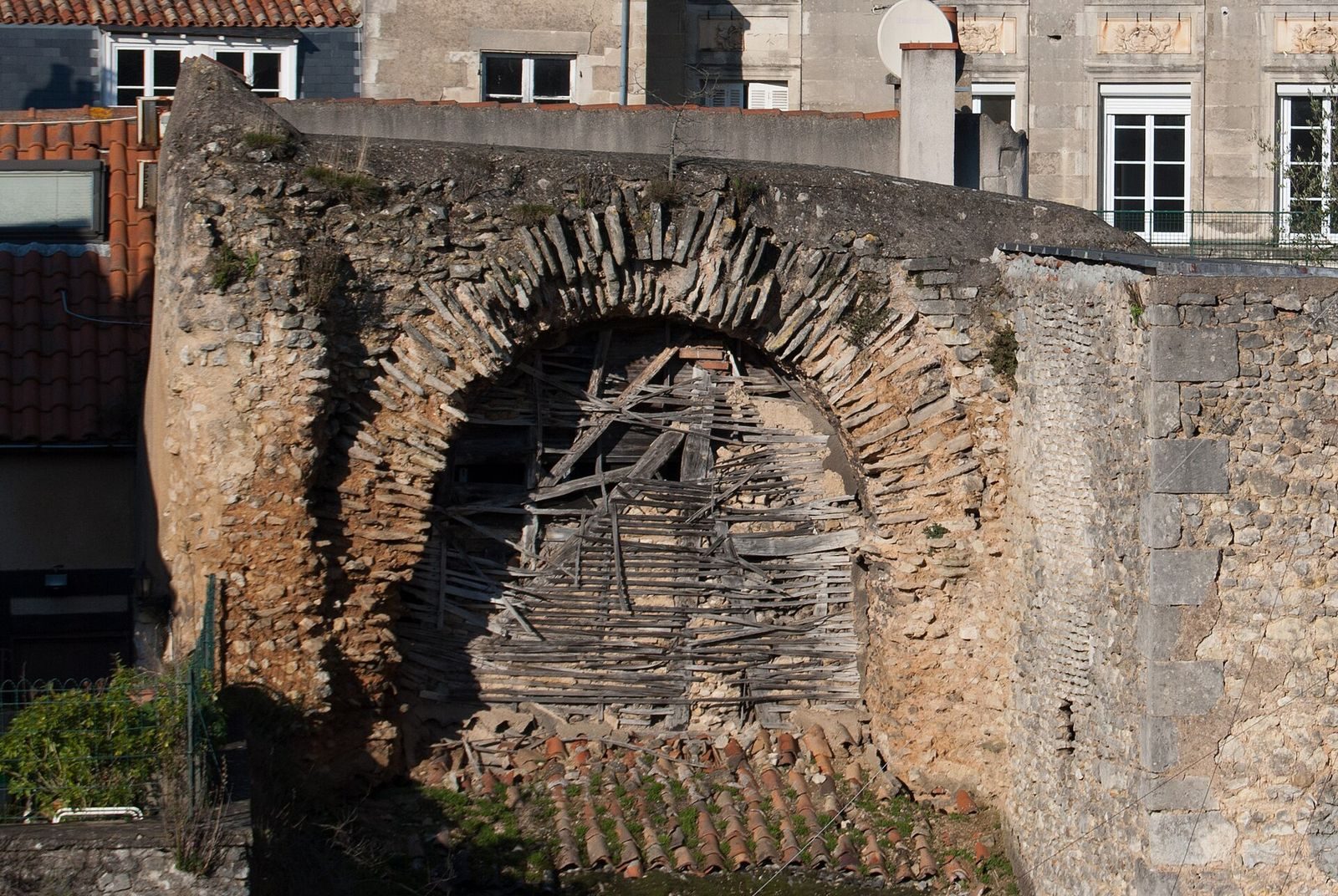
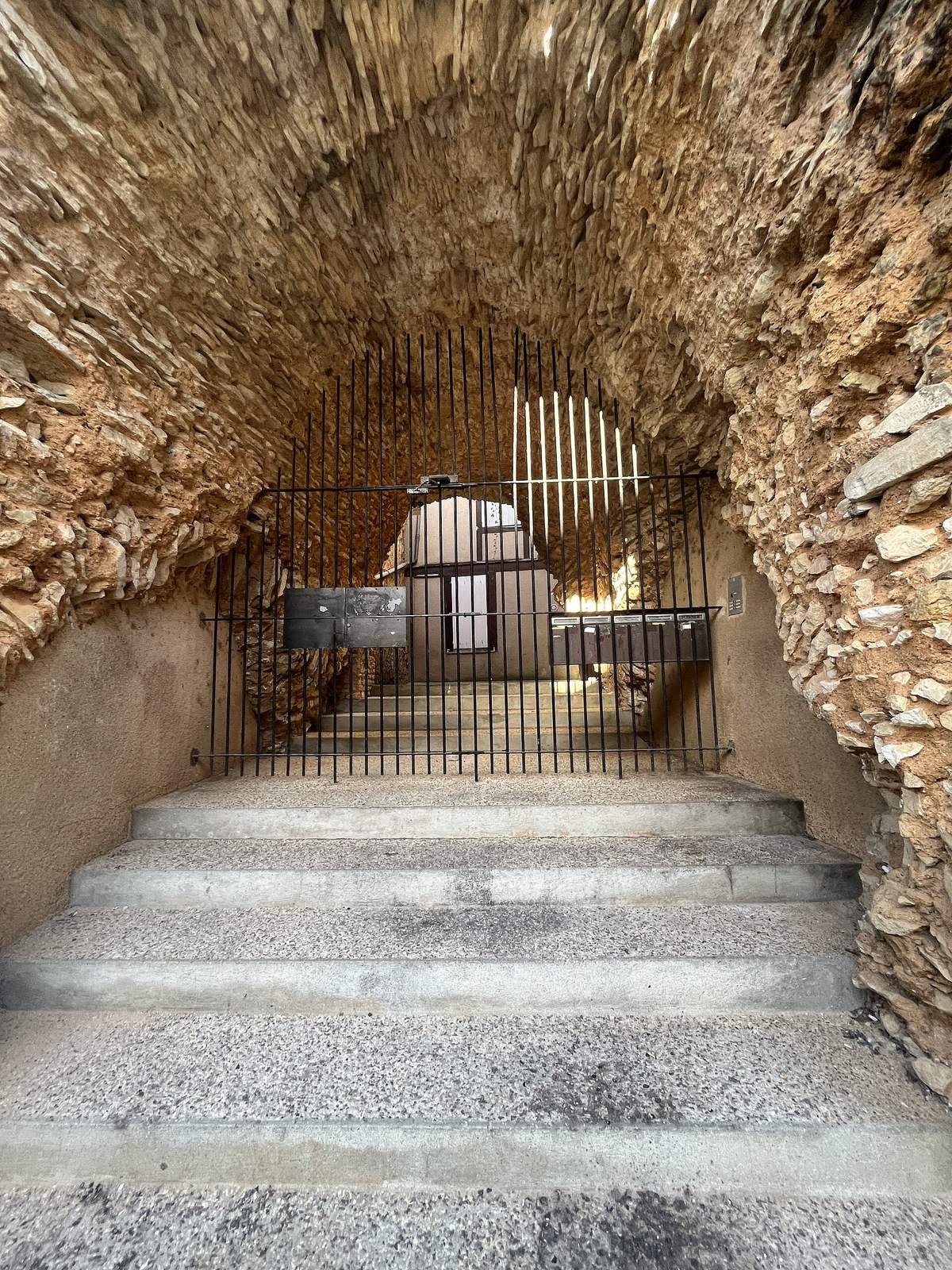
Walls extending outward from the centre were built of small rubble stones laid in regular courses. The walls running around the structure used similar stonework, but their courses were less even; this variation may reflect work by several masonry crews using different methods. Flat stones laid radially formed the vaults over the arches. The façade may have been faced throughout with large cut blocks, or those blocks may have framed only some arches.
Surviving fabric and street pattern
Above ground, vaulted sections of the first and second arcade levels survive at Rue Bourcani. Other wall and vault remains are incorporated into houses on Rue des Arènes romaines and Rue Magenta, including in their cellars, while arena foundations remain underground. Rue Magenta follows the amphitheatre’s long axis, and three other streets converge near the arena’s centre. Three streets follow the curve of the seating: one along its southern-to-eastern edge and two crossing the western half. Rue des Arènes romaines runs along the outer edge of the southeastern seating.