Kamid el-Loz: An Ancient Settlement in Lebanon
Site at a Glance
- Popularity
- Medium
- Country
- Lebanon
- Primary era
- Bronze Age
- Eras represented
- Bronze Age
- Civilizations
- Egyptian, Phoenician
- Site type
- Settlement
- Remains
- City
On this page13 sections
History
Kamid el-Loz is an ancient settlement in Lebanon, occupied from prehistoric times into the Byzantine era. Its Bronze Age city is generally identified with Kumidi, an Egyptian administrative center in the southern Levant. During the Middle and Late Bronze Ages, the city was fortified and contained palaces and temples. A Phoenician temple there was used for ritual activity from about 1750 to 1150 BCE.
Early settlement and Bronze Age city
Kamidos is also given as an earlier name for the settlement. The origin of the modern name is uncertain. In 1897, Hermann Guthe suggested that it was linked to Kumidi, while Anis Freiha later proposed an Aramaic derivation meaning withered almonds.
The site’s occupation began in prehistoric times and continued through the Bronze Age. Its fortified city included temples, palaces, houses, workshops, defensive structures, and burial grounds. It remains uncertain whether Kumidi was the Syrian city named in lists of places taken after the Egyptian pharaoh Thutmose III’s victory at Megiddo.
Kumidi and Egyptian rule
The Amarna letters, diplomatic correspondence from the Egyptian royal archive, mention Kumidi in five texts. Written mainly on clay tablets in cuneiform, a wedge-shaped writing system, they describe the city’s governors and Egypt’s political dealings in the region. Puhuru is named as a governor. Biria-Waza, identified in letter EA 197 as governor of Kumidi or Damascus, complained about rival rulers and called Kumidi the king’s city. In EA 198, Arašša declared loyalty to the Egyptian king and said he had sent his son, apparently as a hostage.
Letters from Rib-Hadda, ruler of Byblos, describe his conflict with Aziru, ruler of Amurru, who sought control of Byblos. Rib-Hadda asked Egypt for assistance and complained about other officials, including one who failed to appear at Kumidi. A letter from the Egyptian king to Zalaja, governor of Damascus, requested that Apiru people be sent to Kush for settlement. Apiru was a term for groups whose precise identity varied by context, and Kush was a region south of Egypt. The letter also reported that the king was well, his army was numerous, and he was in Upper and Lower Egypt. Another royal letter asked Abdimilki, ruler of Sazaena, to send Apiru people.
Other correspondence includes an unidentified letter about returning property to a man named Biridiya, whose possible identification with a ruler of Megiddo is uncertain. A Kumidi correspondent also wrote about Aziru’s efforts against Byblos; he may have been the official who later succeeded Rib-Hadda as governor of Byblos.
Later occupation and archaeological work
Settlement gradually shifted south toward the modern village. Occupation in that area extended through Achaemenid, Hellenistic, Roman, and Byzantine times. A large quarry associated with Kamid el-Loz supplied stone for eighth-century Anjar. Eastern Christians brought from Iraq carried out the work.
Arnulf Kuschke identified the tell in 1954, and German excavations began in 1963. Martin Metzger took over after Kuschke left in 1964, and Rolf Hachmann led the investigation from 1966. Work stopped in 1981 because of the Lebanese Civil War, after excavations had uncovered about 5,700 square metres, mainly in the tell’s northwest, reaching a depth of roughly 7.45 metres. Marlies Heinz of the University of Freiburg led renewed excavations from 1997 through 2011. Work has not taken place since 2012 because of the Syrian Civil War.
Remains
The tell and settlement layout
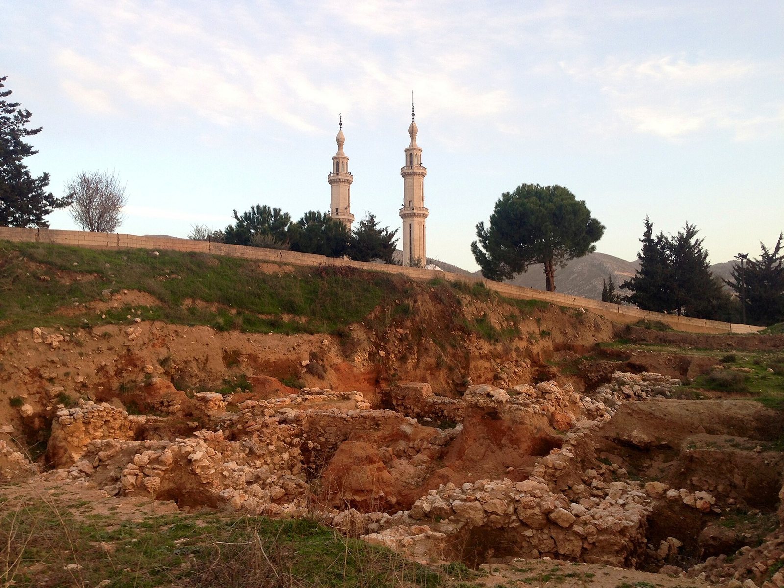
Tell Kamid el-Loz is an oval mound north of the modern settlement. It measures about 240 metres from east to west and 300 metres from north to south, rising roughly 26 metres above the plain. The plain lies about 865 to 867 metres above sea level, while the summit reaches approximately 874 metres. The ancient settlement developed where routes connected Sidon with Damascus through the Bekaa and Anti-Lebanon ranges, and linked Egypt with Syria through Palestine, the upper Jordan Valley, and the Bekaa. A city burial ground lies south of the modern settlement.
Excavated deposits include Late Neolithic pottery fragments from the fifth millennium BCE, Early Bronze Age layers dating to about 3000–2000 BCE, Middle Bronze Age levels from about 2100/2000–1550 BCE, and Late Bronze Age deposits from about 1550–1200/1100 BCE. Early Iron Age material dates to about 1200/1100–800 BCE. Excavation focused especially on the Late Bronze Age and Early Iron Age, while finds from other parts of the settlement area show that occupation continued into the Byzantine period.
Bronze Age religious and royal buildings
Temple precincts
Two separate temple precincts have been identified. Each included an elongated rectangular courtyard and adjoining rooms. Three rooms opened from the western courtyard, while a long room opened from the eastern courtyard. A roofed room used for ritual stood south of each courtyard, and the rooms and courts contained numerous ritual installations. Middle Bronze Age temples lie beneath their Late Bronze Age successors. The foundation walls of the earliest phase of Late Bronze Age Temple T2 are well preserved.
Palaces
The earliest excavated Late Bronze Age palace phase, P5, dates to around 1400 BCE. Its foundations belonged to a residence of the ruling family that had once risen three storeys. A rectangular royal pavilion contained two rooms, a corridor, a stairwell, and a basement. An earthquake brought the P5 palace down. Three people died in the collapse; their skeletons were found in the basement beneath ceiling debris and household equipment.
Later palace phases comprise P4, dated between 1400 and 1300 BCE; P2 and P3, from 1300 to 1200 BCE; and P1, from 1200 to 1100 BCE. These levels included a royal residence made up of separate pavilions and an adjoining metalworking workshop.
Palace and temple finds
The P5 collapse preserved household belongings, furniture, tools, vessels, and weapons. Finds associated with the ruler’s household include gold, silver, and bronze implements; glass, stone, and pottery vessels; Egyptian stone vessels; and Cypriot pottery. Other objects include a model chariot, ivory cosmetic boxes and needles, arrowheads, a sickle-shaped sword, and parts of bronze armor made from overlapping scales. Two game boards with pieces were found, along with clothing and jewelry belonging to the people who died in the collapse.
Temple finds include ritual drinking vessels shaped as a turtle and a fish from the western courtyard, and two pointed vessels with plant decoration from Court K. Temple T1 yielded an idol, a glazed bowl decorated with lotus flowers and fish, and a fragment of a statuette. A treasure of gold-foil reliefs on silver depicts an interceding goddess and a goddess wearing a flounced garment; its date is uncertain, with proposals ranging from about 1700 BCE to 1400–1300 BCE. Finds from the royal pavilion and other palace contexts include an ivory figure of a lyre-player, a clay game board shaped like a liver, ivory objects assigned by their archaeological layer to the 14th century BCE, and additional ivory game boards.
Tablets and inscriptions
Seven cuneiform texts were found near the palace, including six letters from the Amarna period. Two are described as Egyptian chancellery letters addressed to Zalaja, governor of Damascus, and the ruler of Sazaena. Old Phoenician alphabetic writing appears on pottery sherds from the Late Bronze Age palace and temple areas. Two other inscriptions, on a jug handle and a storage jar from the service court of Palace P2, use Ugaritic cuneiform.
Two stone bowls found in the doorway of a Late Bronze Age palace basement bear Egyptian inscriptions on their shoulders. These inscribed objects, together with the texts and pottery marks, preserve evidence of writing in and around the palace and temples.
The Umayyad-period quarry
A large quarry lies east and southeast of the modern settlement. It contains rock-cut tombs and inscriptions. Paul Mouterde recorded 33 inscriptions in 1934: 31 in Syriac, a literary form of Aramaic used by Christian communities, one in Greek, and one in Pahlavi, a script used for Middle Persian. Additional inscriptions came to light in 1967 and during road construction in 1982. Crosses appear beside many of them, and five carry dates of 715–714 CE.
A recurring term in the inscriptions has been interpreted as an abbreviated word for quarry. Some texts give personal names alongside places in the upper Euphrates region, Kurdistan, and the Nineveh Valley; others include religious titles. The title chief of the table, unique to the site, may have referred to the head of a monastery or monastic community.
Kamid Loz I
The prehistoric site of Kamid Loz I lies about one to two kilometres northeast of the settlement and roughly 4.5 kilometres north-northeast of Joub Jannine. Its material spans the transition from the Paleolithic to the Neolithic and includes flint tools associated with the Qaraoun culture, a prehistoric stone-tool tradition linked to the Bekaa region. Scrapers, picks, axes, abundant stone-working debris, other flint, and pottery were found there.