Mazar Tagh: A Tang- and Tibetan-Period Fort in Xinjiang, China
Site at a Glance
- Popularity
- Medium
- Country
- China
- Primary era
- Medieval
- Eras represented
- Medieval
- Civilizations
- Tang
- Site type
- Military
- Remains
- Fort
On this page18 sections
History
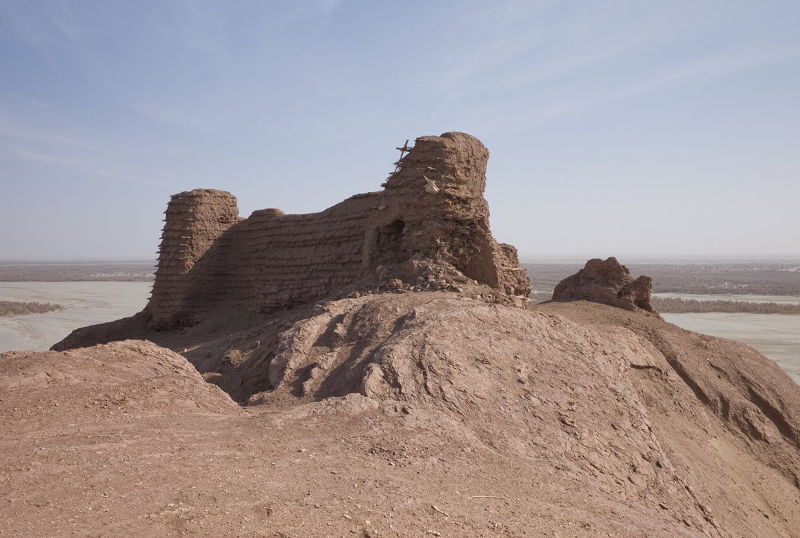
Mazar Tagh is a hilltop fort in Moyu County, Xinjiang, China, used as a military and administrative centre during the Tang and Tibetan periods. It lay within the oasis kingdom of Khotan during the first millennium AD. Before the fort was built, the hill appears to have been a Buddhist pilgrimage site known locally as “the Hill.”
Before and during Tang rule
A Han-dynasty origin, from the period 206 BC to AD 220, has been proposed because the fort and nearby beacon tower have been compared with Han structures. One suggestion links the site to the Han general Ban Chao and an earlier watch post later enlarged for defence, but this identification remains unconfirmed. The clearest evidence of the fort’s use belongs to the Tang dynasty, which ruled China from 618 to 907.
In the Tang period, the fort was called Shen Shan, or “Sacred Mountain.” It guarded an important route along the Hotan River between Khotan and Gumo, another oasis kingdom in the Tarim Basin. A station serving the route, also called Shen Shan, was established there. After the An Lushan Rebellion, a major uprising against Tang rule in the mid-eighth century, the Tibetan Empire expanded into territories formerly controlled by the Tang. Tibetan forces attacked Beiting in 789, and Chinese historical records cease mentioning Khotan after 791.
Documents from the fort include a date corresponding to 798, and the latest known documents reach 802. Tang troops remained active in the area until that year, as Tibetan power took hold across Khotan.
Under Tibetan rule
After Tibetans gained control of Khotan, Mazar Tagh became part of a chain of forts that also included the fort at Miran, in the Lop Nur lake basin. It served as a military and administrative centre for Tibetan authority over Khotan and the Lop Nur region. Soldiers and officials were based there, alongside Khotanese officials who helped administer local affairs.
The fort’s community also included the families and servants of Tibetan soldiers, as well as merchants. Documents from Khotan and from Tibetan and Shanshan territories, another group of oasis settlements in the Tarim Basin, were brought to the site. These records reflect the fort’s role in a broad administrative and military network.
Later history and modern study
When the fort was abandoned is uncertain. It may have fallen out of use around 937, when Khotan’s king Li Shengtian began sending envoys to Later Jin, a Chinese dynasty that ruled from 936 to 947. Alternatively, the fort may have continued operating under Li Shengtian and later been destroyed during conflict between Islam and Buddhism.
A local tradition explains the Islamic shrine on the hill through the story of a former Buddhist who converted to Islam during an eleventh-century religious war. The story says he secretly provided intelligence to Muslim forces and was executed. After their victory, those forces are said to have built a shrine in his memory.
Aurel Stein investigated the site in 1907 and 1913. Huang Wenbi visited in 1929, Hou Can surveyed it in 1984, and further surveys or inspections followed in 1991, 2008, 2009 and 2024. A rescue conservation project was largely completed in 2007; a later conservation initiative for the Xinjiang section of the Silk Road produced a plan for the site in the 2010s.
Mazar Tagh became a Xinjiang regional protected site in 1999 and a Major Historical and Cultural Site Protected at the National Level in 2006, a high-level state heritage designation. In 2020 it was included in China’s first national list of important Great Wall sections and sites, among four Tang-period forts and beacon towers on that list.
Remains
The fort stands at about 1,247 metres above sea level on the summit of the Red Hill spur of Mazar Tagh, on the west bank of the lower Hotan River. The riverbed lies to the southwest; the site is in the southwestern Tarim Basin near the Taklamakan Desert. A poplar forest is below a nearby cliff, while a white dolomite hill lies northeast of the red sandstone-and-mudstone ridge.
Fort and enclosure walls
The fort has a roughly square overall plan, described as two rectangles arranged within three successive walled enclosures. Estimates of its area vary, from about 840 to more than 1,640 square metres; other measurements fall between about 1,100 and 1,160 square metres. Reddish-brown sandstone slabs and sun-dried mud brick form its walls and buildings, laid in staggered courses. Some wall sections contain ropes woven from poplar and tamarisk branches, reeds and grass. A passage or tunnel and underground storage rooms are also part of the complex.
First enclosure
The first enclosure occupies the ridge and contains the fort’s main area, divided into northern and southern rooms. Its western wall survives for more than 20 metres. The wall top is about 3 metres wide and retains an earthen parapet strengthened with tamarisk branches. Square platforms stand at the wall’s northern and southern ends. The better-preserved northern platform is about 4.5 metres wide at its base, less than 3 metres across at the top and still about 16 metres high.
Second enclosure
The second enclosure joins the first along an east–west line. It is more damaged: collapse of the underlying rock has taken away its southern wall and the southern end of its eastern wall, where less than 10 metres remain. Its interior may have been used as a barracks.
Third enclosure
The third enclosure adjoins the first two on the northern slope, at a level about 6 to 7 metres lower, and served as an annex. Deposits of animal fodder and dung several centimetres thick suggest that it may have contained a stable. A gap at the western end of its north wall opens onto a slope with refuse, and a hearth remains beside the opening. A passage between the first enclosure and the second and third yielded Tibetan documents.
Rooms and watchtower
The fort is also described as having five rooms and a watchtower, which is partly standing. The rooms form part of the complex’s main built area.
Other structures on the hill
Beacon tower
A ruined beacon tower stands about 60 metres west of the fort. Its square base measures about 7 metres on each side, and the surviving tower rises about 6 metres. Blocks of yellow earth, reinforced with willow branches, form its structure; the top has collapsed.
Buddhist temple
The remains of a Buddhist temple lie on a terrace more than 20 metres northeast of the fort. A statue base and platforms survive.
Cave and inscriptions
A cave lies beneath the southern side of the hill. It has front and rear chambers, with the front chamber divided into upper and lower levels. A stone ceiling slab in the lower level bears inscriptions in Chinese and ancient Tibetan, alongside an image of a monster. The inscriptions include personal names. The cave may have been used to store food.
Islamic shrine
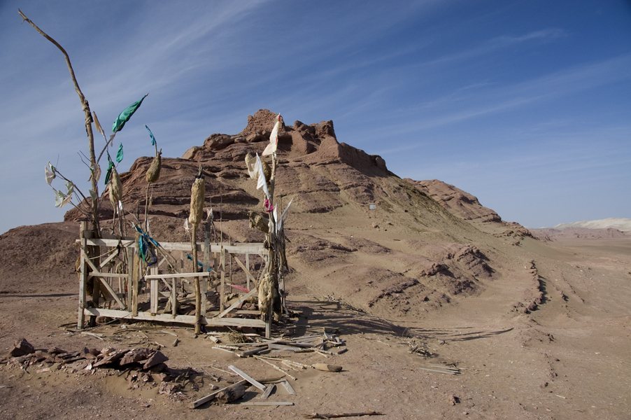
An Islamic shrine associated with the hill stands about 90 metres east of the fort. The hill continues to serve as a place of Islamic pilgrimage.
Documents and excavated objects
Documents
A refuse heap on the northern and northeastern slopes contained hundreds of discarded Tibetan military records written on paper and wood. Documents and wooden slips from the fort include Old Tibetan, Chinese, Khotanese, Old Uyghur, Arabic and Sogdian. Khotanese is the Middle Iranian language associated with Khotan; Sogdian is another historical Iranian language of Central Asia. The texts concern political and military affairs, transport, the economy, religion and personal correspondence.
Among the papers are soldiers’ handwriting exercises copying Chinese calligraphic works, including the Preface to the Orchid Pavilion. The British Library holds more than 1,100 wooden documents and 321 paper documents from the fort and refuse heap. Stein also recovered fragments of Khotanese, Uyghur and Sogdian texts.
Other finds
Excavated objects include red pottery dishes, a mould for making raised designs, wooden and metal items, and goods made of wool and leather. Coins include the Tang type Qianyuan Zhongbao. Two recovered reed pens have paired tips that converge toward one another.
Other objects Stein recovered include arrows, sheaths, shoes, dice, a comb and a pen, now held by the British Museum. Together with the written records, these objects illuminate the varied activities carried out at the fort.