Emperor Franz Stronghold: A Prussian Fort in Koblenz
Site at a Glance
- Popularity
- Medium
- Country
- Germany
- Primary era
- Modern
- Eras represented
- Early Modern, Modern
- Civilizations
- French, German, Kingdom of Prussia
- Site type
- Military
- Remains
- Fort
On this page20 sections
History
Emperor Franz Stronghold is a Prussian fort on Petersberg in Koblenz, Germany, built between 1816 and 1822 in a polygonal design, with straight defensive walls meeting at angles. It became the principal work of a detached fortress system intended to protect the military road and the Rhine and Moselle crossings, and to shield Koblenz from direct bombardment.
Before Prussian construction
Petersberg was considered a useful defensive position before Koblenz came under Prussian rule. Austrian troops raised earthworks there in 1793 to resist advancing French forces. After French Revolutionary troops captured Koblenz on October 23–24, 1794, under General François Séverin Marceau, they replaced these defenses with a fortification later known as Fort Marceau. Marceau, a French general in the wars between revolutionary France and European powers, was buried within the fort.
Construction and expansion
Prussian General Ernst Ludwig von Aster proposed a new bastioned fort for Petersberg in 1814. On March 11, 1815, King Frederick William III ordered Koblenz and Ehrenbreitstein to be fortified. Military commander August Neidhardt von Gneisenau set aside von Aster’s plan in favor of separate works that could be extended more readily. Prussian engineer Claudius Franz Le Bauld de Nans prepared the detailed plans used for construction.
Work began with earthworks on September 16, 1816, and the foundation stone was laid on April 14, 1817. During a visit on November 24, 1818, Frederick William III named the fort for Francis I, Emperor of Austria and an ally of Prussia. By May 1819, the fort was considered ready for defense, although masonry work on its outer strongpoint began that September and grading remained unfinished. Construction was completed in 1822, and troops took up position the following year.
The fort belonged to the wider Emperor Franz system, whose other major works included Bubenheimer Flesche, Metternicher Schanze, Moselflesche, Neuendorfer Flesche, Rheinschanze, and Rübenacher Schanze. Underground passages linked the main fort with Bubenheimer Flesche and Moselflesche. From after 1850, the system also protected military facilities around Lützel, including a freight station, a munitions laboratory, and an artillery depot.
Military changes and declining importance
Structural problems led to substantial changes in 1834–35. The left rear wall was moved about six metres toward the courtyard, and the main entrance was shifted between casemate blocks. Cracks in the vaulted passage prompted the addition of nine supporting piers in 1841–43. The left ditch-defense work was drained in 1861. Later, in 1876–77, a protective outer wall was added on the works-yard side of the inner strongpoint as artillery developed.
During the Franco-Prussian War of 1870–71, fought between France and Prussia and its German allies, the Petersberg fort held Prisoner-of-War Camp II for French soldiers. Those who died in captivity were buried in a new French cemetery at the foot of the hill, near the Marceau monument. After the war, the acquisition of French fortresses in Alsace-Lorraine reduced Koblenz’s strategic value. The left-bank defenses were classified as less important in January 1886. The Lützel fort and the wider system were abandoned in 1890, although they remained under military administration for a time.
Defortification and conversion
After the First World War, Article 180 of the Treaty of Versailles, the peace settlement that followed the war, required the Koblenz fortifications to be dismantled. American troops occupied the fort in 1919, and defortification began on November 6, 1920. Workers removed most ditch walls and ramparts, using much of the earth to fill the ditches. The destruction of Powder Magazine 2 on October 15, 1921, marked the end of the initial works. The Inter-Allied Military Control Commission inspected the demolition in November; work concluded on July 20, 1922, after the ceiling of War Powder Magazine I was demolished and its open space filled.
At the city’s request, the fort’s building complex was retained during this process. From 1923, 47 apartments were created in the surviving buildings, including homes for families displaced from housing owned by the German state. The city took over the area after 1930, but decline continued, and by 1932 demolition and deterioration had greatly reduced the complex.
Nazi persecution and the Second World War
During the Nazi period, the site held a forced-labor camp for foreign workers. In 1938, Sinti and Roma were interned in the fort’s inner strongpoint and deported to Weißenfels, then brought back to Koblenz shortly afterward. Daweli Reinhardt’s family was also held at the fort in 1940. On March 10, 1943, Koblenz’s Sinti and Roma were deported to Auschwitz-Birkenau. Most were murdered; Reinhardt, a Sinti musician, was among the few survivors.
During the Second World War, residents used the underground passages as air-raid shelters. An anti-aircraft gun was installed on the first casemate block to defend the freight station. On December 28, 1944, a bomb struck the passage leading toward Moselflesche, possibly killing about 35 people.
Postwar use and conservation
After the war, the fort became one of Koblenz’s slum districts. About 200 people lived there in 1950, with roughly 30 square metres per family and very limited sanitation. The city cleared the settlement in 1958–59 and moved residents to new housing at nearby Mittelweiden. During a Bundeswehr engineering exercise on January 19–23, 1959, the main inner strongpoint was blown up to make it uninhabitable. The Rhineland-Palatinate government had made this a condition of funding the replacement housing.
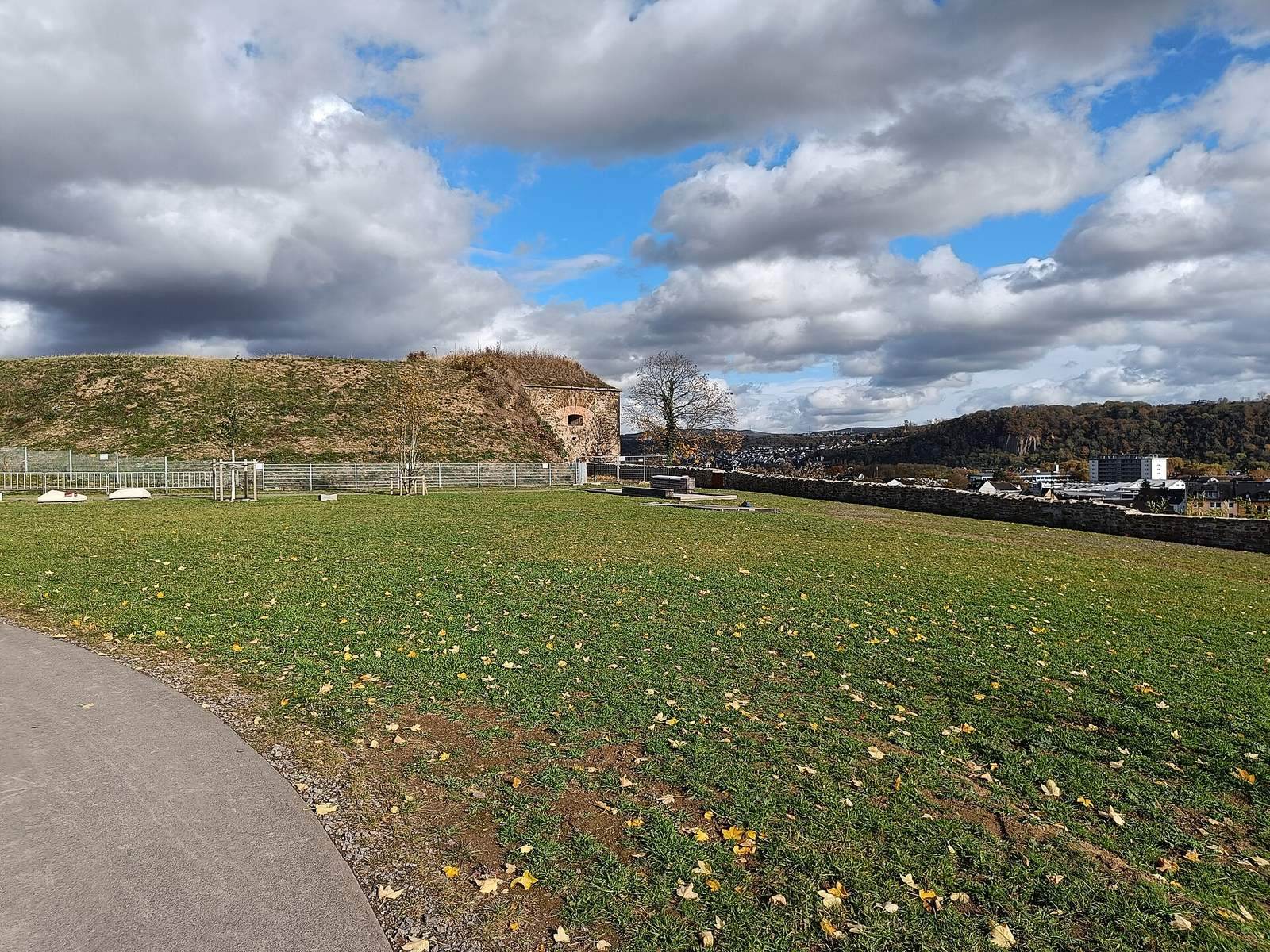
Clearance work in 1984–85 aimed to turn the overgrown site into a park, but the effort and further plans ended. Local fortification enthusiasts began clearing the entrance area in 1997 and formed the Feste Kaiser Franz Association that June. Their work, followed by further conservation efforts, focused on the passage and the gorge tower. From 2018 to 2021, the city created a fortification park on the Petersberg plateau beside the fort. Work there secured and partly rebuilt the gorge wall and restored parts of an underground passage.
The fort is protected under Rhineland-Palatinate’s monument law and lies within the Feste Kaiser Franz monument zone. Since 2002, it has also formed part of the Upper Middle Rhine Valley UNESCO World Heritage property.
Remains
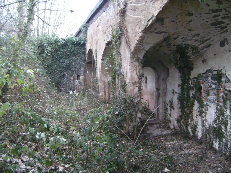
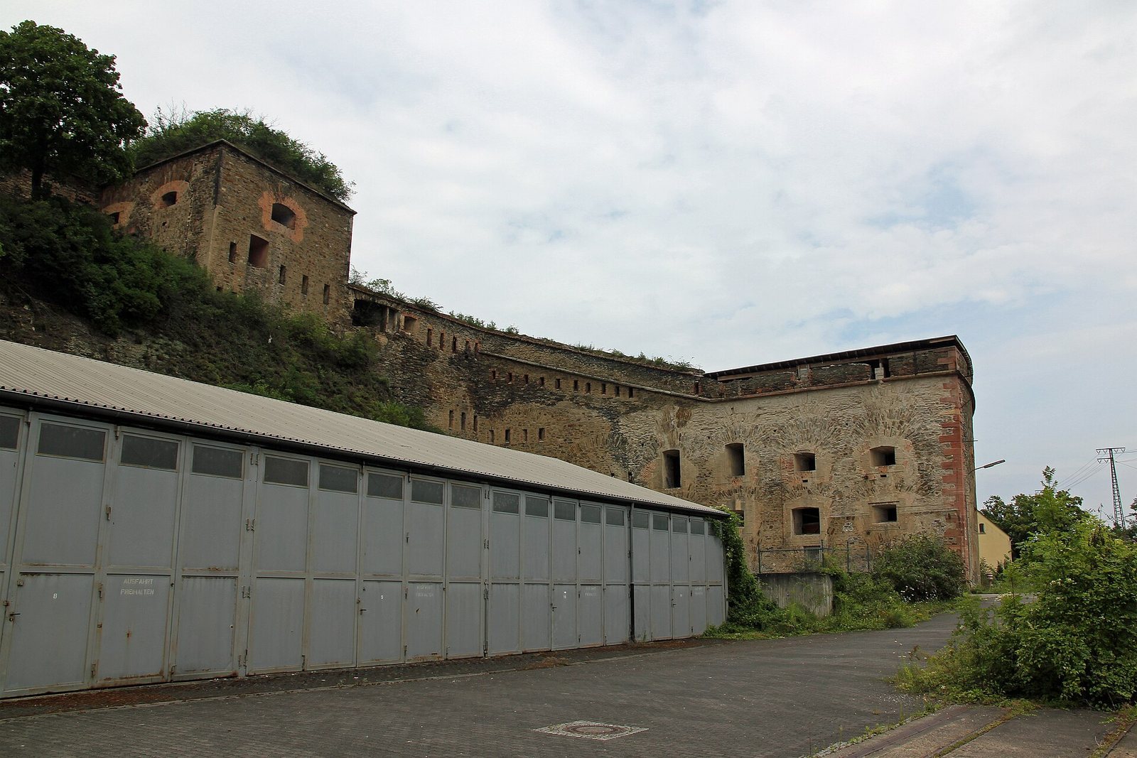
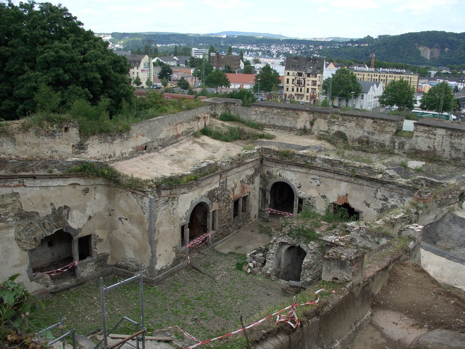
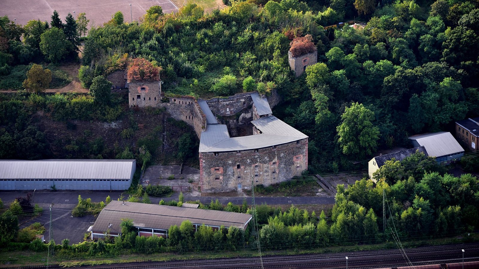
The surviving features belong to a larger fort laid out on Petersberg, with a polygonal rampart, an inner strongpoint at the eastern slope, and a tower at the rear foot of the hill. The main strongpoint was destroyed in 1959, while its two curved side ends remain. The entrance, passage, gorge tower, and parts of the underground communications preserve important elements of the original arrangement.
Main fort and entrance
Plan and defensive walls
The fort’s straight rampart walls formed two obtuse angles facing west. A low, walkable roof covered in earth topped the structure. At first, channels between the vaults carried rainwater toward outlets on the façades. Around 1850, this arrangement was replaced by recessed collection points that fed water through shafts between the casemates, the vaulted chambers built into the fort for troops or guns.
Main entrance and postern
The main entrance stood to the south, at the rear end of the fort’s left side. Two guard positions protected its approach. Nearby remains include the front wall of a former ditch-defense work, with semicircular openings, and a facing wall on the hillside with battlements. The substantial entrance frame has flat wall-mounted columns and a tall horizontal top. A relief of a spread-winged Prussian eagle sits above the carved inscription.
Beyond the entrance, the postern, a secondary entrance passage, leads to a forecourt. A gate through the surviving southern end of the main strongpoint opens from the far side of this area into the courtyard. A steel bridge was installed across the excavated ditch in front of the passage during conservation work.
Main strongpoint
The main strongpoint stood against the Petersberg slope on the fort’s eastern side, slightly turned from the central axis. Its curved rear front measured about 80 metres across. The two-storey building was probably begun in 1818 and completed in 1819. It contained 18 vaulted chambers on each floor, connected by stairs at the north and south ends, and stairs also linked it to the gorge tower below.
Gun openings and rifle slots were arranged across the field-facing walls. On the lower floor, the pattern varied by chamber: several had multiple rifle slots, while others had gun openings. The upper-floor chambers each had a gun opening, with an additional rifle slot in chamber 18. The courtyard façade had a base molding, Doric pilasters, which are flat columns attached to a wall, and a horizontal upper band. Two projecting stair towers rose above it, with arched recesses, windows, and shallow pyramid-shaped roofs.
Ground-floor entrances and paired windows served the courtyard-facing chambers. A separate rectangular doorway from the works yard had a frame of Doric pilasters and a shallow pediment. A well stood in the courtyard near section 7, and battlemented walls connected the main strongpoint to the tower. After the fort was dismantled, its main structure was blown up in 1959. The two surviving side ends mark the outline of its former curved front.
Gorge tower
The gorge tower, a protected work for defending the ditch, stood at the foot of the slope and was free on three sides. Its east face followed a shallow curve, while its flanks rose alongside the steep hillside. The three-storey tower is built of greywacke, with red sandstone at the corners and along the roofline, and brick frames around its gun openings. A battlemented parapet tops the walls. The courtyard begins at the second-storey level.
Each of the upper two floors contains four chambers with curved, half-cylinder-shaped ceilings. Deep grooves in an exterior wall once held a timber barrier intended to protect against fire. Small air openings serve the ground floor. A stair connected the levels, and a two-flight stair with a rounded landing links the upper courtyard area with the level above the powder magazine beneath the works yard. A large doorway originally connected the tower to War Powder Magazine I.
Siege bakery and oven
The tower’s ground floor held a siege bakery established in 1828. Its oven survives in a room at the rear of the southern flank and is the only fully intact fortress oven surviving at Koblenz and Ehrenbreitstein. The pear-shaped hearth is about 4.5 metres deep and 3.9 metres wide, lined with tuff slabs from Bell. It rises gently from the closable mouth toward the rear. Six flues arranged in a semicircle drew air across the hearth and toward a smoke hood and chimney.
A metal sliding plate controlled the air supply at the oven mouth, and separate sliders could close the flues. Damp conditions have badly rusted the metalwork. A small opening beside the mouth allowed the fire and baking to be checked. The room in front likely served as the bake room; it had a water-heating boiler and a window to vent moisture. Its red sandstone floor reduced the risks associated with a wooden surface. A small opening below the window discharged waste and washing water into the ditch.
Dough was likely prepared in the room before the oven and left to rise in the kitchen above. About 250 portions could be loaded within 15 minutes. After around two hours of baking, the loaves were removed and kept in the bread room for 24 hours before issue to the soldiers. The oven could produce about 1,000 loaves a day, rising to as many as 1,500 during wartime. The bake room adjoined the flour room; other rooms held water and fuel, while the basement’s right side served as the bread room.
Works yard and associated features
Mortar battery
The works yard, or courtyard, was probably open at first apart from a mortar battery in its right-hand front angle. The battery had two vaulted gun chambers set within projecting angles of about 150 degrees. Their mortars fired on a high trajectory toward the sloping ground outside the fort and could support an attack by the garrison. The chambers survived defortification and Second World War damage. A sports field now occupies their former position, and they were probably removed when it was built.
Well house and Hoche’s grave
A cast-iron well house stood on the yard’s left side. Designed by Ferdinand Nebel and made at the Sayn ironworks before 1823, it was in the Neo-Gothic style. The yard also held the provisional grave of French general Lazare Hoche. The fort was built around the grave without disturbing it. After the First World War, the French army moved Hoche’s remains and gravestone to his monument at Weißenthurm, which had been begun in 1797.
Underground passages and outer defenses
Protected communications
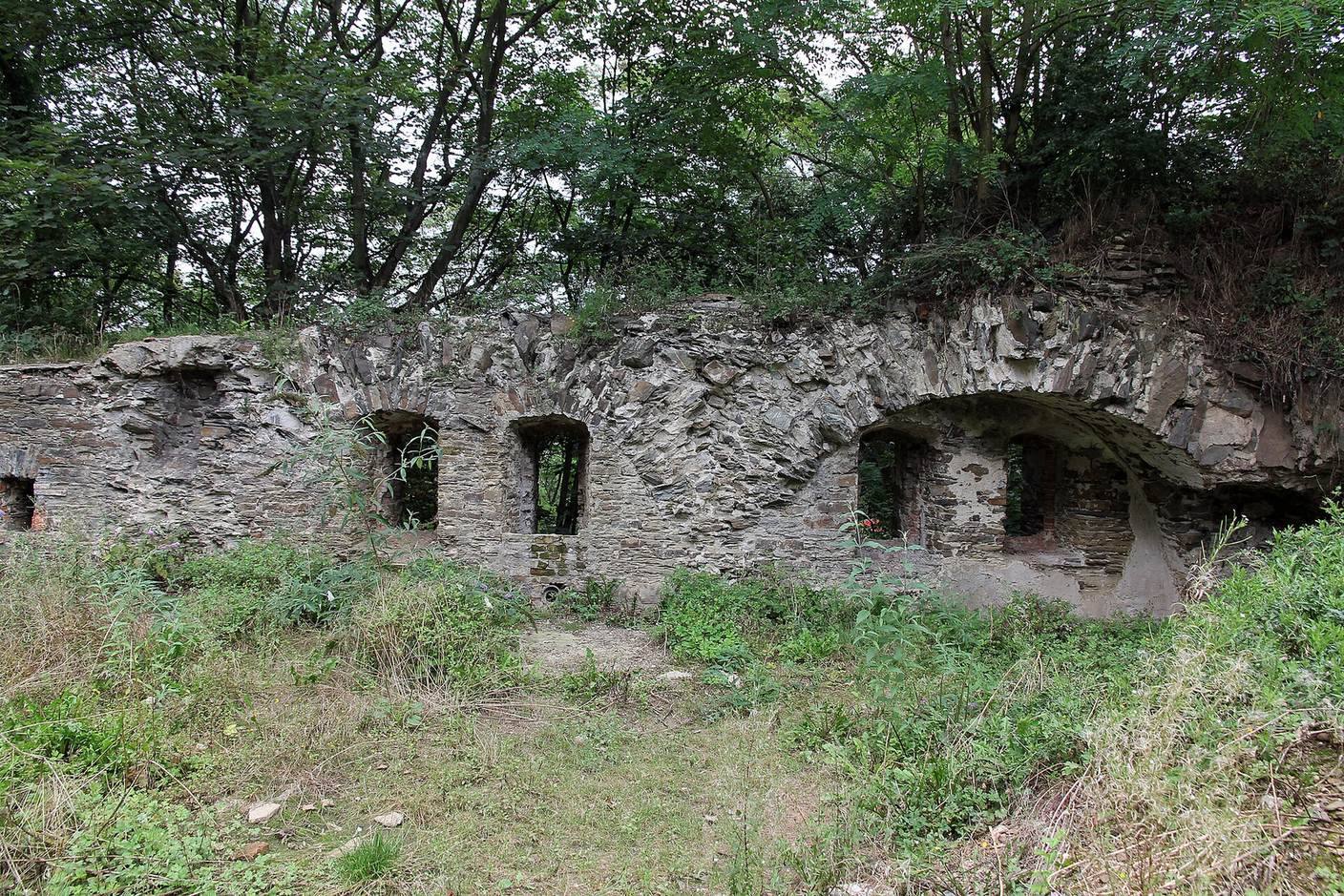
Underground passages connected the fort with the separate defensive works at Moselflesche and Bubenheimer Flesche. Much of the approximately 300-metre passage leading from the north end of the main strongpoint toward Bubenheimer Flesche survives. Its outer wall later served as a retaining wall where the ground outside stood at a different level. A partly damaged passage between the postern and strongpoint was uncovered during the 2018–21 park works, and part of the underground route was reconstructed in 2020.
Lützel enclosure and military buildings
A battlemented defensive wall once protected the freight station and the Lützel area. Two ditch-defense works and a blockhouse formed part of it. Remnants of the wall survive on Deichstraße and in the courtyard of the building at Deichstraße 1. An artillery depot also developed in the fort’s rear area, beginning with carriage house no. 9 after 1867 and expanding to six carriage houses by 1908. Two of the houses and a staff residence were destroyed during the Second World War; the Bundeswehr took over the surviving buildings after 1969.