Raktuvės Hill: A Semigallian Hillfort in Lithuania
Site at a Glance
- Popularity
- Very Low
- Country
- Lithuania
- Primary era
- Medieval
- Eras represented
- Iron Age, Classical, Medieval, Modern
- Civilizations
- Russian
- Site type
- Military
- Remains
- Castle
On this page8 sections
History
Raktuvės Hill is the site of a Semigallian hillfort, a fortified stronghold on elevated ground, in Žagarė, Lithuania. The hillfort is dated from the first millennium BCE to the 13th century. It was the location of Rakte Castle, also known as Raktene, and became the Semigallians’ principal hillfort in 1285. The Semigallians were a Baltic people whose lands included parts of present-day Lithuania and Latvia.
Rakte and Semigallian resistance
The Livonian Order, a medieval military religious order active in the eastern Baltic, captured and burned Rakte in late spring 1272. The castle appears to have been rebuilt afterward. In 1284–85, Semigallians facing pressure from the Order moved from Tervete Castle to Rakte. In 1285, after their ruler Nameisis, a 13th-century Semigallian leader, died and their attempts to capture Svētkalns Castle failed, they burned Tervete and made Rakte their principal hillfort.
Fall and later border
In winter 1289, the Livonian Order launched a surprise attack, captured Rakte’s outer settlement, and seized substantial property. Its forces tried for three days to take the castle but could not climb the ice-covered slopes. The Semigallians nonetheless abandoned Rakte that year and withdrew to Sidabre, their last refuge in their lands. The district commander at Heilingenberg, the Order’s castle at Tervete, then burned Rakte. It was not rebuilt.
The hillfort remained in Livonian Order territory until the 15th century. In 1426, it was named “Berg Rattow” and “Rattowschen bergh” in the demarcation of a new border between the Livonian Confederation and Lithuania. This followed the Treaty of Melno, a 1422 peace agreement between the Teutonic Order and Lithuania. Latvian archaeologist August Bielenstein first identified the hill as the site of Rakte in 1892.
Cemetery and archaeological study
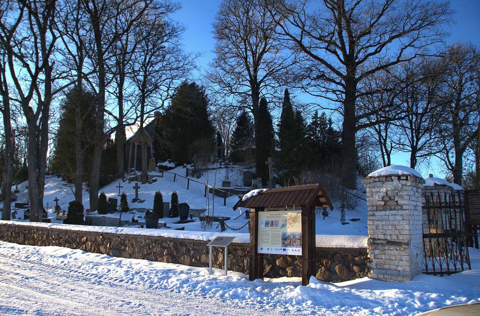
Burials began on the hill in the mid-19th century and substantially disturbed it. A wooden chapel was built as part of the cemetery. Local historians from Žeimelis surveyed the hillfort in 1966, and their finds are held at the Žeimelis secondary school museum. The Lithuanian Institute of History carried out test excavations in 1968, and the settlement at the hill’s foot was investigated in 1997. In 1999, archaeologist Ernestas Vasiliauskas excavated 44.9 square metres. Work in 1998–99 also addressed erosion caused by the cemetery.
Remains
Hillfort layout
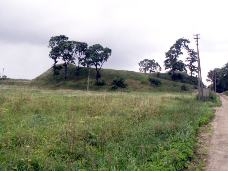
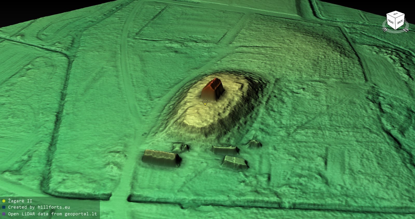
The hillfort occupies an isolated hill on the right bank of the Švėtė River. Its rectangular summit platform measures 70 by 30 metres and runs northeast to southwest. The slopes rise 6–7 metres. A ditch is visible at the western foot, while traces of a rampart and defensive ditch remain on the hillfort.
Cemetery and chapel
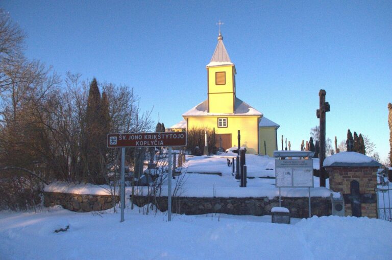
The hill is now a cemetery, and burials have severely disturbed its surface. The northern slope remains undisturbed. Individual deciduous trees grow on the slopes, and the wooden Raktuvės Chapel stands near the centre of the summit platform, within the old cemetery.
Settlement and excavated layers
A settlement covers five hectares along the southern, western, and northern foot of the hill. Finds from its investigation include rough-surfaced and wheel-thrown pottery, as well as a bone spindle whorl. Excavations on the summit and northern slope revealed a soil deposit containing evidence of human activity, up to 2.1 metres thick and divided into three layers. The lowest layer contained handmade pottery, a bone pin, and animal bones. Above it was a layer with burnt logs, wheel-thrown pottery, and a stone casting mould. The upper layer yielded small bronze ornament fragments, iron knives, and both handmade and wheel-thrown pottery.