Qaynargumbaz: A Domed Water Reservoir in Uzbekistan
Site at a Glance
- Popularity
- Very Low
- Country
- Uzbekistan
- Primary era
- Modern
- Eras represented
- Modern
- Civilizations
- Khanate of Kokand
- Site type
- Infrastructure
- Remains
- Cistern
On this page9 sections
History
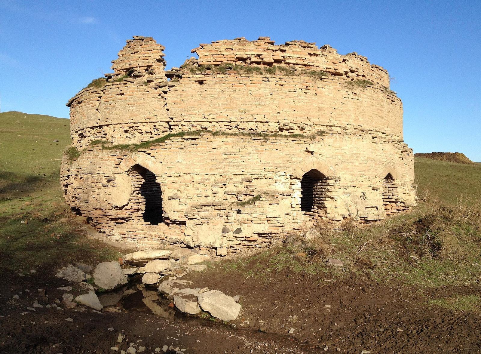
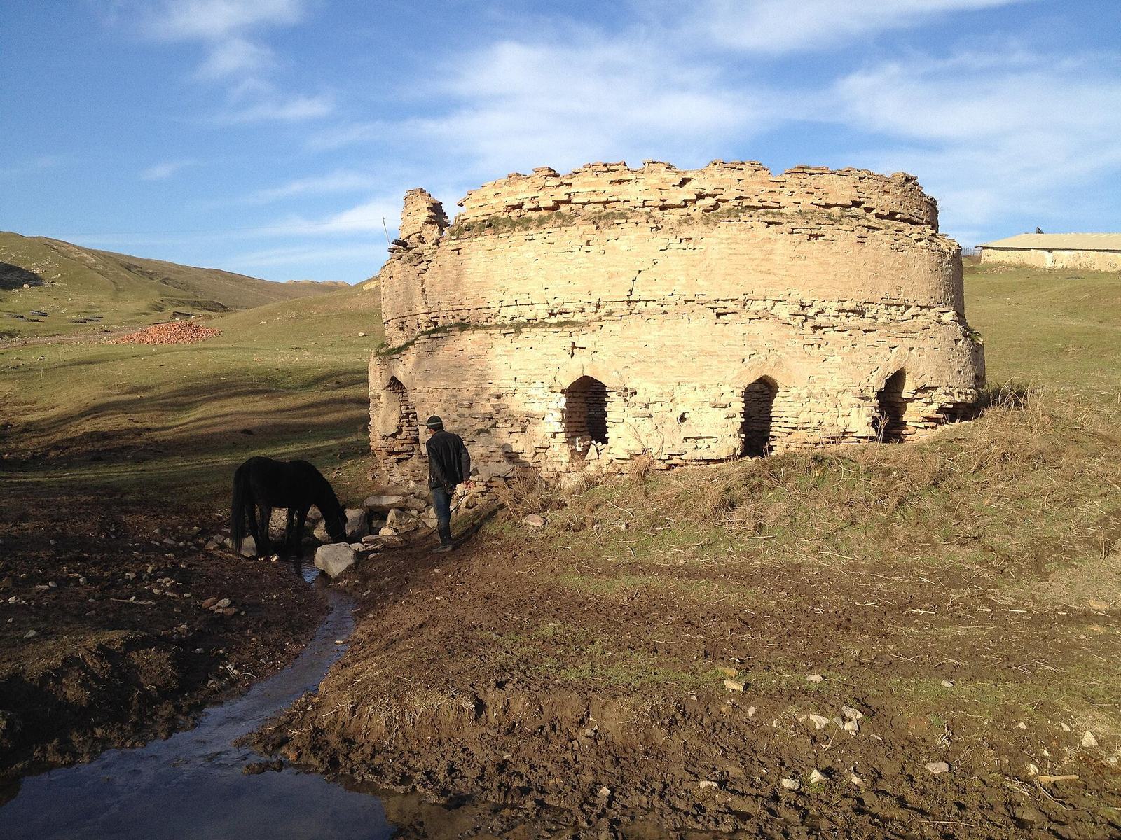
Qaynargumbaz, also called Sardoba Qaynar, is a domed water reservoir in Qaynar village, Ohangaron District, Uzbekistan. It is associated with the architecture of the Kokand Khanate, a Central Asian state centered on Kokand, and local tradition generally dates it to the nineteenth century, although its age remains disputed. It is the only surviving reservoir of this type in Tashkent Region and is among Central Asia’s ten largest.
The reservoir formed part of a complex that included a caravanserai, a roadside lodging and service center for travelers and merchant caravans. Its scale, importance, and function have been compared with those of the reservoirs at Raboti Malik and Kasbi. Among 57 such reservoirs in Uzbekistan, Qaynargumbaz was considered to have water suitable for drinking.
Caravan routes and competing dates
During the eighteenth and nineteenth centuries, Qaynar stood on a busy caravan route between Tashkent and Fergana. Travelers favored it over an alternative road through Toytepa, which crossed marshland and often became impassable; caravans stopped at the spring. Traces also point to a trade route from before the Mongol conquest of Central Asia in the thirteenth century. It ran from Chach, an early name for the Tashkent region, through Yettikent to Tunkat, capital of the historical region of Ilak.
Accounts of the reservoir’s construction differ. One tradition says Umar Khan ordered it in 1811–1812 at the request of his wife, Nodirabegim. Another dates the order to 1816 and names Normuhammadbiy, governor of the Qurama district, as the builder. Architect Abdurashid Hoʻqandiy is also credited with the reservoir and roadside complex. Other local traditions name Muhammad Alixon, whose rule began in 1822, or Mallaxon, who ruled from 1858 to 1862. Road improvements were associated with Mallaxon’s rule.
Official records assign still different dates: an eighteenth-century date appeared in the 2014 cultural-property list, while the 2019 national register placed the building in the thirteenth century. Historian M. E. Masson considered the roadside complex a late Kokand-era structure and the reservoir older, and noted repairs from different periods. Ilhom Temirov, a regional heritage official, proposed a Timurid-period origin. The Timurids were a dynasty whose successors ruled much of Central Asia from the late fourteenth century. Temirov cited bricks he dated to that century and two nearby cemeteries said to contain Timurid soldiers.
Early records and archaeological surveys
The first written mention appeared in an editorial note by E. T. Smirnov in 1896. The note placed the complex near the Belovutsoy River and described the reservoir as a tower over a spring, with a passage inside. A photograph taken in 1906 by an unidentified photographer was later found by botanist P. A. Gomolitsky. The site also appeared in a 1928 guide to the Qoramazor Range.
Masson visited in 1929 and 1934, speaking with local residents and recording an attribution to Mallaxon during his first visit. In 1934 he led the 29th detachment of the Tajik-Pamir expedition on archaeological surveys. His accounts appeared in works published in 1935 and 1953. He found the reservoir substantially intact in 1935, and its dome remained undamaged into the 1950s.
Demolition and later work
The roadside complex was demolished in 1936, and its bricks were reused in a hospital in Ohangaron. The site entered a regional cultural-heritage improvement program in 2013. The Shosh-Iloq scientific and ethnographic expedition and heritage specialists examined it in 2015; improvement and restoration work took place that year and again from 2018 to 2020.
Remains
Layout and foundation
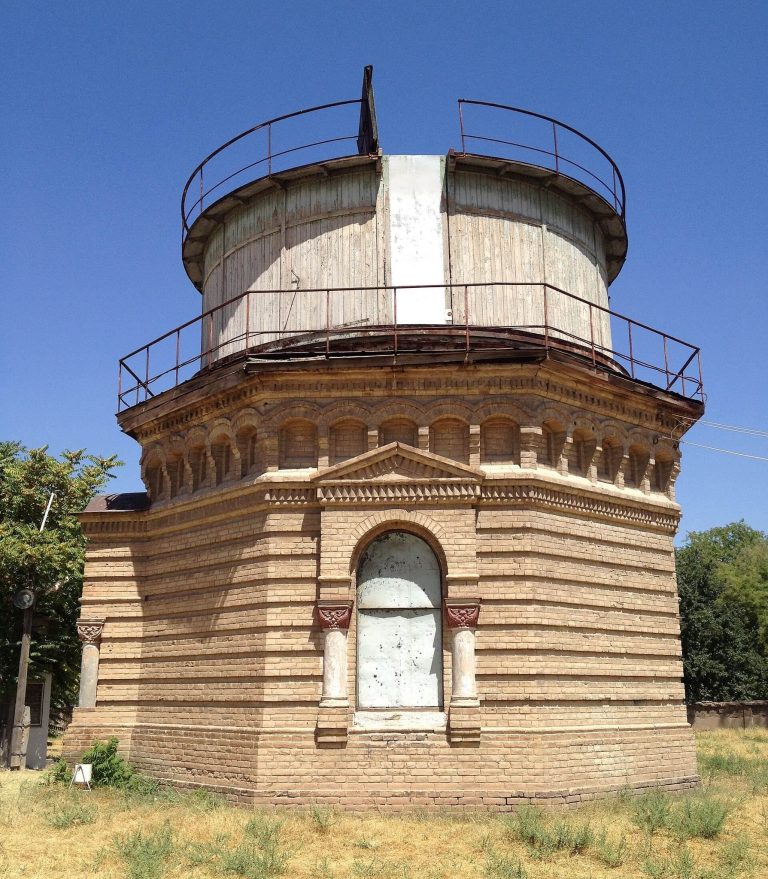
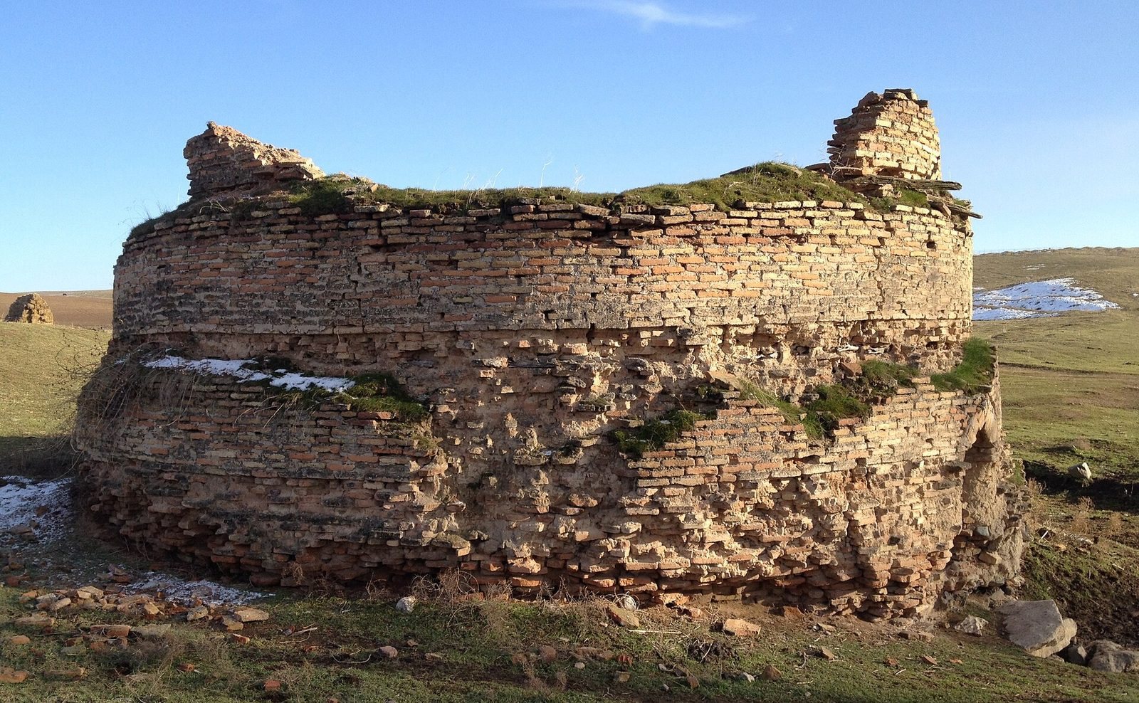
The reservoir stands over the Qaynar spring on the right bank of the Ohangaron River, in Qaynar village, about 8 to 10 km north of Ohangaron city and at an elevation of 648 m. Spring water flows into the small stream Omonqulsoy. The building is almost circular but slightly elongated, with a diameter of about 14 to 15 m and an overall height of about 10 to 15 m. Its large-stone foundation forms a small water-holding basin. Above this, a three-tiered domed structure rises about 6 m and has a curved, arch-like roof. By 2014, only the lower portion of the historic reservoir remained. Later work placed a new structure over deteriorating historic fabric rather than preserving it.
Entrances and openings
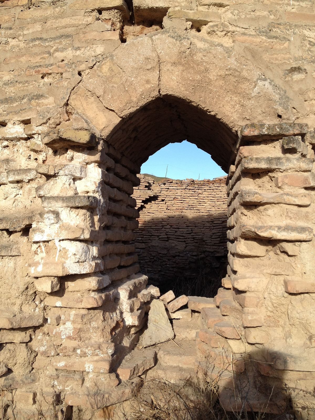
An arched entrance faces northeast, with a small platform just inside. Five openings for light face south and southeast. Square openings sit above them, along with two ventilation openings facing north and south, each formed as an arched gap. The northern vent had been sealed by the time of Masson’s survey. A small channel carries water outward from below the westernmost light opening.
Brickwork and repairs
The walls are made of fired square bricks measuring 24, 26, or 27 cm across and about 5 cm thick. Furnace slag and slagged bricks at the dome’s base indicate that bricks were fired at the building site; some bricks may have been reused from older structures. The bricks form circular rows, with each tier stepping inward toward the center. The workmanship is irregular, and a row of boards and sticks was set diagonally into the masonry about 4.5 m above the interior floor. Replacement bricks interrupt some rows, showing where repairs were made. Joints are 1.5 to 2.5 cm wide and use mainly ganch, a gypsum-based building material, mixed with clay; some outer joints were smoothed with alabaster.
Spring water
The spring nearly fills the basin, with water reaching close to the reservoir walls. Masson found clean water and many marinka, freshwater fish native to Central Asia, including large specimens in 1929. By his visit in 1934, the fish had all been caught.