Beeston Castle: A Medieval Royal Fortress in England



Site at a Glance
- Rating
- 4.5
- Popularity
- Medium
- Country
- United Kingdom
- Primary era
- Medieval
- External website
- Open
- Eras represented
- Bronze Age, Iron Age, Medieval
- Civilizations
- English
- Site type
- Military
- Remains
- Castle
On this page11 sections
History
Beeston Castle is a former royal castle in the United Kingdom, built on Beeston Crag in Cheshire during the 1220s for Ranulf de Blondeville, 6th Earl of Chester. Ranulf, a major early-thirteenth-century nobleman and castle builder, constructed it after returning from the Fifth Crusade as both a strong fortress and a display of authority. Medieval documents called it Castellum de Rupe, meaning “Castle on the Rock.”
Earlier occupation and the medieval foundation
Beeston Crag had been used long before the medieval castle. Neolithic activity included communal use of the site and the deposition of flint arrowheads. A Bronze Age community also occupied the crag, possibly as a specialist metalworking settlement. Its rampart dates to approximately 1270–830 BC. Seven circular buildings belong either to the late Bronze Age or the early Iron Age, and an Iron Age hill fort later occupied the summit.
The medieval defences were mostly in place by Ranulf’s death in 1232, although the castle had no permanent living quarters or barracks. Ranulf’s successor, John, died without a male heir in 1237. Henry III, king of England from 1216 to 1272, then took control of the Earldom of Chester and Beeston Castle. During his wars with Wales, Henry enlarged the fortress and used it to imprison Welsh captives. The garrison probably lived in temporary wooden buildings within the outer bailey, an enclosed area within a castle’s defences, rather than in a permanent residential complex.
Royal control and medieval repairs
In 1254 Henry III granted Beeston and other Cheshire lands to his son, Prince Edward, along with the title Earl of Chester. During the Montfortian rebellion of 1265, James de Audley and Urian de Saint Pierre recaptured the castle from the Montfortians after Edward escaped captivity. Edward became king in 1272 and completed the conquest of Wales.
Beeston was repaired and improved during Edward’s reign and throughout the fourteenth century. By the middle of that century, men from Cheshire served as constables of the royal castle. The constable probably lived in or near the gatehouse. A description from 1593 refers to the gatehouse, strong walls, and other buildings as having formerly made a suitable residence for an important person.
By the sixteenth century the English Crown considered Beeston to have no further military value. In 1602 it was sold to Sir Hugh Beeston of Beeston Hall. A persistent tradition later claimed that Richard II hid part of his treasure at the castle in 1399 while travelling to Chester before sailing to Ireland to suppress a rebellion. After Richard was deposed by Henry, Duke of Lancaster, who became Henry IV, the treasure was said to have remained concealed. Repeated searches, particularly around the deep inner-bailey well, found nothing. The story may be unreliable because Henry IV was recorded as recovering Richard’s gold and jewellery from several hiding places.
The English Civil War and destruction
Parliamentary forces under Sir William Brereton seized Beeston on 20 February 1643 during the English Civil War, the conflict between supporters of Parliament and the monarchy. They repaired the walls and cleared the well. On the night of 13 December 1643, Captain Thomas Sandford and eight soldiers from the Irish royal army infiltrated the castle, possibly with help from a traitor, and surprised its governor, Captain Thomas Steele. Steele surrendered on the condition that he could withdraw with honours, but he was later tried and shot for failing to defend the castle.
Royalist forces held Beeston during a parliamentary siege that lasted from November 1644 to November 1645. They surrendered after their food supplies ran out. In 1646 the castle was partly demolished under Cromwell’s destruction order. This process, known as slighting, deliberately damaged fortifications to prevent their military reuse.
Quarrying, estate ownership, and preservation
Parts of the castle grounds were quarried during the eighteenth century. The gatehouse leading into the outer bailey was demolished to create a track for removing stone. In the late seventeenth century, Sir Thomas Grosvenor, 3rd Baronet, commissioned William Samwell to build Eaton Hall and arranged the estate so that people at the hall would look towards Beeston’s ruins.
John Tollemache, 1st Baron Tollemache, purchased the castle in 1840 as part of a larger estate. During the mid-nineteenth century, Beeston hosted an annual two-day charitable fete that raised money for local widows and orphans and attracted more than 3,000 visitors each day. English Heritage now owns and manages the castle. It is a Scheduled Ancient Monument, a form of statutory protection for nationally important archaeological sites in England. The outer-bailey walls and the inner-bailey gatehouse and curtain walls are separately listed at Grade I, a category reserved for buildings of exceptional interest.
Remains
Beeston Castle occupies two defensive levels on Beeston Crag, a sandstone outcrop about 107–110 metres above the Cheshire Plain. The crag forms part of the southern Mid Cheshire Ridge, with the Beeston Gap between the ridge’s northern and southern sections formed by meltwater at the end of the Ice Age. Its rocks belong to the Triassic New Red Sandstone sequence. Wilmslow Sandstone Formation forms the lower slopes, Helsby Sandstone Formation forms the upper strata, and a small cap of Tarporley Siltstone Formation covers the summit. Sandstone was quarried at several places within the castle grounds.
Natural setting and prehistoric defences
The Peckforton Fault runs along the eastern edge of the hill in a broadly north–south alignment. A low ridge of glacial moraine extending east from the castle lodge marks an ice front during the retreat, or in-place stagnation, of the Irish Sea ice sheet.
The Iron Age rampart influenced the position of the medieval outer-bailey walls, which incorporated the earlier fortification’s line. The surviving prehistoric features therefore form part of the physical setting in which the later castle was built.
Inner and outer baileys
Inner bailey
The inner bailey occupies the rocky summit at the western end of the crag. It is roughly rectangular, with steep or sheer drops on three sides. On the fourth side, a ditch cut into the rock reaches about 9 metres deep in places. Two wells were cut into the rock to provide fresh water. One is 113 metres deep, making it among the deepest castle wells in England. Parliamentary forces cleared it during the Civil War.
Outer bailey
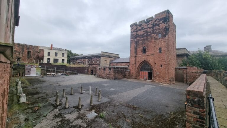
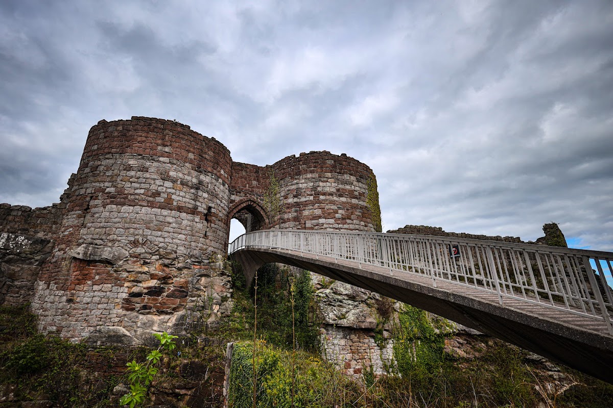
The outer bailey lies on the lower slopes and is also roughly rectangular. A massive gatehouse protected its entrance, while a ditch about 5 metres wide and 3 metres deep strengthened the approach. The outer-bailey walls had sandstone faces with rubble filling and were about 2 metres thick. Several D-shaped towers projected from them. Their form allowed defenders to fire along the wall faces and forward, while the open backs prevented attackers inside the bailey from using the towers as cover.
Beeston had no keep, the major fortified tower often used as a castle’s final defensive position. Instead, the steep natural terrain, massive walls, strong gatehouses, and strategically placed towers made the two baileys the principal stronghold. The design is traditionally, or tentatively, attributed to Ranulf de Blondeville and may have been influenced by fortifications he saw in the Holy Land during the Crusades, although he died before the castle was completed.
Later estate buildings
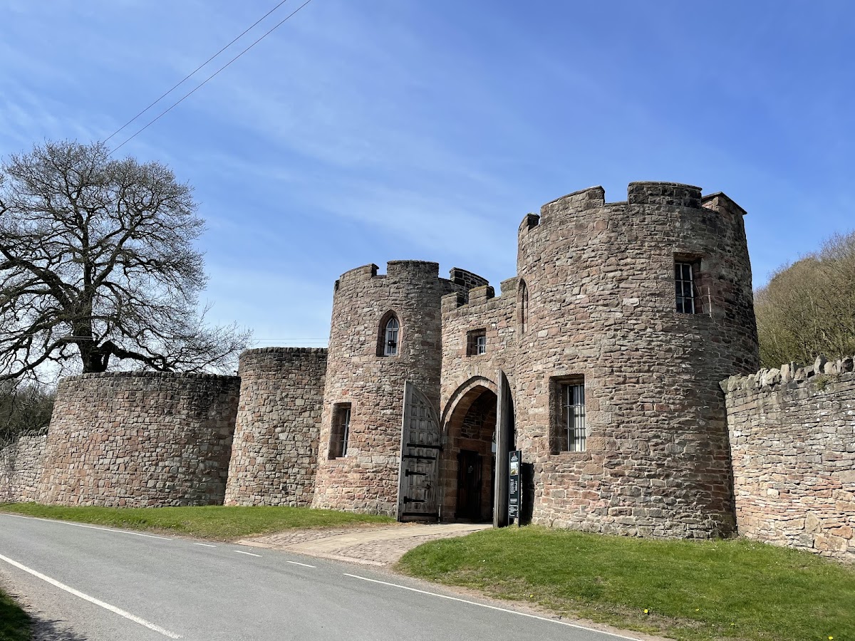
A lodge house built by Tollemache in the nineteenth century stands within the castle estate. Enlarged in the twentieth century, it has two storeys, two circular towers, and a central archway. The lodge is a Grade II listed building. The surviving walls and towers remain extensive enough to convey the castle’s former arrangement and appearance, while views from the crag extend across eight counties, from the Pennines in the east to the Welsh mountains in the west.