Tuvixeddu Necropolis: A Punic and Roman Burial Ground in Cagliari
Site at a Glance
- Popularity
- High
- Country
- Italy
- Primary era
- Classical
- Eras represented
- Stone Age, Iron Age, Classical, Modern
- Civilizations
- Carthaginian, Italian, Roman
- Site type
- Burial
- Remains
- Necropolis
On this page17 sections
History
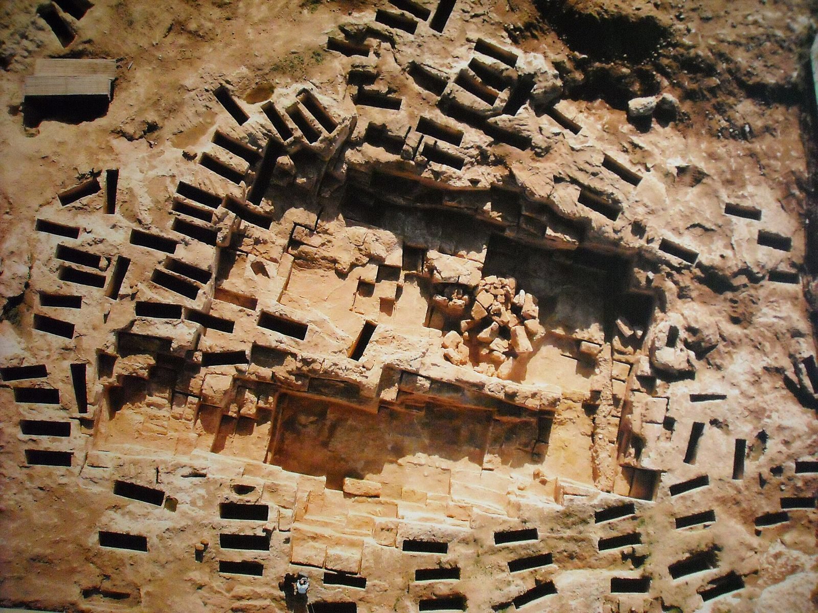
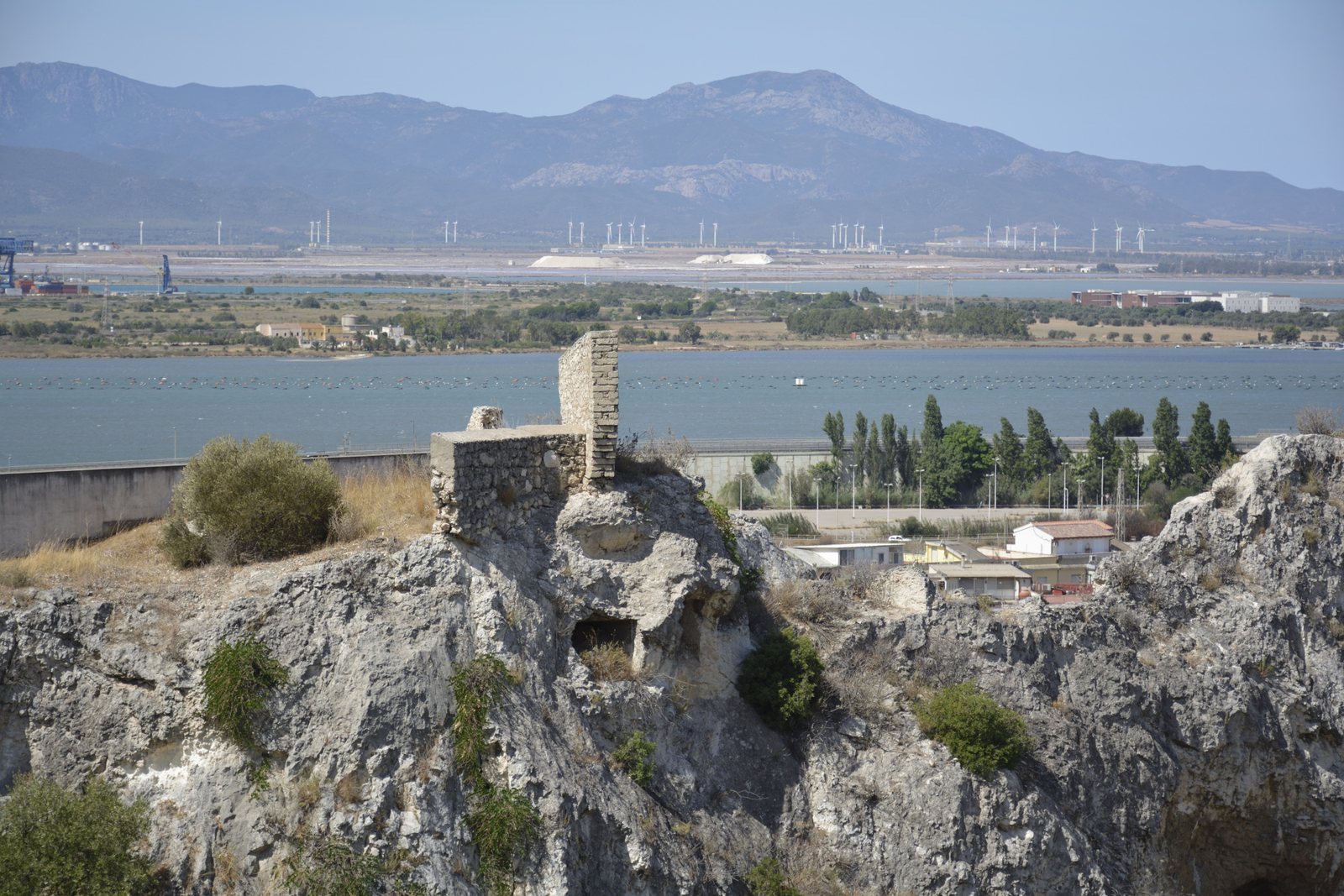
The Tuvixeddu necropolis occupies a hill in Cagliari, Italy, where Carthaginians used the site for burials between the sixth and third centuries BC. It is the largest surviving Punic, or Carthaginian, necropolis in the Mediterranean. People associated with the Ozieri culture had inhabited the hill during the Neolithic.
Punic and Roman periods
Several explanations have been proposed for the name Tuvixeddu. In Campidanese, a variety of Sardinian spoken in the south, tuvu can mean limestone containing clay or a cavity. One interpretation connects the name to a small hill of tuff, rock formed from volcanic ash, beside the larger Tuvumannu. Another links the names to quarrying. A proposed connection with the small openings of tomb access wells is considered less convincing because the place-name is singular.
A Roman cemetery later developed on the hill’s slopes, adding a new burial ground to the earlier Carthaginian necropolis.
Medieval settlement and reuse
After the Pisans and their Sardinian allies destroyed Santa Igia, a medieval Sardinian city, in the second half of the thirteenth century, some survivors settled below Tuvixeddu along present-day Viale Sant’Avendrace. Houses were built against the hill, and some tombs and caves were adapted for domestic use.
Quarrying, war, and recent history
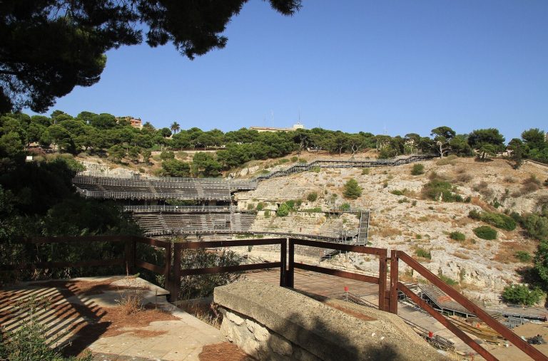
In the twentieth century, the cement manufacturer Italcementi quarried the hill, continuing extraction into the 1970s. A road known as the Canyon was built between 1953 and 1956 to carry rock by truck. Its construction divided the previously continuous landform into the Tuvixeddu and Tuvumannu areas. Quarrying destroyed many tombs while exposing others. Villa Mulas, built at the start of the century by the quarry owners, is now abandoned.
During the Second World War, tombs served as air-raid shelters and, for some older residents, as homes. After the war, people whose houses had been bombed also lived in them. Cultural associations later raised concerns about clandestine tomb robbery. In 1994, young cave explorers alerted the authorities to damage and the removal of archaeological finds. Many burial places were believed to have been destroyed with explosives, and underground cavities were looted.
Excavations by Italy’s Archaeological Superintendency, the public authority responsible for archaeological heritage, brought an area to light in the 1960s. A development plan begun in the early 2000s proposed about 400 homes between Tuvixeddu and Tuvumannu, alongside an archaeological and natural park and a museum. Museum work stopped in 2007 after the regional government led by Renato Soru blocked the project; municipal park works were completed in 2014.
A 2017 ancient-DNA study examined a man buried at the necropolis about 2,000 years earlier. His DNA carried the cod39 mutation associated with beta thalassemia. Genetic variants inherited from both parents indicated that he was probably indigenous to Sardinia.
Remains
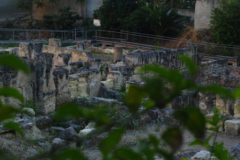
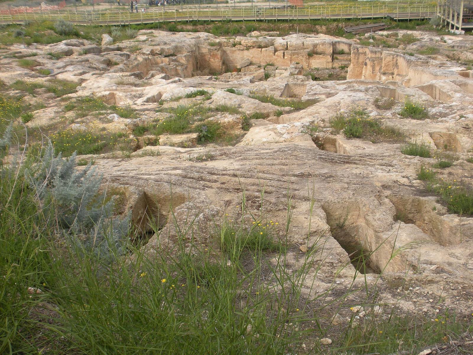
The archaeological area originally covered about 80 hectares on Tuvixeddu hill, extending from the Santa Gilla lagoon toward Via Is Maglias and from Viale Sant’Avendrace toward Viale Merello. Its remains include traces of prehistoric settlement, Punic chamber tombs cut into limestone, and Roman burials on the slopes.
Prehistoric evidence
Finds associated with the Ozieri culture include flint and obsidian tools, pottery, and the floors of huts. Together, these remains show that people lived on the hill long before the Punic cemetery was established.
Punic tombs
Wells and burial chambers
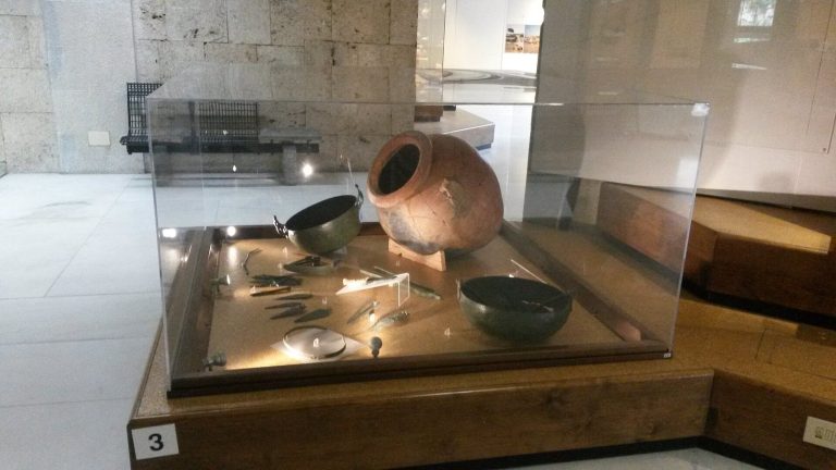
Access to the Punic tombs was through wells cut into the limestone, roughly 2 to 11 metres deep. A small opening at the bottom led into a burial chamber, some of which had elaborate decoration. Decorated storage jars and small flasks for perfumed essences were found in the chambers. Amulets made from talc and hard stone from Tuvixeddu are held at the National Archaeological Museum of Cagliari.
Named tombs
The Tomb of the Uraeus takes its name from a stylized rearing cobra emblem associated with ancient Egyptian royal imagery. The Tomb of the Fighter, also known as the Tomb of Sid, refers in its alternative name to a Phoenician-Punic deity. Both tombs retain well-preserved palm designs and masks. The Tomb of the Wheel is another identified Punic tomb; archaeologist Ferruccio Barreca excavated it.
Roman cemetery
Burials beside the road
The Roman cemetery faced the road leading out of the city, later known as a Karalibus Turrem, the route from Caralis, or Cagliari, to Turris. The road’s present name is Viale Sant’Avendrace. The cemetery’s burial forms include pits, chamber tombs, cremations, arcosolia (burial recesses beneath arches), and columbaria (structures with niches for cremation urns).
Grotto of the Viper
The sepulchre of Atilia Pomptilla is known as the Grotto of the Viper.
Reused spaces and quarry landscape
Reused caves
Some reused caves can be seen behind Siotto Classical High School on Viale Trento. Tombs with signs of domestic use have also come to light during the demolition of old houses.
Quarry workings and the Canyon
The Canyon road runs between Via Is Maglias and Via Falzarego. A dense network of quarry tunnels and underground galleries lies 20 to 60 metres below the hilltop. Digging around 1950 cut through sections of Roman aqueducts and numerous Carthaginian tombs. At the former cement works, the lime-making tower was demolished in 2016. A shed stands beside the new wing of the middle school named for Giovanni Spano.
Reservoir beneath Via Vittorio Veneto
A cavity beneath the high-school building at Via Vittorio Veneto 40 lies a few metres beyond Tuvixeddu’s artificial boundaries. Carthaginians used it as a water reservoir, and Romans used it later. During the Second World War it served as a shelter, and homeless people lived there after the war. The cavity was formerly concealed by vacant, deteriorating apartment blocks, which were demolished as the street was completed.
Villa Mulas
Villa Mulas stands at the hilltop. Its park contains several kinds of trees, including pines and cypresses.