Roman Cisterns of Frigento: A Late Republican Water System
Site at a Glance
- Popularity
- Very Low
- Country
- Italy
- Primary era
- Classical
- Eras represented
- Classical
- Civilizations
- Roman
- Site type
- Infrastructure
- Remains
- Cistern
On this page6 sections
History
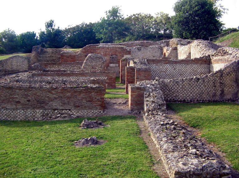
The Roman Cisterns of Frigento are an underground water-storage system in the historic center of Frigento, Italy, built in the first century BC during the late Republic, Rome’s final period of republican government. They provide the principal evidence of Roman-period activity at Frigento.
Late Republican construction and civic setting
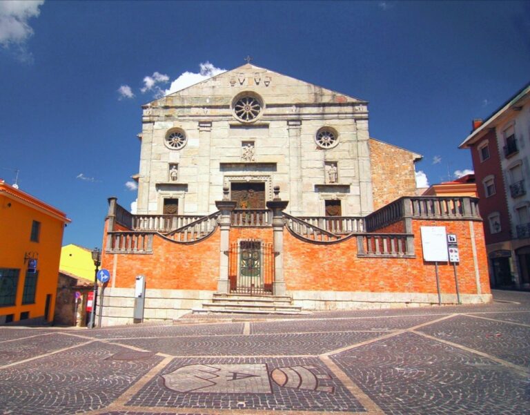
A contemporary inscription found in the Cathedral of Santa Maria Assunta links the cisterns with public works promoted by local quinquennales, Roman municipal magistrates commonly responsible for holding a census every five years. It names Lucius Sepunius and, in particular, Gaius Quinctius Valgus. Valgus had supported Sulla, a Roman general and political leader, and Cicero, the Roman orator and statesman, referred to his land in Hirpinian territory.
The inscription, the cisterns, and Frigento’s relative proximity to the Appian Way, a major road between Rome and southern Italy, have prompted proposals that the town was a municipium, a community incorporated into the Roman state with local civic institutions. This interpretation remains disputed. One alternative is that the inscription originally came from nearby Aeclanum and was later brought to Frigento; arguments for a local origin connect the inscription with the cisterns themselves.
The cisterns’ design may have been the work of Gaius Antistius Isochrysus, who may have been of Greek origin. His name appears on a separate inscription found in Via Roma, near the cisterns. It is the only known inscription in Regio II, an administrative region of Roman Italy, to identify an architect explicitly. Finds of heating-system supports nearby, and perhaps mosaics, have also led to the suggestion that the cisterns supplied a bath complex.
Archaeological investigations
Observations of the cisterns began in the eighteenth and nineteenth centuries. Archaeological investigations started in the 1950s under Giovanni O. Onorato, who directed the clearing of some galleries and the water inlet conduit. Further work in the 1990s and in 2002 brought additional details to light about the coverings of the vaults.
Remains
Subterranean galleries
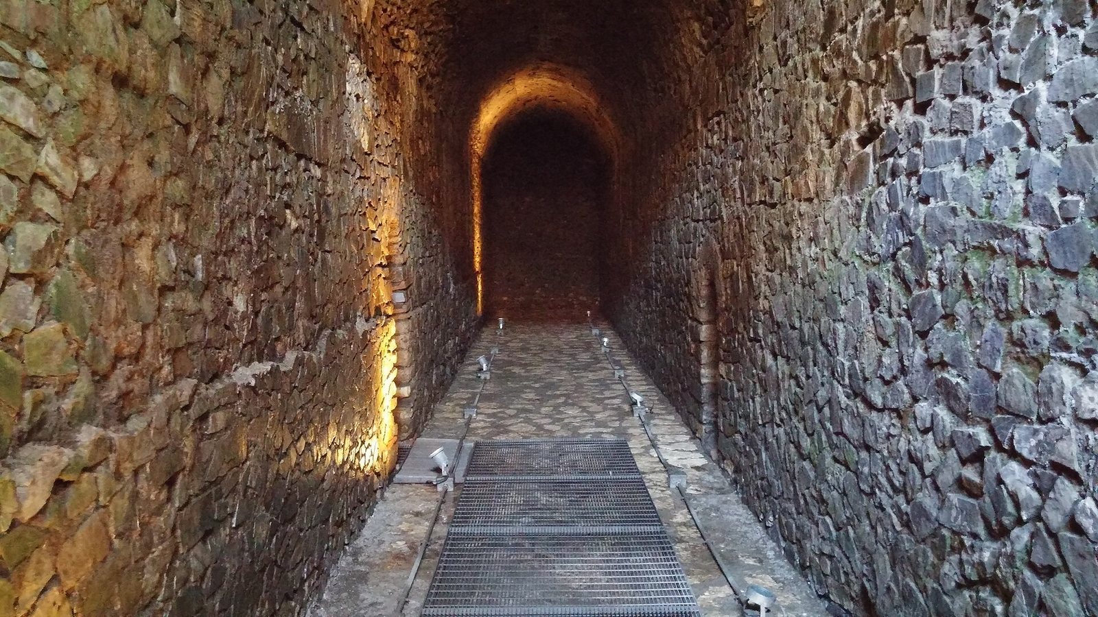
The cisterns lie beneath a nineteenth-century building and a garden. Four arms are visible, although only three can be entered; the fourth is buried. The system may once have extended much farther, perhaps to eleven tunnels. Its entrance, at an altitude of 908 metres, was cut through the vaults so that water could be drawn as needed. The galleries are about 20–21 metres long and 2 metres wide, with heights of roughly 3.5–3.9 metres. Their original crushed-pottery mortar surface is covered by a later floor of local stone, raised by about 30 centimetres.
Continuous barrel-shaped ceilings are built of Roman concrete. The side walls have a facing of irregular limestone pieces. Openings in the vaults include accidental breaks caused by later building work, as well as others that may have regulated water levels or provided ventilation, especially in the first gallery. Arched doorways link the arms; their arches, made of travertine, vary in size and alignment.
Water collection and distribution
The cisterns occupy the highest point on the route between Beneventum, modern Benevento, and Compsa, modern Conza della Campania. From late autumn to early spring, they collected rainwater and melting snow. An apparently active aquifer was also incorporated into the water supply, making a drainage pump necessary. The system was intended to supply water throughout the year, and the stored water was regarded as notably good in quality and suitability for drinking.
Water probably flowed toward a structure in front of the cisterns through a channel sloping by one percent, then continued to other parts of the settlement in conduits. A partial, hypothetical estimate places the cisterns’ capacity at about 5,798–6,526 cubic metres, not counting the water contributed by snowmelt.