Nymphaion: An Ancient Greek City on the Cimmerian Bosporus
Site at a Glance
- Popularity
- Medium
- Country
- Ukraine
- Primary era
- Classical
- Eras represented
- Iron Age, Classical
- Civilizations
- Ancient Greek, Bosporan Kingdom, Roman
- Site type
- City
On this page11 sections
History
Nymphaion was an ancient Greek city on the western shore of the Cimmerian Bosporus in present-day Ukraine. Greek settlers, probably from Ionia, founded it around 580-560 BCE. Miletus is usually identified as its parent city, though Samos has also been proposed; whether Nymphaion began independently or grew from Panticapaeum remains uncertain. An earlier Scythian settlement has also been suggested, but the question remains unresolved. Nymphaion prospered through grain exports and controlled cereal trade important to mainland Greece. It later became an important city of the Bosporan Kingdom, an ancient state centered on the Cimmerian Bosporus and surrounding Black Sea regions.
Athenian alliance
Around 444 BCE, Athens chose Nymphaion as its principal military base in the region. By 438/437 BCE, the city belonged to the Delian League, an alliance of Greek city-states led by Athens. Nymphaion paid Athens an annual tribute of one talent, and an Athenian garrison was stationed there.
Transfer to Bosporan rule
After Athens lost the naval battle of Aegospotami to Sparta in 405 BCE and the Delian League collapsed, Gylon transferred Nymphaion to Satyr I, the Bosporan king. Gylon was the city’s harmost, a military governor or official, and the grandfather of the Athenian orator and politician Demosthenes. Accused of betraying the city, he was recalled to Athens to face prosecution, but fled to the Bosporus. Satyr granted him the district of Kepa. Nymphaion then came under Bosporan rule and later the authority of Panticapaeum.
Destruction, economic change, and later occupation
Nymphaion was fortified in the fourth century BCE and soon destroyed. The cause is uncertain, though the damage may have occurred during a war between the Bosporan state and Heraclea Pontica between 353 and 347 BCE. The city was rebuilt. After Alexander the Great’s conquests, cheaper Egyptian grain weakened the Bosporan cities’ position as suppliers to Athens, and their economies increasingly turned toward wine. During the Hellenistic period, the era following Alexander’s conquests and ending with Rome’s conquest of Egypt in 30 BCE, Nymphaion declined. A major earthquake around the middle of the third century BCE damaged part of the city, and the affected area remained unused for several decades.
Nymphaion regained some prosperity under Roman rule in the first centuries CE. Goths destroyed the city in the third century CE. In the early medieval period, its territory became a cemetery.
Archaeological investigation
Jewelry discovered in 1866 prompted destructive digging in the burial mounds by local residents and private individuals. The Imperial Archaeological Commission began investigating the city and cemetery in 1876, mapping the settlement and its burial mounds through 1880. A survey led by V. F. Gaidukevich in 1938 initiated systematic work at the city, cemetery, and surrounding countryside. From 1939 to 1958, Mark Khudyak directed investigations for the State Hermitage and the USSR Academy of Sciences; work extended to the cemetery in 1966.
Fighting along the coast during the Second World War changed the shoreline and terrain. Large-scale excavations followed the war, and frescoes from a sanctuary were restored. Their discovery and restoration received recognition from UNESCO, the United Nations organization concerned with education, science, and culture, and an Onassis Prize was awarded to Hermitage staff. The archaeological complex is designated a heritage site of federal significance in Russia and a national monument in Ukraine.
Remains
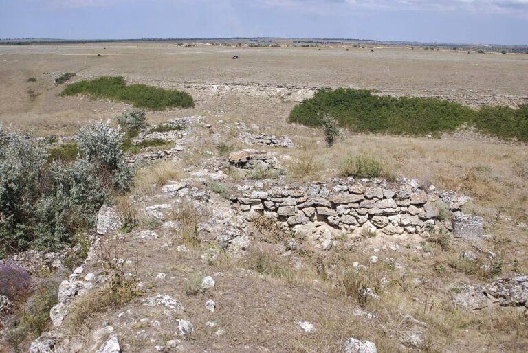
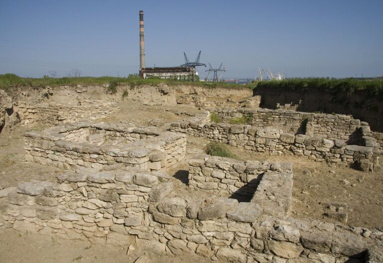
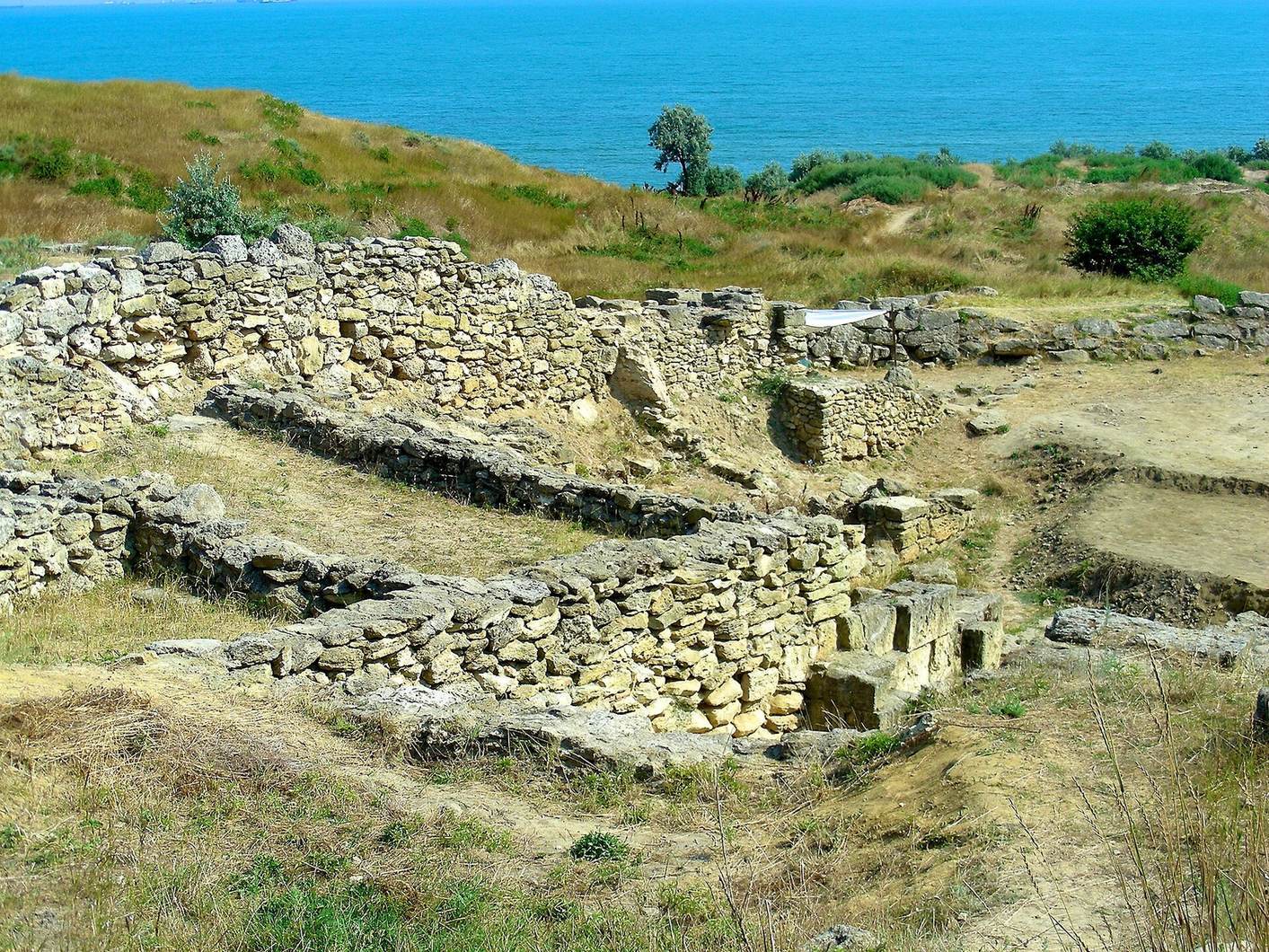
The excavated city covers about nine hectares on a small plateau atop a rocky cape. The ancient coast is estimated to have lain about 300 metres east of the present shoreline; the ruins now sit roughly 200 metres inland. Coastal erosion has submerged part of the city, including its harbor, while beach sand covers other remains. Čurubaš Lake to the north and Tobečik Lake to the south occupy ravines that once had sea inlets at their eastern ends, about seven kilometres apart. Steep hills marked the western boundary of Nymphaion’s territory. These natural features aided defense, while fertile black soil and greater rainfall than in surrounding areas supported settlement. The harbor and a lower district lay near the sea. Strabo, a Greek geographer and historian of the Roman period, described the harbor as excellent.
Sanctuaries
The acropolis, the raised and often fortified part of an ancient city, contained sixth-century BCE sanctuaries to Aphrodite, associated with love and beauty, and the Cabeiri, deities worshipped in Greek mystery cults. The sanctuary of Aphrodite had several rooms, and the acropolis was fortified in the fourth or third century BCE. On a lower terrace near the sea, a sanctuary to Demeter, the goddess of agriculture and fertility, was established in the sixth century BCE and altered repeatedly. Its final known phase consisted of a walled sacred precinct of about 60 square metres and an altar. A long-lived sacred area has also been identified on the southern slope of the city plateau.
Buildings, streets, and wine-making installations
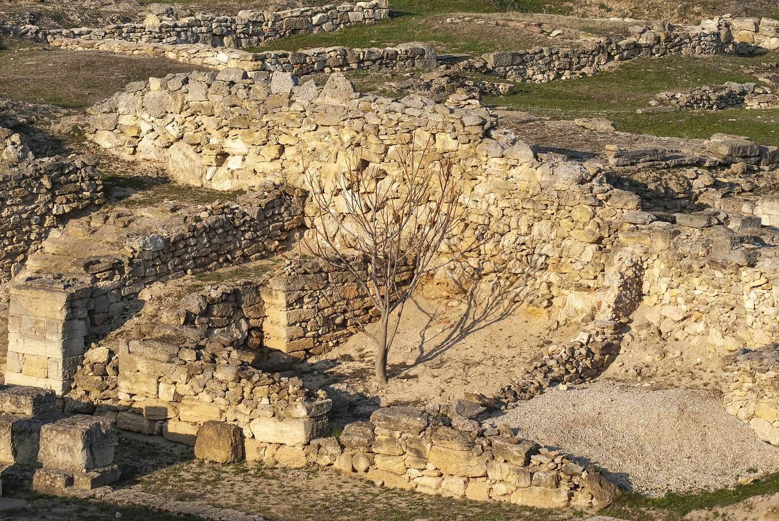
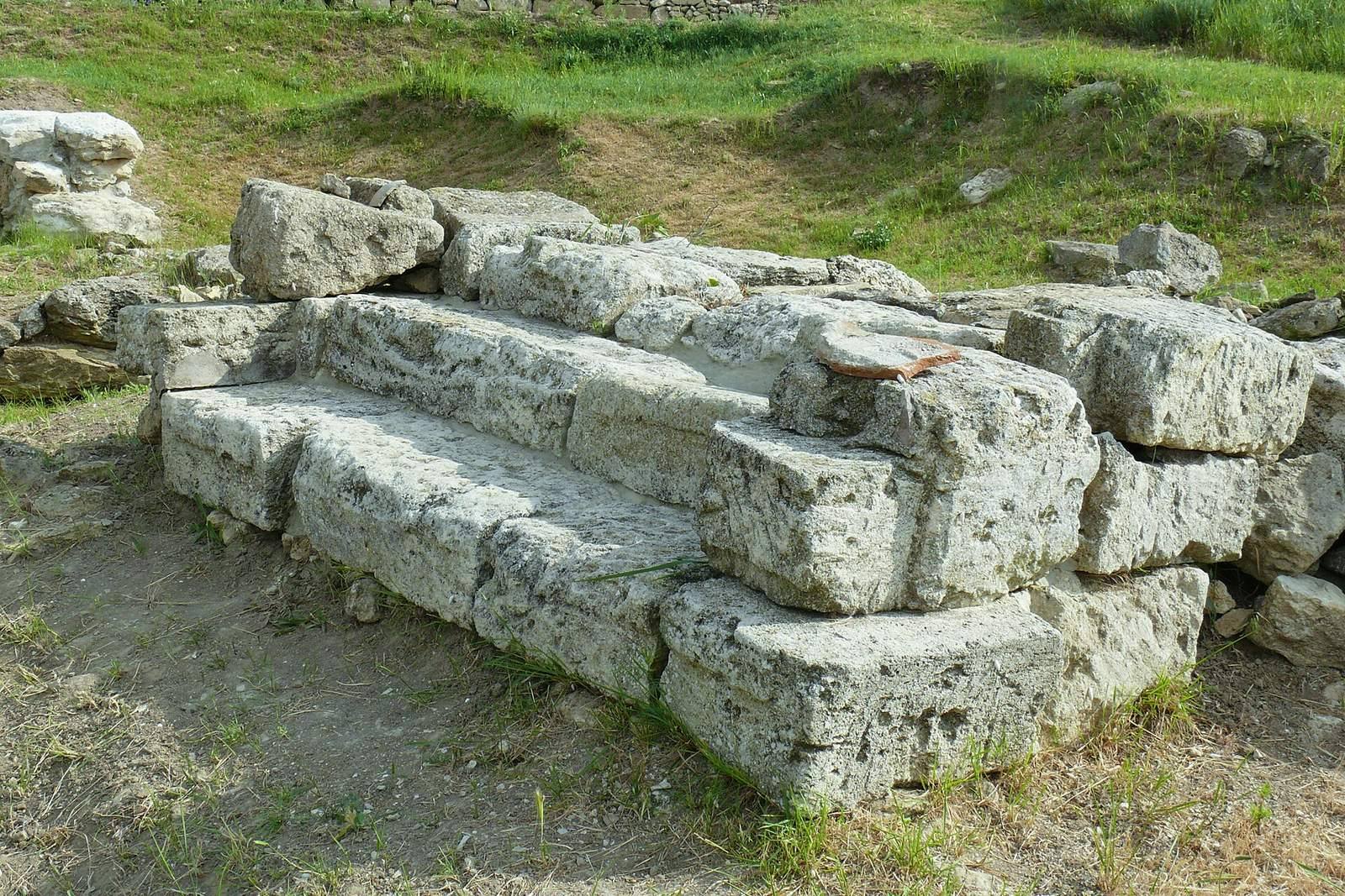
Excavated remains include public, commercial, and private buildings, streets, urban infrastructure, pottery kilns, and wine-making installations. Wine production facilities date to the fourth century BCE, and larger complexes were built in the third century BCE; such complexes are among the earliest known in the northern Black Sea region. A monumental staircase connected the acropolis with the lower city and port. One third-century BCE structure was built of rose-colored marl, a fine-grained sedimentary stone. The urban plan and infrastructure have been traced across areas belonging to different periods.
Rural territory
Outside the urban area, Nymphaion’s territory contained settlements and farmsteads, along with transport routes and water-management systems. The western ridge of steep hills marked the territory’s boundary, while the ravines and former sea inlets to the north and south formed other natural limits.
Cemeteries and grave goods
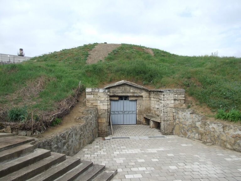
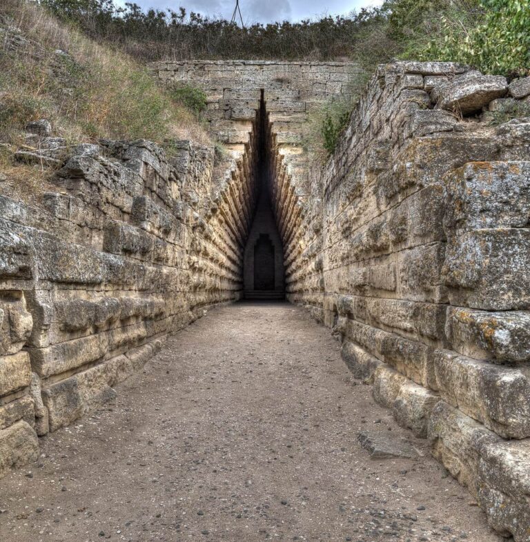
The cemetery extended north, west, and south of the city. West of the settlement were burial mounds and a flat-grave cemetery, including an area called the Alley of Tombs. Most identified graves date to the fifth and fourth centuries BCE. Some burials reflect Scythian customs, while horse burials have also been associated with Sarmatian practices. Male graves included weapons, gold neck rings, black-glazed pottery, and horses. Finds from leaders’ burials in the surrounding mounds include jewelry, Greek black-glazed cups, red-figure vases, and ancient bronze objects. Other fifth-century BCE graves contained helmets, swords, arrowheads, spearheads, and military equipment.
Frescoes and excavated objects
Terracotta figurines offered to deities were found in the sanctuaries. Objects from Nymphaion held by the Hermitage include ancient pottery, terracotta figures, glass vessels, and architectural fragments, some brought to the city from Sinope. A sanctuary’s wall inscriptions and frescoes include a painting of a ship about 1.5 metres long, with the name “Isis” on its hull. Isis was an Egyptian goddess whose worship spread across the ancient Mediterranean. The fresco was reconstructed from hundreds of fragments and is now displayed at the Hermitage.