Belyaus Archaeological Site: A Greco-Scythian Settlement in Ukraine
Site at a Glance
- Popularity
- High
- Country
- Ukraine
- Primary era
- Classical
- Eras represented
- Classical
- Civilizations
- Ancient Greek, Scythian
- Site type
- Domestic
- Remains
- Villa
On this page12 sections
History
The Belyaus Archaeological Site is a Greco-Scythian settlement on the seashore in Ukraine, founded in the final quarter of the fourth century BCE by Greeks from Chersonesus, an ancient Greek city on the Crimean Peninsula. Its original name is unknown. Belyaus supplied wheat to Chersonesus and supported a varied local economy.
Greek foundation and growth
Residents grew grain for export, cultivated grapes, raised livestock, hunted, and fished. Over about a century, the settlement expanded beyond its first fortified estate into a group of neighboring holdings. A Scythian attack around the turn of the third and second centuries BCE marked a period of pressure on the community.
Scythian control and abandonment
Late Scythians, later Scythian communities of the northern Black Sea region, took control in the early second century BCE. They changed the settlement’s arrangement and partly rebuilt its structures. In the late second century BCE, people from Chersonesus sought to recover the territory with troops from the Pontic Kingdom, a Hellenistic state in the Black Sea region. The army was commanded by Diophantus, a Pontic military leader. Although his campaigns, known as the Diophantine Wars, brought victory over the Scythians, Scythian control at Belyaus continued.
During the first half of the first century CE, refuse and ash accumulated in the settlement’s ditch. Occupation ended in the second half of that century. The Scythians probably departed under pressure from Sarmatian tribes, another people of the ancient Eurasian steppe.
Excavation, naming, and protection
Surveys began in 1962, followed by systematic excavations in 1964 under archaeologist Olga Dashevskaya. She led the Donuzlav Expedition of the Institute of Archaeology of the USSR Academy of Sciences. Archaeological work has continued intermittently. The present name comes from a neighboring former village, whose name developed from Bel Avuz, meaning “mouth of a gorge.” The village was first mentioned as a farmstead in the second half of the nineteenth century. A transcription of its name was recorded in 1875, and the modern spelling was proposed in 1933–1934. The site is protected as a local cultural heritage monument in Ukraine and is also listed as a federal cultural heritage site in Russia.
Remains
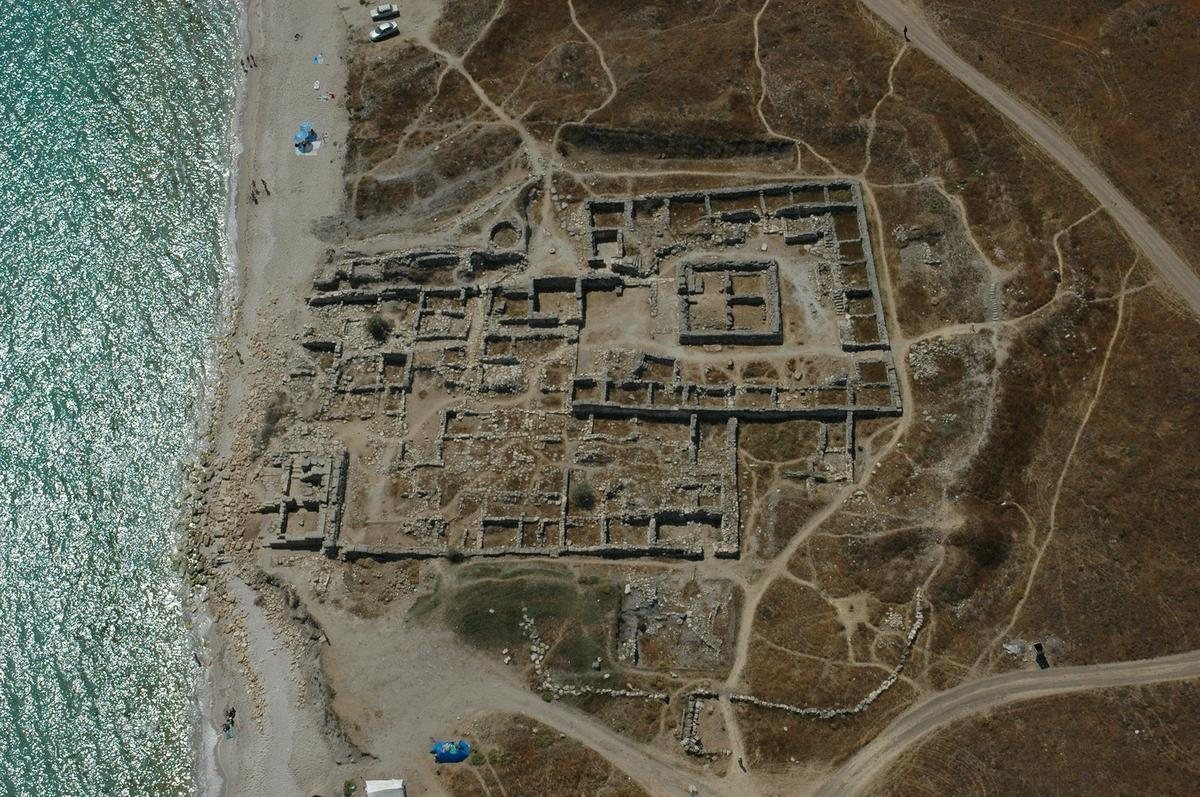
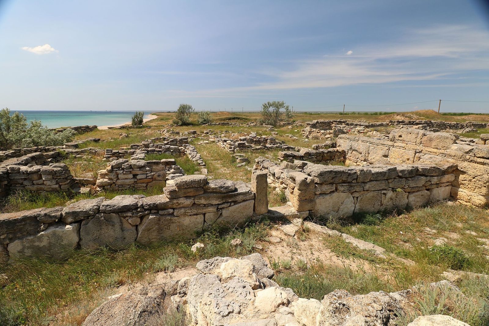
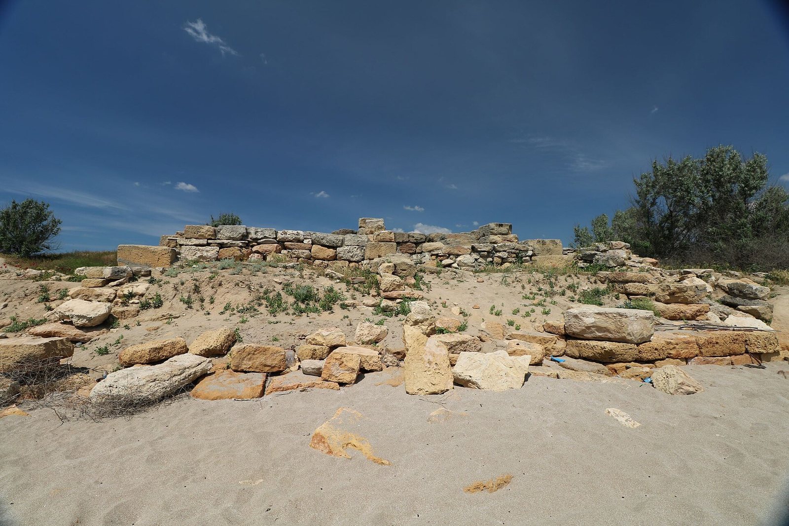
The remains form a coastal settlement of adjoining stone-built estates, defensive works, and a cemetery to the north. The site lies directly on the shore, 1.5 km southeast of Znamenskoye and 7 km west of Lake Donuzlav. The mouth of the Hypakyris River has been proposed as lying here; Herodotus, the ancient Greek historian, counted the river among Scythia’s six principal rivers.
Estates and buildings
Compounds and towers
The settlement grew from an estate with a multi-storey tower, 11 by 11 m, at one corner. Later, five adjoining estates shared enclosing walls, with domestic and service rooms set along their inner sides. Each had a stone-paved courtyard, and nearly all included a square, multi-storey tower at a corner. The tower at the southwest coast served as a lighthouse. It was built from squared stone blocks with deliberately rough, projecting faces, some bearing masons’ initials; several rows of its walls remain. Upper floors provided living space, while the ground floor had utility uses. Towers also contained wells as deep as 6 m, edged with large slabs and covered by stone lids that helped keep soil out.
Bath and drainage
One estate included a bath with a gently sloping floor made from carefully fitted rectangular stone slabs. Water passed through an opening beside a wall into a drain in an adjoining room, then flowed along a main channel toward a ravine and the settlement ditch.
Defensive works
Reinforced tower base
After the Scythian attack around the turn of the third and second centuries BCE, builders strengthened a tower’s base against battering rams. They added a protective band of limestone blocks, some as long as 1.5 m. The band originally rose about 4.5–5 m and gave the tower base a sloping, pyramid-like outline.
Rampart, ditch, and bridge
Scythian defenses included a rampart faced with stone and a ditch. An early first-century-BCE defensive line, up to 3 m high, was excavated along 80 m of the settlement’s eastern edge. A bridge crossed the ditch through a 5 m tunnel built of stone masonry and roofed with ten large slabs.
Cemetery
The cemetery lies 75 m north of the settlement and covers about 250 by 200 m. A small number of its earliest graves contained cremated remains in urns; most burials belong to the Late Scythian period. Adults were generally buried in earthen tombs, while children were placed in graves with side niches. Several tomb vaults built by Greeks from squared stone blocks were reused repeatedly and held mainly Scythian burials from the first century CE. One tomb also contained a later secondary burial of an adolescent boy associated with the Huns, a later steppe people, accompanied by rich grave goods.