Bezereos: A Roman Frontier Garrison in Tunisia
Site at a Glance
- Popularity
- Very Low
- Country
- Tunisia
- Primary era
- Classical
- Eras represented
- Classical
- Civilizations
- Roman
- Site type
- Military
- Remains
- Fort
On this page12 sections
History
Frontier and Severan garrison
Bezereos was a Roman garrison in southern Tunisia, part of the Limes Bizerentanus, a sector of the Limes Tripolitanus, Rome’s southern frontier system in North Africa. It helped secure and monitor this frontier, which consisted of connected forts and military posts. Bezereos and Tisavar were among the earlier fortifications in this stretch. Along the Wadi Hallouf, the frontier turned from southeast toward west, with Roman installations placed in semi-desert rather than in the harsher desert.
The garrison was active from at least the Severan period, the dynasty that ruled Rome from AD 193 to 235. A stone roster dated to AD 209–211 records a detachment of about 300 men from the Legio III Augusta, a Roman legion based at Lambaesis in present-day Algeria. The roster also names eight centurions, officers who commanded groups of soldiers and, in this case, were responsible for nearby forts. The known fort is small relative to the recorded force, leading to the suggestion that a larger installation may lie beneath the sand.
An inscription set up at Bezereos in AD 201 by a detachment of the legion restored the erased name of Commodus. Septimius Severus had restored Commodus’s standing after an earlier formal condemnation of his memory, and later deified him. In AD 238, the legion itself underwent a similar condemnation, and its name was erased from inscriptions.
A second inscription, dated AD 198–211, records Julius Zeno, a junior officer called an optio, dedicating an altar to Minerva Augusta. He said the dedication followed a vision and fulfilled a vow; it also sought the well-being of Severus, his co-ruler Caracalla, and Severus’s wife Julia Domna. Minerva was associated with wisdom, crafts, and warfare, and the inscription described her as the goddess of the homeland.
The third-century Itinerarium Antonini, a Roman road register, lists Bezereos as the fifth station on the route from Tacapae, present-day Gabès, to Leptis Magna. The roster’s form of the name, Vezerei, corresponds to Bezereos, also known as Vezereos.
Late Roman service and supply
Bezereos may have served as the headquarters of a praepositus, a senior officer overseeing several garrisons, as early as the Severan period. The late Roman Notitia Dignitatum, a register of civil and military offices, lists a praepositus limitis Bizerentane under the commander of Tripolitania’s frontier troops. In late antiquity, the later phase of Roman history, the Limes Bizerentanus lay between the Limes Tamallensis and the Limes Talalatensis. The later garrison’s composition is uncertain; it may have included limitanei, frontier troops, or gentiles, soldiers recruited from groups of non-Roman origin.
Nearby posts and agricultural resources supported this frontier zone. Ksar Tabria protected a major road and the hinterland, while an organized irrigation system there produced staple foods for troops and civilians around Bezereos. About seven kilometres northeast, Henchir Krannfir guarded a pass on the northern slope of the Dahar. Ksar Chetaoua lay southeast of Bezereos along the frontier sequence.
Pottery provides evidence for the garrison’s later supply. Third-century finds include a small number of thin-walled and red-gloss vessels, fragments of high-rimmed collar bowls, and part of a clay lamp known as a “sea-urchin” type, with a perforated knob on its handle. Fourth- and fifth-century pottery is more abundant, including late red-gloss plates. The assemblage points to supply largely, and perhaps entirely, from central Tunisian pottery workshops at Henchir el Guellal near Djilma. Those workshops ceased production around the middle of the fifth century. On this basis, archaeologist Michael Mackensen proposed that supplies to Bezereos ended around AD 430–440; continuous military use after that time has not been established.
Rediscovery and archaeological investigation
French military topographical teams noted extensive Roman remains near the well of Bir Ghezen in 1901. French officer Raymond Donau excavated at the fort in 1909–1910, and the roster was found in 1919. Archaeologist Alfred Merlin used it to identify the site.
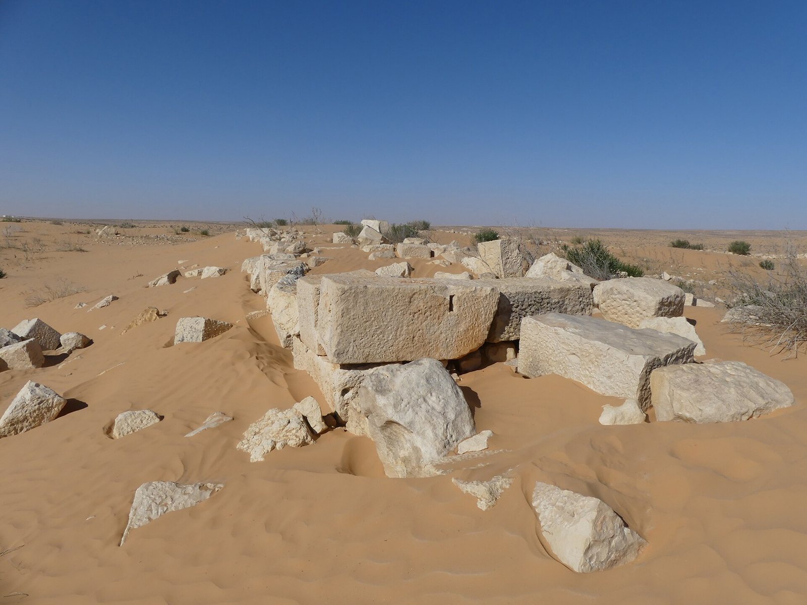
A French-Tunisian frontier research project in 1968–1970 produced a preliminary plan by historian Maurice Euzennat. Mackensen surveyed the site in 1999, 2002, and 2008. His work documented the fort’s deterioration during that period, including the loss of the uppermost wall course that had survived in places in 1998.
Remains
The fort stands on a flattened hill about 8–12 metres high, at an elevation of 125 metres, on the northeastern edge of the Grand Erg Oriental. It lies south of Djebel Tebaga, near Sidi Mohammed ben Aissa in Tunisia’s Kebili Governorate; the northern side of the hill drops steeply toward semi-desert. The enclosure covers about 0.33 hectares and measures approximately 50 by 65 metres.
The fort enclosure and entrances
Enclosure
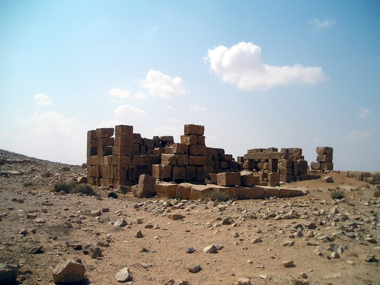
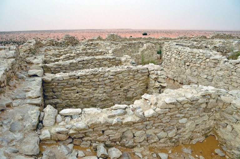
The fort has a rectangular stone enclosure, with rounded corners on the outside and right-angled corners within. This corner form is characteristic of Roman forts of the middle imperial period. The wall is 1.8–2.2 metres thick, built with an outer face of stone blocks, a core of Roman concrete made with rubble, and an inner face of mortared rubble.
Entrances
A narrow secondary entrance, or postern, is centred in the northern short wall. It measures 0.85–0.95 metres across and was blocked at an unknown date. A separate entrance, 3.5 metres wide and designed for one lane of traffic, cuts through the western long wall near the southwest corner. Its two side walls are each 1.3 metres wide and project one metre into the enclosure.
A possible main entrance is indicated at the centre of the southern short wall by a rectangular foundation measuring 3.5 by 6.7 metres and 0.7 metres thick. It projects one metre beyond the wall and half a metre inside; the wall at this point is two metres thick. Its surviving upper course contains reused limestone blocks, moulded cornices, threshold and arch stones, and two plain Tuscan-Doric pilaster capitals, the tops of flat wall supports. The capitals are tentatively dated to the late second or early third century. Mackensen suggested that a tower may have blocked the entrance later, perhaps in the fourth century, though this interpretation is uncertain. The original position of the AD 201 inscription above this possible entrance has also been proposed, but is not certain.
Outer wall
A rubble wall runs parallel to the fort’s northern enclosure, about 15 metres in front of it. A passage roughly four metres wide aligns with the northern postern. The wall curves around a rounded northeast corner, then follows the eastern enclosure at a distance of about 23–25 metres. Near the southeast corner it ends at a small round tower, turns southwest, and reaches the slope below a rectangular tower associated with the fort. Its date is unknown; a late Roman alteration has been proposed.
Associated frontier features and settlement
Watchtower at Mergueb ed Diab
About one kilometre from the fort, on Mergueb ed Diab, stands a Roman watchtower measuring 5 by 5 metres. It served as a signal station for frontier forts farther south. Archaeologist David Mattingly described it as the “eyes” of Bezereos.
Settlement at Sidi Mohammed ben Aissa
A small settlement associated with the garrison, a vicus, stood near Bezereos. Excavations at the ruins of Sidi Mohammed ben Aissa in 1938 exposed part of a two-storey building with five rooms and the beginning of a gallery. The excavators could not determine whether one level was an upper floor or a cellar. One room had a hypocaust, a floor-heating system using hot air, with well-preserved hollow tiles; it was interpreted as a bath or steam bath. An adjoining room contained a heated bathing pool. Very large bricks from the building included greenish-grey painted pieces bearing fragments of a bird’s head, a fish’s tail, and a four-legged animal.