Kanzaki Site: A Late Yayoi Moated Settlement in Kanagawa
Site at a Glance
- Popularity
- Medium
- Country
- Japan
- Primary era
- Classical
- Eras represented
- Classical
- Civilizations
- Yayoi
- Site type
- Military
- Remains
- Fortified Town
On this page15 sections
History
Kanzaki Site is a small moated settlement in Ayase, Kanagawa, Japan, occupied around the second century AD during the late Yayoi period, an era of Japanese prehistory identified partly through distinctive pottery and other material remains. Its pottery and house forms link the settlement to communities in the Tōkai region, which includes present-day Shizuoka and Aichi. The site is important evidence for movement from that region into what is now Kanagawa.
Regional connections and settlement
Pottery styles around the Sagami River basin differ from those in the Hanamizu River basin, about 10 to 20 kilometres away. This contrast suggests that the two areas received migrants from different parts of the Tōkai region. At the Hongo site, roughly one kilometre southwest of Kanzaki, pottery is associated mainly with western Shizuoka. At Kanzaki, most pottery and the house plans instead point to western Shizuoka and eastern Aichi, though the precise origins of the people who settled there remain uncertain.
The migrants may have come from the border area between those regions or included people from both. Relatively low population in Kanagawa compared with Shizuoka and Aichi may have encouraged movement. Settlements along river basins have also prompted the suggestion that people travelled by boat. Related population shifts may have formed part of wider changes during the late second century, a time of political instability and emerging state formation. The circumstances that led to Kanzaki’s settlement are not established.
The settlement seems to have been occupied for a relatively short time before it was abandoned. Its pottery is consistent in style, and the sequence of dwelling remains supports a brief period of use.
Investigation and recognition
When Ayase began preparing its city history in 1987, little was known about Yayoi remains in the area. A field inspection in May 1989 led to the selection of Kanzaki for excavation, following the recovery of late Yayoi pottery nearby. Excavations from July to December that year confirmed the presence of a moated settlement. Later investigations recovered pottery near the southern and eastern parts of the moat in 1999. In 2009, a trench south of the moat revealed a Yayoi dwelling and pottery, while work to the north recovered a small quantity of pottery.
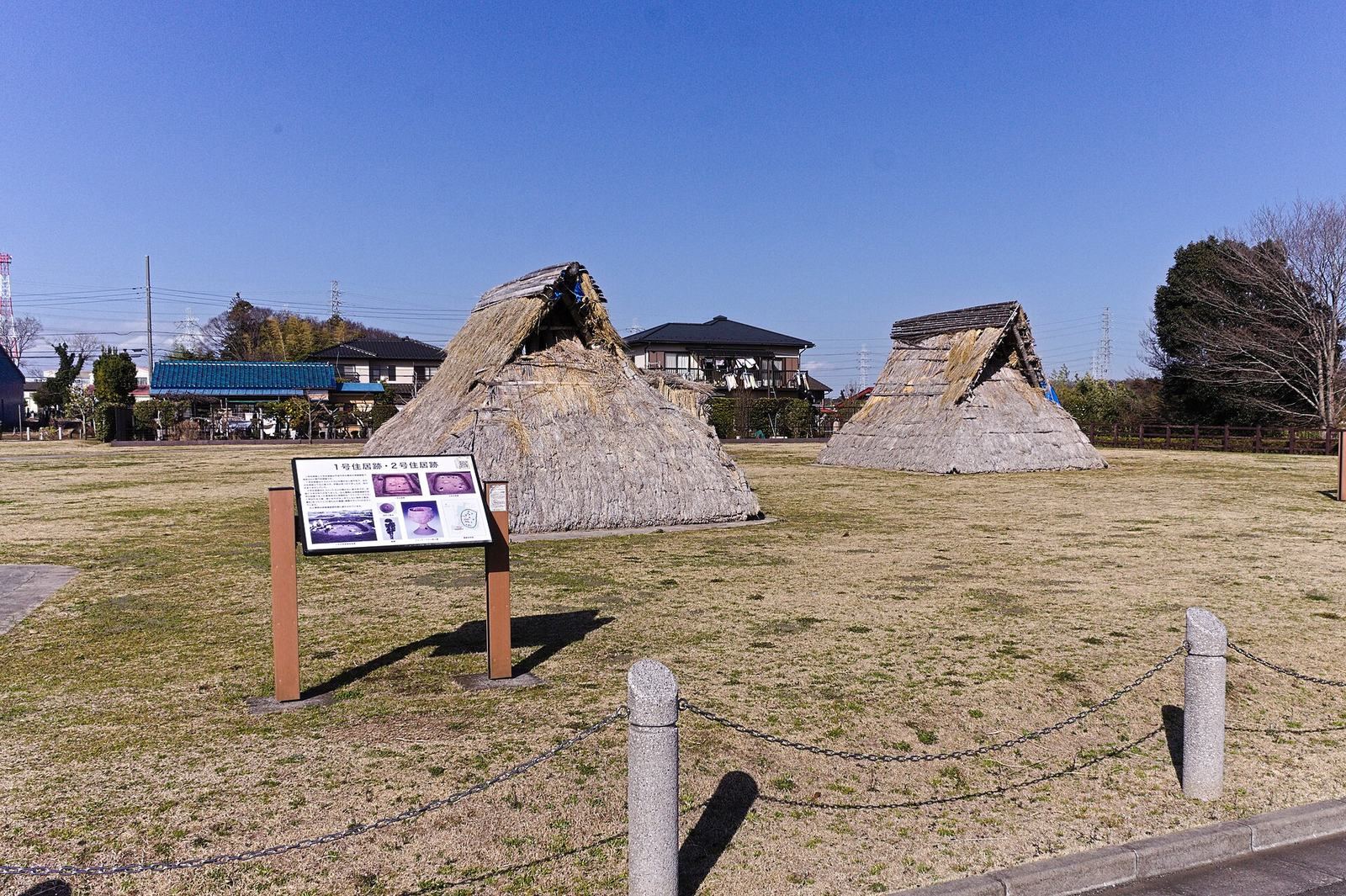
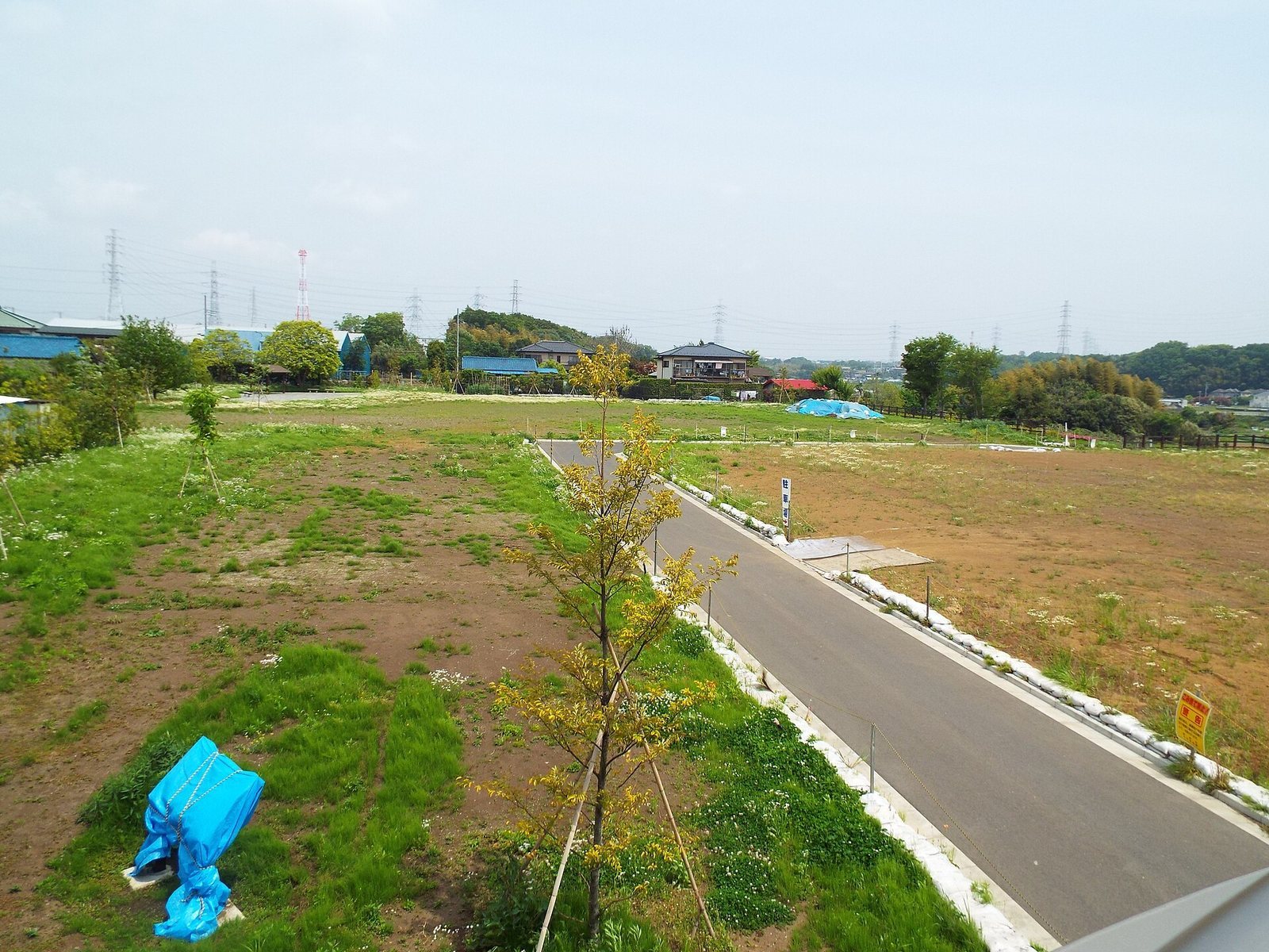
The excavated objects received Important Cultural Property status from Kanagawa Prefecture in 2002, a prefectural recognition of cultural significance. Kanzaki Site became a National Historic Site on 7 February 2011, a designation for places of historical or archaeological importance. Much of the site was left undisturbed in anticipation of future research methods, and limited development before the designation helped preserve it. It is now part of an urban historic park, with the Ayase Kanzaki Site Archaeological Museum presenting finds from the site and the city’s history.
Remains
The settlement occupies the end of a north–south plateau at the edge of the Sagamino Plateau. Its oval moat enclosed an area of about 5,000 square metres, with excavated dwellings and activity areas inside. The surviving evidence also includes pottery and other objects that illuminate the settlement’s links with the Tōkai region.
Setting and enclosure
Plateau setting
The site lies at Ayase’s southwestern edge. The Mekujiri River, a tributary of the Sagami River, runs to the east, while a small valley formed by one of its tributaries borders the plateau to the west. The plateau is about 24 metres above sea level, roughly 11 metres higher than the river’s floodplain. The surrounding lowland is thought to have been wetland or swamp with reeds. The plateau is understood to have supported deciduous broad-leaved trees, including sawtooth oak, as well as abundant firs. Conditions were cooler and wetter than today.
Moat
The oval enclosure measures about 103 metres from north to south and 65 metres from east to west. Its estimated perimeter is 270 metres. The west, south and north sides were cut into the plateau. At the northeast corner and along the eastern side, the moat descends partway down the slope toward the floodplain, then returns toward the plateau from the east to the southeast. The southeastern section follows the plateau’s edge.
Most sections have a steep, V-shaped profile, averaging about 60 degrees, though some have more rounded bottoms. The moat is about 1.8 metres wide and 1.8 metres deep. On the slope, the ground level differs markedly between its inner and outer sides. Excavated areas beyond the enclosure support its interpretation as a single-moat settlement.
Branch and pit
A branch from the moat’s northeast corner runs eastward down toward the river lowland. It may have carried drainage or served as a route between the settlement and the river. A rounded-corner rectangular pit in the moat floor in the southwest measures 192 by 70 centimetres and is 146 centimetres deep. It may have been an entrance or another moat-related feature, but its purpose is uncertain.
Dwellings and activity areas
Houses
Nine dwelling remains have been excavated within the moat, six in the north in 1989 and three in the south in 2009. The enclosure may once have held 10 to 15 houses. Those identified stood 7 to 10 metres from the moat. Five had rounded-corner square or rectangular plans, while Dwelling 3 was nearly oval. Dwellings 2, 4 and 5 may have been rebuilt; Dwelling 4 appears to have changed twice, from an approximately oval plan to a rounded-corner square.
The houses had four posts set in a rectangle, with a hearth near the midpoint between the pair opposite the entrance. In four of the six houses assessed for hearth position, it lay along the house’s long axis. This differs from the short-axis placement common in late Yayoi houses in southern Kantō. The house plans and hearth arrangements resemble examples from western Shizuoka and eastern Aichi.
Pottery deposit and other traces
Between Dwelling 1 and the moat, a deposit of broken pottery occupied an area about 20 metres long and 5 metres wide in the western part of the enclosure. It made up roughly 30 percent of the pottery recovered in the 1989 excavation and included an iron sickle. Joined pottery fragments from the deposit also come from Dwelling 1, other houses and the moat, indicating that these objects were discarded at about the same time.
Three pits found during the 2009 investigation may have been postholes for a raised-floor building, although their function is uncertain. Pottery from the latter part of the Middle Yayoi period, found outside the southern moat, points to human activity at the site before the settlement was established.
Finds
Pottery
The pottery includes pots, jars, high-stemmed vessels and a small number of bowls. Pots, jars and high-stemmed vessels each account for roughly a third of the assemblage. More than 95 percent has forms associated with western Shizuoka and eastern Aichi. The largest group is Mikawa type, part of the Yamanaka style, an archaeological classification of pottery, and associated with the Toyokawa River basin in eastern Aichi. Western Enshu type, linked to the area west of the Tenryū River, is the next most common. Analysis indicates that the clay was probably local rather than imported from those regions.
Pottery associated with southern Kantō makes up no more than about 5 percent of the assemblage. Other pottery with local styles has a different clay composition from the western Tōkai-style pieces and was probably brought from elsewhere. Together, the contrasting pottery traditions help explain the settlement’s connections with communities beyond Kanagawa.
Other objects
A copper arrowhead and a spherical clay object came from Dwelling 2. The clay object may have served as a fishing weight. Copper arrowheads are uncommon at late Yayoi sites in southern Kantō but occur frequently in the Tōkai region; a similar clay object is known from Yayoi sites in the Toyokawa area. These finds, along with the pottery and house forms, accord with Kanzaki’s Tōkai connections. Many excavated objects are housed or displayed at the museum.
Present landscape
The site’s present extent includes several houses and roads, while fields occupy most of the remaining ground. The historic park covers 1.03 hectares. Its associated two-storey museum is built of reinforced concrete: the first floor presents Ayase’s history, and the second displays Kanzaki pottery and models of the settlement and moat.