Nazca Lines: Ancient Geoglyphs of Peru
Site at a Glance
- Popularity
- Very High
- Country
- Peru
- Primary era
- Classical
- Eras represented
- Classical, Medieval
- Civilizations
- Nazca, Paracas
- Site type
- Religious
- Remains
- Sanctuary
On this page12 sections
History
The Nazca Lines are a vast group of geoglyphs, large designs made by altering the ground surface, on an arid plateau in Peru. They were created over a long period, generally dated from about 500 BC to AD 500. An earlier phase, associated with the Paracas culture, is placed around 400–200 BC; a later phase, linked to the Nazca culture, dates to about 200 BC–AD 500. The Nazca are generally credited with the lines, although the influence of the earlier Paracas culture and the origins of some figures remain debated.
Early accounts and twentieth-century research
The first published description appeared in 1553, when Spanish chronicler Pedro Cieza de León understood the marks as trail indicators. Later in the sixteenth century, Spanish colonial magistrate Luis Monzón wrote of ancient ruins and traces resembling roads in Peru. People living nearby could see some of the designs from surrounding hills, while Peruvian military and civilian pilots helped draw wider attention to them in the twentieth century.
Peruvian archaeologist Toribio Mejía Xesspe came across the lines on foot in the foothills in 1927 and presented his observations in 1939. Historian Paul Kosok investigated them in 1940–41 while studying ancient irrigation systems. From the air he identified a large bird figure and noticed lines that seemed to meet the horizon near the Southern Hemisphere winter solstice. With archaeologist Richard P. Schaedel and mathematician and archaeologist Maria Reiche, he examined how the designs were made and what they might have meant. Kosok and Reiche began mapping the lines in 1941; Reiche continued the survey and preservation work on her own after 1948.
Archaeological study and proposed meanings
Wooden stakes found at the ends of some lines have been carbon-dated, helping establish when the designs were made. Their placement also supports the use of surveying methods. In an experiment, investigator Joe Nickell showed that a small group could recreate figures using simple tools without viewing them from the air. The demonstration challenged writer Erich von Däniken’s claim that extraterrestrials had made the lines as landing strips.
Archaeologists Markus Reindel and Johny Cuadrado Isla began systematic fieldwork in 1996, recording and excavating more than 650 sites. By comparing geoglyphs with pottery, they placed some figurative designs around 600–200 BC. This dating concerns particular motifs and does not replace the broader chronology of the geoglyphs as a whole.
Researchers have suggested that some lines marked horizon positions of the sun or other celestial bodies on important dates. Reiche also proposed that certain figures represented constellations. Astronomers Gerald Hawkins and Anthony Aveni considered the evidence for an astronomical system insufficient. Astronomer Phyllis Pitluga associated the spider figure with Orion, a prominent constellation, but Aveni objected that the explanation did not account for all the lines within the design.
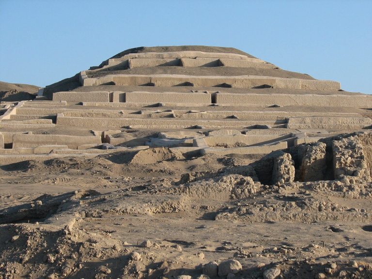
Other interpretations connect the figures with religion, water and the productivity of crops. Archaeologist Johan Reinhard proposed that some designs formed part of practices directed toward water-related deities, and that certain lines served as sacred ways to places of worship. Compacted paths identified through magnetic measurements have been taken to suggest repeated processions, either across trapezoid-shaped designs or along linear figures. Researchers Nicola Masini and Giuseppe Orefici proposed links between geoglyph groups at Pampa de Atarco, about 10 kilometres south of Pampa de Nasca, and Cahuachi, a major Nazca ceremonial center. They suggested that some designs served ceremonial purposes and others related to calendar observations. Other proposals connect the lines to water sources, irrigation, field boundaries, fertility and astronomical calendars. Alberto Rossel Castro grouped proposed uses around irrigation and land division, alignments associated with mounds and stone markers, and astronomy; researcher David Johnson argued that some lines follow underground water channels.
Art historian Henri Stierlin suggested that some lines and trapezoids were large work surfaces for producing long textile threads, while figurative designs had ritual uses. Similarities between the geoglyph patterns and textiles have been noted, but the theory is not widely accepted. Researcher Jim Woodman’s proposal that hot-air balloons were needed to create the figures has likewise been rejected by many specialists for lack of evidence.
New discoveries and protection
The lines were inscribed in 1994 as the UNESCO World Heritage property called “Lines and Geoglyphs of Nasca and Palpa.” UNESCO, a United Nations agency for education, science and culture, uses this designation to recognize places considered to have outstanding universal value. Yamagata University researchers have studied the region since the mid-2000s. In 2011, the team announced two small figures: a human-head-like design dated to the early Nazca period or earlier, and an animal figure whose date is uncertain. A permanent research center opened in Nazca in 2012, and in 2015 the team agreed with Peru’s Ministry of Culture to study and help protect the geoglyphs.
Surveys in 2013–16 added reported human and animal figures, including forms interpreted as llamas, as well as a 30-metre design described as a legendary animal. In 2020, researchers found a cat figure on a steep hillside vulnerable to erosion. A 2018 survey using drones and satellite imagery revealed dozens more designs in the Palpa area. Some were attributed to the Nazca culture and others possibly to the earlier Paracas culture; a group of 25 was attributed to Paracas. As some discoveries lay outside the protected area, the Peruvian government sought an extension of UNESCO protection.
In 2019, Yamagata University and IBM Japan announced 143 additional geoglyphs, some identified through machine learning, a method in which computer systems detect patterns in data. A 2023 deep-learning study, using layered neural networks, identified four further figures interpreted as a humanlike form, a pair of legs, a fish and a bird. In 2024, Yamagata University and IBM Research announced 303 previously unknown figures, including parrots, cats, monkeys, killer whales and severed heads. The field survey took place from September 2022 to February 2023. Researchers screened candidate images and then checked the proposed figures on the ground.
Weather and human activity have both affected the site. After heavy rain and mudslides in February 2007, archaeologists found no major damage to the lines, although the nearby Pan-American Highway was harmed. In 2012, squatters damaged a Nazca-era cemetery and allowed pigs onto the land; quarry machinery damaged geoglyphs in 2013. In 2014, Greenpeace activists placed a banner near the hummingbird figure, disturbing the ground around it. An activist was later convicted and fined. The incident renewed attention to damage from Dakar Rally vehicles in 2012 and 2013 outside the World Heritage area. In January 2018, a truck crossed the site, leaving tire marks over an area about 46 by 107 metres; the driver was released because intent could not be established.
Erosion, pollution, settlement, quarrying and vehicles remain sources of risk. In 2025, Peru’s Ministry of Culture ordered the area of the Nazca reserve reduced by 42 percent, from about 5,600 to 3,200 square kilometres, citing updated archaeological studies. The decision drew criticism amid concerns about informal mining and was reversed shortly afterward.
Remains
The geoglyphs spread across an arid, rocky plateau extending for more than 80 kilometres between Nazca and Palpa, about 400 kilometres south of Lima. Their densest concentration occupies an area roughly 10 by 4 kilometres south of San Miguel de la Pascana. The designs cover about 50 square kilometres, while the World Heritage property encompasses 75,358.47 hectares. A separate group lies among the hills of Palpa, including figures on slopes associated with the Paracas culture.
Designs and ground marks
Lines and geometric forms
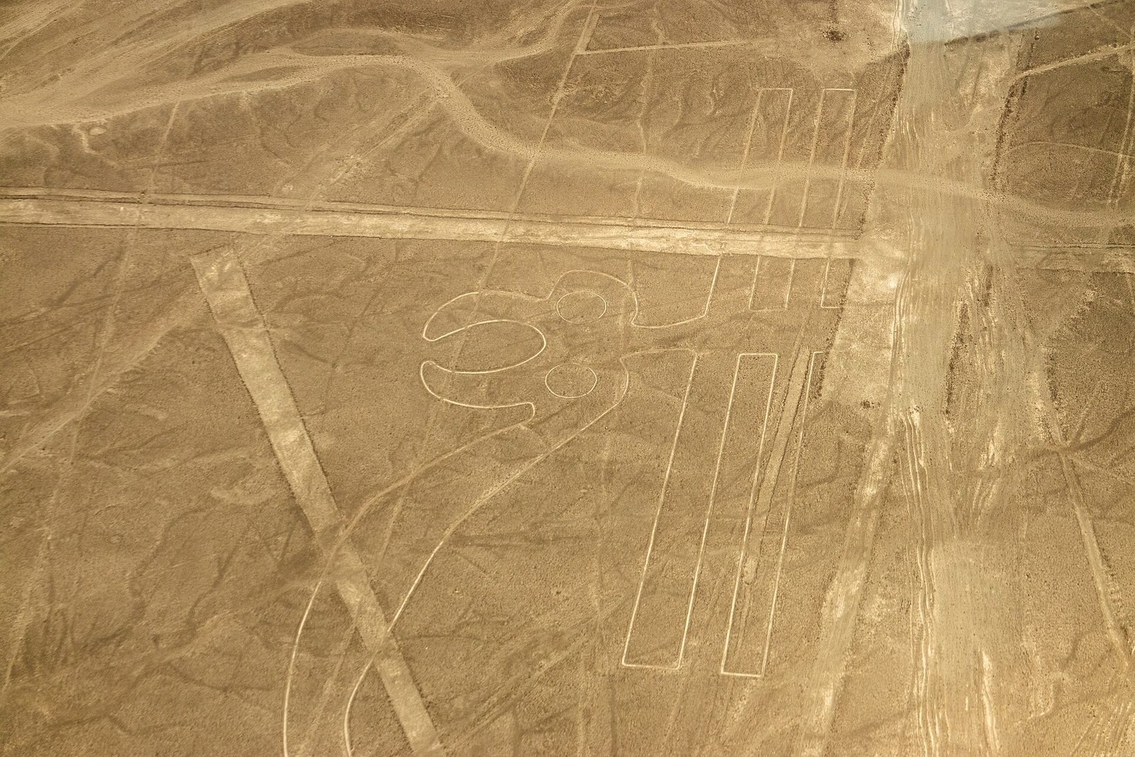
Straight lines form most of the designs, alongside spirals, ellipses, trapezoids and triangles. Many marks are shallow trenches, usually around 10–15 centimetres deep, made by clearing the dark, iron-oxide-coated gravel to reveal paler yellow-grey ground beneath. More than half are slightly wider than 33 centimetres; some are about 30 centimetres across, while others reach 1.8 metres. The change in surface colour makes the marks visible against the plateau.
Figurative designs
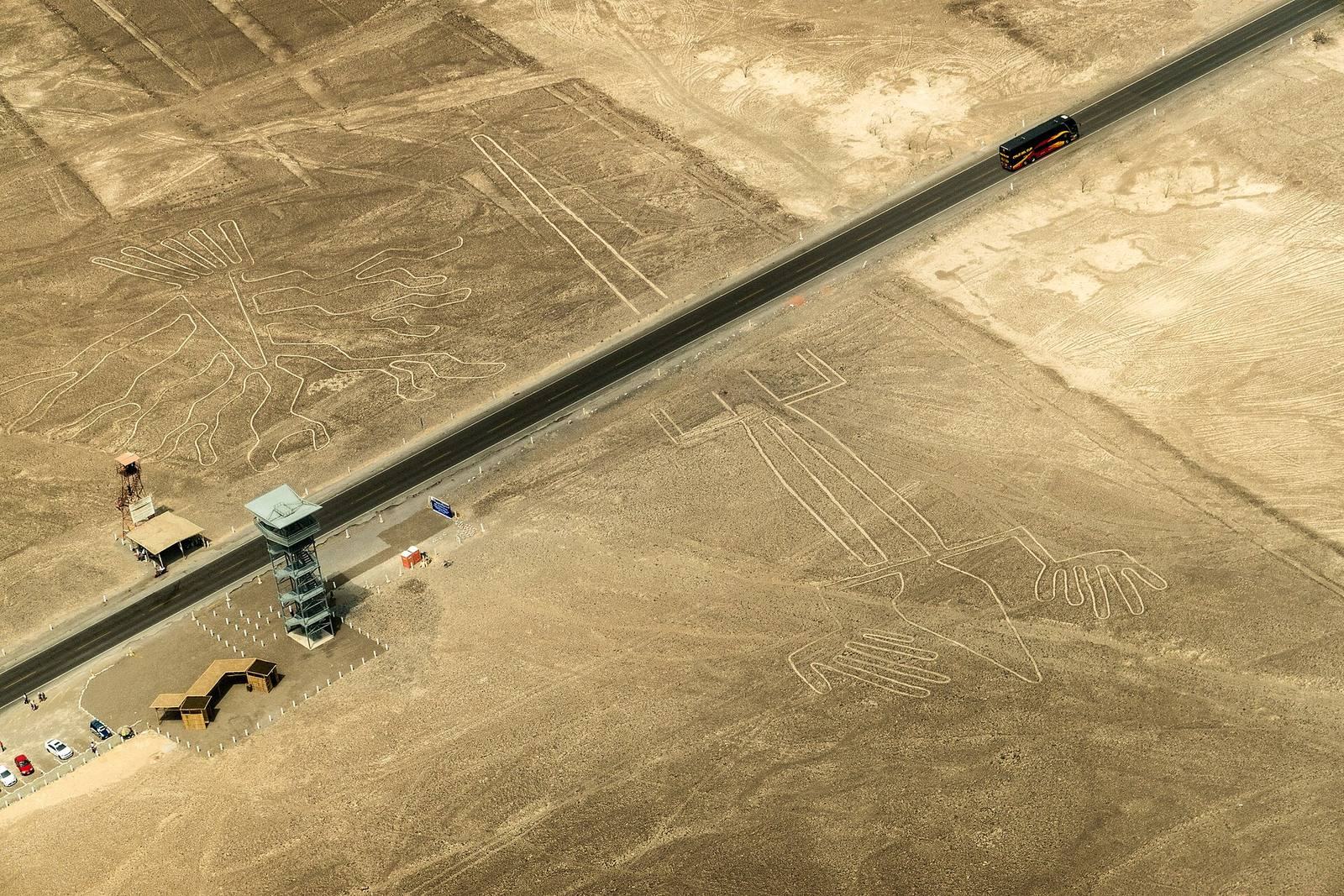
Other geoglyphs depict people, animals, plants and flowers. More than 70 animal-shaped designs have been described, and the studied forms include hummingbirds, spiders, fish, llamas, jaguars, condors, herons, monkeys, lizards, dogs, cats, orcas and pelicans. Nearly 800 geometric designs and more than 350 representations have been studied. The largest figures reach about 370 metres in length. Recorded examples include a hummingbird about 93 metres long, a condor about 134 metres long, a monkey about 93 by 58 metres and a spider about 47 metres long.
Construction and landscape
Measuring and making the designs
Most figures appear to follow a single continuous line. A large rectangle, about 800 metres long and 100 metres wide, held 300 wooden stakes. Stakes at the ends of some lines, together with experimental work, indicate that simple geometric procedures were used, possibly with a grid. A stake and cord could also mark circles and spirals. Some figures can be seen from nearby hills, while the larger designs are clearest from the air at roughly 500 metres. The lines cross ravines and climb hills while retaining their apparent form and straightness.
Plateau conditions and preservation
The plateau receives about 30 millimetres of rain each year and has little vegetation. Its generally calm, dry conditions limit the accumulation of sand and dust over the designs. Gypsum in the ground, together with slight morning moisture, helps bind the surface; lime-rich subsoil also hardens when damp and offers protection from wind erosion. Exceptional rainfall can still threaten the site. The Pan-American Highway runs parallel to the plateau, but its course cuts through the lizard figure and divides it in two.
Archaeological traces
Pottery associated with the geoglyphs carries stylized designs similar to the ground figures. Platforms at the ends of some geoglyphs have yielded ceramic fragments, plant remains and crab pincers. These finds have informed interpretations of the platforms as offering altars and of some figures as places or routes connected with ritual practice.