Shmankivtsi Castle: A 17th-Century Wooden Defensive Fortification in Ukraine
Site at a Glance
- Popularity
- Very Low
- Country
- Ukraine
- Primary era
- Early Modern
- Eras represented
- Early Modern
- Civilizations
- Polish–Lithuanian Commonwealth
- Site type
- Military
- Remains
- Castle
On this page10 sections
History
Planning and construction
Shmankivtsi Castle was a wooden defensive fortification on the eastern outskirts of Shmankivtsi, Ukraine. Built in the mid-17th century, it was intended to guard against attacks by Tatar peoples of the Eurasian steppe. On 26 November 1624, Dominican friars from Chortkiv, members of a Catholic order devoted to preaching and communal religious life, and Paweł Kełpiński, a neighbor of Shmankivtsi, decided to build the castle.
Dismantling and rediscovery
The castle was dismantled in the 18th century, and its materials were reused in walls around a Catholic church, monastery, and garden in Chortkiv. In the early 1990s, archaeologist Volodymyr Dobrianskyi discovered its remains during investigations in the Nichlava River basin. The site was entered on the list of newly discovered cultural heritage sites under protection number 2088.
Remains
Setting and plan
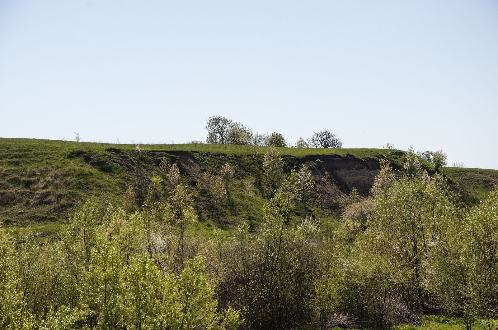
At Castle Hill, on the left bank of the Nichlava River, the castle occupied the corner of an elongated slope about 10–15 m high. Its plan was pentagonal, with a steep western slope extending for about 60 m. The fortification’s defensive earthworks remain visible across the site.
Earthworks
Eastern rampart
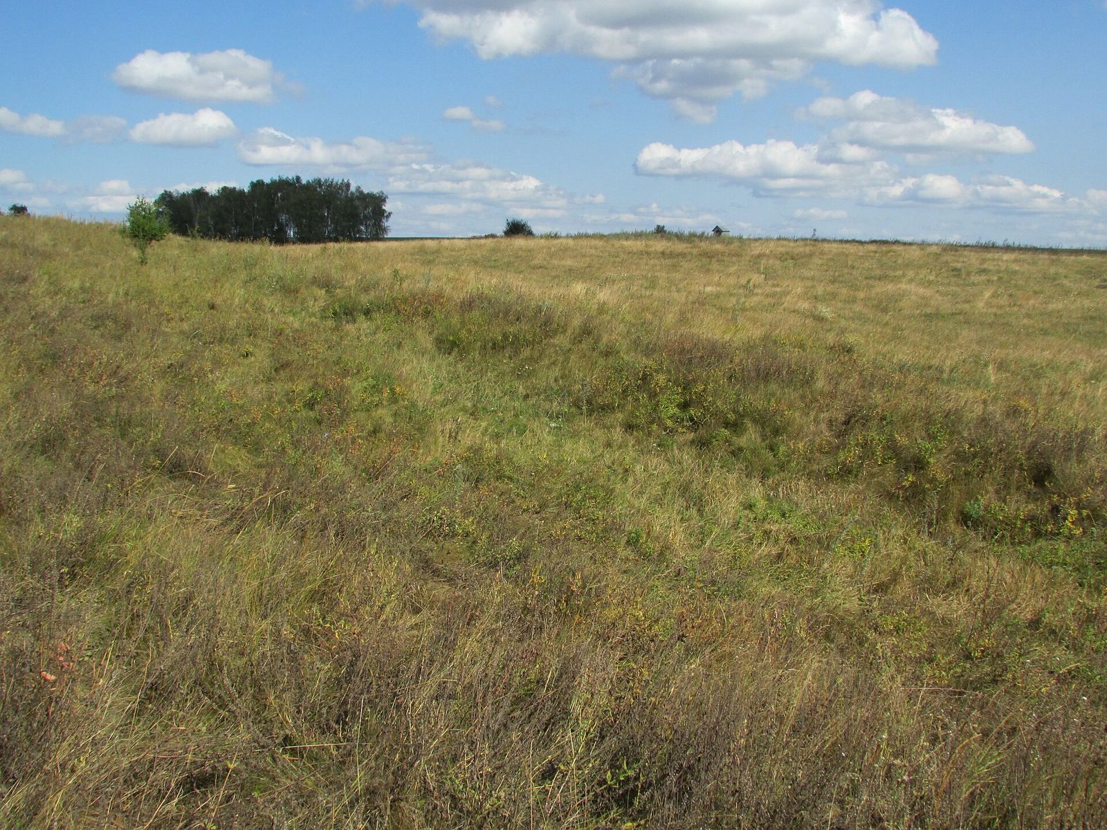
An earthen rampart, or defensive bank, occupied the eastern part of the castle. It now stands about 1 m high and reaches 5 m in width. Its inner face slopes gently to form a ramp, while its front face has been steepened. Soil has slipped downhill over time. The rampart had a counterscarp, the outer slope of a ditch, in the 17th century.
Triangular outwork
Below the rampart, at a depth of up to 1 m, lies a triangular platform resembling a ravelin, an outwork set before a fortification. Two of its sides measure about 30 m. From its northwest corner, a tenaille, an angular defensive work, descends into the slope deposits to a depth of up to 1 m. Sections of an earthen parapet, a protective bank, can be traced along the platform’s front.
Outer ramparts and ditch
An outer rampart, up to 100 m long, connects with a second, raised rampart near the triangular outwork. Some sections of the banks stand 0.5–0.7 m high. The ditch in front of the rampart has been heavily levelled by erosion and deep plowing. The area was cultivated as a field until the early 1990s.
Western remains
Quarrying destroyed the western hill, and local residents also destroyed the western part of the castle. Layers of ash and charcoal are exposed in the quarry cliff, where pottery fragments dating to the late 17th century were found. A palace and service buildings are thought to have stood in the western part and burned during an assault and siege. The castle’s western entrance is thought to have passed through a fortified keep or tower.