Tagliata d’Incanal: An Italian Military Road Barrier
Site at a Glance
- Popularity
- Low
- Country
- Italy
- Primary era
- Modern
- Eras represented
- Modern
- Civilizations
- Italian
- Site type
- Military
- Remains
- Fort
On this page11 sections
History
Construction in Italy’s northern defenses
Tagliata d’Incanal is an Italian military road barrier in Italy, built in 1884 to block the Adige Valley north of Verona against Austro-Hungarian forces. It formed part of the Kingdom of Italy’s late-19th-century effort to strengthen the valley’s defenses and complete an earlier Austrian barrier around Rivoli Veronese.
After Veneto became part of the Kingdom of Italy in 1866, the Royal Italian Army, the kingdom’s land force, focused fortification planning on northern Verona, especially the Adige Valley. Construction proceeded under the second general fortification plan, prepared by a commission led by Italian generals Luigi Mezzacapo and Giuseppe Salvatore Pianell. Existing Austrian works were updated and turned to face north. Fort Masua and the lower battery of Fort Rivoli were also built during this period.
Tagliata d’Incanal worked with the Upper Battery of Incanal, an artillery position, to block the valley floor. It belonged to the Rivoli group, which also included Fort San Marco, Fort Rivoli, Fort Ceraino, Fort Monte, and the road barrier at Chiusa.
Inspections and artillery limits
In the late 1880s, the Austro-Hungarian Evidenzbureau, the empire’s military intelligence office, surveyed and sketched the barrier. Its plan represented the interior of the casemate block, an enclosed fortified space for troops or artillery, as symmetrical, although the structure was asymmetrical.
In 1908, Colonel Vittorio Italico Zupelli inspected fortifications built in the Rivoli area between 1845 and 1888. He found that their gun openings and mounts allowed only low firing angles, which limited the artillery’s effective range.
First World War and later changes
During the First World War, Tagliata d’Incanal was included in the Chiusa-Rivoli group of the right and lower Adige sector of the Fortress of Verona, the city’s system of military defenses. At the war’s outset, the Royal Italian Army armed it with four 87B guns. The work remained in service until the war’s final year, despite being set back from the front. A separate armament listing gives six guns loaded from the rear, identified as either 120 or 150 mm; it assigns 12 to 18 guns to the connecting battery and four to six guns of those calibres to the Upper Battery of Incanal.
The barrier left the public domain in 1950 and became private property. Road widening later caused partial demolition, probably in the 1960s.
Remains
Main barrier
Plan and surviving fabric
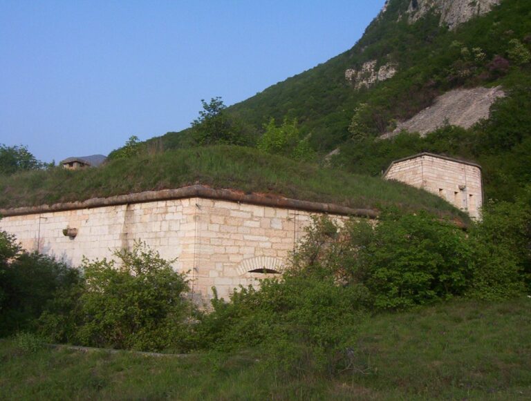
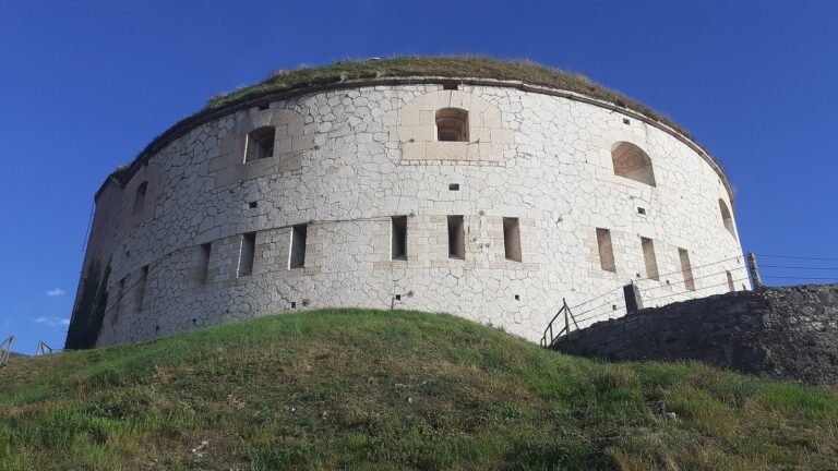
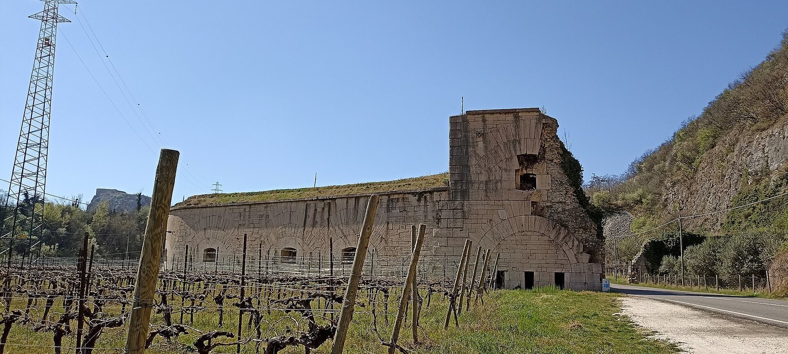
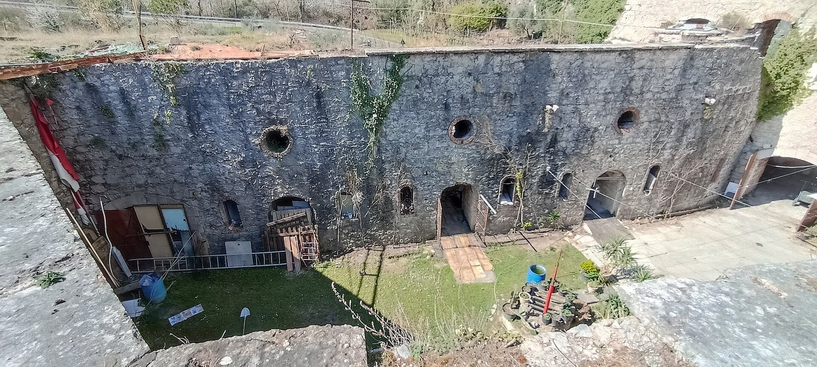
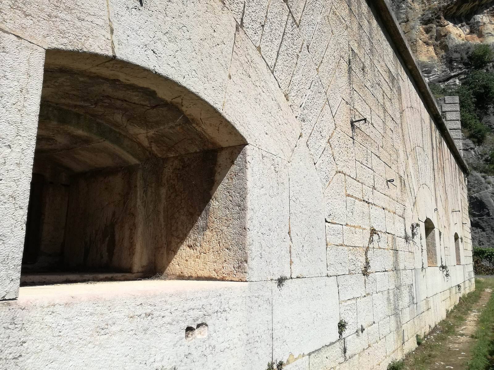
The fort stands about 100 m above sea level on the Adige’s right bank, between Monte Cordespino and the river, near the Ceraino narrows and Provincial Road 11. Its walls were built from regular blocks identified as Veronese marble and covered with plaster. A gate building stood between defensive sections on either side. The river-facing section was a casemate block arranged around an inner courtyard; on the mountainside, two defensive walls were fitted with rifle loopholes, narrow openings for firing rifles.
The eastern section is the best preserved, particularly to the north. It has an asymmetrical horseshoe-shaped plan, a single level, and artillery casemates on both fronts. The southern part was partly demolished and has lost its original form. Only small remnants of the mountainside defensive walls survive.
Gate and firing positions
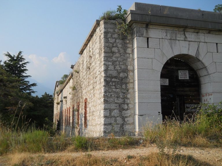
The gate building had two road passages, two drawbridges, and an underground level from which defenders could protect the surrounding ditch. Its first floor held artillery positions facing both the front and the rear. Road widening demolished most of the building; surviving fragments include a front corner and sections of the eastern first-floor outer wall, where one gun embrasure, an opening in a wall for a weapon, remains visible.
The front had nine gun embrasures, six at ground level and three raised within the gate building, as well as ten ground-level rifle loopholes in the gate area. The rear, or gorge, had eight gun embrasures and 15 rifle loopholes arranged in a similar pattern. Six further gun openings covered the ditch toward the river: two at ditch level, two level with the surrounding ground, and two raised above the gate passage.
Ditch and river defenses
A dry ditch about five metres wide and four metres deep at the front and rear surrounded the fort and extended toward the Adige. Its front wall was vertical, while the rear wall sloped up to an earth bank. A protected passage ran behind the bank, which could also shelter field guns. The ditch opened toward the river and could flood when water levels were high. A caponier, a protected position for firing along a ditch, was attached to the fort’s right face at the projecting angle of the gorge, or rear side, to provide additional flank defense.
Connecting battery
An earthwork connecting battery extended the defensive line from the fort’s eastern side toward the Adige. The Brenner motorway now follows the route of the battery’s former protective ditch.
Upper Battery of Incanal
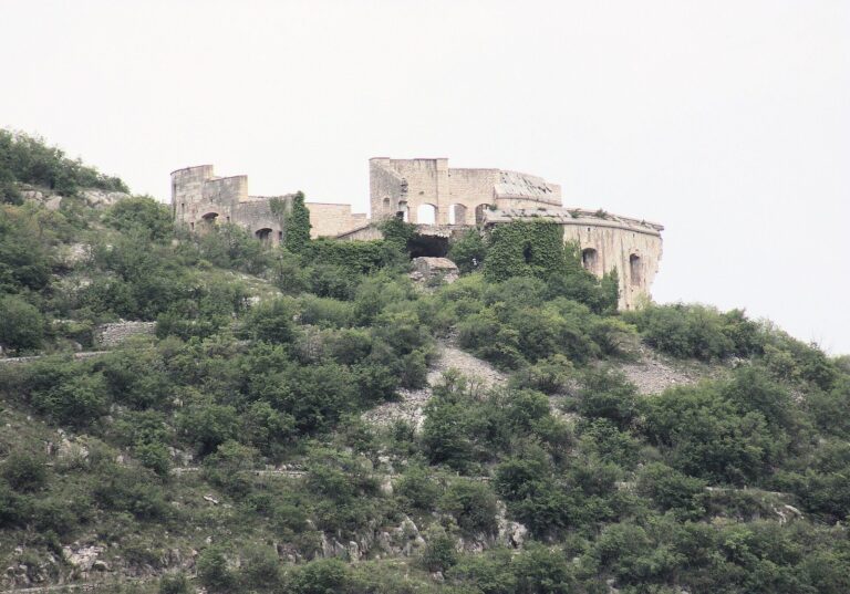
About 200 m southwest of the main barrier, the Upper Battery stands on a hill against a rock face. This detached rear work was linked to Tagliata d’Incanal by a protected passage that can no longer be traversed. The battery is ruined but retains its overall form. Its lowest firing level has 15 rifle loopholes in groups of three; the middle level has five gun embrasures. Above them, an earth barrier on the roof contains two hollow traverses, protective barriers with sheltered interiors for field guns. An ammunition bunker stands behind the battery.