Bojná–Valy Hillfort: An Early Medieval Military Stronghold in Slovakia
Site at a Glance
- Rating
- 4.6
- Popularity
- Medium
- Country
- Slovakia
- Primary era
- Medieval
- External website
- Open
- Eras represented
- Medieval
- Civilizations
- Great Moravia
- Site type
- Military
- Remains
- Fort
On this page14 sections
History
Bojná–Valy Hillfort is an early medieval fortified site near Bojná, Slovakia, built by Slavic communities during the middle or later ninth century. Rebuilt as a major fortress around 890, it became the largest and most extensively investigated hillfort in the Bojná network, a group of settlements, strongholds, and burial grounds in the southern Považský Inovec.
The regional hillfort network
The wider network was active roughly from the seventh to the tenth century, along a route linking the Nitra valley with the Váh basin and Moravia. The route crossed the Bojnianka valley and the Kamenné vráta pass, forming part of a regional communications and trading network. The group included sites with different histories and functions, among them the seventh- to ninth-century stronghold and burial ground at Bojná III–Žihľavník, and early medieval linear defenses at Bojná IV–Nové valy. Bojná V–Halšiny was a hillfort of the Hallstatt period, while Bojná VI was a burial ground used in the eighth and ninth centuries.
Bojná III, which began in the mid-seventh century, is currently the earliest known Slavic hillfort in Slovakia. Settlement there probably lasted until the start of the ninth century. Its defenses were relatively weak, leading to the suggestion that it served as a gathering place where local elites could display their authority. After the stronghold was abandoned, a small cemetery of burial mounds was established there. The decline coincided with changes following the fall of the Avar Khaganate, an early medieval political power in the Carpathian Basin. Other related places included Bojná II, built in the ninth or tenth century over a settlement occupied from the second to fifth centuries, and the complex at Nitrianska Blatnica–Jurko, with a fortified manor, round church, and cemetery dating from the ninth to eleventh centuries.
A ninth-century fortress
Use of the Valy hilltop probably began before its main defenses were built. Activity at the locality is thought to have extended from about 800 to 950, including an earlier phase before construction of the great ramparts. The hillfort itself likely took shape in the middle or later ninth century; tree-ring analysis of timbers supports a major rebuilding around 890.
Bojná–Valy was once linked to a proposed Principality of Nitra, a possible early polity in western Slovakia and potential predecessor to Great Moravia. Archaeological findings have not confirmed that dating, and an independent Principality of Nitra has not been established by clear scholarly evidence. More recent interpretations emphasize military use. During the rule of Svätopluk, one of Great Moravia’s major ninth-century rulers, the site may have served as a fortified camp or base for a warrior retinue. It may also have been among Great Moravia’s largest military bases and an important point of territorial administration. The hillfort and the fortified manor at Nitrianska Blatnica may have formed parts of a connected regional center in the late ninth and first half of the tenth century, with residential and religious activity at the manor and chiefly military and strategic functions at Valy.
Decline and archaeological study
Repairs to the hillfort’s defenses took place around 920. The end of the Bojná center came in the first half of the tenth century amid political changes in Central Europe after the fall of Great Moravia and the formation of the Hungarian state.
Bojná-area sites were known during the second half of the twentieth century, while systematic archaeological work began in the early twenty-first century. Excavation and scientific dating have helped refine the chronology of the wider network, drawing on eight tree-ring dates and 79 radiocarbon dates from five sites. This work has contributed to understanding Slavic settlement and early medieval defenses, suggesting that some regional hillforts may date to the seventh century and that construction of fortifications expanded rapidly in the second half of the ninth.
Remains
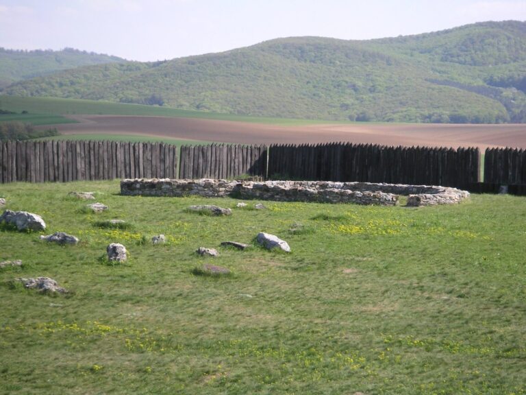
The hillfort occupies a prominent rise about 430 metres above sea level. Its plateau measures roughly 600 by 200 metres, with an enclosed area of about 10 hectares. A rampart approximately 1,340 metres long follows the perimeter. Its construction combined stone, earth, and timber in a system of compartments filled with earth and stones.
Fortifications
Enclosing rampart
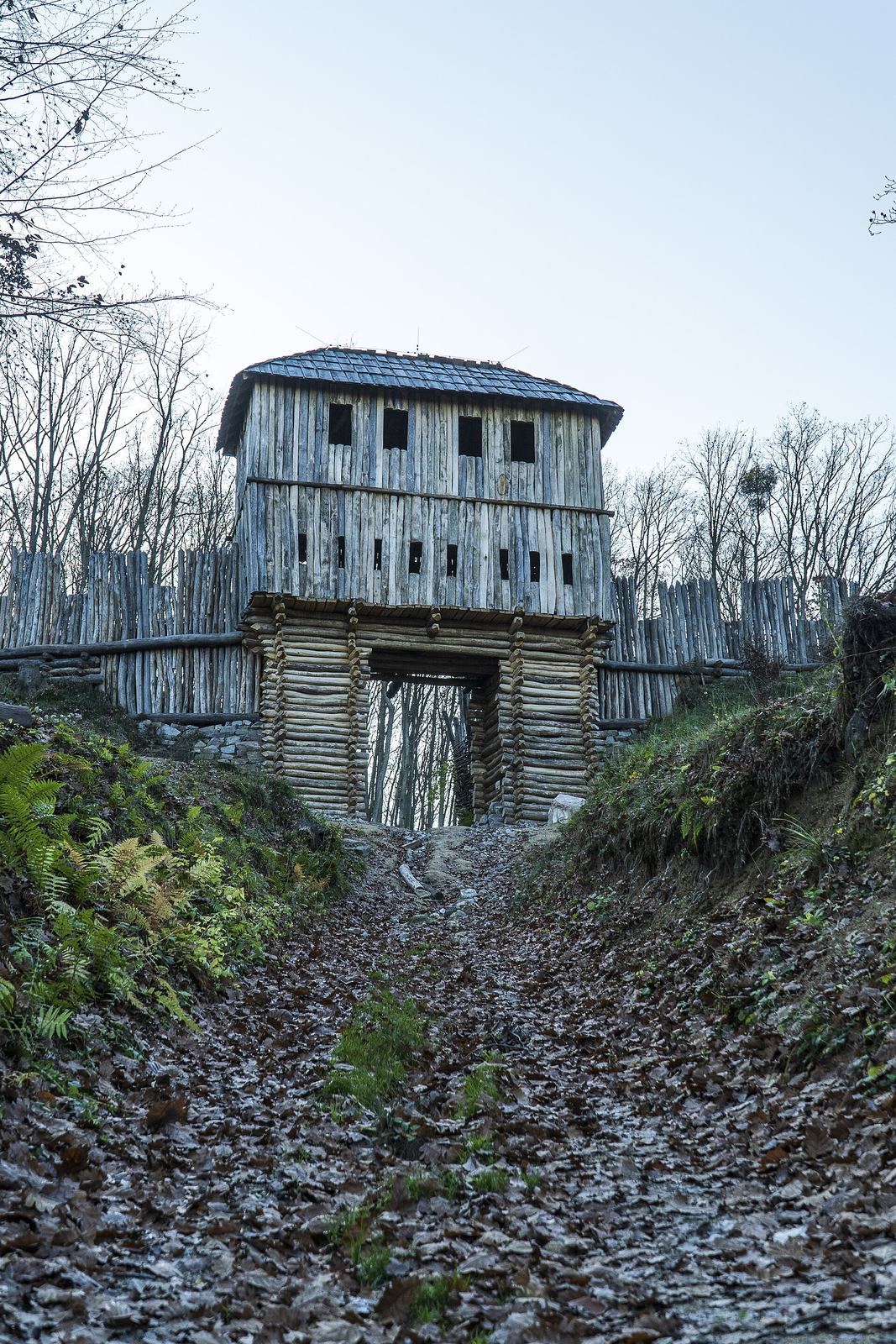
The rampart rested on a substantial base of stone and earth, with timber compartments built into it and filled with earth and stones. Dry-stone facing reinforced the most vulnerable stretches. At some points the base was about seven metres wide, and surviving sections rise to more than four metres.
Eastern defenses
Narrow corridors between ramparts formed two gates, one on the east and one on the west. On the northeastern side, a ditch about two metres deep ran in front of the main rampart. A ramp interrupted the ditch where the approach road crossed it. Near the northeastern bend, a cross-rampart descended the slope, with a ditch on its eastern side. A comparable outer rampart and east-facing ditch lay downhill near the southeastern bend. These works were designed to control the ground below the stronghold against attack from the east.
Western approaches
To the west, the ridge narrows and slopes toward a low, accessible saddle. A pincer-shaped gate, which uses projecting defenses to channel entry, strengthened the main fortification there; a ditch and an outer earthwork rampart protected it. At the ridge’s narrowest point, another large ditch and earthen rampart guarded the approach, with a second gate interrupting the barrier.
Buildings and finds
Domestic buildings
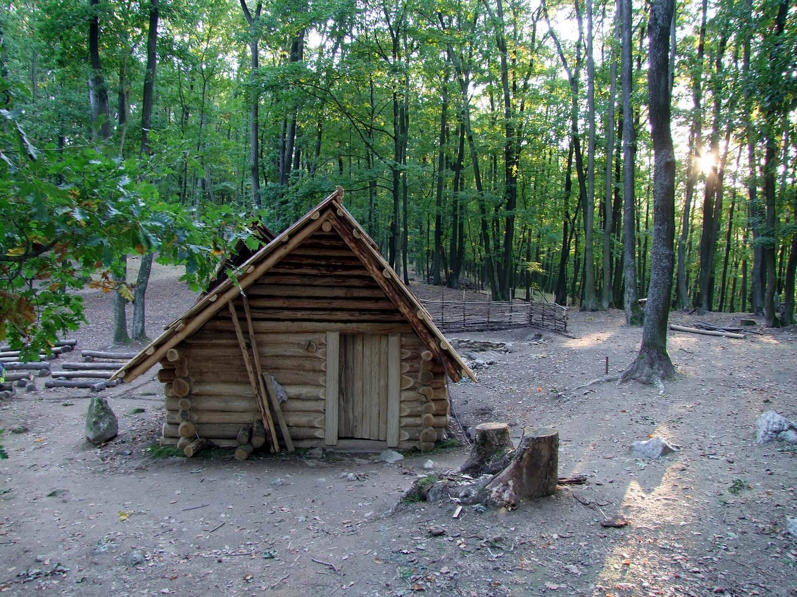
Excavations have covered about five per cent of the hillfort. Most of the buildings uncovered were small structures partly set below ground level, with floor areas of roughly nine to eleven square metres. Each had a stone oven in one corner. The excavated settlement pattern appears relatively uniform.
Weapons, equipment, and metalworking
Thousands of finds, mostly metal, include axes, arrowheads, fragments of mail armor, spurs, stirrups, horse bits, tools, ornaments, and clothing fittings. More than 70 spurs and over 200 arrowheads have been recovered, along with many belt fittings and other warrior equipment. The finds point to developed craft production, especially metalworking and blacksmithing. More than 40 deposits of iron objects have also been found. One deposit of axe-shaped iron bars lay in the oven of a partly sunken building, and the site has yielded notable lead bars as well.
Christian plaques
Six plaques made from thin copper sheet were gilded and shaped by hammering and modeling. Their images show winged figures commonly interpreted as Christ, archangels, or angels, and two plaques carry inscriptions. They survive as fragments and do not make up the complete original set. The plaques were probably buried deliberately as the hillfort declined, although their origin, date, and purpose remain debated. The suggestion that they belonged to a portable altar or reliquary is provisional. They constitute the most extensive and complete group of early Christian objects known from a West Slavic context and have no close European parallels.
Bronze bell
A bronze bell with an iron clapper was also found at Bojná. Its shape and manufacturing method place it among Europe’s earliest surviving medieval bells. It is dated broadly to the eighth through eleventh centuries.