Alauna: The Roman Fort and Coastal Base at Maryport
Site at a Glance
- Popularity
- Medium
- Country
- United Kingdom
- Primary era
- Classical
- Eras represented
- Classical, Modern
- Civilizations
- British, Roman
- Site type
- Military
- Remains
- Fort
On this page22 sections
History
Alauna, the conventional but uncertain name for the Roman fort at Maryport in the United Kingdom, was established around AD 122 during the reign of Hadrian. It served as a command and supply base for coastal defenses protecting the western end of Hadrian’s Wall, the Roman frontier barrier in Britain. Its garrison remained in place even after Roman forces withdrew from much of the Wall and moved north to build the Antonine Wall, a later frontier barrier.
Before and during the fort’s foundation
The area was inhabited by the Iron Age and lay within the territory of the Carvetii, a people of Roman-era northern Britain. A timber-and-earth fort preceded the stone fort, beneath or partly beneath its later remains. It may date to the late first century, perhaps during the campaigns of Gnaeus Julius Agricola, the Roman governor whose operations extended Roman military activity northward. This earlier fort may have been larger than the stone fort that followed.
The coastal forts were intended to prevent hostile forces from bypassing Hadrian’s Wall by landing on the west coast or crossing the shallow Solway Firth. Alauna may also have been a fleet base. It has been interpreted as the headquarters of the wider coastal defenses, though that role remains uncertain. The fort’s name is similarly unsettled. The late-antique Ravenna Cosmography, a geographical compilation, securely gives Alauna as the name of a place, but it may refer to the River Ellen as well as the fort. The Antonine Itinerary, a Roman route list, names a place called Alone that is generally identified elsewhere. The late Roman register of offices and military commands known as the Notitia Dignitatum includes Alione, which has been associated with either Alauna or Alone. Possible explanations for the name Alauna include a Celtic water deity, words meaning “beautiful” or “wonderful,” or a term for a shrine or altar. “Carvetiorum” is sometimes appended to distinguish this site from other places called Alauna.
The Roman garrison and coastal settlement
Construction involved detachments from Legions II Augusta and XX Valeria Victrix, as well as auxiliary soldiers. Cohors I Hispanorum, an infantry unit described as 1,000 strong, is linked with the fort’s early building work. Cohors I Delmatarum later replaced it. After the Antonine Wall was abandoned around AD 158, a unit of Baetasians replaced the Dalmatians. Other units associated with Alauna include Cohors I Aelia Hispanorum, Cohors III Nerviorum, and the cavalry unit Ala II Asturum, which was there in the early third century. These associations do not mean that all the units served at Alauna simultaneously.
Roman forces left much of Hadrian’s Wall around AD 138 when they moved into the Central Lowlands and built the Antonine Wall, but Alauna continued to be occupied. For nearly three centuries it supported the coastal defenses and their garrisons. A civilian settlement grew northeast of the fort beside the road to Beckfoot. The area may also have served as a point for sending out produce and materials from nearby farms, quarries, forests, and mines. Alauna’s size has prompted the suggestion that it was an administrative and command center for the western coastal defenses, but this interpretation has not been established.
In the late second century, this coast was part of Britannia Inferior, one of the administrative provinces of Roman Britain. It belonged to Britannia Secunda in the fourth century and may later have been included in the province of Valentia. Inscriptions give names and careers of officers who served at the fort. Gaius Cornelius Peregrinus, a second-century tribune commanding the auxiliary garrison, dedicated an altar at Alauna and later joined the town council at Saldae in North Africa. Gaius Caballius Priscus and Marcus Maenius Agrippa are also named as tribunes. Agrippa commanded Cohors I Hispanorum at Maryport around 123–126, later led the British fleet, and became a senior imperial administrator in Britain in the second half of the 130s.
Other inscriptions name prefects Marcus Censorius Cornelianus, Lucius Antistius Lupus Verianus, Helstrius Novellus, Lucius Cammius Maximus, and Publius Cornelius, whose final name is incomplete. Cornelianus commanded Cohors I Hispanorum from 132 to 135 before transferring to Legion X Fretensis in Judea; Verianus took command in 136. The dedicants Lucius Caecilius Vegetus and Paulus Postumius Acilianus are also known from inscriptions at the site.
Later Roman use and the end of the garrison
The fort underwent extensive renovation in the early third century, perhaps in connection with Emperor Septimius Severus’s campaign against the Picts. Further building or repairs followed in the middle of that century, including work by a detachment of Legion XX. In late antiquity the garrison was counted among the frontier troops assigned to the empire’s borders. Regular soldiers may have remained until around AD 409 or later. The fort was probably abandoned as a military post when Roman forces left Britain, although the timing and circumstances are uncertain.
Evidence also points to activity at the site beyond its military life, perhaps until about AD 600. A church or monastery and a cemetery may have formed part of this later occupation. In the fourth century, Jupiter altars were placed around the supports of a timber building as packing in its foundations. This reuse may reflect changes in religious practice, but it does not by itself show that the community had become Christian. Earlier explanations of the altar deposit as a ritual burial or concealment before an expected invasion were reconsidered after excavation identified its use in construction.
Collecting, excavation, and the modern town
The Senhouse family owned the fort site from the sixteenth century and began collecting Roman altars and inscribed stones during the reign of Elizabeth I. William Camden, an English antiquarian and historian, described the collection in his Britannia in 1599. In 1772 Colonel Humphrey Senhouse arranged for inscriptions uncovered during demolition to be set aside rather than reused in new building work. Stone from the fort was also taken for construction in Maryport and for harbor works that began in 1762. Maryport had been founded near Ellenfoot in 1749 by Humphrey Senhouse and named for his wife, Mary.
In 1870 Humphrey Pocklington Senhouse uncovered seventeen Jupiter altars in a series of pits about 300 metres northeast of the fort. More than twenty such altars are associated with Maryport, including a group of about two dozen linked with fort commanders. Inscriptions from the site also record dedications to more than twelve deities, among them Roman, local, eastern, and Celtic gods.
Investigations took place at intervals from the late eighteenth century onward. Joseph Robinson’s 1880 work exposed a road in the civilian settlement and remains of a Mithraeum and a nearby round temple. Excavation at the fort’s northeast corner followed in 1966. Air photography from 1949 to 1977 helped trace the settlement, and the Royal Commission on the Historical Monuments of England surveyed the fort in 1992–93. Geophysical surveys covered 72.5 hectares at Camp Farm between 2000 and 2004, with further work in 2010. In 2011, Ian Haynes and Tony Wilmott investigated the altar deposit, identifying the earlier fort and the late Roman building. Haynes, Wilmott, and the Senhouse Museum Trust examined the two temples near the fort in 2013–14.
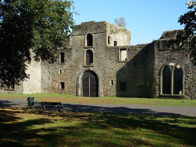
A former naval-artillery drill hall built at the site in 1885 became the Senhouse Roman Museum in 1990. The museum houses the Senhouse family’s Roman collection, which Joe Scott Plummer entrusted to the Senhouse Museum Trust in 1998.
Remains
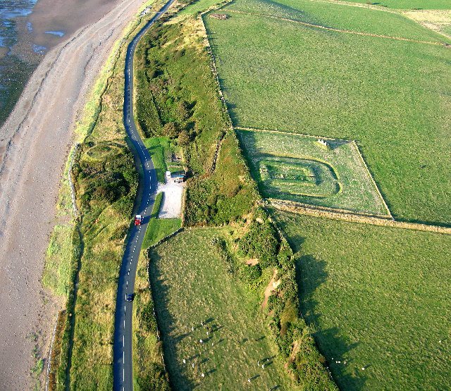
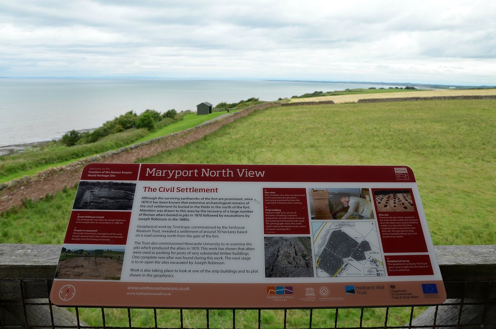
The fort and its associated settlement occupy a sandstone ridge about 45–56 metres high, above the west bank of the River Ellen and near the coastal cliffs. The position overlooks the Solway Firth, the Irish Sea, the Scottish shore about 16 kilometres away, and the coastal hinterland. The Ellen estuary southwest of the fort may have offered a sheltered natural harbor. The stone fort had a rounded-corner rectangular plan, oriented northwest, and covered about 2.58 hectares.
The fort
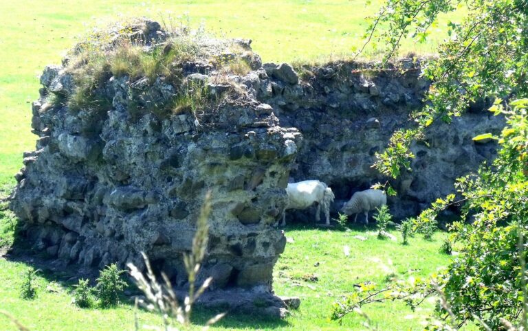
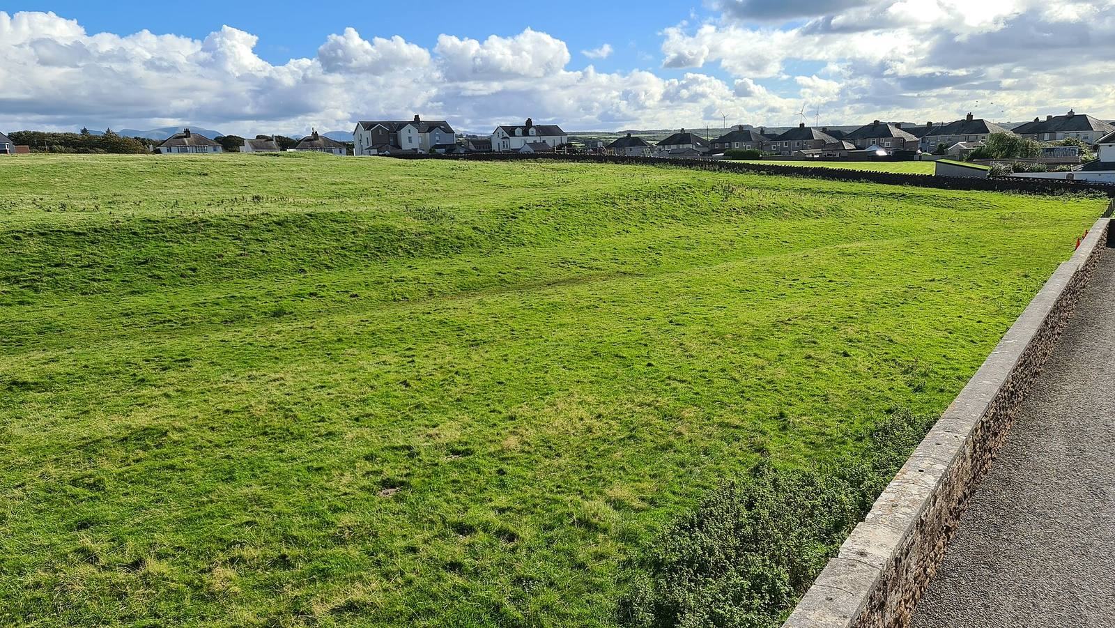
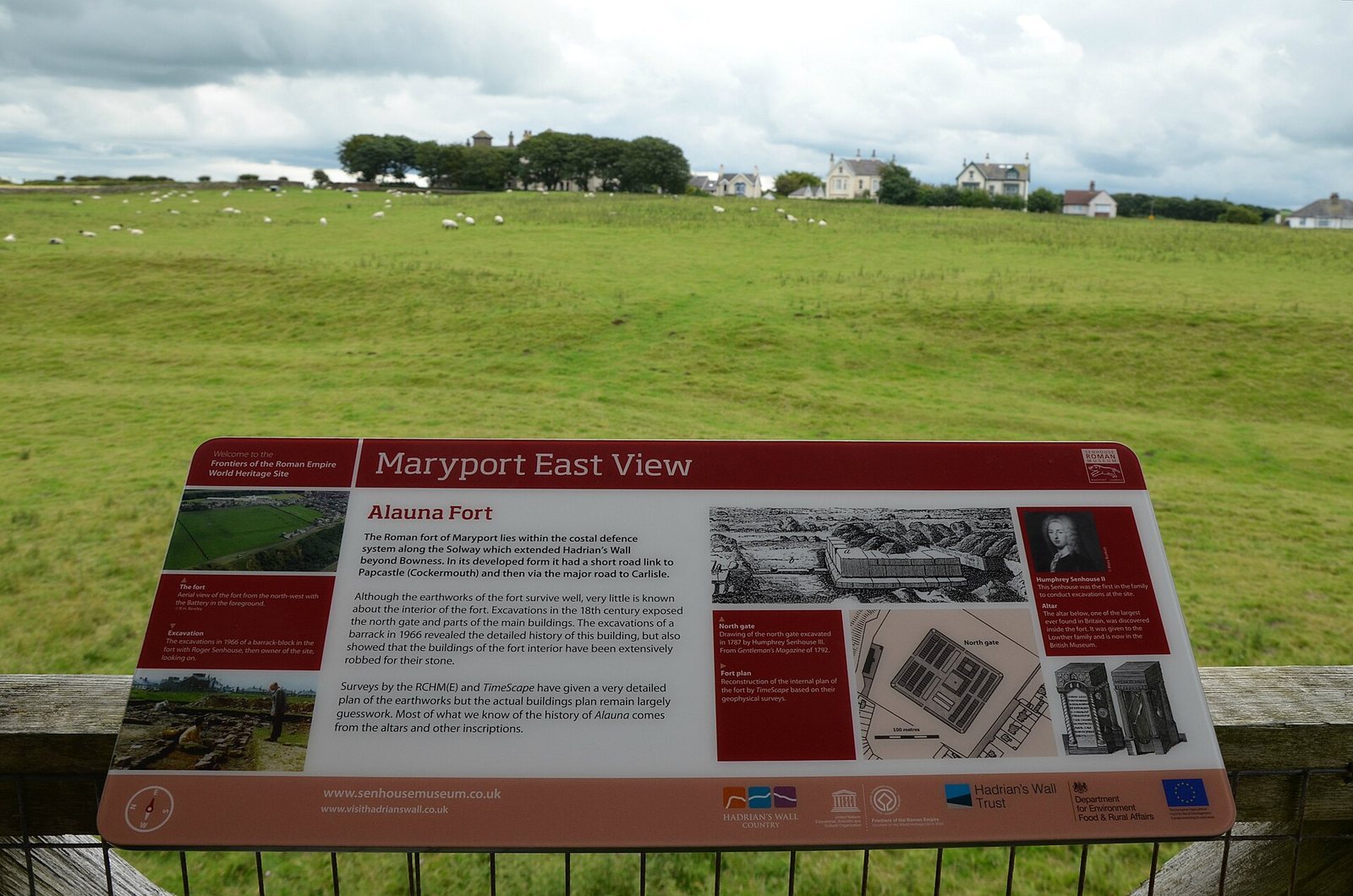
The fort measured about 135 metres from north to south and 139 metres from east to west. Its surviving remains are slight, including a raised earth platform and a stretch of wall near the north gate.
Walls, gates, and defenses
The perimeter walls were about 1.8 metres thick and survive in places to a height of 3.1 metres. Square towers set within the walls and elongated towers at the corners strengthened the defenses; their locations can still be discerned as slight rises in the ground. Several ditches surrounded the fort, with four recorded on the north side. Counts on the other sides vary. An earth bank inside the wall formed a raised walkway for defenders. Gates opened to the north, south, east, and west. The stone fort may also have replaced watchtower 23B.
Headquarters and interior buildings
The headquarters building and the commander’s residence have been located near the fort’s center. Magnetometry revealed the outline of the headquarters and a cellar beneath the shrine that held the unit’s standards. Granaries, barracks, a bathhouse, bakeries, and workshops probably also stood within the fort, although their individual locations are not all established.
Barracks and later structures
Excavation identified two phases of barrack construction. Pottery and a heavily worn coin dated AD 164–167 connect the earlier phase with the second century. A detached centurion’s quarters stood beside the eastern barracks. Later, two long, narrow stone buildings replaced earlier structures; one appears to have been used as a stable. Stone-lined postholes elsewhere in the fort may belong to the late fourth century.
The cult precinct and temples
A paved religious precinct lay northeast of the fort, at the eastern edge of the civilian settlement. It covered about 50 by 95 metres. Paving marked its northern, western, and southern edges, while its eastern limit may have followed a natural hollow about 1.5 metres deep. Two temples stood within the precinct.
Mithras sanctuary
The Mithraeum, a sanctuary for Mithras, a deity worshipped in Roman mystery cults, stood about 150 metres east of the fort. Built of red sandstone with yellow sandstone inserts, it was roofed with slate. The structure measured about 14 by 7.6 metres, its walls averaged 0.75 metres thick, and it may have reached about 8.4 metres in height. Its northern entrance opened into an entrance vestibule and then a chamber partly paved with stone slabs. At the far end, a recessed rectangular space held the cult image of Mithras.
Column bases were identified at the entrance, with a stone pedestal beside it. A Jupiter altar stood directly in front of the recessed end. The west wall of this niche had collapsed outward. Fallen roof tiles helped establish the building’s reconstructed form, and lamb and poultry bones were found there in 2014.
Round temple
Beside the Mithraeum stood a round temple about 10.3 metres in diameter, with walls roughly 0.7 metres thick. Its roof rested on a central post and probably five beams around the perimeter. Three of those beams remained in place on the north and west sides. The entrance was on the northeast. Finds included a heavily weathered inscribed altar, two stone heads, five coins dating to the early and late second century, and a small group of figures of mother goddesses.
The civilian settlement
The civilian settlement spread north and northeast of the fort. A road from the north gate crossed the settlement, and the built-up area may have extended about 420 metres along the road toward Beckfoot. It is considered the largest settlement so far identified around Hadrian’s Wall. Surveys and excavations revealed a substantial road, a possible landing place or harbor, and another road thought to lead to a warehouse. They also identified extensive fields and small garden plots, some containing buildings.
Buildings beside the Beckfoot road
Buildings, probably including narrow frontage houses, lined the road toward Beckfoot; many may have been constructed around AD 200. One building excavated in 2013 measured about 20 by 5 metres and had three main rooms. Its purpose is undetermined, though comparable buildings could combine workshops, shops, and living quarters. Coins and pottery indicate use for no more than fifty years before it was abandoned in late Roman times. An earth bank around the area, once understood as an extension of the fort’s defenses, was more likely a later field boundary.
Late Roman timber building
A long building with several phases, dating to the fourth century, stood northeast of the fort at the altar-deposit site. Its timber upper structure rested on postholes packed with stones, and reused altars were placed around the post bases. At least part of its floor was made of rammed earth, and a drain was lined with stone slabs. Late Roman graves nearby and the building’s recessed end have led to the suggestion that it may have been an early Christian church.
Burials, altars, and other finds
Cremation features and grave markers
A Roman road crossed Deer Park field southeast toward the fort’s southeast gate. Ten cremation features were found beside it on a low, flat rise. One excavated feature, about 0.5 metres wide and 0.1 metres deep, contained Roman pottery, burnt bone, and charcoal. Another held two urns containing burnt bone, probably from one adult, along with nails, charred hazelnut shells, and grape pips. Grave markers from Maryport also point to a cemetery near the fort and civilian settlement.
Altars and inscriptions
Altars and other inscribed stones from the fort and settlement include many carved from local red St Bees sandstone. About two dozen Jupiter altars are associated with fort commanders; ten are attributed to Cohors I Hispanorum, and the earliest dates to AD 123–138. Peregrinus’s altar is now in the British Museum. Other inscribed stones include a construction text naming Legions II and XX, altars associated with Gaius Caballius Priscus, Titus Attius Tutor, and Lucius Caecilius Vegetus, and a dedication by Postumius Acilianus to Jupiter Capitolinus, the form of Jupiter worshipped as part of Rome’s state religion.
Two early Christian grave inscriptions name Rianorix and Spurcius. Inscriptions from the site also preserve dedications to a range of Roman and other deities, including Jupiter, Vulcan, and the mother goddesses. The carved stones and altars provide evidence for religious practices and military life at the settlement.
The Serpent-Stone
The Serpent-Stone is an octagonal red sandstone monument about 1.2 metres high, topped with a human head. A serpent rises along its rear face from the base toward the head, which may have been crowned with a ring or neck ornament. Its original purpose is uncertain; it may have belonged to a larger shrine or served as an altar in the cemetery. Whether it is Roman or Romano-British remains disputed.
Domestic and imported objects
Finds from the fort and settlement include pottery made in Gaul and the Rhineland. Storage vessels were used for goods such as Spanish olive oil and Gallic wine. Other recovered materials include oyster, mussel, and snail shells, fragments of glass vessels, a finger ring, and part of a decorated glass bracelet.
Later reuse of fort stone
Stone from the fort was incorporated into later buildings. In 1880, stones from the arch over the north gate’s passage were recovered and built into the chancel of St John’s Church at Crosscanonby.