Arbor Felix: A Late Roman Frontier Fort in Switzerland
Site at a Glance
- Popularity
- Low
- Country
- Switzerland
- Primary era
- Classical
- Eras represented
- Classical
- Civilizations
- Roman
- Site type
- Military
- Remains
- Fort
On this page23 sections
History
Arbor Felix was a late Roman fort at Arbon, in present-day Switzerland, probably established in the late third or early fourth century. It formed part of the Danube-Iller-Rhine frontier, the Roman defense network along those rivers and around Lake Constance, in the province of Raetia I. The fort was occupied from the late third century into the fifth.
Settlement and frontier foundation
A smaller Roman settlement probably lay in the southern part of today’s Bergli district before the fort was built. It may have grown after the road between Vitudurum, now Winterthur, and Brigantium, now Bregenz, was improved around the beginning of the Common Era. This followed Rome’s conquest of the Lake Constance region under Augustus, the first Roman emperor. The settlement remained inhabited until about AD 280. Second- and third-century pottery from the fort area also indicates Roman activity before the fort’s establishment.
The fort probably belonged to Rome’s shift of its frontier toward the Rhine and Lake Constance after the upper Germanic-Rhaetian boundary was abandoned around AD 260. The Alamanni, a confederation of Germanic peoples, took control of the Decumate lands, the territory between the upper Rhine and upper Danube. Probus may have begun work on forts along the new frontier; Diocletian and his junior imperial partner Constantius I continued and expanded it. Arbor Felix stood in the frontier’s first line alongside Tasgetium, Ad Fines, and Constantia.
Archaeological evidence places the fort’s construction no later than the reign of Constantine I. Most datable small finds and coins belong to the fourth century, while the coin sequence runs from issues of Diocletian dated to AD 285 to coins of Arcadius and Honorius dated to AD 408. A previously proposed construction date of AD 367–368, during Valentinian I’s reign, does not fit the excavation evidence.
Roman records and garrison
The place appears under several ancient names, including Arbor Felix, Felicis Arbore, and Arbore. Arbor Felix has been understood as a name meaning roughly a fortunate or blessing-bringing tree. One proposed explanation links it to Roman priests’ practice of burying cut hair and nails beneath trees considered auspicious, including trees struck by lightning or flowering out of season. Another possibility is a connection with Arbona, a place-name widespread in Celtic-speaking areas.
The third-century Itinerarium Antonini, a Roman itinerary of routes, describes a fortified posting station at the junction of roads between Vitudurum and Brigantium, and between Constantia and Curia, now Chur. The early fourth-century Tabula Peutingeriana, a map of Roman routes, marks a fort there. Around AD 400, the Notitia dignitatum, a register of Roman offices, lists a tribune at Arbore. The historian Ammianus Marcellinus records that Emperor Gratian passed through Felicis Arbore in AD 378 while travelling east to support his co-ruler Valens against the Goths. The medieval life of Saint Gall, the earliest medieval text to mention Arbon, also calls it a castrum or castra, Latin terms for a fort or fortified camp.
The garrison was the Cohors Herculea Pannoniorum, a Roman military unit commanded by a tribune under the dux, or senior military commander, of Raetia I and II. The unit’s title suggests it was raised under the Tetrarchy, Diocletian’s system of shared imperial rule, and may first have served in the army of his co-ruler Maximian. Maximian placed his rule under the protection of Hercules, a Roman god. Arbor Felix may also have acted as a calling point for the Lake Constance fleet, whose principal bases were at Brigantium and Constantia. Its likely military tasks included watching routes toward Pfyn and Bregenz and keeping the lakeshore under observation.
The fort’s destruction during the usurpation of Magnentius, who tried to seize imperial power in AD 350–353, remains unconfirmed. Valentinian I strengthened the Rhine frontier around AD 370, and forts across the frontier saw building work under the general Stilicho around AD 400.
Life after Roman rule
Roman authority in the Thurgau region weakened gradually after AD 403, but local people continued to use the fort as a settlement. As western Roman military and administrative structures collapsed later in the fifth century, much of the Romance-speaking population remained. They were probably assimilated by the Alamanni. Arbon’s Christian Romance-speaking community was among the oldest around Lake Constance and may have been one of the few to survive the unsettled early Middle Ages.
Around AD 610, Irish missionaries led by Columbanus encountered a flourishing Christian community at the fort. Its presbyter, or Christian cleric, was named Willimar. The community’s spiritual superior was probably the bishop who had been resident at Constance since about 585. Columbanus and his companions moved on at first. About two years later, Gallus returned to Arbon alone and ill; Willimar’s companions cared for him. After recovering, Gallus founded a hermitage in the nearby Steinach valley, where the Abbey of St Gall later arose. He eventually died at Arbon.
From the eighth century, Arbon belonged to the estates of the bishopric of Constance, the area of church jurisdiction governed by its bishop. Under the Frankish system of counties, the fort passed from royal property to the bishop, who became lord of the Arbongau, the district centered on Arbon, and controlled its church organization. The office of tribunus Arbonensis, the tribune at Arbon, continued to carry secular authority after Roman and Gothic rule. Talto held the office in the Ostrogothic period, and around AD 719 Waltram commanded the fort’s garrison under Frankish rule. By the time the bishop’s castle was built in the thirteenth century, the fort no longer survived as an intact built complex.
Archaeological investigation
Reports of Roman finds date to the eighteenth century, and discoveries of coins, pottery, and masonry on the Bergli slope and plateau followed between 1864 and 1902. Archaeological work established the fort’s existence in 1957, after ancient building foundations were found west of the castle. Elmar Vonbank’s soundings from 1958 to 1962 investigated the fort’s extent and the line of its walls around the castle and St Martin’s Church. Further investigations took place in 1973, 1986, and 1990; work in 1986 accompanied restoration inside the church, while the 1990 excavation located the western ditch. Separate excavations in 1991 uncovered three lime kilns, dating to the early or middle Roman imperial period, about 1.5 km south of the fort. Investigations have covered about 800 m² of the fort area. The site is protected under Switzerland’s 1966 Nature and Cultural Heritage Protection Act.
Remains
Setting and overall plan
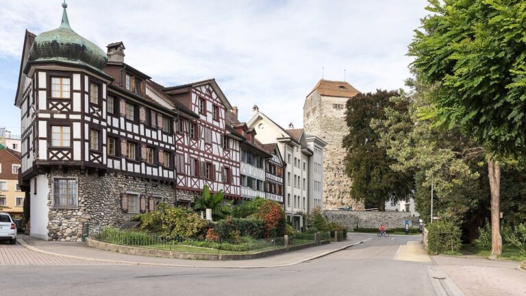
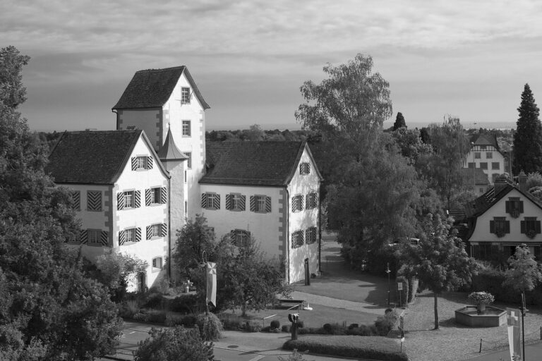
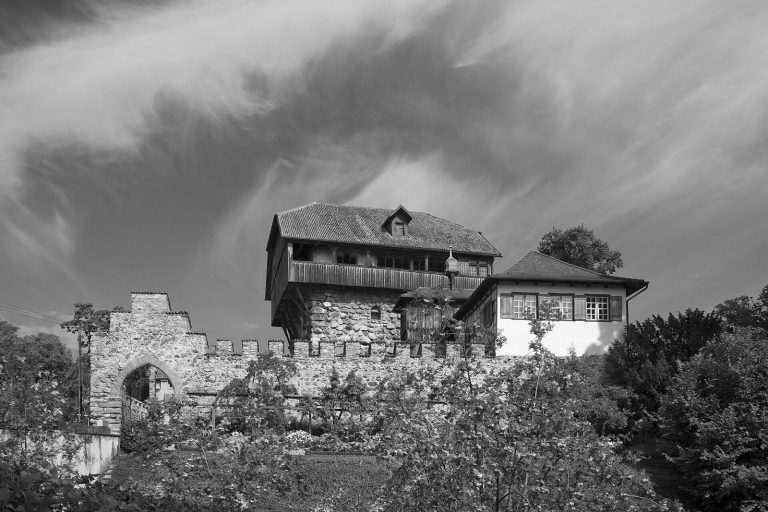
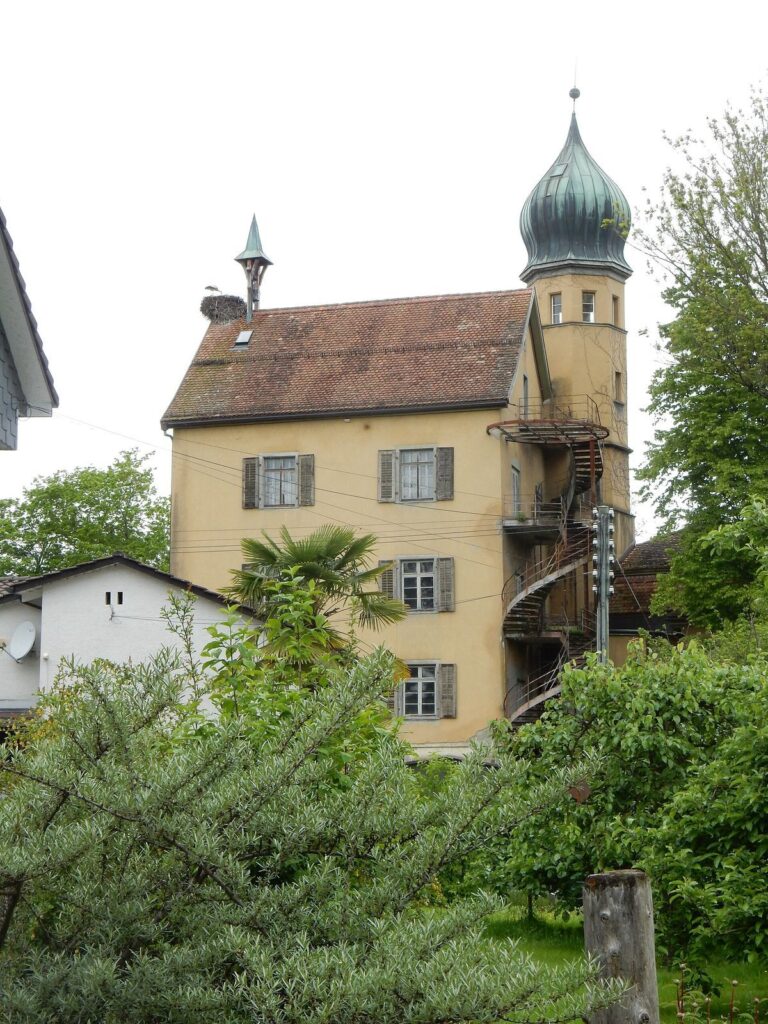
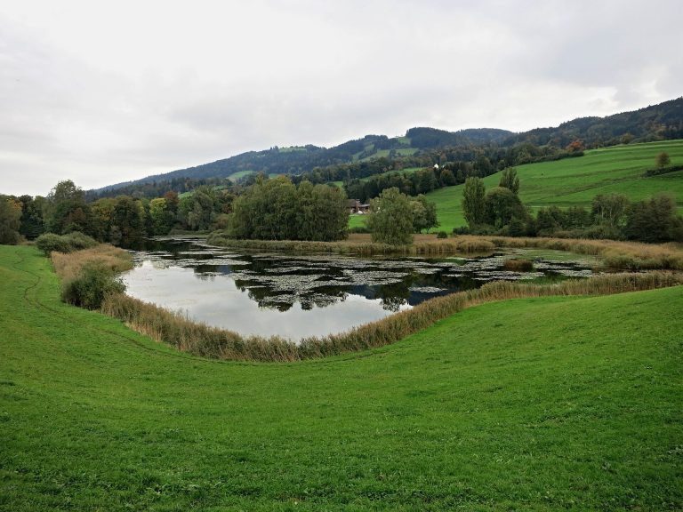
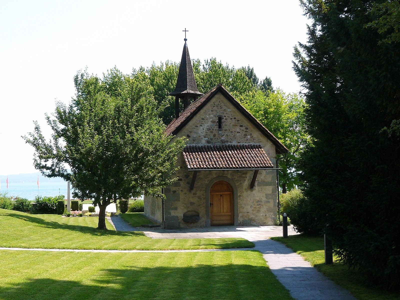
The fort followed the shape of Bergli hill, an elevated glacial moraine, or ridge of material left by a glacier, that projects into Lake Constance. It covered an estimated 10,000 m² and measured about 110 m from north to south and 80 m from east to west. Streams entering the lake to the north and south made parts of the shore marshy, including the area called Seemoosriet. Later infilling and construction changed the ancient shoreline. The medieval town center now occupies the fort: the castle lies over much of its northern part, while St Martin’s Church and the Gallus Chapel stand in the south, with the castle moat and park between them. A cemetery in the park remained in use until about 1890. The fort’s irregular perimeter, walls, towers, and ditch appear to have belonged to a single building scheme. Northeast and southeast gates are suspected, and a harbor may have stood east of the hill.
Walls and towers
Wall circuit
About 80 m of the wall has been examined in detail, and its full course may have extended up to 350 m. It was between 1.8 and 2.6 m thick, with the landward section measuring 2.6 m and the lakeside wall 1.8 m. Much of its route followed the hill. The eastern and northeastern line is less certain; a stretch between towers 5 and 6 probably followed the former lakeshore, and a gate is suspected near the northern edge of the present harbor or main street. The south wall of the Gallus Chapel follows the Roman wall exactly, which must still have been visible when the chapel was built in the twelfth or thirteenth century.
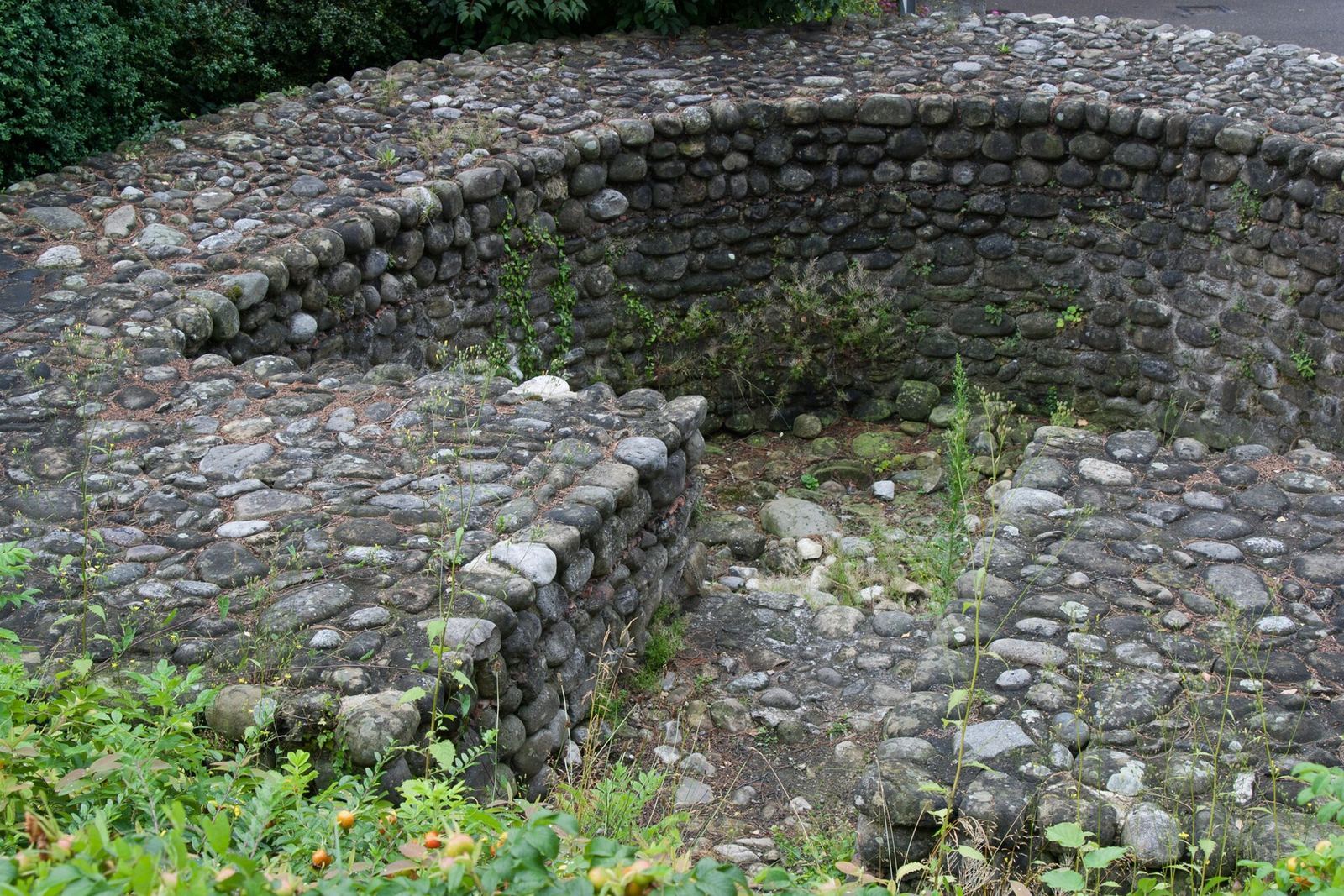
The walls used a late Roman method in which selected stones formed the two outer faces, while a core of lime mortar mixed with unworked stream cobbles filled the space between them. Some cobbles had their exposed ends trimmed. Broad foundations rested on a drainage layer and used large stone blocks; the rising wall was made with smaller stones, about 10–15 cm across. These foundations projected beyond the wall on both sides. On the north side, their upper surfaces were about 5 m higher than those on the south.
Semicircular towers 1–3
Six wall towers have been wholly or partly excavated. Four had semicircular or horseshoe-shaped plans, while two intermediate towers, numbers 4 and 5, were square. On the excavated western, northern, and southern walls, towers stood at intervals of about 22 m. Tower 1 stood just north of a slight bend. Its foundation, built of unmortared cobbles, curved outward about 3.10 m beyond the wall line. The tower was 7.10 m wide, with its rear extending 0.85 m into the fort. Two courses of the rising wall survived on its north side. Construction of a toilet facility later destroyed the tower.
Tower 2 stood at a bend in the wall. Its curved outer face was examined, while the rear lay beneath later construction; its foundations survived to a height of 2 m. Reused stone blocks were incorporated at its junction with the north-running wall. Tower 3 guarded the northwest corner, where construction of the castle’s Landenberg wing disturbed it. Excavated sections show that it enclosed the corner concentrically. Its outer radius was 3 m and its overall circumference 10.40 m; the foundation slab projected markedly northward.
Square towers 4 and 5
Tower 4 stood 45 m east of tower 3, and another intermediate tower may have stood between them. Its rectangular plan measured 8 by 4.60 m. The rear projected about 2.40 m into the fort, while the walls facing outward were 1.20–1.40 m thick. Two rooms occupied its interior. Reused blocks helped form the tower and its corners; their clamp, lifting, and chisel holes show that they came from a finely worked public building or monument. Sandstone blocks formed its outer foundation, including blocks measuring 90 by 65 by 45 cm. The tower probably flanked the west side of the northeast gate.
Tower 5 lies almost entirely beneath the medieval Gallus Chapel, near the ancient lakeshore, and may also have formed part of a gate. It connected more heavily built landward and harbor walls, 2.40 m thick, with shore walls that were 1.80 m thick. The tower measured 9 by 10.50 m externally and 4.60 by 5.60 m internally. Its outward-facing wall was 2.70 m thick, compared with 2.20 m on the fort side, and the structure projected about 4 m beyond the wall. Its design resembled tower 4, but it was not built entirely from cut stone; its foundation probably used cobbles set in mortar. Sandstone and volcanic tuff, a rock formed from volcanic ash, were used in the facing of both towers 4 and 5.
Tower 6
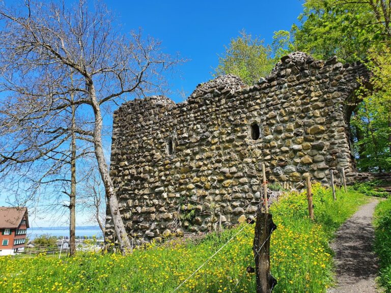
Tower 6 secured the southwest corner. Its outward curve had a radius of 4.40 m and projected about 5.60 m beyond the fort wall; the tower’s middle axis measured 5.10 m. The curved outer wall was 1.60 m thick, while the rear wall was 2.40 m thick. A rear doorway about 1.10 m wide had a sill roughly 1 m above the interior floor, perhaps indicating a wooden ground floor. Small patches of coarse white plaster survive inside. This is the only part of the fort restored and conserved above ground. Hollow-tile fragments found in the tower were once interpreted as evidence of heating, but excavators considered them more likely to have come from the bath beneath the parish church.
Western ditch and waterlogged finds
Western ditch
The western defensive ditch was found in 1990 during construction of an underground garage at Fischmarktplatz. It had a pointed, trapezoidal section, measured 8.8 m across and 3 m deep, and extended to groundwater level. Its base was 4.10 m wide and rose slightly toward the west before meeting the steep outward-facing slope. The broad strip between ditch and wall measured about 50 m; its purpose is uncertain. The ditch may have belonged to an earlier fort, or the late Roman fort may have had two ditches. A second parallel cut found in 1991 on Promenadenstrasse could instead have belonged to the medieval castle.
Waterlogged finds
Waterlogged conditions in the ditch preserved fourth-century objects, including an oak barrel made from staves, a hollowed tree trunk, and fragments of a probably left-footed closed leather shoe. Iron pieces and a bronze arm ring lay inside the trunk. The barrel contained coins, glass and pottery fragments, and parts of a goat or sheep skull. The barrel and trunk may have served as water containers or tanning vats, but their use is uncertain.
Buildings within the fort
Castle courtyard remains
Medieval construction destroyed most of the fort’s interior structures, although a few building remains survive in the castle courtyard. Excavations in its eastern part revealed walls with cobble facings and a core of lime mortar and small rubble. A surviving stretch was about 14 m long; other sections included a northeast extension and a wall angle measuring 2.50 m. The main wall was 1.65 m wide, stood on a 1.10 m foundation, and retained 30 cm of rising masonry. Plaster survived inside the angle, and a floor layer met the wall. A doorway had a threshold 1.28 m wide. The walls probably divided a room within a larger building. Taken together, their layout suggests a hall-like structure about 29 m long, though the foundations of probably two courtyard buildings cannot be dated securely.
Bath beneath St Martin’s Church
Excavations in the west end of St Martin’s nave in 1986 revealed parts of two Roman buildings from different periods. The older building’s use is unknown. The later structure was a bath, probably from the reign of Constantine I. Its excavated northwest section included a hot room, a rectangular bathing annex measuring 1.30 by 2 m, and a furnace room. A hypocaust, a system that warmed rooms from beneath the floor, heated the building. Fourteen brick supports for the raised floor survived to an average height of 90 cm. A square masonry base among them may have supported another pool.
A brick-vaulted heating channel, 90 cm wide, ran through the annex’s projecting west wall. Eight hollow wall tiles carried hot air upward through the walls. Both the hot room’s west wall and the annex walls were 0.74 m thick and plastered on each side. The structure, including its annex and furnace room, extended 7.80 m. When the church was built, its foundations reused those of the bath.
Buildings along the walls and roof tiles
Reddish floor layers against the fort wall indicate that buildings stood along its inner edge. North of the wall, a mound of small roof-tile fragments shows that the fort had tiled roofs. Scattered pieces of fine red-coated Roman tableware from the second and third centuries point to earlier activity in the area.
Burial grounds and collections
Roman cemetery
The ancient cemetery lay about 500 m west of the fort. Modern construction has greatly disturbed it.
Early medieval cemetery
An early medieval cemetery on the south slope of Bergli, probably used in part by people from the fort, remained in use into the seventh century. Its east–west graves include 49 sparsely furnished burials. Finds from the area include human skeletons and swords.
Roman finds
Some Roman small finds are exhibited in medieval rooms within the castle complex that houses the Historical Museum Arbon; other objects are held in cantonal collections.