Samarra: An Abbasid Capital and Archaeological City in Iraq
Site at a Glance
- Popularity
- Very High
- Country
- Iraq
- Primary era
- Medieval
- Eras represented
- Medieval, Modern
- Civilizations
- Abbasid, Ottoman
- Site type
- City
On this page18 sections
History
Samarra is an archaeological city on the east bank of the Tigris in Iraq, about 125 kilometres north of Baghdad. The Abbasid caliph al-Mu’tasim founded it in 836 CE as a new administrative capital and military base. A caliph was the sovereign ruler of the Abbasid Caliphate, an Islamic empire ruled by the Abbasid dynasty. Samarra served as the caliphs’ residence until 892.
Prehistoric and early history
The region was inhabited in prehistoric times. The Samarra culture, an early Mesopotamian culture associated with settled communities and distinctive pottery, flourished alongside the Ubaid period. It is generally dated to about 5500–3900 BCE. Tell es-Sawwan, an early settlement in the region, is associated with this culture.
A stele records that Sennacherib, a king of the Neo-Assyrian Empire, refounded a city called Sur-marrati in 690 BCE. Its identification with a fortified Assyrian site at al-Huwaysh, across the Tigris from modern Samarra, remains uncertain. Other ancient names linked to the area include the Greek Souma, the Latin Sumere, and the Syriac Sumra. Sumere has been identified with a fort associated with the retreat of the Roman emperor Julian’s army in 363 CE. Sumra is described as a village that still exists in Samarra district.
During the Sasanian period, when the Sasanian Empire ruled Iran, and under the Lakhmids, an Arab kingdom aligned with it, forts in the Samarra area had strategic importance amid Roman-Persian conflict. Water management also shaped settlement in the region. The Qatul al-Kisrawi, a northern extension of the Nahrawan Canal that carried Tigris water into the area, may have helped support a larger population. The medieval geographer Yaqut al-Hamawi attributed the canal to Khosrau I, Sasanian ruler from 531 to 578.
Harun al-Rashid, another Abbasid caliph, later had the supplementary Qatul Abi al-Jund canal excavated. An octagonal city called al-Mubarak was planned in connection with it, but the project was abandoned unfinished in 796.
The Abbasid capital
Al-Mu’tasim established Samarra as the Abbasid capital in 836. A foundation tradition relates that he spent three days examining land belonging to Iraqi Christians before buying the site of a monastery for 500 dirhams. After the new city was laid out, the caliph moved there with his troops. Residents followed, and tall buildings soon appeared.
The garrison included troops from Central Asia and Iran, among them Turks and regiments known as the Khurasani, Ishtakhaniyya, Faraghina, and Ushrusaniyya, as well as the North African Maghariba. These soldiers were often described as Mamluks, a term for soldiers of enslaved origin, but they held elevated status. Some commanders bore Sogdian titles of nobility; the Sogdians were an Iranian-speaking people of Central Asia.
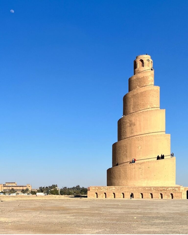
Under al-Mu’tawakkil, Samarra was expanded with palace complexes, including al-Mutawakkiliyya. He sponsored the Great Mosque and its minaret, and built the palace of Bulkuwara for his son al-Mu’tazz. The Church of the East, a Christian church led by a patriarch, also moved its patriarchal seat from Baghdad to Samarra under Patriarch Sargis, who held office from 860 to 872. One or two of his immediate successors may have lived in the city as well.
The caliphs left Samarra in 892, when al-Mu’tadid returned the capital to Baghdad. The city may have been looted around that time, and its population probably declined, although it continued to serve as an important market centre.
Decline and later history
From the tenth century, Samarra developed into a major pilgrimage destination. Its position as a trading town weakened in the twelfth and thirteenth centuries, after the Tigris shifted east south of the city and the Baghdad–Mosul road moved to the river’s western bank. The Mongol invasion of 1258 and later Safavid incursions, carried out by the Iranian dynasty that ruled Iran, destroyed much of the city. Its walls and tall buildings were demolished.
Samarra experienced a modest building phase during Ottoman rule. The Battle of Samarra took place during the Ottoman–Persian War of 1730–1735, a conflict between the Ottoman and Persian empires. More than 50,000 Ottoman and Persian soldiers became casualties. The battle helped maintain Ottoman overlordship over Iraq until the First World War. In the nineteenth century, a bridge across the Tigris connected Samarra with the western bank in 1878, and the city’s first primary school opened in 1881.
In 1954, the Samarra Barrage was built to reduce recurring floods that threatened Baghdad, and Lake Tharthar became permanent. The reservoir displaced local residents; some moved to nearby villages or to Samarra. The city’s population also grew through natural increase.
Archaeology and recent conflict
The German archaeologist Ernst Herzfeld excavated at Samarra between 1911 and 1914, with Friedrich Sarre also associated with the early work. Samarra Archaeological City was inscribed on UNESCO’s World Heritage List in 2007 under cultural criteria ii, iii, and iv, and was placed on the List of World Heritage in Danger that same year.
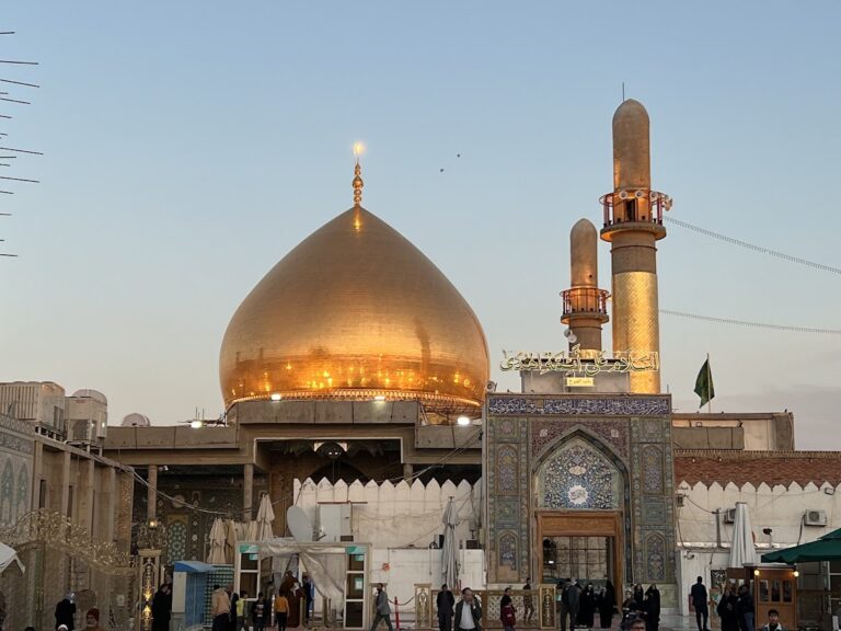
At the beginning of the Iraq War, fighting between al-Qaeda and U.S. forces in Samarra lasted about three months. During the 2006–2008 Iraqi civil war, the city lay within the area informally known as the Sunni Triangle, associated with Sunni Arab insurgency, and tensions grew between Sunni and Shia communities. On 22 February 2006, a bombing destroyed the golden dome of the Al-Askari Mosque. The attack triggered unrest and reprisal attacks across Iraq in which hundreds died. Sunni insurgents attacked the mosque again in June 2007, destroying its two minarets; its clock tower was blown up the following month.
Local police and tribal forces gained control of Samarra in 2008, after which reconstruction and restoration began at schools, archaeological sites, and Muslim shrines with UNESCO assistance. Work on the Al-Askari Mosque compound was still under way in 2009. In 2014, the Islamic State of Iraq and the Levant seized Samarra’s municipal building and university and held them for two days before Iraqi army and SWAT forces repelled the attack.
The Al-Askari Shrine gives Samarra religious importance in Twelver Shi’ism, a branch of Islam that recognizes a line of twelve Imams as authoritative spiritual leaders. Ali al-Hadi and Hasan al-Askari are revered as the tenth and eleventh Imams. Their association with the city, and the shrine’s importance to pilgrims, forms a continuing part of Samarra’s history.
Remains
The archaeological city extends about 41.5 kilometres from north to south along the east bank of the Tigris and is between 4 and 8 kilometres wide. It retains much of its historic plan, architecture, and artistic remains. Mudbrick ruins cover extensive areas, while about 80 percent of the archaeological city remains buried.
Prehistoric settlement and material remains
Tell es-Sawwan
At Tell es-Sawwan, an occupation mound associated with the Samarra culture, archaeological evidence dates to about 5500–4800 BCE. The remains include evidence of irrigation engineering and flax cultivation, indicating a flourishing settlement with an organized social structure.
Pottery
Samarra’s finely made pottery is decorated with stylized animals and birds against dark backgrounds, as well as intricate geometric designs. It was widely exported across the ancient Near East. A Chinese-made sancai shard, a ceramic piece decorated with three-colour glazes, found at Samarra and dated to the ninth or tenth century, illustrates Chinese influence on Islamic pottery.
Canals and planned settlement
Qatul al-Kisrawi
The Qatul al-Kisrawi formed the northern extension of the Nahrawan Canal, drawing water from the Tigris in the Samarra region. A commemorative tower, now called Burj al-Qa’im, stood at its southern inlet, south of the city. Near the northern inlet, by modern Nahr ar-Rasasi and ad-Dawr, a palace was built with a walled hunting park.
Qatul Abi al-Jund and al-Mubarak
The Qatul Abi al-Jund was a supplementary canal associated with the planned city of al-Mubarak, identified with modern Husn al-Qadisiyya. The city’s layout followed a regular octagonal plan.
Abbasid mosques and palaces
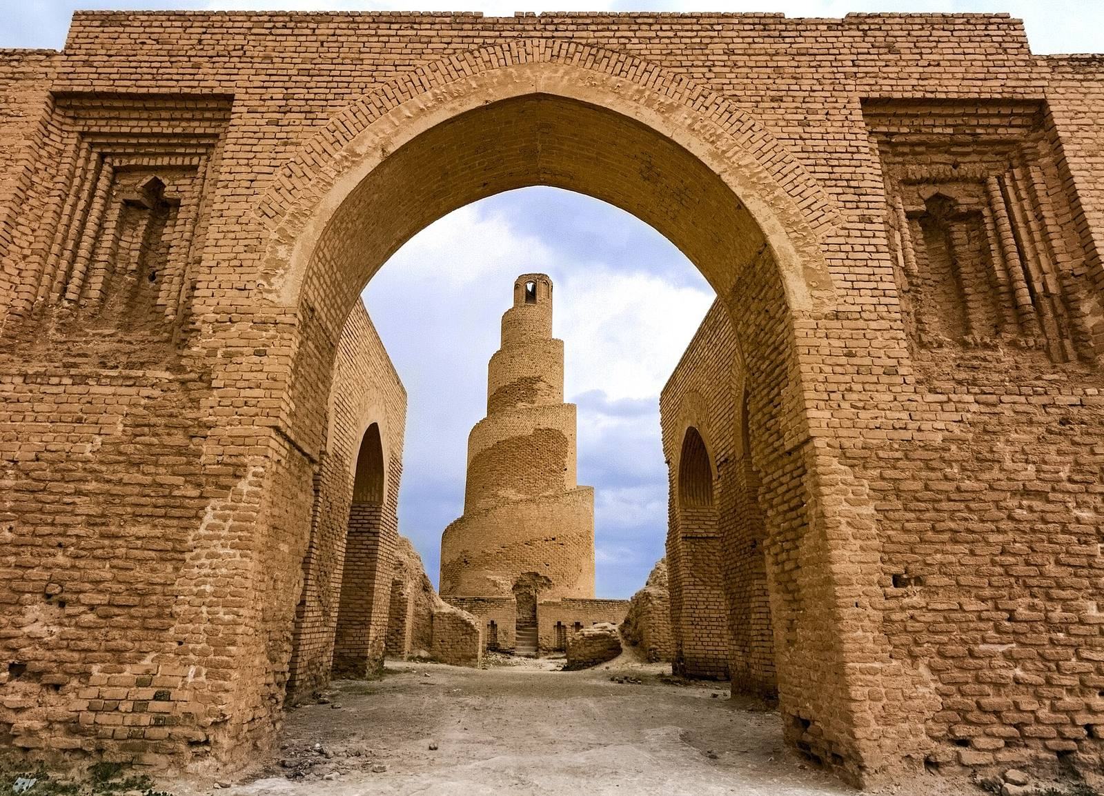
Great Mosque and Malwiya minaret
The ninth-century Great Mosque of Samarra includes the Malwiya minaret, a tower associated with a mosque. Its distinctive form rises in a spiral.
Other mosques and palace remains
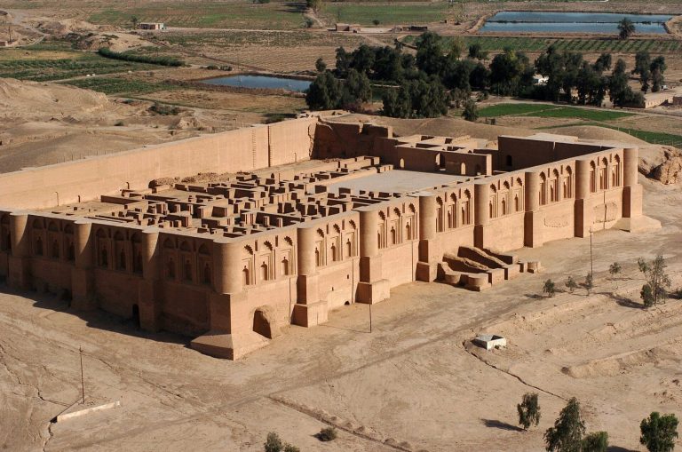
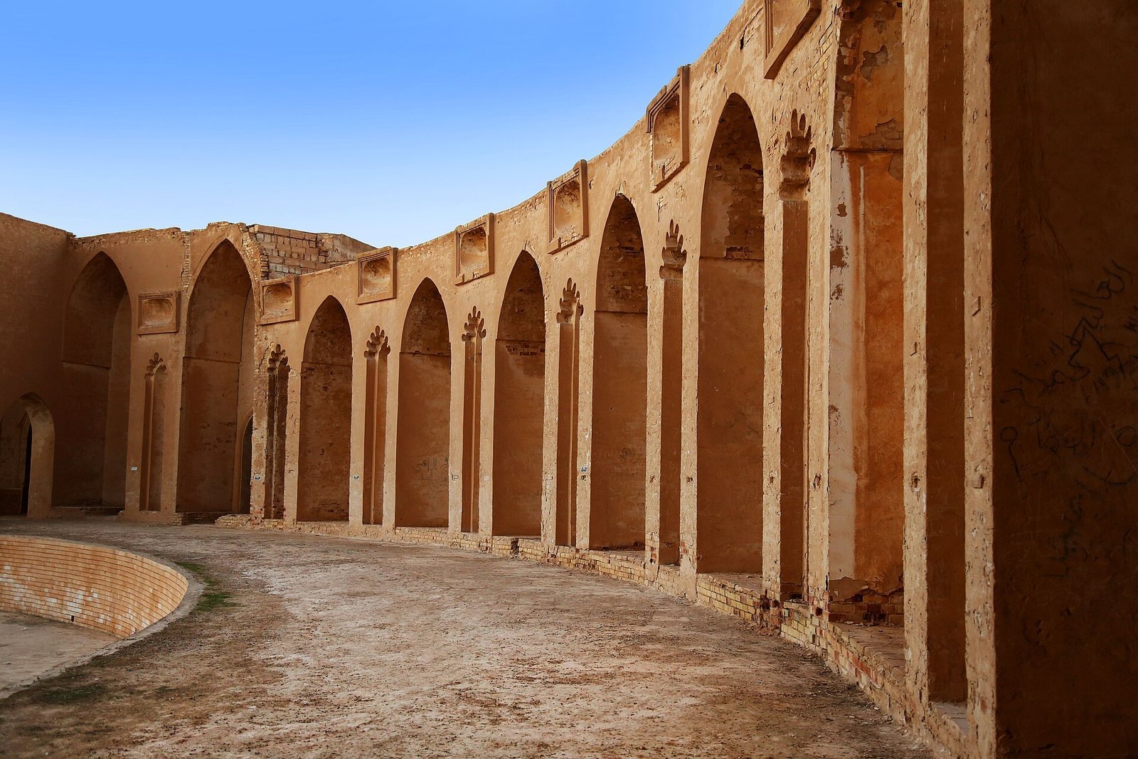
Other named remains include the Abu Dulaf Mosque and Qasr al-‘Ashiq, as well as the palace complexes of al-Mutawakkiliyya and Bulkuwara. The remains of Dar al-Khilafa include a circular pool within the palace.
Religious and modern features
Al-Askari Shrine
The shrine contains the tombs of Ali al-Hadi and Hasan al-Askari, along with the burials of Hakimah and Narjis, esteemed female relatives of the Prophet Muhammad and the Imams. A cellar beside the tombs is associated with the residence of al-Hadi, al-Askari, and al-Mahdi, the awaited twelfth Imam in Twelver belief.
Samarra Barrage and Lake Tharthar
The Samarra Barrage created the permanent Lake Tharthar near the city. The lake and barrage form part of the modern landscape shaped by water management in the Tigris region.