Maštaičiai Hillfort: A Fourteenth-Century Fortification in Lithuania
Site at a Glance
- Rating
- 5
- Popularity
- Very Low
- Country
- Lithuania
- Primary era
- Medieval
- External website
- Open
- Eras represented
- Medieval
- Civilizations
- Teutonic Order
- Site type
- Military
- Remains
- Castle
On this page15 sections
History
The castle and its sieges
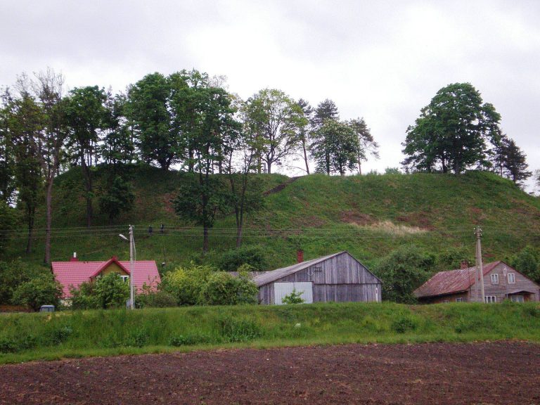
Maštaičiai hillfort is a 14th-century fortification near Maštaičiai village in Lithuania. One identification links the surrounding archaeological complex to New Bayerburg, a castle built around 1344 by the Teutonic Order, a Catholic military-religious order that established strongholds in the Baltic region. The hillfort itself is dated to the 14th century.
In 1380, a Lithuanian force led by Kaributas, a prince of the Gediminid ruling family, attacked the castle from three sides. The attackers filled its ditches with timber and set the outer bailey ablaze. The defenders, unable to hold the position, set the castle on fire; the flames reached its latrine tower. After six days, the siege ended in a truce as relief forces from Prussia were hurrying to the defenders’ aid. The castle was captured and burned in 1384.
Changing identifications and modern recognition
The site has also been identified as Christmemel, and the nearby pond interpreted as a harbor dug by the Teutonic Knights. Another proposal associates it with the Teutonic castle of Bajerburg. Petras Tarasenka instead considered the remains those of a castle belonging to the Lithuanian noble Masto, who may have fought alongside Sudargas. Local legends helped make the hillfort widely known.
The Institute of History surveyed the hillfort in 1960. A government resolution designated it a cultural monument in 2008, protecting an area of 82,000 square metres.
Remains
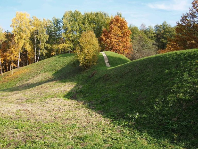
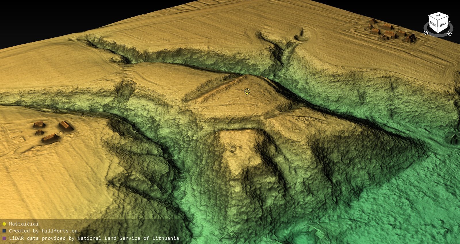
The archaeological complex occupies the edge of the high left bank of the Nemunas River, between two streams, about four kilometres west of Gelgaudiškis. Its main features are a hillfort and three baileys, enclosed defensive areas adjoining a principal fortification, arranged along a north–south axis, with an old-harbor site in the Nemunas valley. Ditches divide the defensive areas, while deep ravines surround the complex.
The hillfort
Platform and earthworks
In the complex’s northeastern corner, the hillfort stands across a ditch 30 metres wide and 5 metres deep from a bailey, and rises 3 metres above it. Its truncated-cone form carries a trapezoidal platform, elongated northeast–southwest and sloping north. The platform measures 50 metres long, 45 metres wide at the southwest, and 25 metres at the northwest, covering 2,500 square metres. Its southwestern edge is higher. A bank on that side is 0.8 metres high and 10 metres wide; a terrace runs along the slope 2 metres below it. Farther southwest, a ditch measures 26 metres across and 7 metres deep, with a raised strip crossing its southeastern part.
On the northern slope, a shallow ditch lies in front of a low bank, 5 metres below the platform. A terrace runs along the northeastern slope, 4 metres below the platform. At the eastern edge, a pit reaches 1 metre deep; mixed soil extends 30 centimetres down, and burnt-clay fragments occur at its southern end.
Ponds at the northern foot
A rectangular pond at the hillfort’s northern foot measures 50 by 25 metres. Banks 2 to 3 metres high border its western and eastern sides; they appear to have been formed from soil dug out of the pond.
The baileys
First bailey
West of the hillfort, beyond a ditch 20 metres wide and 2 metres deep, the first bailey has an irregular diamond-shaped platform, elongated northwest–southeast and sloping slightly north. It measures 81 by 75 metres. Its southern bank has been levelled. A ditch behind that bank, 16 metres wide and 4 metres deep, separates the first bailey from the second. A terrace lies on the northern slope, 2 metres below the platform.
Second bailey
South of the first, the second bailey has a rectangular platform elongated west–east, measuring 100 by 70 metres and covering about half a hectare. Bricks have been found there. Its southern bank is 3 metres high and 15 metres wide, with a ditch 14 metres wide and 2 metres deep beyond it. On the western slope, a shallow ditch sits in front of a low bank, 2 metres below the platform.
Third bailey
The third bailey lies south of the second. Its nearly square platform is slightly elongated north–south and measures 105 by 100 metres. A ditch runs at the foot of its southeastern slope, which is 2 metres high. On the eastern slope, another shallow ditch lies in front of a low bank, 2 metres below the platform.
Harbor and settlement remains
Old-harbor site
North of the hillfort, at its foot on the edge of the Nemunas valley, the old-harbor site consists of a rectangular pond elongated north–south. It measures 70 metres long and 20 metres wide. Banks along its eastern and western sides are 2 metres high and 20 metres wide, formed from excavated soil.
Settlement area
A settlement area of 0.2 hectares lies south of the third bailey.
Landscape and condition
The hillfort’s slopes descend at angles of 60 to 70 degrees, and its side facing the Nemunas rises more than 40 metres. Its northern slope and that of the first bailey are 33 metres high; the hillfort’s eastern slope is 25 metres high. The hillfort and baileys have been damaged by ploughing, and pits have disturbed the hillfort platform. A former road damaged the eastern defensive features of all three baileys. Trees cover the complex, while the bailey platforms are open grassland. Its defensive works place the hillfort among the largest of the 14th- and 15th-century examples.