Orraon: A Molossian Fortified Settlement in Greece
Site at a Glance
- Popularity
- Medium
- Country
- Greece
- Primary era
- Classical
- Eras represented
- Classical
- Civilizations
- Ancient Greek, Roman
- Site type
- Military
- Remains
- Fortified Town
On this page15 sections
History
Orraon was a fortified settlement of the Molossians, an ancient Greek people of Epirus, on Kastri Hill near Ziros, Greece. Its foundation and fortification probably date to the reign of Molossian king Alcetas I (385–370 BCE), or at the latest to the second quarter of the fourth century BCE. Orraon controlled a route through the Louros Valley between inland Epirus and Ambracia, as well as a military passage important to the Molossian kingdom’s defense. Settlements along this route also served as stations for moving goods.
Molossian settlement
The name Orraon appears in ancient literature and in inscriptions of the fourth and second centuries BCE. An inscription from Ambracia supports the identification of the site, and a boundary decree involving Ambracia and Charadra also refers to the settlement. The Roman historian Livy called it Horreum. Historian Nicholas Hammond proposed identifying Orraon with Phylake, but later research rejected that identification.
Roman destruction and relocation
In 168–167 BCE, Orraon resisted Roman forces by closing its gates against the legions of Anicius Gallus. It was one of four Epirote cities to resist in this way. Roman forces destroyed the settlement, an act attributed to Aemilius Paulus, and demolished its fortifications. The attack formed part of reprisals in Epirus, attributed to hostility over King Pyrrhus I’s campaigns in Italy. Roman orders called for the destruction of 70 Epirote cities and the enslavement of 150,000 Epirotes. The Greek geographer and historian Strabo later described Epirus and Illyria as severely depopulated, with inhabited settlements in ruins.
Orraon was rebuilt after its destruction, but the settlement lasted only a short time afterward. Following the Battle of Actium, its inhabitants were compelled to move to Nicopolis, founded by Augustus, Rome’s first emperor, in 31 BCE.
Investigation and conservation
Archaeological investigation began in 1972 with a preliminary excavation led by Julia Vokotopoulou, then head of the regional 12th Ephorate of Prehistoric and Classical Antiquities. From 1972 to 1975, the University of Ioannina, directed by Sotirios Dakaris and working with the German Archaeological Institute, excavated House 1; work there resumed in 1981. Wall stabilization took place from 1972 to 1976 and again in 1981. Further excavation and conservation were carried out under archaeologist Konstantinos Zachos from 2003 to 2006, when ancient coins were found.
Remains
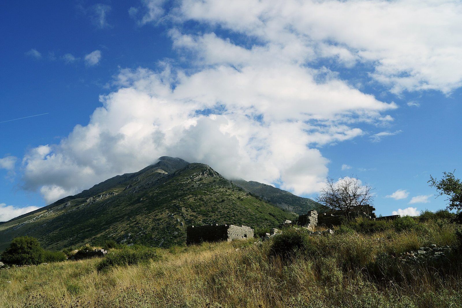
The fortified settlement occupies Kastri Hill, about 345 metres high, near the Ambracian Gulf and between the villages of Gorgomylos and Ammotopos. Its oval enclosure contained a planned residential grid, stone houses, and water-storage installations. The hill’s southern slope is steep and rocky.
Fortifications and street plan
Defensive enclosure
A double defensive wall enclosed an area of about 5.5 hectares. The circuit measured approximately 750 metres and was strengthened by square towers and angular offsets. The principal entrance stood on the northeastern side.
Streets and blocks
Twelve narrow, parallel streets ran north to south and crossed two wider streets, dividing the settlement into elongated blocks about 15 metres wide. A house commonly occupied the width of a block. In 37 BCE, Orraon had about 100 houses, 12 streets, and a cemetery. Faint remains of additional houses are visible outside the walls. Population estimates for the settlement at its height range from 1,500 to 2,000 people, and rise to as many as 5,000 to 10,000 if the houses beyond the defenses are included.
Houses and residences
Domestic architecture
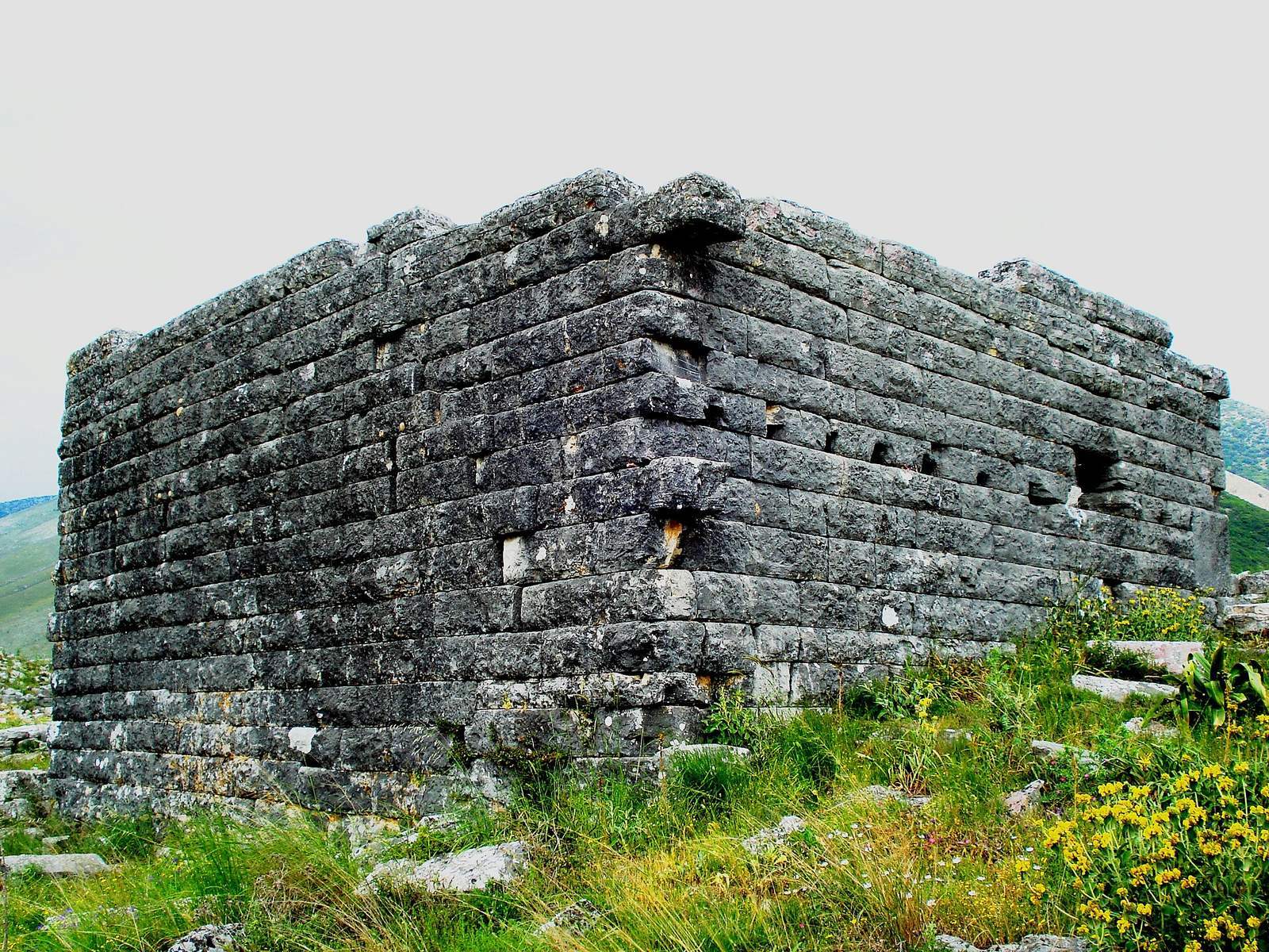
The houses were generally spacious, farmhouse-type buildings of about 270 square metres. Builders used local limestone laid in even-height rows. Some houses remain in unusually complete condition, with upper-storey walls reaching the roofline in places, as well as windows, stone door frames, and holes for roof beams. This survival is exceptional for late Classical domestic architecture, the later phase of the Classical period in Greece. The houses use conventional letter labels, including Houses A through D.
House D
The walls of House D stand about 5 to 7 metres high, preserving the substantial scale of the domestic buildings.
House 1 and possible official residences
House 1 has been interpreted as a palace. Other buildings at the settlement may have served as residences or palaces for officials.
Administrative and water installations
Northern building and cistern
A small administrative building with upright stone blocks stood in the northern part of the settlement, where the public area is thought to have been. A large cistern, a built tank for storing water, had a capacity of 400 cubic metres. A reconstruction depicts it with a roof. Houses also had their own cisterns.
Cistern near the main entrance
A second cistern stood near the northeastern entrance, at the town’s highest point, inside an enclosing wall. A projecting end of its southern wall formed a frame, and straight stairs at the northeastern corner descended to the bottom for cleaning and drawing water. The surrounding wall, made of rectangular limestone blocks and built higher than the cistern, helped keep rubbish from being thrown into it.