Son Catlar: A Talayotic Settlement and Fortified Enclosure on Menorca
Site at a Glance
- Popularity
- Low
- Country
- Spain
- Primary era
- Iron Age
- Eras represented
- Bronze Age, Iron Age
- Civilizations
- Unclassified
- Site type
- Military
- Remains
- Fortified Town
On this page12 sections
History
Son Catlar is a prehistoric settlement near Ciutadella on Menorca, in Spain’s Balearic Islands. Founded in the late Bronze Age, it originated in the pre-Talayotic period. The Talayotic culture, a prehistoric Balearic tradition known for monumental stone towers called talayots, shaped the settlement’s later development. Son Catlar expanded rapidly and flourished during the Iron Age, especially in the third and second centuries BC. During the post-Talayotic period, a later phase following the main Talayotic period, it was among Menorca’s largest settlements.
Iron Age growth and defenses
Son Catlar, Trepucó, and Torre d’en Galmés may have served as centers of power on the island. New defensive works appeared from the fourth century BC as warfare in the Mediterranean changed. Their development has been linked to Menorca’s involvement in the Punic Wars, conflicts between Carthage and Rome fought mainly in the third and second centuries BC, or to Rome’s later conquest of the island. The local population was aligned with Carthage, and the settlement’s defenses were strengthened in the late third century BC during the Second Punic War.
Rome conquered Menorca in 123 BC, and parts of the settlement wall were destroyed during the conquest. Some affected sections are dated to the end of the second or beginning of the first century BC. Parts of Son Catlar continued to be inhabited after the conquest. The settlement declined toward the end of the Roman period, while some areas saw habitation again during the medieval rule of the Almohads, a Muslim Berber dynasty that governed parts of North Africa and the Iberian Peninsula.
Research and protection
Joan Ramis i Ramis mentioned Son Catlar in Celtic Antiquities in 1818, followed by Rafael Óleo y Quadrado in History of the Island of Minorca in 1874 and Émile Cartailhac in Primitive Monuments of the Balearic Islands in 1892. Francesc Hernández Sanz excavated the taula sanctuary in 1924, though the findings were not fully published. In 1957, Maria Lluïsa Serra Belabre and J. Flaquer excavated a columned hall behind the northern talayot, with results that likewise remained incompletely published. The following year, Lluís Pericot and architect V. Tolós restored the lintel of the northern entrance and excavated there.
Vegetation covering parts of the wall was cleared in 1987, and a plan of the wall was made. Octavi Pons led an excavation at the entrance in 1995. Since 2014, the University of Alicante’s Proyecto Modular has investigated the impact of Phoenician-Punic culture, associated with Phoenician settlements and the world centered on Carthage, and its interactions with Menorca’s Talayotic population. Photographic measurement and recording took place in 2015, followed by excavations of the defensive wall from 2016 under Fernando Prados Martínez. Son Catlar was declared a protected cultural monument in 1931 and became part of the UNESCO World Heritage property Talayotic Menorca in 2023.
Remains
Settlement setting
The settlement occupies a small hill about 40 metres above sea level and covers approximately four hectares. Its position offers broad views of the surrounding area, particularly to the southwest and across the sea toward Mallorca. The circuit wall encloses talayots, building foundations, and a central sanctuary, while burial chambers and other remains lie beyond the enclosure.
Circuit wall
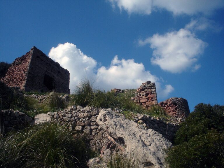
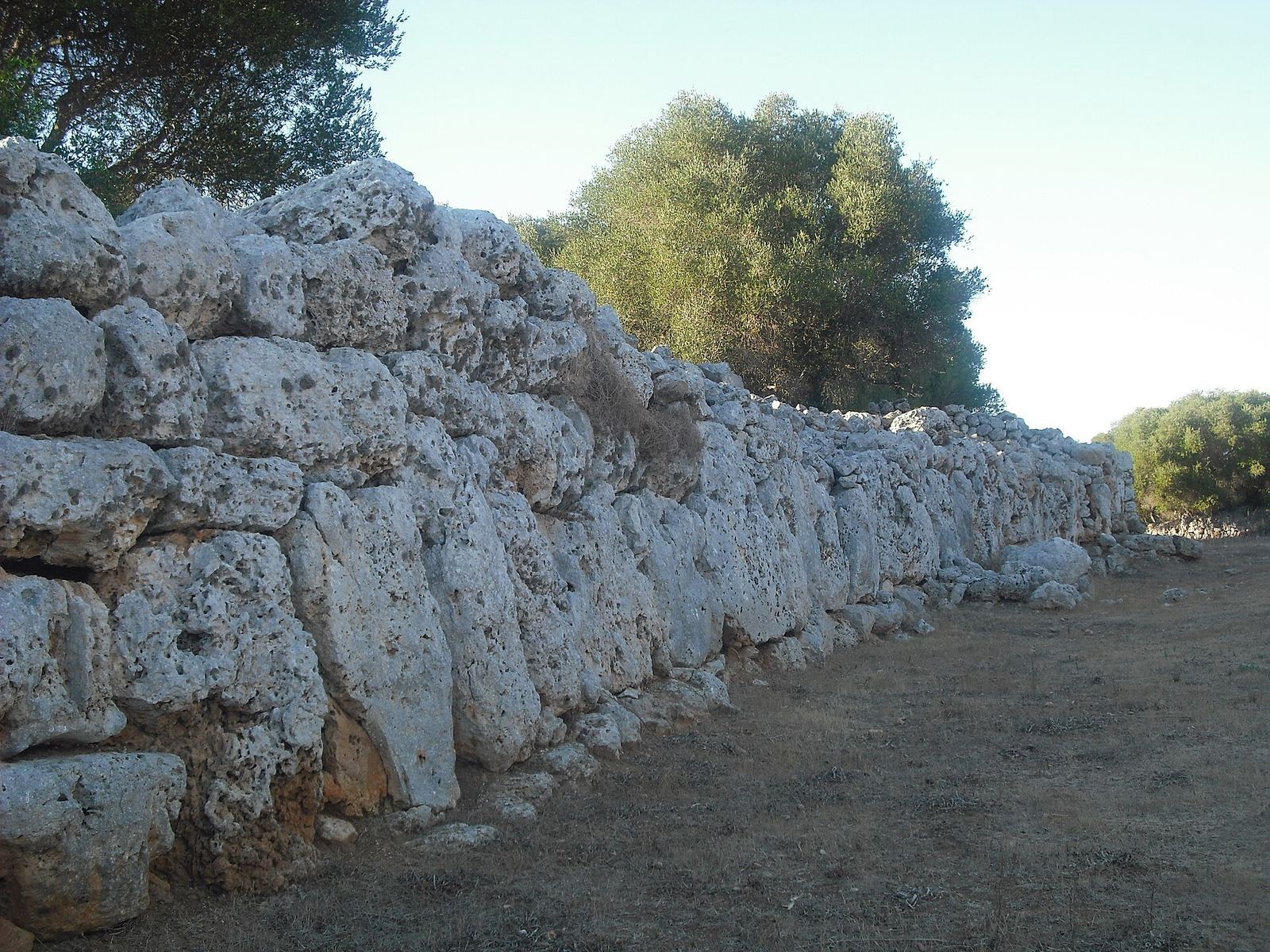
Son Catlar has Menorca’s only completely preserved prehistoric circuit wall. Built without mortar from exceptionally large stones, the dry-stone wall is about 900 metres long, up to six metres thick, and around three metres high. Its oldest sections date to the sixth century BC. Some of the building stone came from earlier talayots that appear to have been abandoned. Much of the wall has a Talayotic-style base, with upright stones supporting horizontal courses.
Defensive features and gates
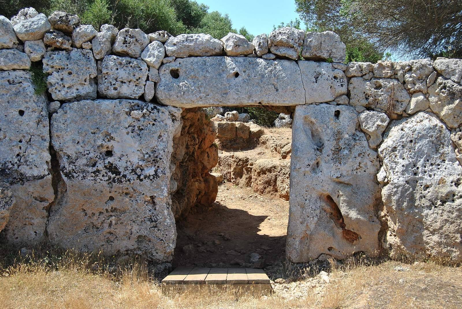
Reinforcements incorporated towers, bastions (projecting defensive works), outer walls, artillery platforms, sentry posts, angled entrances, and small secondary gates. Eight square-plan towers were added along the wall’s front. Two rectangular towers stand in the eastern section, while two northeast bastions face different directions and flank a corner of the settlement. Their dimensions and construction are described as Carthaginian in character. In the north, a passage is roofed with stone courses that project inward. At the northeast entrance, two upright stones support a crosswise lintel. A second, angled entrance was identified in the northwest in 2019, and that section of wall contains protected compartments known as casemates. These defenses are unusually well preserved and reflect changing military needs rather than internal social conflict.
Talayots
The settlement contains five talayots, four of them visible. The largest stands in the southeast; stones accumulated around its base add to its apparent size. It may overlie an earlier trapezoidal structure about 25 metres across, while the talayot itself is about 13 metres in diameter. Another, roughly 80 metres to the north, was heavily damaged when the enclosure wall was built. An elliptical talayot measures about 15 by 13 to 14 metres and has a chamber with a central pillar. The northernmost may once have had an upper chamber, which has collapsed. The westernmost survives as three rows of stone.
Buildings within the enclosure
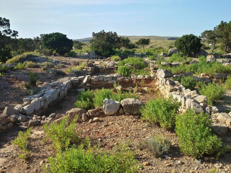
Foundations of many buildings are visible inside the wall. Rectangular and semicircular structures remain unexcavated, and a columned hall stands near the northern wall.
Taula sanctuary
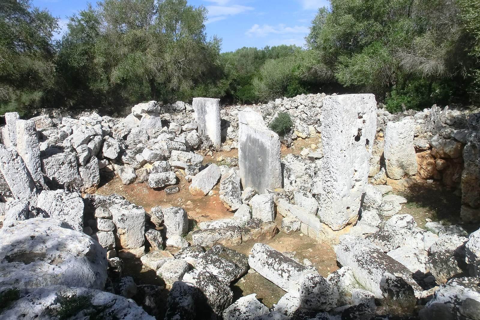
The central sanctuary has a horseshoe-shaped enclosure and two entrance portals. Its taula, a T-shaped stone monument characteristic of Menorca, consists of two large stones; the capstone has fallen and broken. Upright and fallen monoliths suggest that the sanctuary space was divided radially. Two inscriptions carved on stones inside the enclosure probably date to the Roman period. A cistern immediately in front of the sanctuary may have served a ritual purpose. Excavation there found abundant ash mixed with animal remains, particularly horns, as well as pottery fragments.
Burial chambers and remains beyond the wall
Outside the western wall, a hypogeum, or rock-cut underground chamber, dates to the second millennium BC. A corridor about 2.45 metres long and 1.40 metres wide leads to a chamber roughly five metres long and 2.80 metres wide. Its descending corridor is in poor condition, and small niches are cut into the chamber walls. A second hypogeum lies just south of the wall and dates from between the ninth and first centuries BC; its chamber measures about 4.30 by 5.20 metres. Foundations of other Talayotic dwellings lie outside the enclosure, and a small burial ground of rock-cut tombs is near the country house. A standing stone bearing humanlike engravings also stands outside the western wall.
Archaeological finds
Roman military objects dating to around 100 BC were found at one of the gates in July 2021. The group includes knives, arrowheads, spearheads, surgical instruments, and a bronze spatula.