Alinja Tower: A Mountain Fortress in Azerbaijan
Site at a Glance
- Country
- Azerbaijan
- Primary era
- Medieval
- Eras represented
- Medieval
- Civilizations
- Unclassified
- Site type
- Military
- Remains
- Castle
On this page19 sections
History
Origins and early history
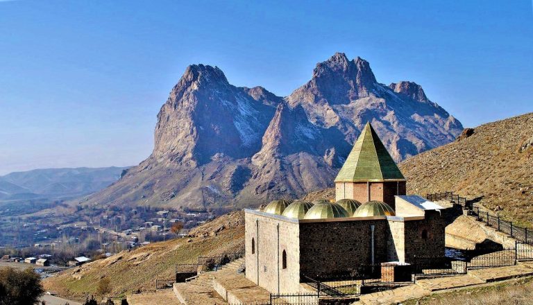
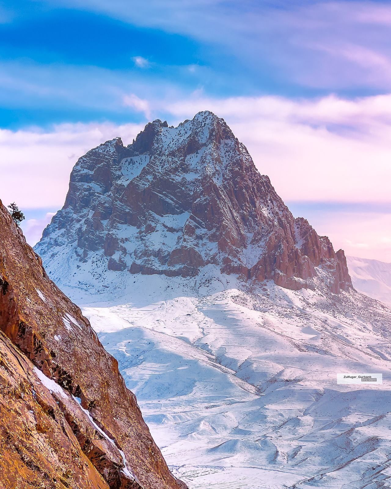
Alinja Tower is a mountain fortress on Mount Alinja near Julfa, Azerbaijan. Its construction date and earliest political affiliations are uncertain. Proposed beginnings range from the early centuries CE, with a possible restoration in the fifth century, to the seventh through ninth centuries. The fortress existed before the eighth century. It has been linked to Syunik, a historic Armenian principality, and its ruling House of Siuni; other interpretations connect its name to Turkic origins and emphasize its later role under the Atabegs.
The earliest known literary reference appears in the Book of Dede Korkut, an Oghuz heroic epic. In the story of Segrək, the fortress is held by Qara Tekur and serves as a stronghold and a prison for Oghuz captives. Egrek is imprisoned there and later rescued by his brother Segrək. The episode belongs to literary tradition and does not establish when the fortress was built.
Alinja was already in existence by 821, during the Arab conquest of the region. It may have come under the Bagratuni, an Armenian royal dynasty, in the early tenth century. In 914, Yusuf ibn Abi’l-Saj besieged it during the reign of Smbat I, king of Armenia. Yusuf killed Smbat outside the fortress in an attempt to force its surrender. An Arab emir of Goghtn captured the stronghold soon afterward.
Atabeg rule and the medieval struggles
Under the Eldiguzids, also known as the Atabegs of Azerbaijan, Alinja became a military, political, and economic center. An atabeg was a senior guardian and political authority, often acting on behalf of a Seljuq ruler. The fortress sheltered the ruling family and held the Eldiguzid treasury as well as the principal treasury of the Iraqi Seljuqs. Zahidə Khatun, wife of Muhammad Jahan Pahlavan and governor of Nakhchivan, maintained her principal residence there.
In 1225, Atabeg Uzbek took refuge at Alinja when Khwarazmshah Jalal al-Din Mangburni invaded Azerbaijan, and Uzbek died at the fortress. Earlier in the thirteenth century, the districts of Ernjak and Chahuk passed from Eldiguzid control to Elikum Orbelian. Alinja may later have served as a residence for a branch of the Orbelians, an Armenian princely family.
Timur’s forces began a siege in 1387 that continued intermittently until they captured the fortress in 1401. Georgian forces and local rulers aided the defenders. Khwaja Jawhar led the defense until his death in 1390, when Emir Altun took command. During the winter of 1397–1398, Sidi Ali Orlat, ruler of Shaki, and Georgian allies helped defeat a Timurid force. Sidi Ali later died in the defense of Alinja.
Conflict among the garrison weakened its resistance. Emir Altun and Malik Tahir became enemies; Altun was killed after leaving the fortress, and Malik Tahir fled to Baghdad with the treasury and his followers. When Alinja fell in 1401, its commander, Emir Sayyid Ahmad Ogulshami, was captured and executed. Timur appointed Muhammad Obahi as commander and later visited the fortress.
After Timur’s death in 1405, control returned to the Jalayirids and then passed to the Qara Qoyunlu, a Turkmen confederation. In 1406, Imad al-Din, the Islamic judge of Tabriz, attacked and damaged Alinja. Sultan Ahmad ordered repairs and made the surrounding population pay for them. The fortress later passed to the Timurids in 1429 and returned to Qara Qoyunlu control in 1435.
In the 1430s, Qara Qoyunlu prince Qara Iskander sought refuge at Alinja after defeat by Shah Rukh. Jahan Shah, his brother, besieged the fortress; Qara Iskander was killed by his own son, Shah Qubad. After the Qara Qoyunlu dynasty collapsed in 1468, Alinja came under Aq Qoyunlu rule, another Turkmen confederation. In 1491, Sultan Baysunqur imprisoned the prince Rustam Mirza there. Rustam escaped the following year.
Safavid, Ottoman, and later rule
Alinja remained a military headquarters and prison under the Safavids, a dynasty that ruled Iran and surrounding territories. Ottoman forces, the Safavids’ major imperial rivals, captured it in 1514. In 1534, the Ottoman commander Xosrov Pasha was sent to take the fortress. That year, Safavid official Ahmad Beg Nur Kamal and his brothers were imprisoned there. During the Ottoman-Safavid wars, Alinja continued to serve defensive purposes. In 1583, Safavid governor Muhammad Khan Toxmaq Ustaclı withdrew to Nakhchivan and sheltered the wives and children of his warriors at the fortress.
The Ottomans administered Alinja from 1588 to 1603. After Shah Abbas I recovered Tabriz in 1603, Safavid forces retook the fortress, and Amirguna Khan later used it as a base for operations against the Ottomans. Ottoman rule returned in 1724. The fortress and nearby lands then belonged to the Alinja subdistrict of the Nakhchivan district, where people farmed, raised livestock, tended orchards, and cultivated market gardens.
In 1826, a commander named Lala Bey fought an enemy force at Alinja for more than six months. During the Russo-Persian War, Persian troops were stationed at the fortress, followed by small Russian detachments.
Systematic investigation began in 1930, followed by further examination of the summit in 1936 and studies of the fortress buildings in the 1930s and 1940s. Work in 2006 extended investigations to the lower slopes. Alinja was designated a monument of world significance in 2007.
Remains
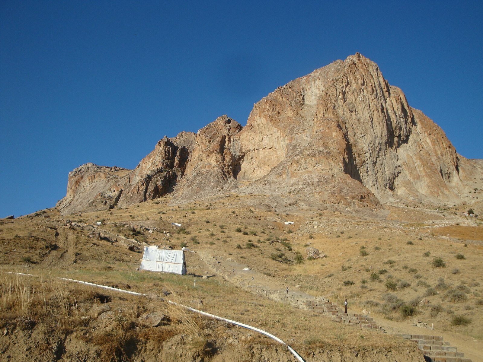
The fortress’s defenses rise in stepped lines from Mount Alinja’s lower slopes to its summit, enclosing the peak. The complex has three broad areas, including defensive zones for soldiers and a central district with the character of a settlement. Local stone forms most of the walls, with fired brick used in some sections. Large dressed stones commonly reinforce foundations, and lime mortar binds many stretches of masonry. The site is an important example of the Nakhchivan–Maragha tradition, a medieval regional architectural style associated with Nakhchivan and Maragha.
Lower defenses and entrances
The lower settlement and eastern entrance
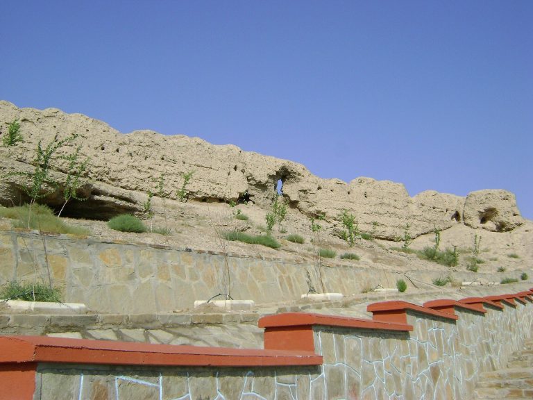
On the eastern side, the lower settlement includes square dwellings and eight defensive structures. Its perimeter wall survives in places to a height of two to three metres and is about 2.5 metres thick. Built from large and medium-sized stones, it has rectangular projections that strengthen the wall. This may have been an early defensive line. A large qanat, an underground system for collecting and carrying water, lies in this area and has three wells. Investigations in 2006 also identified a walled area and traces of dwellings on the mountain’s lower slopes, where people may have sought shelter during attacks.
The eastern entrance, in the Khanega area, may have been the main gate. Carved platforms outside the walls provided positions for defenders. Near the entrance, a final wall follows the rock face and rests on niches cut into the stone. Square buildings along it housed gate defenders, while two large reservoirs stood nearby. The number of gates is uncertain, with two or three proposed; the eastern and western entrances are relatively well preserved.
Western entrance and upper approaches
The western entrance was protected by square towers, zigzag projections, and a winding approach. Stone forms most of its walls, while fired brick appears on the sides of the entrance. Three defensive wall lines protected this part of the fortress, which could be approached from the west along the Khanega–Qazanchi route. Elsewhere, walls follow a ravine near the summit, bordered by steep cliffs on two sides. Most run straight, with some rectangular zigzag turns. The vulnerable northeastern approach had an additional wall and traces of semicircular towers. In one section, a pair of walls about 2.5 metres apart encloses a habitation area, with reservoirs nearby.
Settlement and inner citadel
The central district
The largest district contains foundations and ruins of residential and public buildings made of stone and fired brick. Most surviving homes consist of a single room, and some have square niches in their walls. Excavation and restoration exposed small ovens and hand mills inside houses, along with troughs, bread ovens, animal stalls, and food stores. These remains indicate that some buildings accommodated livestock. Square openings in thick walls carried away water and also formed part of the walls’ design.
Şahtaxtı and its defenses
The inner citadel, locally called Şahtaxtı, occupies the mountain’s highest point, about 1,700 metres above sea level. It is separated from the central district by steep rock. A narrow path cut into the rock, originally around 30–40 centimetres wide, has eroded and collapsed. The terrace held palaces associated with rulers, including the Eldiguzids. Finely worked stone details survive on fortress walls and buildings.
Three defensive systems protected the citadel from the north. The first, facing Qazanchi, includes stone walls reaching four to five metres in places, bonded mainly with lime mortar and sometimes with mud. A square tower at its western end also served as soldiers’ quarters, and platforms outside the wall provided defensive positions. A narrow route across steep rock linked this line with the citadel. The second system, toward Khanega to the northeast, has stone-and-mortar walls strengthened by semicircular towers. A third wall encloses the citadel buildings and lies between them and a reservoir.
Fired brick was used extensively in the citadel’s buildings. Large and small rooms connect through narrow passages. Four large reservoirs were identified in this area; the largest is about 25 metres long.
Water systems
Reservoirs and channels
Rock-cut reservoirs collected rainwater carried by channels cut into the stone. Most lie in the Narınqala area, a fortified inner section; most are square, although one is circular. The largest reservoir in Şahtaxtı measures about 25 by 5 metres and is two to three metres deep. A stone wall bonded with lime mortar strengthens its front. Another, in the central area, measures about 23 by 4 metres and is three to four metres deep.
The channels are generally about 20–25 centimetres wide and 15–20 centimetres deep. A channel could extend as far as 200 metres, and individual reservoirs could receive water through two or three channels. Some reservoirs remain unfinished. Iron picks used to cut reservoirs were found during restoration work in 2014–2015.
Western qanat
Near the entrance from the Qazanchi road, the western qanat has a square entrance built from dressed stone slabs and a water channel about 60 centimetres wide and two metres long. A horseshoe-shaped supporting wall protects it from collapse. Erosion has covered the probable shafts, leaving the outlet identifiable. The entrance has been restored. The qanat flows strongly in spring but can dry during drought, particularly in hot summer weather.
Eastern qanat
Near the mountain’s foot, the eastern qanat is known locally as the upper spring, and its water is still used. Its three wells have room-shaped upper sections. The main shaft descends at about a 45-degree angle to a depth of eight metres, then opens into an underground chamber extending nine to ten metres, large enough for three or four people. A basin cut 0.6 metres into the rock collected groundwater, which small ceramic channels and pipes carried downward. Steps in the last well gave access to the water level. A three-way distributor indicates three outlets, one of which is currently used. Its concealed outlet within the settlement helped protect the water supply from besieging forces, while also serving civilians.
Historical evidence and conservation
The fortress in medieval descriptions
In the fifteenth century, Castilian envoy and travel writer Ruy González de Clavijo described walls and towers around the lower mountain. His account also noted vineyards, gardens, cultivated fields, pasture, springs, and water cisterns on the slopes, with the castle or citadel at the summit. He described three broad areas connected by stone steps.
Coins and religious remains
Alinja was a minting center in the second half of the thirteenth and first half of the fourteenth centuries. A small number of copper dirhams, coins used across Islamic lands, have been attributed to that period on the basis of their form and minting technique. A silver coin from the seventh century found at the fortress bears a Sogdian inscription, an Iranian language of Central Asia, reading ‘Chach’, the ancient name of Tashkent, along with the name of a ruler whose identity is unknown.
In 1851, an Armenian monastery within the fortress was described as well preserved and housed relics of St. Gregory, commonly identified in Armenian Christian tradition as Gregory the Illuminator.
Archaeological work and restoration
Investigations in 1930 examined the walls, gates, towers, and defensive works. A 1936 expedition identified built features on the rocky summit, including reservoirs cut into the rock. Studies in the 1930s and 1940s concluded that buildings inside the fortress had been destroyed and rebuilt repeatedly.
Archaeological and restoration work begun in 2014 exposed buried buildings and clarified their former uses. It returned the eastern and western gates to earlier forms, stabilized walls built from large rock blocks bonded with lime mortar, and cleared buildings enough to reveal their layouts. The work brought residential and public buildings, stables, food stores, ovens, reservoirs, and remains of water channels to light.