Abdah: A Nabataean Station on the Petra–Gaza Incense Route
Site at a Glance
- Country
- Israel
- Primary era
- Medieval
- Eras represented
- Classical, Medieval
- Civilizations
- Abbasid, Byzantine, Nabataean, Roman, Umayyad
- Site type
- City
On this page22 sections
History
Abdah, also known as Avdat, is a Nabataean settlement at Abar al-Abdah in Israel’s Negev, founded in the 3rd century BCE as a station on the Petra–Gaza Incense Route. The Nabataeans were an ancient Arab people whose trading network linked Petra and other Arabian centers with Gaza and Mediterranean markets. The route carried aromatics and other goods between these regions.
Nabataean foundation and trade
From the 3rd to the late 2nd century BCE, Abdah served as a seasonal caravan camp on an early route between Petra and Gaza. It later developed into one of the route’s leading stations, second in importance only to Petra. During the Hellenistic period, which followed Alexander the Great’s conquests and spread Greek culture, Abdah functioned as a trading post.
The city’s name is traditionally linked to a Nabataean king called Obodas, who was revered as a deity after his death and said to have been buried at Abdah. His identity is uncertain. The tradition may refer to Obodas I, while Obodas II, who ruled from 62 to 60 BCE, is another proposed connection.
Roman rule and changing trade
Abdah’s trade weakened after Alexander Jannaeus, ruler of the Hasmonean kingdom in Judea, captured Gaza around 100 BCE and disrupted commercial routes. Its importance recovered under Roman rule following Rome’s annexation of Nabataea in 106 CE. Former Roman soldiers settled in the city to help protect its residents and the routes through the area. Trade later declined again as routes between Arabia and the Nile Valley changed.
Under the Nabataean king Aretas IV, the acropolis, the settlement’s elevated fortified center, was strengthened with substantial retaining walls. In 9 BCE, during the reign of Obodas II, a hard-limestone temple was built at Abdah for the deified Obodas I. As regional trade contracted during the 3rd century CE, the city relied increasingly on farming, particularly wine production. Roman forces also used stations along the Petra–Gaza road in the 4th and 5th centuries. A military camp at Abdah was established in the late 3rd or early 4th century, though its original builders may have been Nabataean or Roman.
Byzantine prosperity and later occupation
A major earthquake heavily damaged the early town in the early 5th century. Abdah was rebuilt and remained occupied, becoming an agricultural center and frontier settlement under Byzantine rule, the history of the eastern Roman Empire. Its border position received economic and military support, and its Byzantine population is estimated at about 2,000 to 3,000 people.
A Persian attack around 620 CE brought burning and destruction. The city also experienced earthquake damage, but the date of that event and its relationship to the Persian attack are uncertain. Occupation continued into the Early Islamic period, with intensive activity around 650–900 CE. The date when Abdah was finally abandoned is not known.
Exploration, excavation, and preservation
European exploration began with Ulrich Jasper Seetzen’s visit in 1807. Edward H. Palmer established the site’s identity in 1870, and Alois Musil surveyed it in 1902 and 1904. Antonin Jaussen, Rafael Savignac, and Luis Vincent prepared a plan in 1904. Leonard Woolley and T. E. Lawrence worked at Abdah in 1912, followed by Theodor Wiegand in 1916.
Systematic excavation began in 1958 under Michael Avi-Yonah and continued under Abraham Negev. Further work took place in 1975–1977, 1989, and 1999, including investigation of the military camp. Finds and dating from a residential area on the southern slope support activity during Byzantine, Umayyad, and Abbasid times. In the late 1950s, one Nabataean farm at Abdah was reconstructed as part of an effort to recover ancient runoff-farming methods, later continued through a joint project of the Hebrew University of Jerusalem and Ben-Gurion University of the Negev. Abdah became part of the UNESCO World Heritage property Incense Route – Desert Cities in the Negev in 2005. In October 2009, vandalism damaged hundreds of artifacts and left paint on walls and an ancient wine press.
Remains
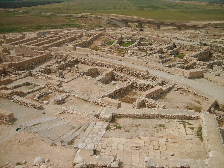
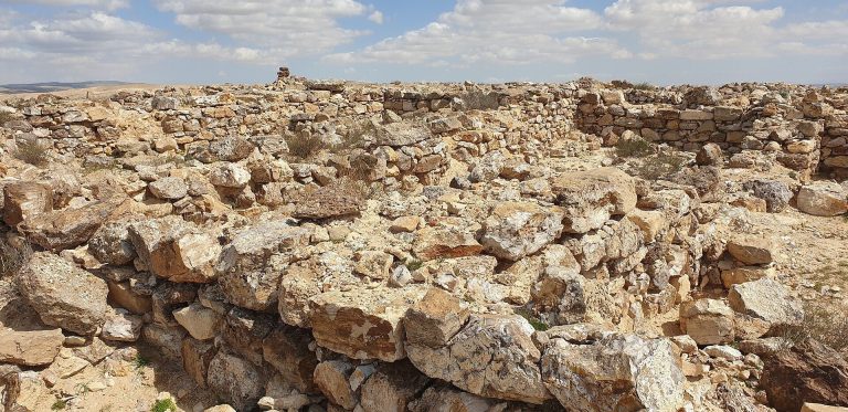
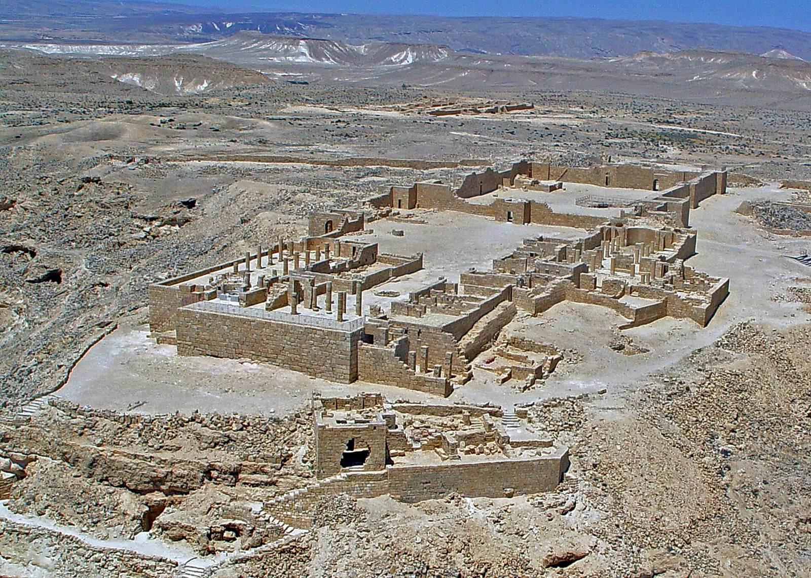
The ruins occupy a hilltop in the Negev at about 655 metres above sea level, rising roughly 80 metres above the surrounding terrain. The built area covers about 85 dunams, with a dunam equal to 1,000 square metres; the surrounding national park covers about 2,100 dunams. Nabataean and Roman remains are concentrated on the western side of the hill, while the military camp lies at its eastern edge and a Roman palace occupies the southern side. Most Byzantine remains lie in the east and at the foot of the western slope. The Byzantine Quarter is southeast of the acropolis.
Temple precinct and churches
Temple of Oboda
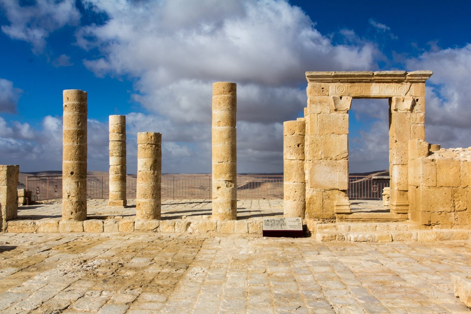
A temple platform was established along the western edge of the plateau before the end of the 1st century BCE. The Temple of Oboda, built of hard limestone, measured about 14 by 11 metres and served both as a place of worship and as the intended eternal resting place of Obodas I. Its porch, hall, and sanctuary were divided into four rooms. Worshippers entered from the south, crossed the hall to the sanctuary at the north, then turned south toward images in wall niches. Two niches in the western sanctuary room may have been intended for Allat and Dushara, while a larger niche in the other room is thought to have held an image of Obodas.
The temple stood beside a Christian chapel and another structure known as the western temple. A Nabataean dedication inscription dated to 268 CE was found on a threshold, and inscriptions from Aretas IV’s reign came from the temple treasury.
Northern basilica
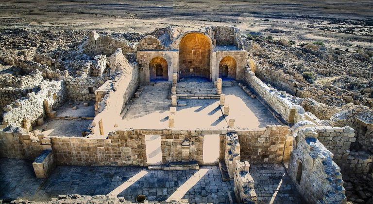
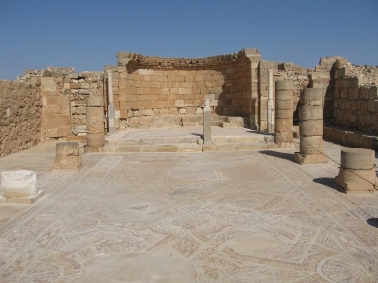
The Temple of Oboda was dismantled in the 4th century and a church was built on its site. This northern basilica, a long church divided into aisles, had three aisles, a colonnaded atrium or entrance courtyard, and an underground cistern, a tank for storing water. A sacrificial stone and an entrance gate from the earlier temple remained in place. A raised feature in the apse, the rounded end of the church, may have supported a bishop’s chair.
The church had two baptisteries, rooms or basins used for Christian baptism. The small, irregularly shaped one was for children, while the larger, cross-shaped one was for adults. It is the larger of the two relatively well-preserved Byzantine churches at Abdah.
Church of Saint Theodore
On the southern flank of the acropolis, west of the fortress, the Church of Saint Theodore was a basilica measuring about 21 by 12.6 metres. Two side chapels held relics. Its western atrium measured about 15 by 14 metres and was bordered on three sides by rooms probably used as monastic cells; surrounding buildings may have had an upper storey. A tower behind the apse dates to the 3rd century, while the rest of the church dates to the 6th century.
Marble tombstones set into the church floor bear Greek inscriptions dated between 541 and 618. One commemorates Kapito, a priest and son of Erasinos, who died on 22 September 617. Another refers to a ‘virgin of God,’ possibly a consecrated nun.
Monastery and carved entrance
A Byzantine monastery stood beside the Church of Saint Theodore. Nearby, a lintel carved with lions marks an entrance to the castle.
Fortifications and roads
Fortress
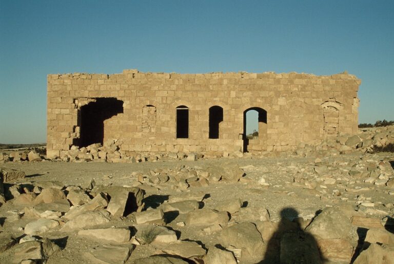
Northwest of the Temple Precinct, the fortress covers about 2,500 square metres and measures approximately 60 by 40 metres. Its walls are more than two metres thick, with rectangular towers reinforcing the corners and sides, and a large cistern within the enclosure. Its date is uncertain: proposals place it either during the reign of the Roman emperor Diocletian, from 284 to 305 CE, or as late as the 6th century. The enclosed area may have offered people and livestock refuge from threats by nomads. A small chapel was built inside after the Persian attack.
Roman military camp
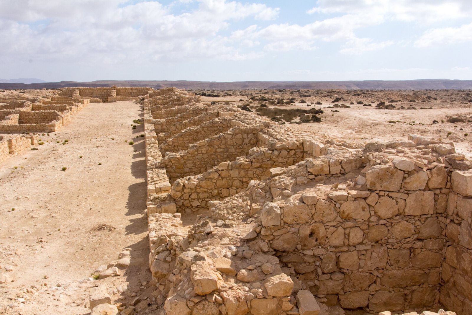
The camp at the eastern edge of the site was roughly 100 metres square. Double defensive walls, reinforced with square towers, enclosed four gates and eight long barracks capable of housing hundreds of soldiers. The barracks stood about six metres apart, with walkways between them.
Road and towers
A 12-kilometre section of the Nabataean road from Petra to Gaza began at the camp. The road was about five metres wide, unpaved, and cleared of loose stones. Roman milestones mark parts of the route between Abdah and Shar Ramon and farther north toward Halutza.
Roman defenses also included a three-storey, square-plan tower with sides about ten metres long. An inscription dated to 293/294 CE names one of its builders as a man from Petra. A watchtower supported by stone arches dates to 294 CE.
Settlement and land use
Residential quarters and cave houses
The Byzantine residential quarter contained about 350 to 400 houses on the slope between the road and the acropolis. Many combined stone-built rooms with multi-chamber caves cut into the slope. These caves served as storerooms, workshops, wine cellars, chapels, and burial places. A central street and systems of cisterns and channels gathered rainwater. Roman residential remains on the acropolis’s northwestern slope include a quarter, a villa, and pit graves.
A two-hectare residential sector on the southern slope contained stone-built houses and multi-room caves. Red sketches found there include crosses and a possible image of Saint Theodore. In one reconstructed dwelling, a corridor connects the house to a multi-chamber cave with ceiling projections for hanging plants, a bench for jars, rock-cut grain bins, and a toilet. Two nearby caves have wall inscriptions indicating their use as shelters during the Persian attack; one contains four capitals carved from the rock. A restored Byzantine house is also associated with caves used for a toilet and agricultural storage, and with a relief showing a cross, bull heads, and grape clusters.
Bathhouse
A Byzantine-period bathhouse dating to the 4th century stood on the plain below the settlement. Water reached it from a well connected by a tunnel about 70 metres long through bedrock. Its sequence included a cold-water pool with a separate entrance, a changing room, and rooms for cold and hot bathing.
Pottery workshop and animal enclosures
A Nabataean pottery workshop had three kilns and a pool for working clay. In an adjoining room, a potter’s wheel stood on a round plinth, and three benches along the walls provided places to dry prepared vessels. Nabataean remains also include enclosures for camels.
Farms and wine presses
Terraced farms and water channels collected runoff from winter rains, and some terraces have been restored. Farming included grapes, lentils, barley, and wheat, alongside livestock raising. Agricultural tools have been recovered south and west of the city.
At least five wine presses date to the Byzantine period. The best-preserved has a square plan and small storerooms on three sides. A channel on the fourth side carried pressed juice into a circular depression. Another press had a stepped working surface and an underground channel leading to a storage pit. From there, wine could be carried to caves at the edge of the hill for processing and storage.
Nabataean funerary cave
A Nabataean funerary cave dating to the 3rd century CE has a square plan and 22 burial places. Its entrance has an altar and sun and moon motifs. Three Greek inscriptions give women’s names; the women may have served as priestesses of Aphrodite. The cave was once proposed as the tomb of King Obodas, but that identification is uncertain.
Trade finds
Hellenistic amphorae from Rhodes provide evidence of trade connections. Together with agricultural tools found south and west of the city, they reflect the range of material recovered from Abdah’s commercial and farming areas.