Gavrinis Cairn: A Neolithic Passage Dolmen in France
Site at a Glance
- Country
- France
- Primary era
- Stone Age
- Eras represented
- Stone Age, Modern
- Civilizations
- French
- Site type
- Burial
- Remains
- Burial Mound
On this page15 sections
History
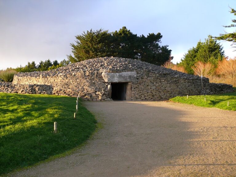
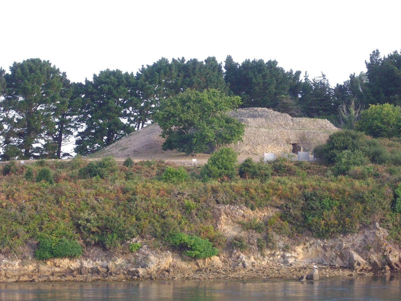
The Gavrinis Cairn is a Neolithic stone mound covering a passage dolmen on Gavrinis Island in Larmor-Baden, France. A dolmen is a large-stone structure, here formed by a passage leading to a single chamber. The monument was built during the Neolithic, the later part of the Stone Age associated with farming and polished stone tools, although its precise construction date is unknown.
Neolithic construction and closure
Gavrinis was connected to the mainland when the monument was in use, which ended during the fourth millennium BCE. The cairn belongs to a long-passage dolmen tradition found in Brittany between about 4500 and 3000 BCE, as well as in Normandy, Poitou, Ireland, England and the Iberian Peninsula. It was probably associated with the cult of the dead, but the chamber’s small size in relation to the passage and mound has led to questions about its exact purpose.
Wooden structures stood in front of the cairn. They were burned, the entrance was sealed with stone, and sand covered the monument, leaving it as an unmarked mound. Charcoal from the area places the fire between about 3400 and 2900 BCE, and the burning probably accompanied the closing of the passage.
Roman and medieval activity
Finds of amphora fragments, red-gloss Roman tableware and a hand-operated millstone indicate that people frequented the island during Roman times. A monastery later stood there in the Middle Ages.
Rediscovery and investigation
Canon Joseph Mahé described the cairn in 1825, while briefly noting the monastery’s ruins. In 1801, Dr Cauzique, then mayor of Crach, had bought the former monastic property. He cleared the land for farms in 1829, demolishing the monastery’s last remains and exposing the cairn. In 1832, he accidentally discovered a cavity leading to the chamber, which may have been entered before then.
The first known excavations began in 1835. At that time, rubble blocked the passage up to its ceiling. Prosper Mérimée, a French writer and heritage official who visited during the clearance, described the carved stones and wondered whether their geometric lines and shapes resembled writing. Gustave de Closmadeuc investigated the site further from 1881 to 1884. Zacharie Le Rouzic excavated it in 1925–1927 and began restoration work around 1930.
Restoration and heritage recognition
The department of Morbihan acquired the monument in 1961. Restoration and excavation by the French Ministry of Culture and the department’s general council began in 1969, bringing major changes to understanding of the site. Archaeologists revealed carvings on previously concealed stone faces in 1984. Charles-Tanguy Le Roux excavated the cairn fully between 1985 and 1995 and helped shape its presentation during the 1980s.
Around 1980, concrete and sea sand were used to secure access and approximate the monument’s presumed original form. Their interaction with the granite has contributed to deterioration, including brown streaks; an assessment of the damage was still under way in 2024. A digital recording project led by archaeologist Serge Cassen and researcher Laurent Lescop began in 2011 and was completed in 2013. It produced a three-dimensional representation and recorded the carvings, marking the first use of this technique at a megalithic site in France.
Gavrinis became a French historic monument in 1901. In 2025, it was included in the UNESCO World Heritage property Megaliths of Carnac and of the shores of Morbihan, recognized for human creative achievement and as an example of a type of building or landscape illustrating a stage in human history. The carvings also strongly influenced the work of painter Jean-Claude Bédard.
Remains
The island and cairn
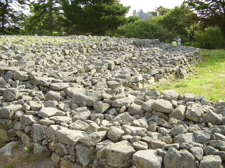
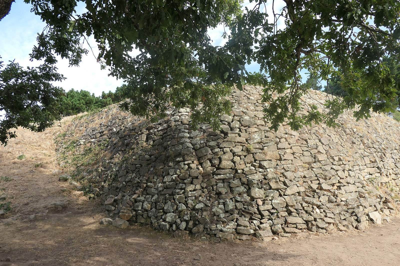
Gavrinis is an island in the central Gulf of Morbihan, about 0.30 square kilometres in area, 700 metres long and up to 400 metres wide. The cairn stands at its southern end. Nearly circular in outline, it is more precisely a four-sided form with rounded corners, measuring about 54–60 metres across and 6–8 metres high. It contains roughly 5,000 cubic metres of stone.
The outer face was carefully assembled, while the interior is packed with stones of different sizes. Several concentric walls help contain the mound’s weight. This dry-stone masonry, built without mortar, consists almost entirely of fine-grained, light-coloured granite from the local ground. The stones’ edges suggest that most were collected from the surface rather than quarried. Construction may have required about 100,000 person-days, equivalent to roughly three years for a workforce of one hundred.
Stone extraction, probably in ancient or medieval times, disturbed the cairn’s upper part. Otherwise, the monument has remained substantially intact since its construction. Its upper surface has also undergone later restoration.
The passage and chamber
Passage
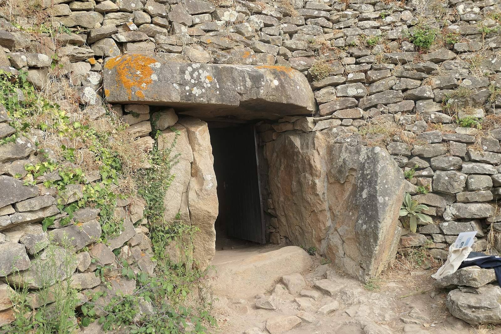
The entrance faces southwest. The passage extends for more than 11 metres, making it the second-longest passage dolmen in Brittany after Mané-Rutual. It is about 0.8 metres wide and 1.5 metres high, with a slight narrowing around its midpoint. Twenty-nine upright slabs form its sides: fifteen on the northeast, including two of quartz, and fourteen on the southwest. Nine capstones cover the passage.
The passage floor is paved and rises about one metre from the entrance to the chamber. Beneath it, a layer of rubble and sand about 0.7 metres thick helps steady the side stones and level the floor. The paving was altered during excavation work between 1881 and 1886. The upright stones throughout the passage and chamber sit in foundation trenches about 40 centimetres deep, cut into bedrock and filled with sand. They were selected and sometimes trimmed to narrow the gaps between them.
Chamber
The chamber lies near the centre of the cairn. It is trapezoidal, about 2.55 metres long, 2.45 metres wide at the back and 2.10 metres wide at the entrance, with an average height of 1.70 metres. Six upright stones form its sides. A single capstone of orthogneiss, a type of gneiss formed from igneous rock, covers it and weighs nearly 17 tonnes.
Le Roux identified the capstone as one of three pieces of a menhir, or large standing stone, about 14 metres long. The menhir was probably erected near the great broken menhir of Er Grah. Its other two fragments were reused as covers at the Table des Marchands and the burial chamber of Er Vinglé, both at Locmariaquer about four kilometres away.
Carved stones
Visible decoration
Twenty-three of the passage’s twenty-nine upright stones are decorated, with carvings covering nearly 50 square metres. The most carefully worked designs are in the passage rather than the chamber. Many stones were first shaped by repeated pecking, then engraved with quartz pebbles; simpler patterns were sometimes carved directly onto naturally uneven surfaces.
The designs include shields made from nested or radiating arcs, curved crooks, axes, zigzags, winding lines, small circular hollows and spirals. Axe blades sometimes appear in asymmetrical pairs, their cutting edges pointing down, often alongside paired crooks. Axes can be rendered as elongated triangles, angular lines or uneven crosses; other versions show curved handles or loops at their base. Some have holes at the butt, perhaps so they could be hung or displayed. One interpretation associates polished Alpine jadeite axes with local elites and axes from Carnac with supernatural powers. Cassen has suggested that the imagery may express a relationship between people and the world around them.
Carvings on concealed faces
Three upright stones and the capstone also bear carvings on their concealed sides. Their figurative style differs sharply from the passage designs, suggesting that older stones were reused. The hidden side of the capstone carries a motif almost three metres long, interpreted either as an axe-plough or, by Cassen, as a sperm whale. It also shows a large bovine in profile, more than two metres long, with exaggerated horns nearly as long as its body. The horns of a goat-like animal appear on the same face; a fragment bearing its missing body was reused at the Table des Marchands.
The concealed face of upright stone 15, at the chamber’s right rear, bears a finely carved hafted axe about 0.80 metres long, a second, rougher axe and a small four-sided shield. Stone 19, at the left-hand junction of passage and chamber, carries a large, enigmatic design traditionally read as an axe blade fitted at its base into a sleeve.
Distinctive stone surfaces
Stone 18 has a natural cavity formed when marine erosion wore away a softer amphibolite inclusion within the granite. Three engraved rings were added above the hollow. Stone 23 carries two adjacent shields carved directly into its rough surface, with the designs following its natural irregularities.
The threshold stone at the chamber entrance has bands of chevrons on both narrow sides and pecked decoration underneath. The patterns may have been designed to play on contrasts between light and shadow, perhaps enhanced with black and white paint.
Forecourt evidence
Excavations on the open ground in front of the façade revealed several pits. The largest measured six metres long and 0.80 metres deep. The pits contained granite plaques and many quartz pebbles with three faces. Other traces included charcoal, a streak of ash extending more than 15 metres, and eight charcoal masses identified as the bases of burned wooden uprights. Finds included three polished axes, one of flint and two of dolerite, a hard igneous rock, as well as two heaps of shells.