Monolithic Churches in Lalibela: Medieval Rock-Cut Places of Worship
Site at a Glance
- Country
- Ethiopia
- Primary era
- Medieval
- Eras represented
- Medieval
- Civilizations
- Ethiopian
- Site type
- Religious
- Remains
- Sanctuary
On this page18 sections
History
The Monolithic Churches of Lalibela are a group of medieval rock-cut churches in Lalibela, Ethiopia, traditionally associated with the Zagwe dynasty and the reign of King Gebre Meskel Lalibela, around 1181–1221. Their creation is linked to a plan to establish a symbolic Jerusalem within the Ethiopian kingdom. Tradition says the churches took 24 years to build, although the complex probably developed through multiple phases, perhaps over several centuries.
Town foundation and royal tradition
Lalibela was traditionally known as Roha. Local tradition places the town’s founding in 1137, when an Agew family known as the Zagwe established it. This foundation predates the churches and should be distinguished from their later creation.
Tradition credits King Lalibela with commissioning the churches as a second Jerusalem. It also relates that, before becoming king, he visited Jerusalem under the guidance of Christ and was instructed to create a counterpart in Ethiopia. The project is associated with the growing difficulty of pilgrimage to Jerusalem as Islam expanded; Saladin captured the city in 1187.
Construction and later development
Accounts of the project describe tools being prepared for cutting and shaping the stone, followed by the gathering of workers, masons, and excavators. Workers were paid according to their demands, while land for the churches was bought with gold, even though the king could have taken it by royal authority.
A later tradition places further work after the Zagwe dynasty fell. It describes an architect overseeing construction with the help of workers who had fled Egypt. A royal chronicle groups the churches differently from later arrangements: it names Mary, Sinai, Golgotha, the Cross, and the Virgins together; Gabriel and Abba Matae as two buildings sharing a wall; and Merqorewos and Amanuel as another group. It then describes Giyorgis as standing apart.
Religious use and historical records
The complex was conceived as a sacred recreation of the Holy Land and Jerusalem. Its religious geography connects places associated with Adam and Golgotha to the Jordan River, and links Saint George, Ethiopia’s patron saint, with Medhane Alem, meaning Redeemer of the World. The churches remain places of worship and pilgrimage for the Ethiopian Orthodox Tewahedo Church. They serve for daily prayer, religious festivals such as Timkat and Genna, and as residences for clergy. Annual gatherings also bring worshippers and religious leaders to the site.
Francisco Álvares, a Portuguese cleric who reached Ethiopia with a mission in September 1520, described the churches and drew them, sometimes realistically and sometimes interpretively. He praised the buildings carved into living rock and gave particular attention to Bet Giyorgis. The churches were in better condition at that time than they are today. Later images in Raffray’s book show erosion, while photographs and drawings made by Monti delle Corte in 1940 convey concern about the monuments’ condition.
Conservation and heritage status
Protective restoration began during Empress Zewditu’s reign, from 1916 to 1930. The churches were added to the UNESCO World Heritage List in 1978, in recognition of their artistic achievement, their place in architectural and cultural exchange, and their testimony to a cultural tradition.
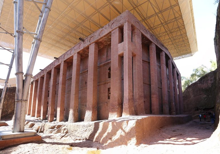
Later conservation work faced coordination problems. An initiative involving Biete Gabriel-Rufael and then Biete Golgotha-Mikael was affected by disputes over its scope and inadequate information-sharing among the heritage authority, a local committee, and the church. In 2008, four shelters were installed above five churches as temporary protection. They remained in place much longer than intended, and their weight and other factors now threaten the shelters with collapse, putting the buildings beneath them at risk.
Remains
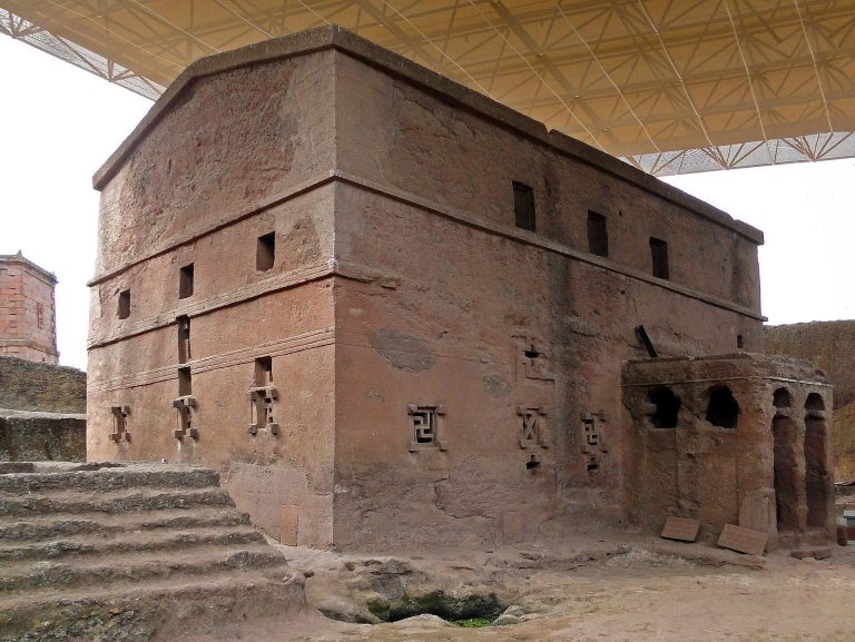
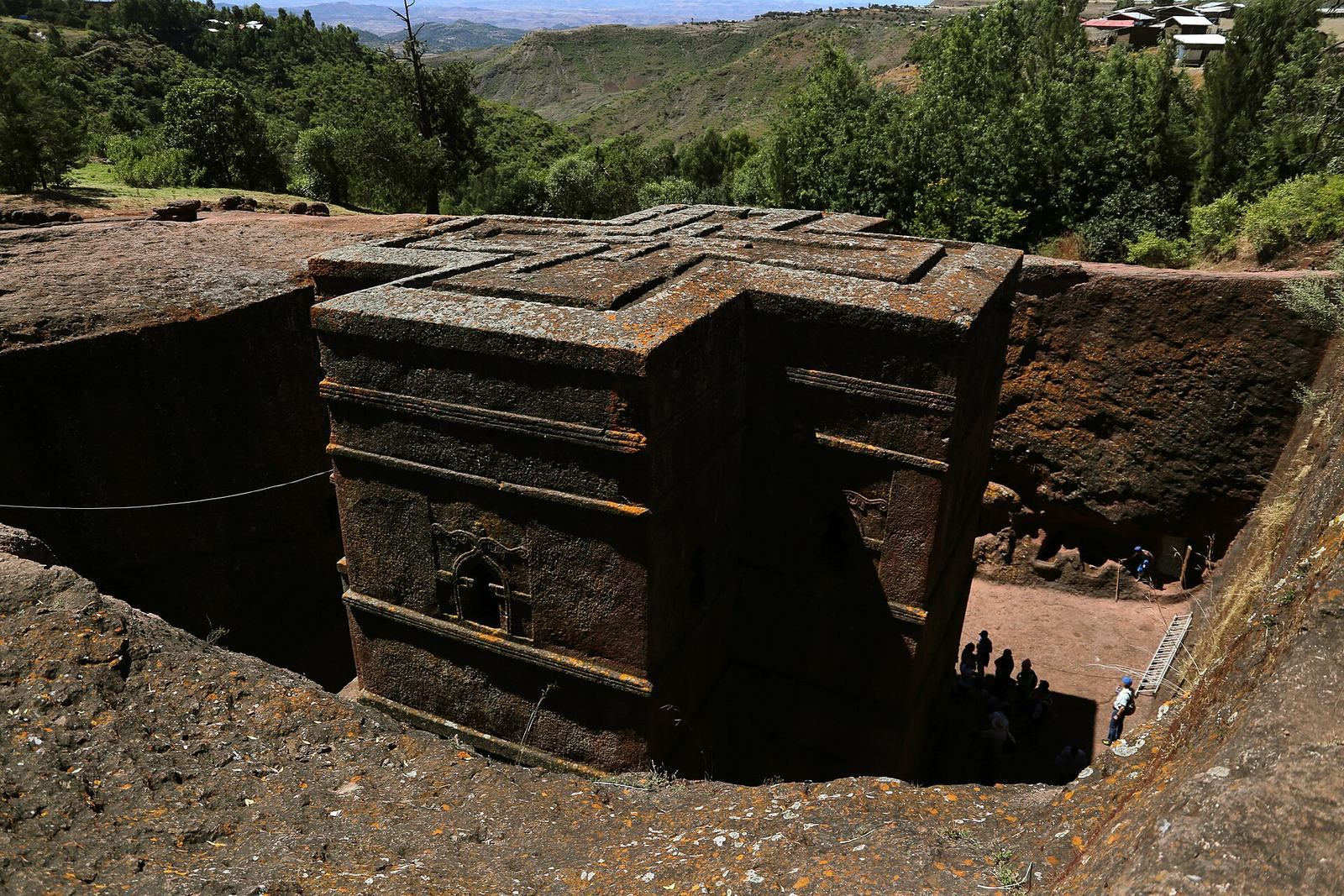
The churches occupy three hills of volcanic rock near Lalibela, at about 2,480 metres above sea level. The site consists of two principal clusters and the separately placed Biete Giyorgis. The buildings were carved from the rock rather than assembled from blocks: four stand free as monoliths, while seven retain a wall connected to the surrounding mountain. Some have exposed façades; others are cut into cliffs so that only parts such as an entrance or façade are visible. Each church lies within a rock-cut pit approximately 7 to 12 metres deep.
Layout and rock carving
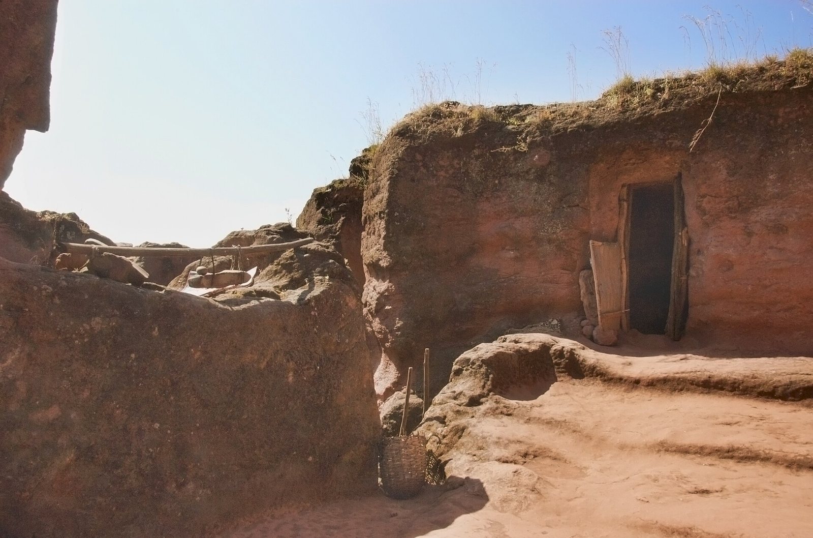
Two different ways of dividing the churches reflect the site’s complex arrangement. One counts six churches in the northwest cluster and four in the southeast. Another uses the Jordan River as a dividing line, placing five churches to its north and five to its south, with Giyorgis as an independent eleventh church. Biete Lehem is included among the southern churches in the river-based count, but is also interpreted as a defensive tower, helping explain the difference in totals. The two main clusters are connected by passages, tunnels, and trenches, and each has routes cut through the rock.
The carving was carried out with basic tools such as hammers, chisels, and picks. Workers cut trenches around the buildings and passages between groups, shaping the churches from the top down as they descended into the rock. Pillars and windows were finished with simple tools. The work is also thought to have proceeded in three phases. Shaped decorative profiles and horizontal bands divide the larger forms of many churches into smaller sections.
Excavation removed about 3,400 cubic metres of rock from the courtyard and 450 cubic metres from inside Biete Giyorgis. At Biete Medhane Alem, the corresponding amounts were about 15,000 cubic metres from the courtyard and 10,000 cubic metres from within the church. The present ground level reflects erosion and repeated cutting back. Water wore away the bases of some pillars, prompting workers to lower the ground to reach sound rock; further erosion and a collapse led to additional lowering. The upper parts of the churches were carved first and are older than their lower sections.
Northwestern cluster
The northwest cluster comprises Biete Debre Sina, Biete Mikael, Biete Golgotha-Mikael, Biete Maryam, Biete Meskel, and Biete Medhane Alem. The churches follow a west-to-east sequence along a ridge that slopes from north to south. One main rock-cut entrance comes from the Jordan side and faces toward Biete Maryam; another enters from the west, near Biete Debre Sina, Biete Mikael, and Biete Golgotha-Mikael. The Tomb of Adam lies near the end of the western route.
Biete Medhane Alem
Biete Medhane Alem is the tallest and largest church in the complex. It has five broad naves and no paintings. Its design reproduces the Church of Saint Mary of Zion at Aksum, which Ahmad Gragn’s forces destroyed in 1535. Ahmad Gragn was a sixteenth-century Muslim military leader associated with campaigns in Ethiopia.
Biete Maryam and neighboring chapels
Biete Maryam contains colourful paintings of geometric patterns and biblical scenes. A rectangular basin cut into the living rock lies northeast of the church. It has a raised rim and steps leading down into it, and may have served for baptism by immersion. Biete Meskel and Biete Denagel also have varied decoration and features associated with Ethiopian Christianity. Biete Denagel, a chapel dedicated to the Virgins, is excavated underground or into a cliff.
Biete Golgotha-Mikael
Biete Golgotha contains human figures carved in bas-relief and is associated with Lalibela’s burial. Its religious name connects the church to Golgotha, the place associated in Christian tradition with Jesus’s crucifixion.
Tomb of Adam
The monolithic Tomb of Adam stands in front of the Golgotha church. Its façade is about 2.5 metres wide and 9 metres high. A small room beneath the tomb measures about 3 by 2 metres, and graves can be reached to the north and south of the building. On the upper level, a small inner chamber contains a representation of a cross about 1.5 metres high. The tomb’s form and position relate to Christian imagery connecting Golgotha with Adam’s skull.
Southeastern cluster
The southeast group comprises Biete Gabriel-Rufael, Biete Merqorewos, Biete Abba Libanos, and Biete Amanuel. A network of tunnels and gorges, extending for nearly 400 metres, links this area with Biete Giyorgis. Other passages connect buildings within the cluster.
Biete Amanuel and Biete Merqorewos
Biete Amanuel has exterior ornament drawing on Aksumite themes. A 35-metre tunnel connects it to Biete Merqorewos, also known as Biete Qeddus Mercoreus.
Biete Abba Libanos
Biete Abba Libanos is rectangular and cut into the rock on all four sides, but remains attached to the rock above.
Biete Lehem
Biete Lehem is included in the river-based division of the churches but is also interpreted as a badly deteriorated defensive keep. On this interpretation, a ditch isolated the structure, a removable bridge crossed the ditch, and an underground passage connected it to Biete Merqorewos. Towers and ditches elsewhere around the churches also form part of the site’s defensive remains.
Biete Giyorgis and the sacred landscape
Biete Giyorgis stands apart, southwest of the northwest cluster and west of the southeast group. Its plan has four arms of equal length, forming a Greek cross. A free-standing stone cross in the torrent between the two main clusters marks, symbolically, the place where John the Baptist baptized Christ. A monolithic cross also marks the start of a sacred route for pilgrims. The seasonal gorge dividing Lalibela has been interpreted as the Jordan River.
Shared church features
The central room of each church is the maqdas, the innermost sanctuary. It houses the tabot, a sacred object representing the Ark of the Covenant and the Tablets of the Law. Only a priest may enter the sanctuary; its doorway is generally adorned with religious images and rich draperies.
Other structures include a chapel associated with the Apostles and a feature called Biet Lalibela, whose location within the complex is uncertain.