Seibal: A Maya Regional Capital in Guatemala
Site at a Glance
- Popularity
- High
- Country
- Guatemala
- Primary era
- Medieval
- Eras represented
- Iron Age, Classical, Medieval
- Civilizations
- Maya
- Site type
- City
On this page28 sections
History
Seibal is a Maya archaeological site above the Pasión River in Guatemala. Maya communities occupied it from around 900 BC, during the Middle Preclassic, an archaeological period in Maya history, through the Terminal Classic, with a substantial interruption. Its river position supported access to regional trade, and the city rose to prominence as a ceremonial center and, later, a regional capital.
Early settlement and decline
The name Seibal derives from a Spanish word for a place where ceiba trees grow. El Ceibal was also the name of a lumber camp near the ruins. The spelling Seibal became widely used after Teoberto Maler adopted it in a publication in 1908.
Settlement began around 900 BC in the Real/Xe phase, initially concentrated in Group A. Seibal’s first major period of growth came in the Late Preclassic, when activity spread to Group D and the population reached an estimated peak around 200 BC. Construction and occupation varied among the groups: activity increased during the Escoba phase, while ceremonial building took place in Groups A and D during the Cantutse phase.
A decline began late in the Late Preclassic and continued into the Early Classic. By about AD 300, Seibal was nearly deserted. Activity continued at Structure C-79 and in parts of Groups A and D before a more extensive break in occupation.
Renewal and conflict
Occupation resumed around AD 650, with new inhabitants linked to Tikal who sought to establish a kingdom. Building restarted in Groups A and D, especially in Group D, which became an important ceremonial center. During the Tepejilote phase, about AD 650–770, activity focused on Group D; from about AD 770 to 830, construction shifted toward Group A.
Seibal entered the written record in an inscription at Dos Pilas dated October 13, 721. The inscription belongs to a struggle between Tikal and Calakmul, rival Maya powers whose allies and subordinate kingdoms were drawn into the conflict. Tikal had founded Dos Pilas to control the Pasión River, but Calakmul took control of the developing kingdom.
In AD 735, Ucha’an K’in B’alam, king of Dos Pilas, attacked Seibal and captured its ruler, Yich’aak B’alam. Rather than execute him, Ucha’an K’in B’alam kept him as a subordinate ruler. The victor commemorated the conquest at Dos Pilas, Aguateca, and Seibal, and ordered earlier royal inscriptions at Seibal erased. K’awiil Chan K’inich, who succeeded him at Dos Pilas, later presided over ceremonies there in 745 and 747.
Yich’aak B’alam remained in power under Dos Pilas’ authority, but was sacrificed in a ritual ballgame twelve years after his capture. An inscription also records a shrine dedicated to his ancestor, the earlier Seibal ruler Kan Mo B’alam, and the accession of Ch’ok Ahaw as king under K’awiil Chan K’inich’s oversight. After the Dos Pilas kingdom broke apart late in the eighth century, Seibal regained independence. Ajaw B’ot acceded in 771, restoring the city’s position as an independent kingdom’s capital. A pause in the erection of new monuments followed after AD 800.
Refoundation and final florescence
Seibal’s revival began with its refoundation in AD 830. Wat’ul Chatel, also known as Aj B’olon Haab’tal, arrived from Ucanal and became ruler under Chan Ek’ Hopet. Texts connect the revival with an alliance involving Ucanal and Caracol, which may have aimed to reopen the Pasión–Usumacinta trade route. The river setting offered access to trade and natural defenses, while arrivals from other centers may also have contributed to the city’s rapid growth.
During the Bayal phase, about AD 830–930, Seibal became a prominent regional capital. Its population is estimated to have reached 8,000–10,000 around AD 830–890, a second peak after the Late Preclassic. In AD 849, Wat’ul Chatel dedicated a building and monuments in the presence of rulers from Tikal and Calakmul. Seventeen carved stone monuments were erected between 849 and 889, even as many other southern Maya lowland centers declined during the Maya Classic collapse, a period of political and population decline at many such centers, not the disappearance of Maya peoples.
Art and pottery from Seibal’s final flourishing reflect connections with northern Yucatán and Mexico’s Gulf Coast. The changing imagery has been interpreted as Maya rulers adapting to political change by drawing on symbols from both the Maya lowlands and central Mexico. These shifts have also been linked to river trade controlled by Chontal Maya, Gulf Coast warrior-merchants.
Wat’ul Chatel’s last monument was erected in 889. Seibal was largely abandoned by about 900 as regional disruption weakened trade and outside support, and it was completely deserted by about 930. The later monuments show a decline in carving quality over roughly forty years, possibly reflecting the loss of specialist skills. Estimates suggest that the population had reached about 1,600 in the core and 8,000 in the surrounding area at its Late Preclassic peak, then recovered to about 85 percent of that peak in the Late to Terminal Classic before falling sharply.
Rediscovery and archaeological study
Loggers working for the Hamett Mahogany Company probably encountered the ruins around 1890. In 1892, Federico Artes reported them after a Guatemalan government mission sought material for the 1893 World’s Columbian Exposition in Chicago. Casts made from the stone monuments were displayed there under the name Saxtanquiqui, drawing archaeological attention to the site.
Teoberto Maler surveyed Seibal in 1895 for Harvard University’s Peabody Museum, mapping Group A and recording monuments. He returned in 1905 to revise his map, and his published photographs helped establish the spelling Seibal. Sylvanus Morley and Herbert Spinden surveyed the site in 1914–15 and named Groups A through D. Later visits and excavations identified further mounds and monuments and helped establish the site’s chronology.
The Peabody Museum carried out intensive mapping and excavation from 1964 to 1968 under Gordon R. Willey, with A. Ledyard Smith as field director. A Ceibal-Petexbatun archaeological project resumed in 2005, with field research continuing through 2017. Seibal is recognized as Cultural Heritage of Guatemala.
Remains
Seibal occupies limestone terrain amid tropical forest, on bluffs about 100 metres above the Pasión River. Its core covers slightly more than one square kilometre and is arranged around hilltop groups linked by raised, masonry-faced causeways, with parapets along some stretches. Causeway I approaches from the west, Causeway II from the south, and Causeway III from the east. The central groups and outlying settlements form a broad archaeological landscape rather than a single compact precinct.
Groups and settlement layout
Groups A, C, and D make up the principal hilltop areas. Group B lies about three kilometres from the core, while house mounds beyond the central area are spaced roughly 50–100 metres apart and extend for several kilometres to the north, south, and west. The northern satellite site of El Anonal has large clay-built structures from the Middle Preclassic.
Group A architecture
The plateau and plazas
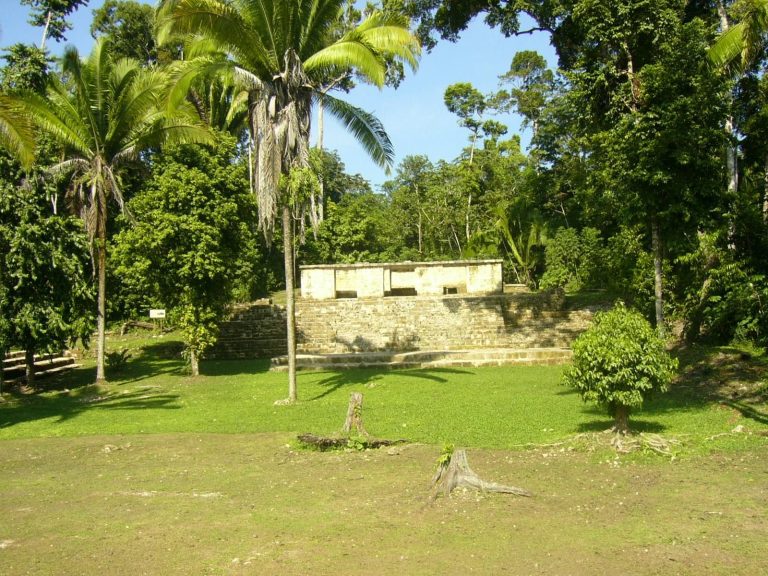
At the western end of Causeway I, Group A stands on an artificial, roughly rectangular plateau identified through excavation and LiDAR imaging. It measures about 600 metres from north to south and 340 metres from east to west, and rises 6–15 metres above the surrounding ground. More than fifty mounds are arranged around its North, Central, and South plazas. Group A contains most of Seibal’s sculpted monuments.
Structure A-3
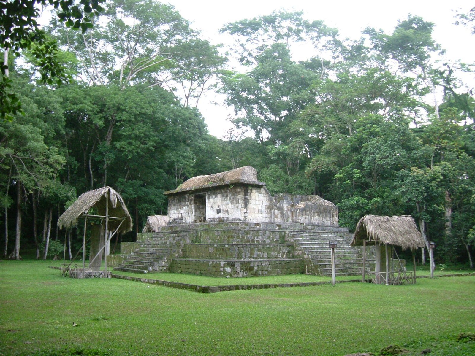
Structure A-3 stands in the middle of the South Plaza. Its three-tier platform, just under four metres high, supports a shrine about five metres tall. Stairs rise on all four sides, making it a radial pyramid, a pyramid with stairways on several sides. Each stairway leads to one of the shrine’s four entrances. Three jade stones were placed beneath the central stela. Inside are three north–south chambers linked by doors along an east–west axis; one preserves Seibal’s surviving Maya corbel vault, a ceiling formed by inward-projecting masonry courses. Stelae and altars stood before the stairways, and the platform was restored during the 1960s excavations.
A brightly painted plaster band once ran along the temple’s cornice before collapsing in antiquity. Recovered fragments have helped reconstruct it. Sculptures of Wat’ul Chatel crowned the four entrances, with twelve smaller figures around the cornice. Other panels showed cross-hatching, plants, animals, and seated deities, including Itzamna and Pawatun.
Structures A-10 and A-24
Structure A-10 is a 28-metre-high temple-pyramid, identified as Seibal’s tallest building. Structure A-24, in the South Plaza, is the site’s largest building, measuring about 70 by 60 metres and rising 18.5 metres above the plaza. Excavation exposed a small section of its platform to a depth of 7.5 metres. The lower layers, between 1.7 and 7.5 metres deep, date to the early Middle Preclassic and include a platform-like structure over five metres high that had been rebuilt five times, evidence of substantial early public construction.
Structure A-13 and Burial 4
Structure A-13 is a radial pyramid. Excavators found Burial 4 there, a mass burial containing the remains of eleven people, including two women and a child. It dates to about AD 930 and differs from a traditional Classic Maya burial.
Structure A-14 and the East Patio
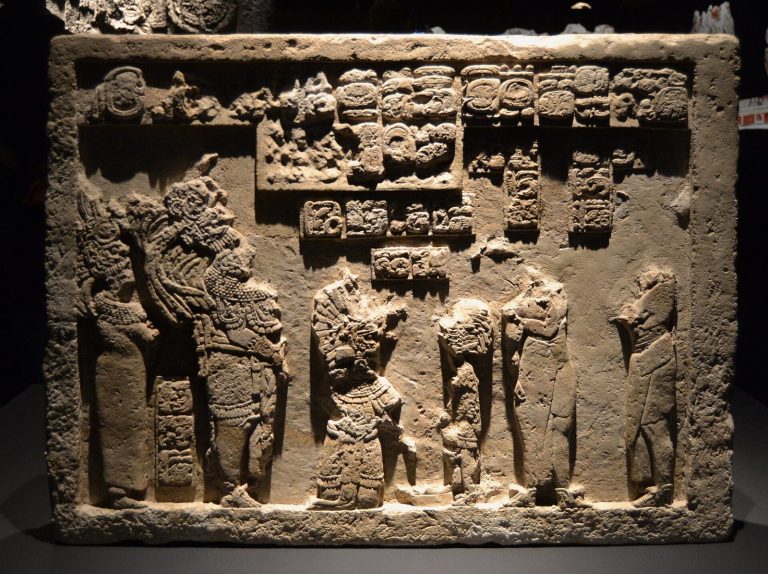
Structure A-14 is a north–south range building in the northern part of the Central Plaza, now covered by forest. Its elite female burial is known as Burial 1. The glyphic stairway that once stood at the building’s front recorded Seibal’s subordination to Dos Pilas; its carved stones and inscriptions are now in the area of the former archaeological project camp.
Behind A-14, the East Patio forms part of an elevated building complex. It sits on a platform nearly seven metres above the surrounding ground and is entered by stairs on its south side. Structures A-15 and A-16 stand within the patio.
Structure A-15
A-15 is a low, elongated building on the north side of the East Patio, where it closes the patio’s northern edge. It runs east–west, measures 24 by 8 metres, and stands 1.5 metres high. A wide entrance on the south opened toward the patio. Inside, a long room contained a stone bench assembled from reused blocks. The final building covers two earlier structures, the oldest set at a different angle. All three phases appear to belong to the Terminal Classic, and the latest may have been built near the city’s fall.
Structure A-16
A-16 is a rectangular building on the patio’s northeast side. It runs north–south, faces west, measures 16 by 10 metres, and survives to a height of 2.7 metres. Fallen limestone blocks indicate a vaulted chamber; the building may have contained six rooms and originally had a stone roof. An L-shaped interior bench and finely cut limestone walls coated with orange and turquoise plaster survive. Fragments of a painted band with modelled human figures retain traces of orange, green, and yellow pigment. The building is thought to have formed part of a Terminal Classic royal palace.
Groups C and D
Structure C-79
At the end of Causeway II, circular Structure C-79 is a three-tier platform built in the Terminal Classic over an earlier structure. It measures about 17.5 metres across and 3.7 metres high. A broad stairway rises on the west, with a smaller stair on the east. The platform supported a rectangular upper platform rather than a circular temple. In front stands a circular jaguar altar, supported by two crouching figures; a modern central support was added during restoration. A roughly carved jaguar head decorates the altar’s edge. The platform and altar date to about AD 870.
The earlier temple and nearby burials
Below C-79 is a Late Preclassic temple with a rectangular plan measuring 9.5 by 5.9 metres. Its platform rises 2.5 metres and has a stairway on the west. Nearby Structure C-24 yielded Burials 22 and 30.
Group D and its ceremonial court
Group D occupies defensible bluffs above the river at the eastern end of Causeway III. Its roughly oval hill measures about 200 metres east–west and 400 metres north–south, with steep valleys to the north and south. More than seventy structures are arranged around five plazas. One stela stood before a stepped pyramid about 20 metres high. Excavations at Structure D-30 and Courtyard A revealed part of a building thought to have been used for ceremonies; the courtyard was enclosed by pyramid temples.
Ballcourts
Seibal has two east–west ballcourts, built spaces for ritualized ball games. Structure A-19 lies on the west side of the North Plaza, while C-9 stands west of Causeway II and measures about 70 by 31 metres. This orientation was unusual in the Maya area and reflects the constraints of the site’s topography. A-19 has been compared stylistically with the court at Uxmal, and both courts have been compared with examples at Chichen Itza.
Stone monuments and ceremonial deposits
Carved monuments
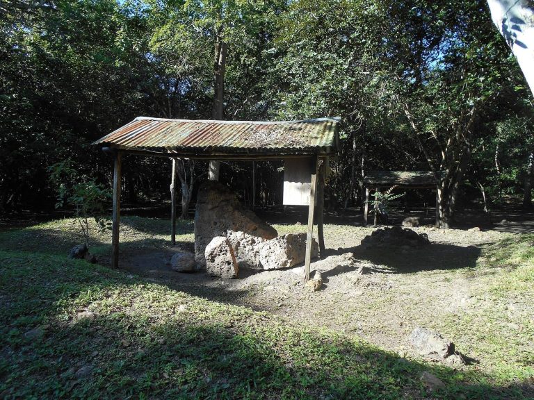
Seibal’s upright stone monuments, or stelae, are carved limestone slabs that often show rulers and hieroglyphic writing. Excavations in the 1960s identified 57 stelae, 22 sculpted and 35 plain. Their arrangement across the plazas and around buildings preserves evidence of the city’s changing political and ceremonial life.
Stelae near Structure A-3
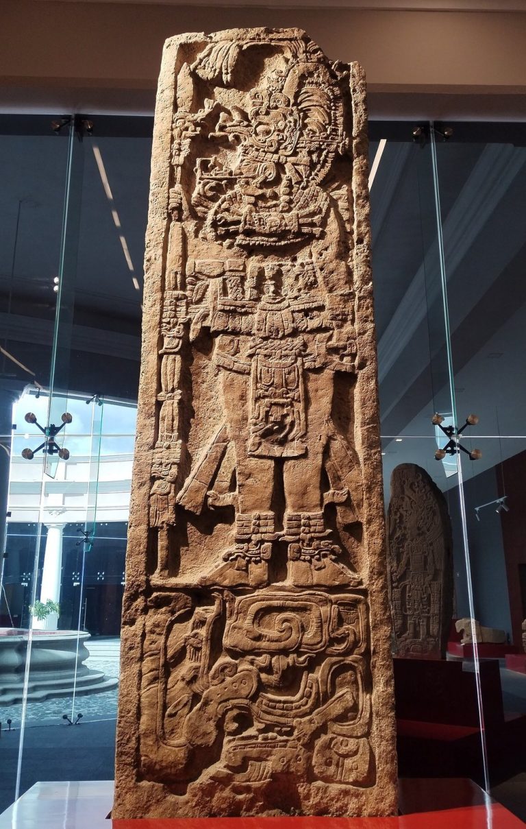
Stela 1, north of the South Plaza, names Knife-Wing, a figure also known at Chichen Itza, and dates to AD 869. Stela 2, probably from about AD 870, shows a masked figure facing forward, the only frontal portrait on a Seibal monument; it was broken into six or seven pieces and restored. Stela 3, originally beside it, uses a non-Maya calendar date. One sign, cipactli, is a crocodile head used for the first day of the 260-day calendar in central Mexico. The monument was moved to a museum in Guatemala City. Stela 5 preserves a broken middle section showing a ballplayer, while Stela 7 depicts a ruler dressed as a ballplayer.
Monuments of Wat’ul Chatel
Stela 8 shows Wat’ul Chatel with jaguar claws and other attributes of the Bearded Jaguar God, holding the head of K’awiil. Stela 9 depicts him with attributes of the Maize God as he invokes the Vision Serpent. On Stela 10, he wears Terminal Classic Maya dress and a headdress associated with Seibal’s patron deities, the heron god and K’awiil; the inscription names visitors from Tikal, Calakmul, and Motul de San José. Stela 11 portrays him above a bound captive, while Stela 21, found inside the chamber atop A-3, shows him holding a manikin sceptre and wearing attributes of the Bearded Jaguar God. The latter monument was damaged by the chamber’s collapse and erosion, and has been restored.
Other late monuments
Stela 14, placed where two causeways meet, is in good condition and has sculptural similarities to works at Chichen Itza. Stela 19 shows a lord wearing a mask of Ehecatl, a central Mexican wind deity. Stela 18 lies west of the group formed by Stelae 5, 6, and 7, and Stela 20 stands west of the South Plaza. Stela 4 was damaged by a falling tree and, after being lost for sixty years, was rediscovered and buried beneath a thin layer of soil.
Cache 7
A cruciform cache, or deliberately placed ceremonial deposit, in Group A’s Central Plaza dates to about 900 BC. It contained six jade axes arranged in a cross, five Real-phase ceramic vessels, a bloodletting implement, and charcoal. The jade objects resemble offerings from the Olmec center of La Venta and may have been made there.
Ceramics and material evidence
Pottery
Seibal’s ceramic sequence includes Real/Xe pottery, followed by wares associated with the Escoba, Cantutse, Junco, Tepejilote, and Bayal phases. Real/Xe pottery differs in clay paste from material at nearby Altar de Sacrificios, while later Preclassic pottery resembles wares from the Petén lowlands and Belize. Junco pottery includes glossy red, black, and multicoloured vessels, as well as bowls with projecting bands around their bases. Tepejilote vessels carry animal or human imagery and Maya glyphs. Later Bayal pottery includes fine-orange vessels with raised figures resembling those carved on contemporary monuments; clay analysis links this pottery to the Usumacinta drainage.