Benin Moat: The Central Defensive Earthwork of Benin City
Site at a Glance
- Popularity
- Very High
- Country
- Nigeria
- Primary era
- Medieval
- Eras represented
- Medieval, Modern
- Civilizations
- Benin Kingdom, British
- Site type
- Military
- Remains
- Wall
On this page13 sections
History
The Benin Moat is the central defensive earthwork of Benin City, Nigeria, developed over centuries by the Kingdom of Benin and its predecessors. Its principal inner section was built around the mid-15th century. Known also as Iyanuwo or the Inner City Iya, it formed part of a wider network of earthworks constructed in successive phases.
Early earthworks and royal traditions
The network’s earliest works may date to around AD 800, and some were already in place before the Ogiso, an earlier Benin dynasty, and the later monarchy whose rulers held the title Oba. The origins of the moat cannot be attributed to one ruler. Oba Oguola, who reigned around 1280, is associated with enlarging and deepening some sections. Traditions credit him with outer works at Benin City, while assigning inner defenses to Ewuare or Esigie and the spread of moat building to other communities to Ozolua. These attributions do not match a single construction period: archaeological evidence points instead to gradual development.
Construction and city defense
A major phase of work on the inner city defenses took place around the mid-15th century and is associated with Ewuare, who also renewed or deepened existing earthworks. The wider system served different purposes. Earthworks around towns and villages could define boundaries, while the central moat defended the city. Internal divisions also had social and economic functions and reflected beliefs about the nature and order of the universe.
Entry to the fortified city was controlled through nine gates, where travelers paid a toll. These defenses helped give Benin City a reputation for security, and visitors, including traders, were subject to scrutiny.
Written descriptions and later change
Portuguese navigator Duarte Pacheco Pereira provided an early written account of Benin City in 1508, emphasizing a broad, deep moat. Archaeologist Graham Connah suggested that Pereira may not have regarded an earthen bank as a wall. Around 1600, Dutch captain Dierick Ruiters described the defenses, and in 1668 Dutch writer Olfert Dapper published an account compiled from other travelers and missionaries. Connah proposed that the timberwork in Dapper’s description may have belonged to gateways rather than extending along the entire bank.
In 1820, British naval officer John King wrote that much of the city’s walling had been destroyed. He linked the reduced inhabited area to depopulation after an earlier civil war. During the British Punitive Expedition of 1897, Reginald Bacon described a defended entrance with a stockade, a causeway across a ravine about 20 feet deep, and a cannon. He placed the city about a mile beyond the major ditch and bank.
Archaeology and heritage
Astley John Hilary Goodwin worked at Benin City and Ife between 1953 and 1957. A 1964 survey found the ramparts and ditches still largely intact. Graham Connah and Patrick Darling investigated the wider earthworks during the 1960s and 1970s; in 1984, Darling examined about 1,300 kilometres of them.
The Benin Moat became a Nigerian national monument in 1961. A 1974 Guinness World Records recognition referred to the combined Benin and Isha earthworks, not just the city moat. In 1995, Benin Iya and Sungbo’s Eredo were placed on UNESCO’s Tentative List for World Heritage. As urban growth brought more communities within former enclosures, competing claims over land and ancestral rights sometimes led to disputes.
Remains
The defenses consist chiefly of linear ditches paired with raised banks of excavated earth. A raised bank beside a ditch is called a rampart. A small portion of the wider works is described as a constructed wall. The inner city earthworks have taller banks and deeper ditches than many surrounding sections.
Earthwork structure
The inner city moat
The inner city works extend for about 12 kilometres and enclose 329 hectares. Their ramparts rise to 9 metres, while the height from the ditch bottom to the top of the bank reaches about 20 metres in places. The ditch may originally have exceeded 35 feet in width. The defenses comprised a primary moat around the urban core and sacred palace area, followed by a secondary moat enclosing land to the south.
The wider network
Beyond the central defenses, a generally lower-profile system connected outer city works with earthworks across rural Edo State. Estimates of about 16,000 kilometres in total length and 6,500 square kilometres in area apply to this broader network, including its boundary traces, rather than to the Benin City moat alone.
City plan and recorded forms
The historic core
The historic core covered more than 7 square kilometres and contained the Oba’s residence, noble residences, and homes of the city’s inhabitants. Its plan centered on two perpendicular streets: a sacred passage running east from the royal palace, and a cross street linking King’s Square with Oba Market. Enslaved people and ivory were traded at the market. Smaller roads and communities extended from these main routes.
Descriptions of the defenses
In 1778, French captain J. F. Landolphe described a ditch more than 20 feet wide and deep, with the excavated earth forming a bank on the city side. He also reported a dense thorn hedge, gates spaced far apart, and houses screened by the bank at a distance. In 1787, French naval officer M. Legroing described deep ditches across a plain and traces of an old earthen wall.
Survival and present condition
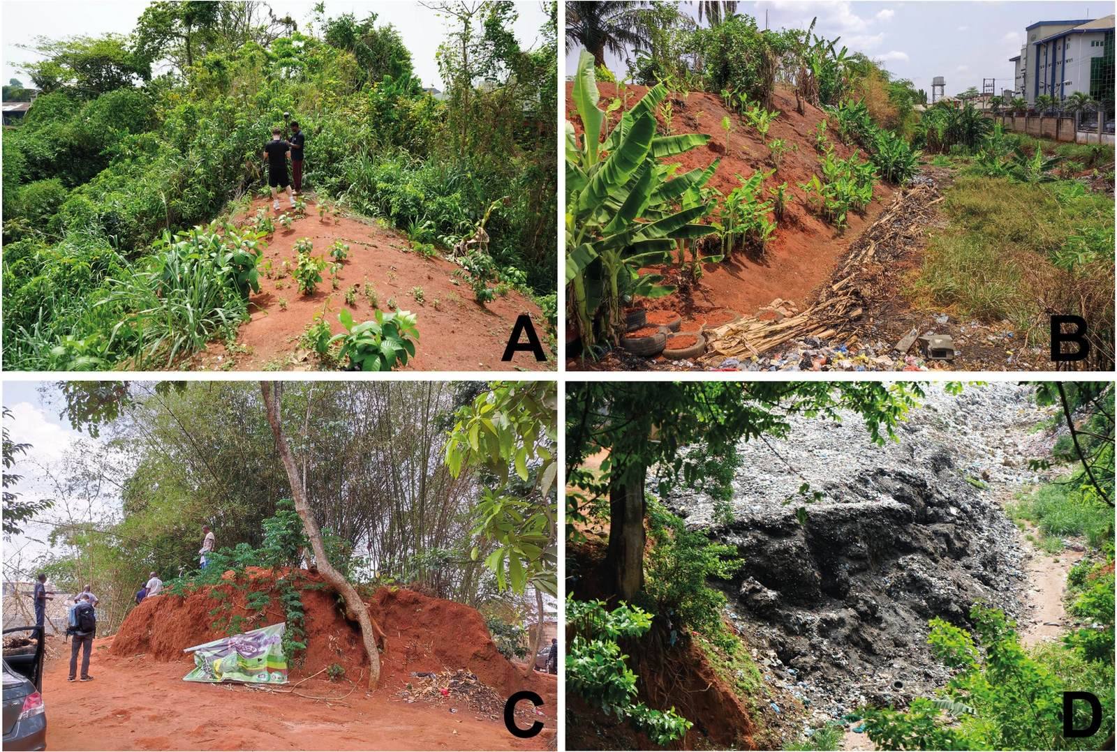
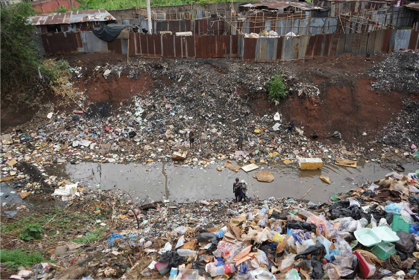
Excavations in the 1960s recorded 12.4 kilometres of city earthworks. About 6 kilometres remain, with less than 3 kilometres in good condition. Some surviving sections form tree-lined embankments within the modern city. Urban development has removed more than half the original ramparts. Earth has been taken for road repairs and brickmaking, while other sections have been flattened or covered by buildings and streets. Drainage-related erosion and silting, ditch filling, and refuse dumping have also damaged the works. The area near Ogba Road is polluted and used for dumping. Rural earthworks across Edo State have likewise experienced damage and neglect.