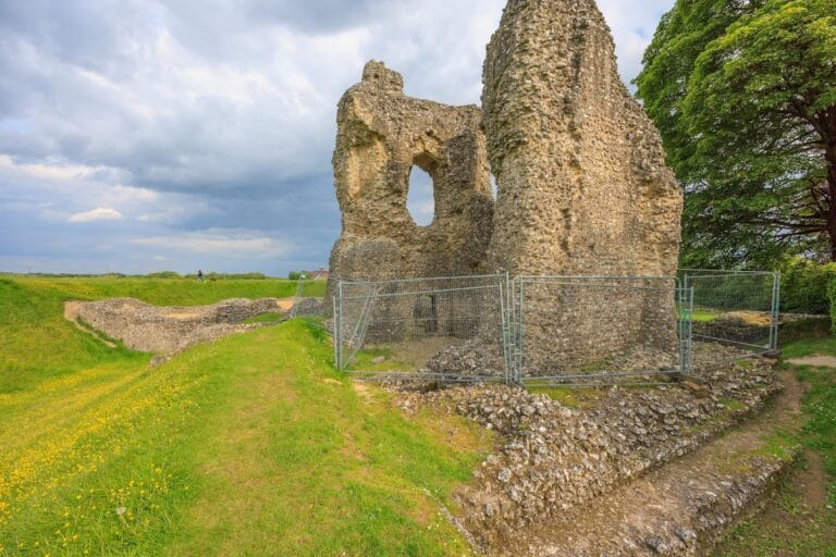
Avebury: A Neolithic Henge and Stone Circle in the United Kingdom
Site at a Glance
- Popularity
- Very High
- Country
- United Kingdom
- Primary era
- Stone Age
- Eras represented
- Stone Age
- Civilizations
- Unclassified
- Site type
- Religious
- Remains
- Sanctuary
On this page22 sections
History
Avebury is a prehistoric monument in the village of Avebury, in the United Kingdom. Neolithic communities built it in stages during the third millennium BC, creating an earthwork enclosure, stone circles and avenues. Its original purpose remains uncertain, although ritual or ceremonial use has been proposed.
Earlier activity and Neolithic construction
People used the surrounding area before the monument was built. Late Mesolithic flint tools, associated with hunter-gatherer societies, date from about 7000 to 4000 BC. Neolithic activity followed during the early fourth and third millennia BC, as farming spread and woodland gave way to more open land. The extent and precise nature of this early activity remain difficult to establish.
Avebury was not completed as a single project, and the dates of its component structures are still debated. Archaeologist Aubrey Burl proposed dates of about 3000 BC for the central stone cove, a small group of standing stones; about 2900 BC for the inner circle; about 2600 BC for the henge and outer circle; and about 2400 BC for the avenues. Radiocarbon dating places the henge around the middle of the third millennium BC, while some outer-circle stone settings have been dated to between about 2870 and 2200 BC.
Archaeologists have suggested that Avebury served ritual or ceremonial purposes, perhaps bringing people together for gatherings or seasonal festivals. The presence of human remains has also prompted interpretations involving funerary activity or the veneration of ancestors. Other proposals connect the monument with astronomical observations, gendered meanings assigned to different stone shapes, or the idea of a symbolic centre of the world. These are interpretations rather than established explanations of its purpose.
Some interpretations place Avebury within a wider period of religious activity. Mike Parker Pearson suggested that adding stones may have coincided with major construction at Silbury Hill, Stonehenge and Durrington Walls, perhaps reflecting a religious revival. Aaron Watson proposed that raising the henge banks by moving earth may have represented a boundary between the worlds above and below ground.
From late prehistory to early medieval settlement
By the Iron Age, a later prehistoric period before Roman rule in Britain, Avebury seems to have ceased serving its earlier purpose and was largely overlooked. Roman-period pottery from the ditch nevertheless indicates visits during Roman Britain, when Rome ruled parts of Britain from AD 43 into the early fifth century. Some visitors may have travelled from nearby settlements along a newly constructed road.
Settlement developed around the monument in the early Middle Ages. A timber hut with a sunken floor stood just beyond the western bank in the sixth century, and a church was built west of the monument in the tenth century. Avebury’s earliest known written mention is in a charter of 939 issued by King Athelstan, an Anglo-Saxon ruler. The charter describes boundaries of the neighbouring parish of Overton. The village may have been destroyed during tenth-century conflicts between Vikings, Scandinavian raiders and settlers, and Anglo-Saxon groups.
Medieval stone removal
In the later Middle Ages, local Christians associated the pre-Christian monument with the Devil. From the early fourteenth century, villagers toppled standing stones and put them in prepared pits. Religious beliefs may have contributed, as did practical demand for stone. The Black Death, a major plague pandemic, reached the village in 1349 and killed nearly half its population. Survivors’ need to focus on farming probably left less time and labour for further stone-breaking.
Antiquarian study and destruction
Interest in Avebury grew among antiquarians, people who studied historical remains, during the sixteenth and seventeenth centuries. John Leland noted the monument around 1541. John Aubrey visited in 1649 and began a systematic survey in 1663, after Charles II asked him to describe the site. The king later directed Aubrey to look for burials beneath stones, but Aubrey did not carry out that search. His plan preserved a record of stones that were later destroyed.
William Stukeley surveyed Avebury repeatedly from 1719 to 1724, while stones were still being broken up. He interpreted the monument as a temple of the Druids, religious specialists of ancient Celtic societies, and assigned it a date of 1859 BC. His explanations of the inner circles changed over time and included a landscape representation of the Trinity. In his 1743 account, he altered some measurements to fit his interpretations. A different Roman-period explanation had appeared in 1723, but later archaeological work established Avebury’s Neolithic date.
Stone destruction increased from the late seventeenth through the eighteenth centuries. Puritan hostility to objects regarded as pagan may have played a part, while stone was also used as local building material. Workers heated the hard stones, cooled them with water, and then broke them with sledgehammers.
Preservation and archaeological research
As the village grew in the nineteenth century, houses were built within the henge. In the 1870s, politician and archaeologist Sir John Lubbock, later Baron Avebury, bought much of the land then available to discourage further building inside the monument. He encouraged construction outside it. Alexander Keiller also bought land at Avebury between 1924 and 1939 to help preserve the site. He sold some property to the National Trust in 1943, and the Trust later acquired additional farmland.
An excavation trench across the southeastern bank in 1894 provided the first evidence that the earthworks had been built in two phases. From 1908 to 1922, archaeologist Harold St George Gray led surveys and excavations. An early estimate placed Avebury around 1700 BC, but later dating moved the henge’s construction back to the third millennium BC. Keiller financed and led excavation and reconstruction work from 1934 to 1939, with Stuart Piggott as co-director. The Second World War, Keiller’s declining health and finances, and Piggott’s other work prevented them from completing a full report. Isobel Smith published one in 1965, reorganising the stone numbers and setting Avebury in context with Windmill Hill and West Kennet Avenue.
Later investigations included excavations in 1960, 1969 and 1976, as well as work in 1982 to obtain material for radiocarbon dating and environmental study. Avebury is a scheduled monument, meaning it has statutory protection in England, and forms part of the Stonehenge, Avebury and Associated Sites UNESCO World Heritage Site, inscribed in 1986. The National Trust owns and manages the site.
Living religious traditions
Avebury remains sacred to some adherents of contemporary Pagan religions, including Druidry, Wicca and Heathenry. They may regard it as a living temple connected with ancestors and spirits of place. Public rites continue, particularly at seasonal celebrations, and may include ceremonial gatherings, invocations and performances of poetry, song and stories.
Remains
Earthwork and outer circle
The henge
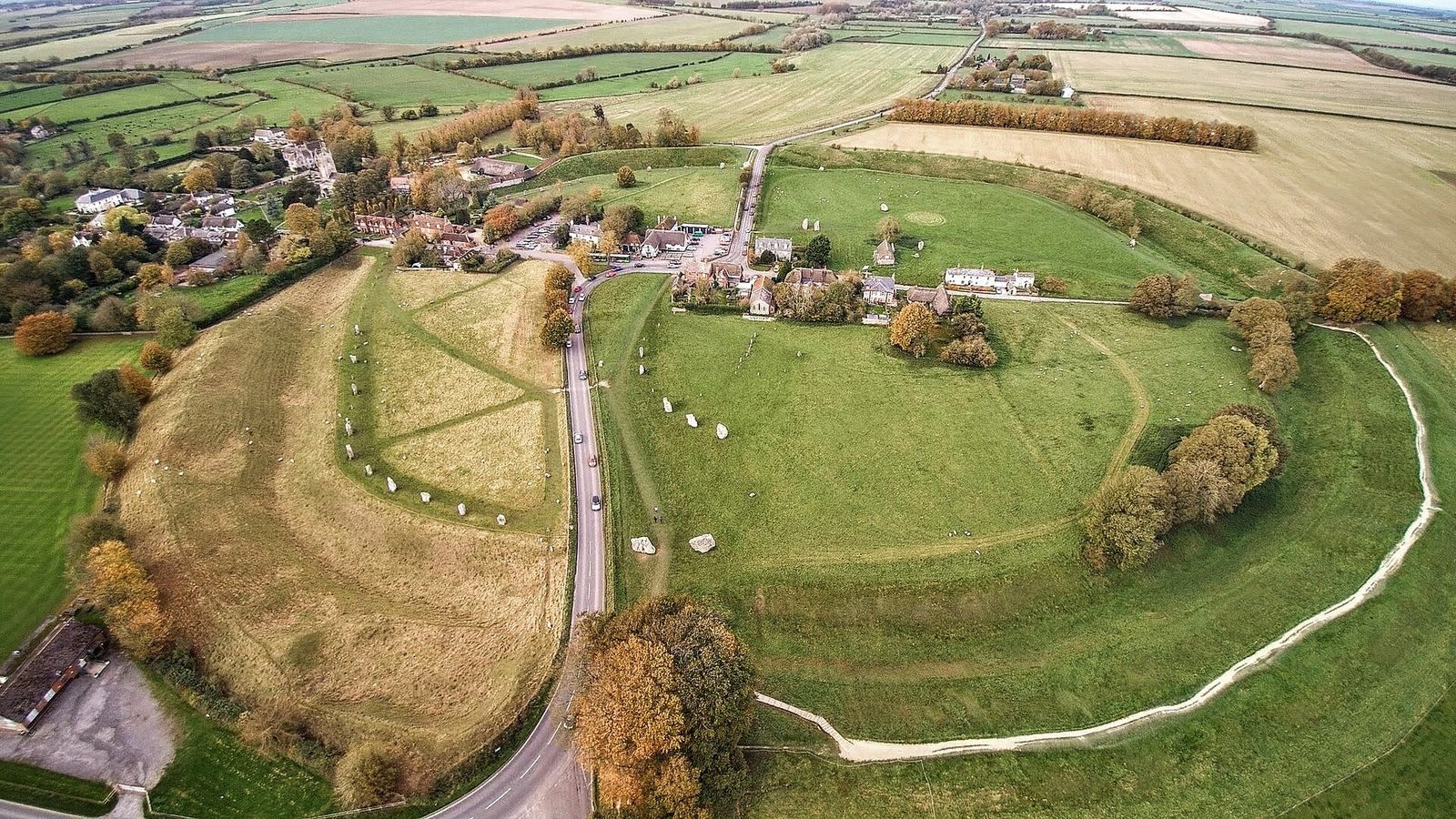
Avebury stands on a low chalk ridge about 160 metres above sea level in the Upper Kennet Valley, a chalkland area with springs and seasonal watercourses. The Marlborough Downs lie to the east. The henge is an irregular, nearly circular enclosure about 347.4 metres across and more than 1,000 metres around. A broad bank lies outside an internal ditch, and four entrances form two opposing pairs, on approximate north-northwest to south-southeast and east-northeast to west-southwest axes.
The ditch was cut into natural chalk, probably using red-deer antler picks and stone axes. Excavation indicates that it reached about 11 metres into the chalk, while the surrounding bank rose to about 9 metres. The ditch measures roughly 10 to 11 metres deep and 20 to 24 metres across at the top. Its original width is estimated at about 12 to 15 metres. Gray proposed a flat base about 4 metres wide, although later archaeologists questioned his reconstruction of the ditch’s profile. The earth removed is estimated at more than 90,000 cubic metres, weighing about 165,000 tons. The uneven crest of the bank may result from later excavation or may be an original Neolithic feature.
The outer stone circle
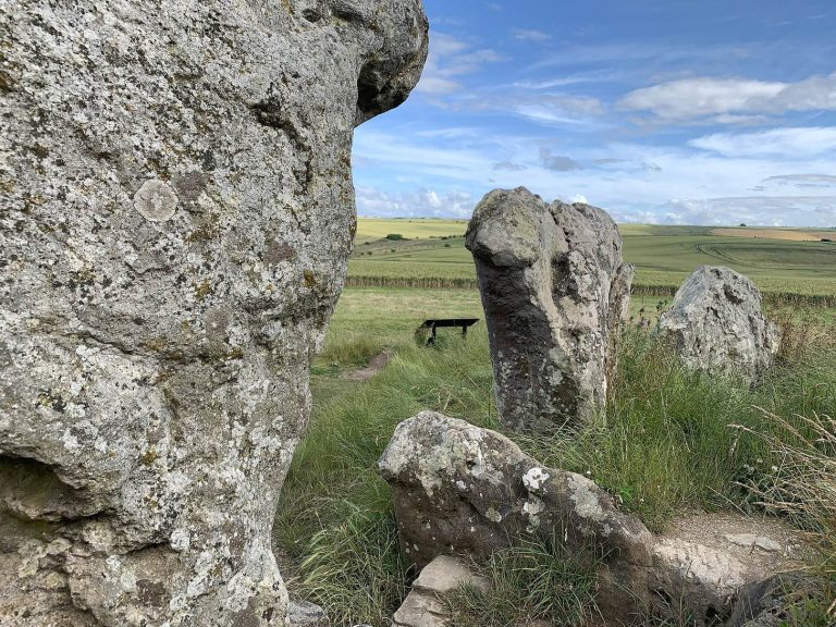
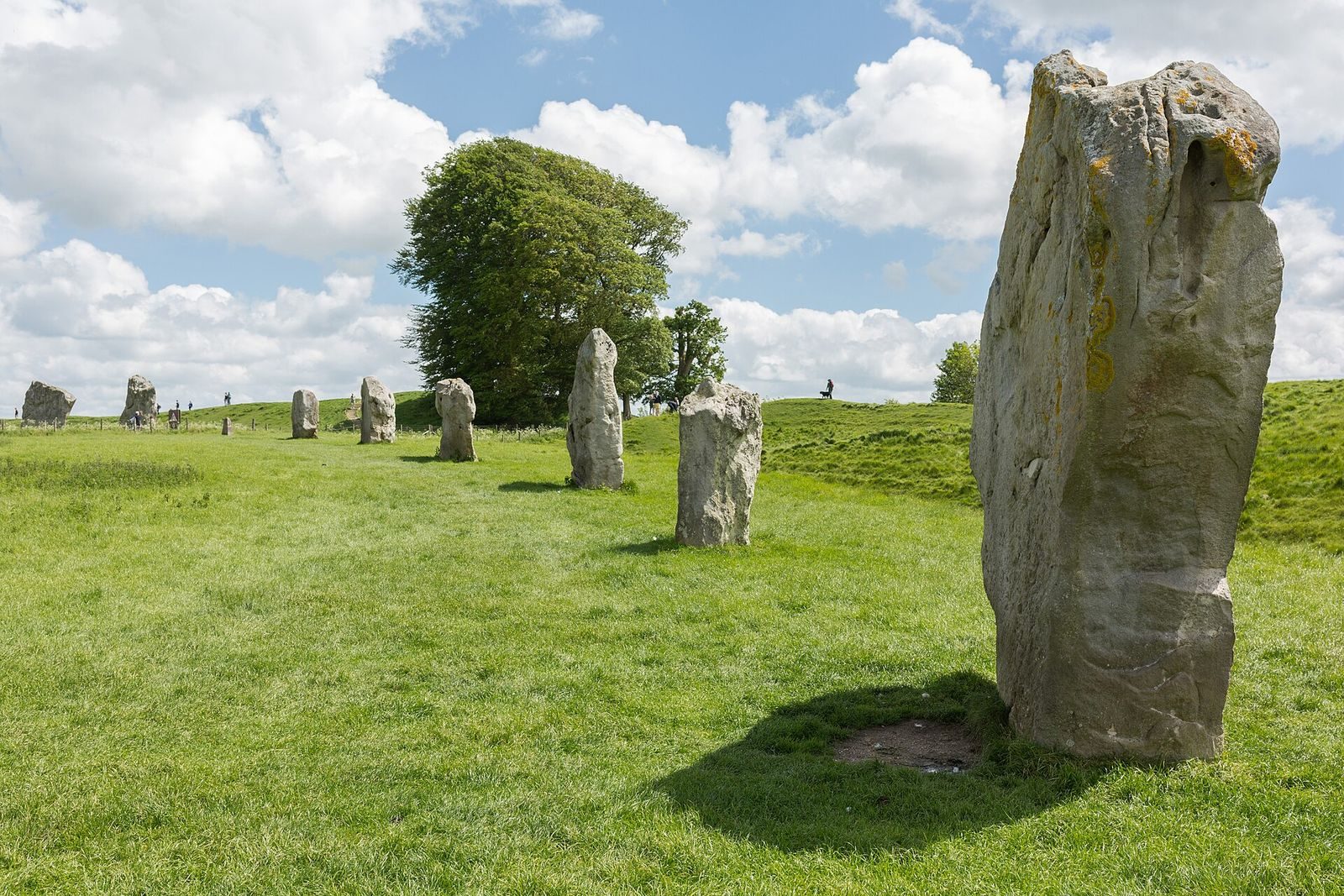
Inside the henge is a stone circle 331.6 metres across. It is described as Britain’s largest stone circle and the world’s largest megalithic stone circle, a circle built from large stones. It is thought to have contained about 98 sarsen stones, a hard silicified sandstone found in southern England. Some were more than 40 tons in weight and stood between 3.6 and 4.2 metres high. Two large stones at the southern entrance have unusually smooth surfaces, probably produced by polishing stone axes.
By 1939, nine stones of the outer circle remained upright and another ten had fallen. About 27 are visible in the circle today. Keiller raised some fallen or buried stones, and concrete markers indicate positions where stones no longer stand above ground. Additional stones may remain buried.
Inner circles
Northern circle and central cove
The northern inner circle measures 98 metres across. Of its four standing stones, two remain upright. At its centre was a three-stone cove with an opening facing northeast. Experiments at the Ring of Brodgar led researchers to suggest that sounds made within Avebury’s inner circles would echo from the stones.
Southern circle
The southern inner circle measured 108 metres across before it was destroyed in the eighteenth century. Part of its arc lies beneath village buildings. A standing stone 5.5 metres high once occupied its centre, beside an alignment of smaller stones.
Avenues and wider landscape
Prehistoric landscape
Avebury forms part of a prehistoric landscape extending across about 23 square kilometres. Nearby monuments include West Kennet Long Barrow, an elongated burial mound; Windmill Hill, a Neolithic enclosure; Silbury Hill, an artificial prehistoric mound; and the Sanctuary, a separate Neolithic monument.
Stone avenues
West Kennet Avenue consists of paired stones running from the henge’s southeastern entrance towards the Sanctuary. Traces of a second avenue, Beckhampton Avenue, extend from the western entrance. Aaron Watson interpreted the avenues and nearby monuments as shaping movement through the landscape and the views available to people moving among them.
Later names also preserve traditions associated with individual stones. The largest stone at the southern entrance was called the Devil’s Chair. Three stones once forming the Beckhampton Cove were known as the Devil’s Quoits, while stones in the northern circle acquired the name Devil’s Brand-Irons.
Excavated and buried evidence
Finds from the ditch
In 1894, excavation at a depth of about 4 feet uncovered a box-like arrangement of chalk blocks. It contained 20 large, heavily worn deer-antler picks and three worked flints. Later excavation of the ditch recovered more than 40 antler picks from or near its bottom, as well as scattered human bones, especially jawbones. At about 2 metres below ground, Gray’s team found the skeleton of a woman about 1.5 metres tall.
The medieval burial
In 1938, a man was found beneath a fallen stone with three silver coins dated to about 1320 to 1325, iron scissors and a lancet. The objects suggest that he may have been a travelling barber-surgeon, someone who combined barbering with basic surgical services. He may have been fatally struck by the stone while digging a pit to bury it. Stories of a man crushed by a stone persisted locally into the eighteenth and nineteenth centuries.
Surveyed stones and buried monument
During preparations to straighten stones in 2003, one was found to extend at least 2.1 metres below ground and was estimated to weigh more than 100 tons. A geophysical survey that year identified at least 15 buried large stones in the southeastern and northeastern parts of the circle. A 2017 survey identified an apparently square monument built from large stones within the circles. Its date and character remain uncertain, though it may be among the site’s earliest structures.
Historic buildings and collections
The Alexander Keiller Museum occupies a seventeenth-century stable. A nearby threshing barn of the same century houses an exhibition on Avebury and its history. The museum holds prehistoric and later objects from the Avebury landscape, most of them Neolithic or Early Bronze Age, alongside Anglo-Saxon and later finds.