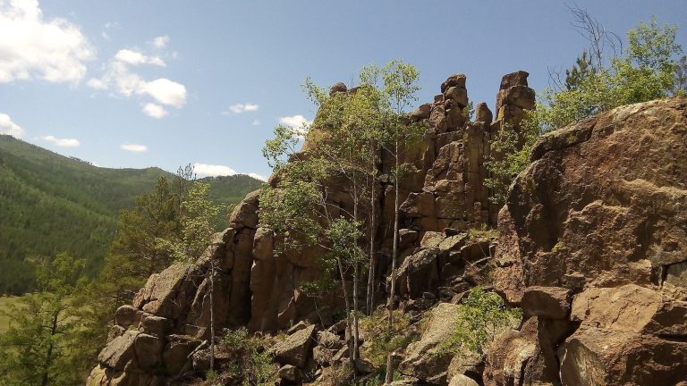
Ivolga: A Xiongnu-Era Fortified Settlement in Russia
Site at a Glance
- Popularity
- Medium
- Country
- Russia
- Primary era
- Classical
- Eras represented
- Classical, Modern
- Civilizations
- Russian, Xiongnu
- Site type
- City
On this page19 sections
History
The Ivolga archaeological site is a fortified settlement of the Xiongnu, an ancient confederation of steppe peoples, in western Transbaikalia, Russia. Broadly dated to the late second or first century BC, it remained occupied into the first half of the first century AD and probably came to an end around the middle of that century. On the northern frontier of the Xiongnu Empire, it developed into a major political, economic, and cultural center in the region.
Growth and regional role
Ivolga may first have served as a military post on the empire’s frontier. It later combined administrative functions with farming, craft production, and trade. Archaeologist N. N. Kradin interpreted it as the only known true city of the Xiongnu Empire. The settlement belonged to a broader network of Xiongnu communities in Transbaikalia, which supplied agricultural produce and crafted goods to the empire’s elites. Administrative oversight of the region may have been based at another fortified settlement in the network. Ivolga’s distance from the Xiongnu heartland may also have made the area harder for Han forces to reach. The Han dynasty was the contemporary imperial state in China, and distance from its territory may have hindered Chinese residents’ return there.
The inhabitants cultivated millet, barley, and wheat, raised livestock, and also hunted and fished. Their work included a range of crafts, while imported goods point to connections extending beyond Transbaikalia. Cowrie shells may have served as money. Preliminary anthropological findings suggest that the population included Xiongnu, local people, and people from northern China. Chinese residents may have arrived as refugees or captives, or worked as craftspeople or farmers, but their individual circumstances and the community’s composition remain uncertain. Kradin estimated that the excavated houses held about 250 to 300 people and proposed a total population of 2,500 to 3,000. Houses and burials also point to several social groups within the settlement.
Destruction and abandonment
A military attack around the middle of the first century AD probably sacked and burned the settlement. The attacker is unknown. An identification with the Dingling, an ancient people associated with regions north of the Xiongnu, has been proposed but remains uncertain. A. V. Davydova inferred from the distribution of finds that the site was not occupied again after the Xiongnu left.
Archaeological investigation and protection
Local people knew the ruins before archaeologists began formal investigations and reused stone slabs from the site. V. V. Popov and colleagues surveyed the area in 1927, collecting surface finds and making trial excavations. In 1928–1929, G. P. Sosnovsky excavated three houses and examined the defenses. He published a site plan and description in 1934 and recognized the earthen ramparts.
Systematic excavations began in 1949. Work in 1949–1950 uncovered 22 houses, a metalworking workshop, and a large above-ground building interpreted as an administrative center. From 1955, Davydova directed further investigations. Excavations in 1955–1956, 1958–1959, and 1961–1962 opened more than 6,500 square metres in the southwest and uncovered 29 houses. Her expedition returned in 1974 and excavated a further 740 square metres. Across 12 field seasons between 1949 and 1974, archaeologists excavated more than 7,000 square metres and recorded 51 houses. Davydova located the contemporary cemetery in 1956.
The settlement received state protection in 1960, and the complex was placed on the state register in 1973–1974. The site was fenced in 1974, and protection zones were established in the early 1980s. It is registered in Russia as a cultural heritage site of federal significance. Irrigation proposals prompted archaeological and restoration investigations in 1987–1989. Flooding in the early 1990s damaged supports for a power line crossing the site’s northern part, and rescue excavations followed their replacement in 1995. Later investigations included magnetic and radar surveys in 2015 and excavations in the central and northern areas from 2017 to 2022. In 2018–2019, researchers found three building remains, two affected by a trench cut for an unauthorized communications cable. Further geophysical work and excavation began in 2026.
Modern land use has also affected the site. Plowing continued until 1955 and returned to some areas in 1963 and 1966; power-line work, roads, a communications trench, spoil heaps, and nearby development have caused further disturbance or posed threats. A reconstruction project began in 2019, adding modern structures that must be distinguished from the ancient remains.
Remains
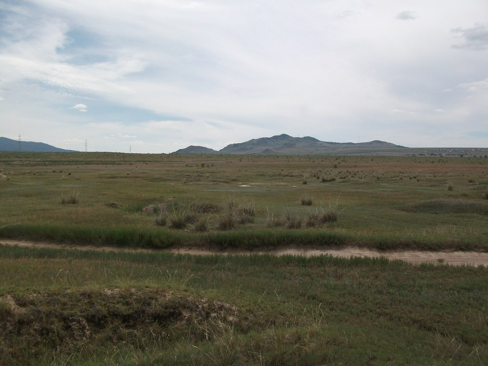
The Ivolga archaeological complex comprises the Great Settlement, the smaller settlement about 100 metres to its south, and a cemetery to the northeast. The Great Settlement occupies open steppe on the left bank of the Selenga River, near the Ivolga River. The ground rises gently to the west and north. More than 80 low surface rises, generally no higher than 15 centimetres, mark places where houses were often found below ground; upright stone slabs can also be seen in some areas.
Great Settlement
The Great Settlement forms an irregular rectangle elongated from north to south, with a planned internal arrangement. Commonly cited dimensions are about 348 metres by 194 to 216 metres. More detailed measurements give an outer area of about 7.6 hectares and an inner area of about 4.5 hectares. Archaeologist L. R. Kyzlasov proposed that the enclosure may originally have been nearly square, about 340 metres on each side, before erosion by the Selenga removed roughly a third of it. The river later shifted away, leaving a dry former channel.
Defensive enclosure
A steep slope toward the former Selenga channel protected the eastern side. The other sides were defended by four earthen banks separated by three ditches, with a timber wall or palisade, a defensive barrier of upright wooden posts. Together, the defenses were about 35 to 40 metres wide, and the bank crests stood about 7 to 8 metres apart. Builders used loam dug from the ditches, mixing it with gravel, coarse sand, and sandy loam. Stones, mostly about 20 by 30 centimetres, were pressed into the crests in a band roughly half a metre wide.
The surviving banks are low and eroded. The outer bank was measured at about 50 centimetres higher than the inner one, while the inner bank rose about 20 centimetres above its ditch bottom. The bank slopes facing outward are steeper than those facing inward. Measured depths were about 2.1 metres for the inner ditch, 1.16 metres for the middle ditch, and 1.13 metres for the outer ditch. Layers of soil and gravel occur in the ditches; tree bark was found in the outer ditch and stones in the inner one.
Three postholes in a row parallel to the southern banks provide evidence for the timber defense. Posts about 25 to 30 centimetres across were set roughly three metres apart and more than 60 centimetres into the ground; thinner logs may have filled the spaces between them. The southern defenses are best preserved, while the northern banks are almost entirely lost and the western ones survive as faint rises. The original entrances remain debated. Sosnovsky noted breaks in the southwest and northwest, while Davydova identified four openings along the southern defenses. Kyzlasov argued that a southwestern break was a later cart track and proposed two original gates near the middle of the southern side. Other breaks may also result from modern roads.
Residential and production layout
Houses and work buildings stood close together in rows parallel to the southern defenses. Ditches divided the interior into large quadrangular areas, with buildings arranged in streets and in residential and production zones. The overall plan has also been described as cross-shaped. Excavations have identified 57 houses. Most were square or nearly square, with floors sunk about 1 to 1.1 metres below ground. Ordinary houses were roughly 3 to 7 metres across, ranging from about 2.8 by 3.2 metres to 6.85 by 6.65 metres. Their orientations followed the cardinal directions. A few buildings stood above ground, including houses 9 and 46a, as well as house 28.
Houses and heating
Most houses had layered gabled roofs supported by a ridge, posts, and the surrounding ground. Reconstructions of the roof layers include beams and crosspieces, a clay coating, a framework of branches, birch bark, straw, possibly ash, and an outer covering of turf. Gable ends were built of unfired bricks around a wooden frame. Clay covered interior walls and floors. Entrances were generally in the southeastern part of the south wall and measured about 0.6 to 1.3 metres wide. Two houses had corridor-like approaches measuring 1.7 and 1.8 metres. Postholes along walls, near the centre, and beside entrances probably supported raised sleeping platforms.
Heating installations commonly stood opposite the entrance in the northeastern corner. A hearth built from stone slabs opened toward the southwest. Smoke passed through stone channels along the northern and western walls to an outlet in the southwestern corner. The channels used roughly fitted quartz-porphyry slabs, with small stones packed into gaps; in some houses, an earthen wall formed one side. A heated stone platform could serve as a sleeping bench, covered with hides and mats. The low front part of the hearth was used for cooking, with vessels held above it in supports. Small pits beside hearths and storage hollows beneath floors also occur. Possible enclosures near eastern walls may have held young livestock or birds.
Houses 14 and 28 were divided into two sections by a low built-in platform, with each section having its own hearth and smoke channel beneath a shared roof. Houses 17 and 18, 21 and 22, and 38 and 42 stood only 65 to 80 centimetres apart and may have shared walls. House 46a lacked a hearth and smoke channel and may have served as a summer annex to house 46. Infant burials in pottery vessels were found beneath the floors of houses 27 and 41. Most excavated houses preserve evidence of fire, including collapsed charred building material, burned objects, and heat-damaged pottery. Houses 26, 30, 31, and 37 show signs of dismantling during the settlement’s occupation, with reusable materials removed. Some houses also overlay earlier features: houses 26 and 27 cut into earlier pits, and house 32 partly covered house 33.
House 9 and its neighbor
House 9, interpreted as a possible ruler’s residence, was the largest excavated building. It stood on a low rise slightly south of the settlement’s centre and measured about 13 by 11.5 metres. Unlike most houses, it was entirely above ground and had thick unfired-brick walls. The south wall was 1.12 metres thick, the west wall 1.3 metres, and the east wall 1.38 metres. Its 1.35-metre-wide entrance was in the south wall, 1.7 metres from the southeastern corner. Two burned posts and a threshold with traces of a plant-fibre mat framed the entrance.
A hearth of quartz-porphyry slabs, about 2.5 by 2.28 metres, occupied the northeastern corner and opened to the west. A smoke channel about 30 centimetres wide ran along the north and west walls to an oval vertical flue in the southwestern corner, up to 35 centimetres across. Excavations also found a central pit 75 centimetres deep, ash-rich fill, charred roof timbers and boards, clay-coated boards, and L-shaped structural pieces. Finds included vessels, a quern, a stone used for grinding grain, weapons, and animal bones. Outdoor hearths with pottery and bones probably served in summer; a heavily corroded bronze bowl lay near an ash deposit southwest of the entrance. House 10 adjoined the east side of house 9, with its floor 72 centimetres lower. This smaller, otherwise typical dwelling may have housed servants. Finds there included pottery, animal bones, and an iron horse-harness fitting.
Pits, well, and workshop
Numerous pits and long trenches accompanied the houses and other buildings. Some irregular pits were created when clay and soil were extracted for construction, then filled with ash, charcoal, and refuse. Smaller, regular pits probably served as storage spaces or cellars. Larger features may have had roofed shelters. Archaeologists have also identified narrow elongated features interpreted as settings for posts supporting raised shelters, and long trench-like features whose purpose remains uncertain; they may have divided parts of the settlement or helped drain them.
A square well lined with timber stood between houses 36 and 38. It measured about 1.23 by 1.25 metres and extended more than 4.5 metres deep; spring water appeared at its bottom during excavation. Pits and trenches defined a roughly rectangular area of about 1,089 square metres containing houses, the well, and other work areas. About 22.5 metres north of house 9, a production building contained an iron-smelting furnace beneath stones.
Small Settlement
The Small Settlement occupies the same river terrace, about 100 metres south of the Great Settlement. Its surviving enclosure is trapezoidal, with a clearly visible bank about 6 to 8 metres wide. Recorded lengths are 94 metres for the southern bank, 142 metres for the western one, and 15 metres for the northern one. Kyzlasov proposed that it may originally have been a square about 145 metres on each side, with roughly half lost to river erosion. Excavation identified an inner ditch and showed that soil dug from it was used to build the bank. The enclosure may have served as a livestock pen or as a temporary fort abandoned after the main defenses were built.
Cemetery
The cemetery lies near the Ivolga River, about 440 metres northeast of the Great Settlement. Excavations covered an area of about 8,000 square metres and recorded 216 graves containing 244 people. The graves are flat burials rather than elite burial mounds. Most contained one person, while some held two or three. Burials generally faced north or east, with three oriented southwest.
Burial containers included thin-board coffins, thick-log structures, nested chambers, hollowed larch-log coffins, and stone-lined boxes; some people were buried without a constructed container. Infants were also buried in pots. Two hundred graves had been robbed, disturbing human remains and removing or displacing many grave goods. A disturbed grave found in 2007 contained leg bones, traces of decayed material that may have been a leather lining, two iron buckles, a plate fragment, and a bone bead near the feet. The position of the legs indicated that the head had been toward the north-northeast.
Finds and production
Pottery
Pottery is the largest category of finds. Nearly all vessels were made on a wheel, usually a slow-turning one, with their interiors finished by hand. Potters commonly mixed crushed pottery into the clay and sometimes added grit or sand. Dense gray wares predominate over less common porous red ones, and firing was uneven. Decoration includes polished bands and wavy lines, either incised or applied. Some vessels served for storage; vessels with holes in their bases may have been used in making alcohol. A character on one vessel base has been interpreted as meaning deservedly and may point to Chinese craftspeople, though their role in pottery production remains uncertain. Ten complete vessels were found on the floor of house 36.
Metalworking
The iron-smelting installation was a bloomery furnace, in which iron forms as a solid mass rather than melting into liquid. Its clay-lined shaft measured about 35 centimetres deep and 37.5 centimetres wide, and connected to an air channel 90 centimetres long. Fragments of a rounded clay dome with a charging opening were also found. Slag, charcoal, and porous iron blooms occurred in and around the furnace, and chemical analysis supports use of the bloomery process. Iron objects were forged, while bronze objects were cast. Slag, bronze droplets, casting debris, and defective castings show that metalworking took place at the settlement.
Imported objects and everyday tools
Finds include iron and bronze objects, bone and antler tools, ornaments, stone objects, animal bones, and fragments of wood and plant-fibre items. Tools and equipment include agricultural implements, weapons and arrowheads, horse-harness fittings, fishing gear, knives, axes, sickles, chisels, querns, whetstones, needles, and awls. Bone and antler objects include hoes, bow fittings, handles, buckles, and scrapers. Stone finds range from an open limestone bowl with side projections and small dishes to querns, whetstones, quartz-porphyry throwing balls, basalt rings of uncertain purpose, and part of a thick-walled object resembling a low table.
Seven fragments from Chinese mirrors have been found, dating from the third to the first centuries BC and ranging from pre-Han times to the early Western Han. Some show wear. The earliest described fragment came from a mirror about 12 centimetres across, decorated with small diamonds and spirals around a square containing bird forms. Other imported materials include turquoise, glass, cowrie shells, and shell imitations. Preserved plant-fibre remains include cord about 7 millimetres thick, finer thread, and mat fragments near a house entrance. Wooden remains include building timbers, part of a hollowed trough about 1.23 metres long and 36 centimetres wide, and the base of a birch-bark container. Surviving finds are held in museums in Buryatia and at the State Hermitage.
Nearby ritual places
Several sacred places lie south of the Great Settlement near a mountain, where shamans, ritual specialists in Indigenous religious traditions, and Buddhist lamas, religious teachers or clerics, have performed rites. A suburgan, a Buddhist reliquary monument generally shaped like a tower, stands on the mountain’s northern slope.
Modern reconstructions
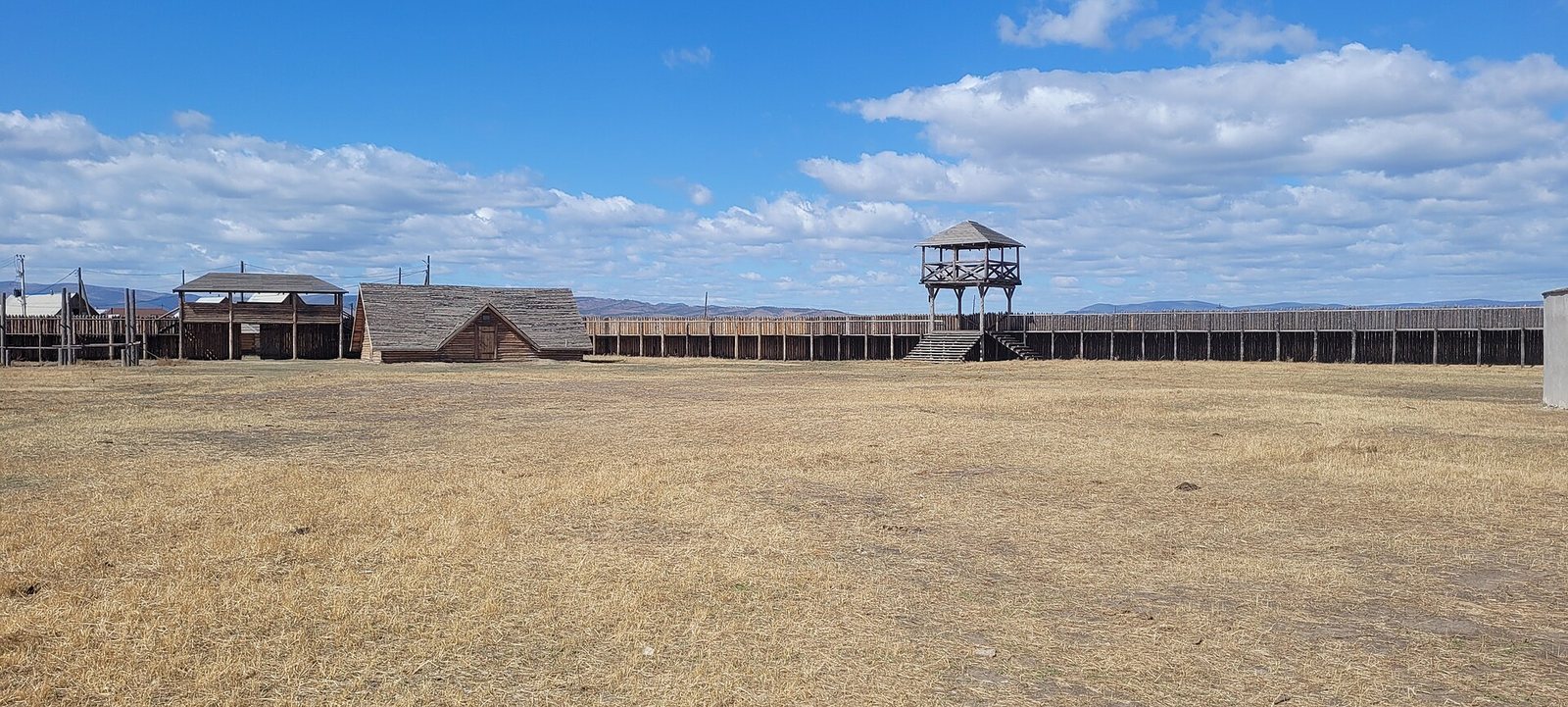
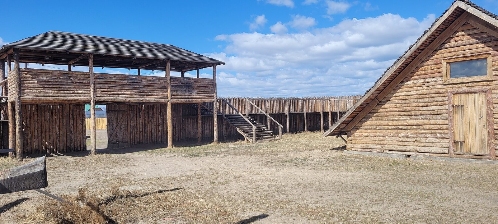
Modern buildings added from 2019 are reconstructions, not surviving ancient structures. The project began with a palisade, two watchtowers, and a gate. A horse yard and wooden yurt followed in 2020, and a wooden museum building with an earthen roof was built in 2021. A memorial stone was installed at the site in 2016.