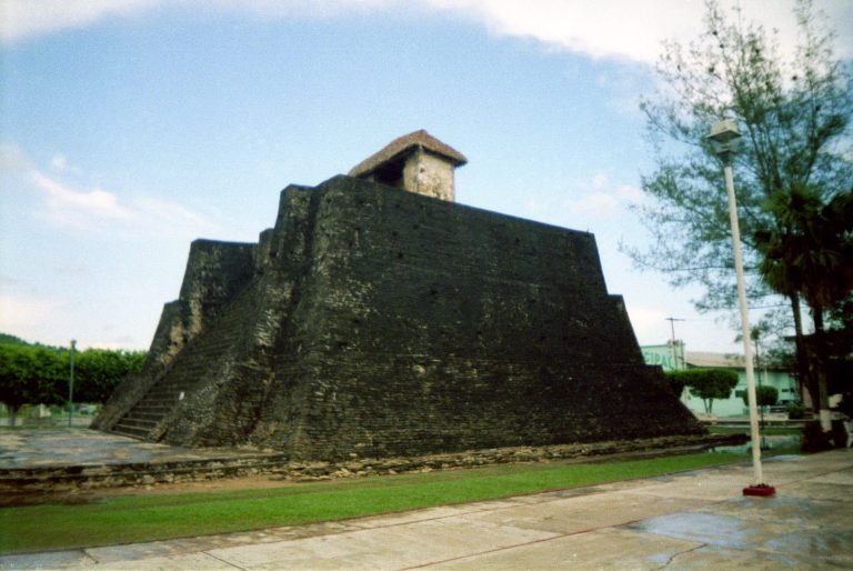
El Tajín: An Ancient City-State in Veracruz, Mexico
Site at a Glance
- Popularity
- Very High
- Country
- Mexico
- Primary era
- Medieval
- Eras represented
- Classical, Medieval
- Civilizations
- Unclassified
- Site type
- City
On this page31 sections
History
Early settlement and urban growth
El Tajín is an ancient city in Veracruz, Mexico, whose monumental construction began in the first century CE. The people who founded it are uncertain: Totonac and Xapanec origins have been proposed, while Huastec people inhabited the area when the settlement was established. The surrounding region had been occupied by at least 5600 BCE. Its mobile hunting and gathering communities gradually adopted settled agriculture, and social development accelerated as the nearby Olmec civilization emerged around 1150 BCE. Olmec populations, however, remained relatively small at the site.
El Tajín developed within the Classic Veracruz culture and became an important center of the Remojadas culture, known for its clay sculpture. It had grown into a city by 600 CE. Its position on Mesoamerican trade routes supported rapid growth: the city controlled the movement of goods that included locally exported vanilla and imports from other parts of present-day Mexico and Central America. Objects from Teotihuacan, the major ancient city and cultural center of central Mexico, were abundant during El Tajín’s early centuries.
City-state, religion, and regional influence
From about 600 to 1200 CE, El Tajín prospered as a highly centralized city-state controlling much of present-day Veracruz. More than fifty ethnic groups lived in the city, while many residents occupied the surrounding hills. Food arrived largely from the Tecolutla, Nautla, and Cazones areas. Maize and beans formed part of the supply, alongside cacao and other luxury products.
Religious practice at El Tajín was associated with the movements of the planets, stars, Sun, and Moon. The Mesoamerican ballgame, which combined sport with ritual, and pulque, an alcoholic drink made from fermented agave sap, both held important religious roles. The city had seventeen ballcourts. Its influence reached along the Gulf coast toward the Maya region and into the central Mexican highlands. At nearby Yohualichan, buildings have decorative niches resembling those at El Tajín. The city also retained cultural traits inherited from Teotihuacan and is described as having Toltec influence.
El Tajín endured the broad social collapse and abandonment of population centers at the end of the Classic period. It reached its height during the Epiclassic, a Mesoamerican period dated here to about 900–1100 CE, after Teotihuacan fell. The city’s prosperity continued into the early thirteenth century.
Fire, abandonment, and local memory
A fire destroyed El Tajín in the early thirteenth century, probably during an invasion. Chichimec attacks, associated with peoples of northern and central Mexico, may have contributed to the city’s abandonment around 1230. After its fall, Totonac people established the nearby settlement of Papantla.
The ruins became overgrown for more than five centuries. A village stood at the site when the Spanish arrived, and Totonac people continued to regard the area as sacred. The city’s place in local knowledge therefore did not necessarily disappear, although no European record of it is known before the late eighteenth century. The name El Tajín is associated with a Totonac rain deity and has also been interpreted as referring to thunder or lightning. Totonac tradition held that twelve storm deities lived among the ruins. Indigenous maps made around the time of the Spanish conquest suggest that an earlier name may have been Mictlan, meaning “place of the dead”; the name also appears in an Aztec tribute record. “Place of invisible beings or spirits” is another proposed interpretation.
Rediscovery and archaeological study
In 1785, government inspector Diego Ruiz encountered the Pyramid of the Niches while searching for clandestine tobacco cultivation that violated the royal monopoly. He drew the pyramid and publicized it in the Gaceta de Mexico. The publication drew attention in New Spain and Europe. Antiquarians José Antonio de Alzate y Ramírez and Ciriaco González Carvajal, as well as Pietro Márquez and Alexander von Humboldt, helped bring the monument to wider notice.
German architect Karl Nebel documented the Pyramid of the Niches and nearby ruins at Mapilca and Tuzapan in 1831. He was the first to propose that the pyramid formed part of a larger city. His drawings and descriptions appeared in a book published in Paris in 1836.
Archaeological work began in the early twentieth century. Road construction and improvements prompted by oil discoveries during the 1920s–1940s made more intensive investigation possible. From 1935 to 1938, Agustin Garcia Vega carried out the first formal mapping, clearing, and exploration. He cleared 77 acres, starting at the Pyramid of the Niches, uncovered other buildings, and proposed the name “Archaeological City of El Tajín.”
Beginning in 1938, the National Institute of Anthropology and History sponsored excavation and reconstruction under José García Payón. His work exposed platforms, ballcourts, and part of Tajín Chico, including its palaces. He continued investigating the site until his death in 1977. Between 1984 and 1994, Jürgen K. Brüggemann’s work uncovered 35 additional buildings. Roughly half of the archaeological site is estimated to have been excavated. El Tajín joined the UNESCO World Heritage List in 1992 in recognition of its cultural, architectural, and engineering importance. Later research, conservation, and restoration have continued to improve understanding and protect the site.
Air pollution from coastal oil-drilling platforms and power stations has contributed to acid rain, which erodes the buildings’ soft limestone reliefs. Conservation work also addresses the fragility of the murals and the challenge of protecting the ruins while allowing access. The annual Cumbre Tajín festival connects Totonac identity and guardianship of the site with traditional cultural practices and contemporary arts. The Voladores, performers who descend from a high pole in a ritual associated with fertility, are also linked with El Tajín.
Remains
Setting and construction
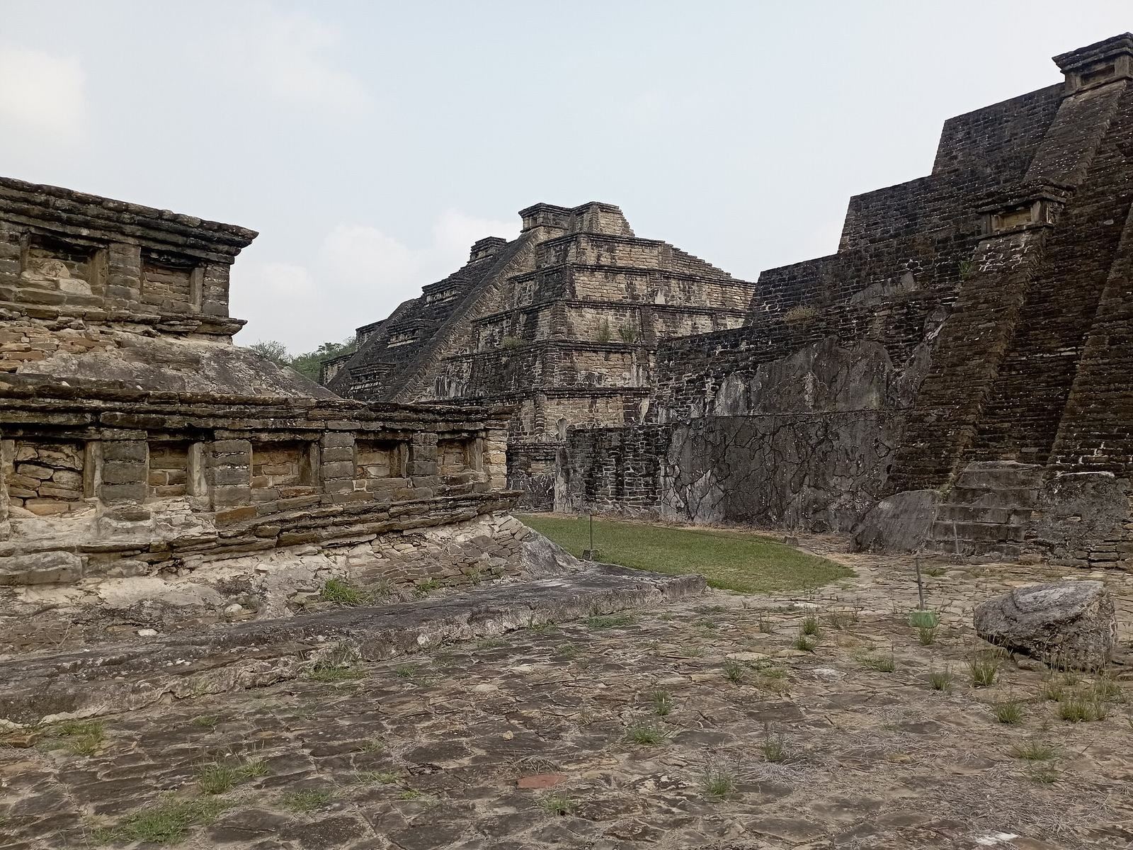
El Tajín lies among low hills near the Tecolutla River. Two streams join to form the Tlahuanapa Arroyo, a tributary that supplied drinking water. Most buildings occupy relatively flat ground in the southern part of the site near the streams’ meeting point. Terraces extend northwest and hold additional buildings, especially those associated with the elite. Communities and dwellings also spread across hills to the east and west. The site covers about 1,056 hectares, or 10.7 square kilometres. Excavation has exposed plazas, palaces, and administrative buildings across an area of roughly two square miles.
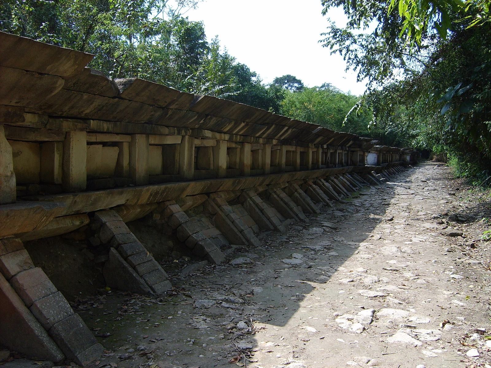
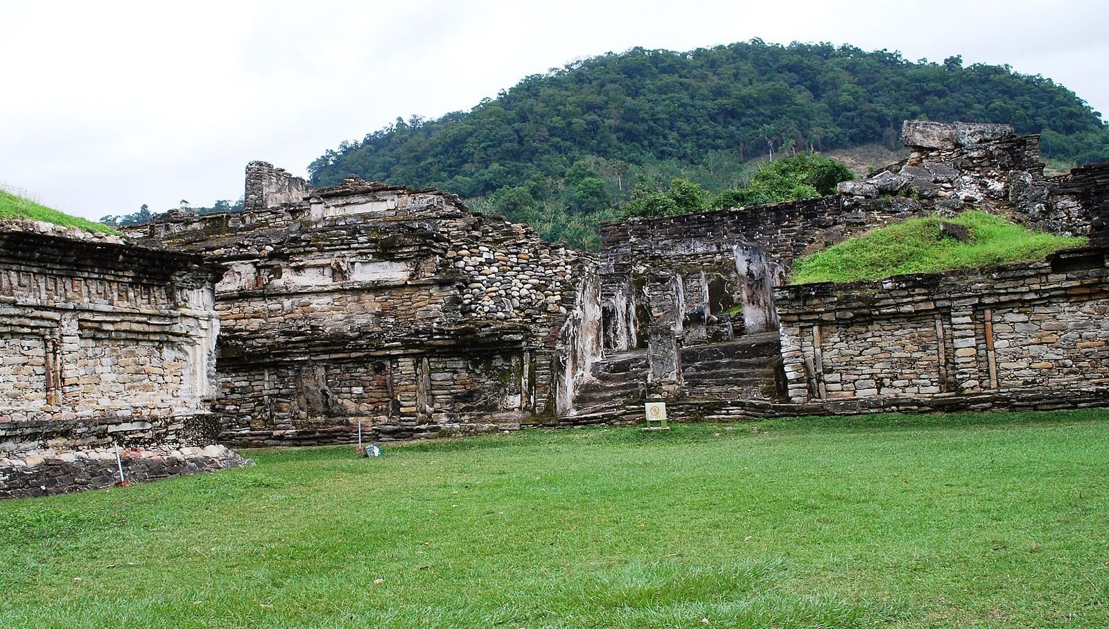
Buildings were arranged as individual units rather than in the rigid grid plans characteristic of ancient cities in central Mexico. Niches and stepped-fret designs, geometric patterns of angular steps, appear on structures across the site, including practical supports and platform walls. Stepped frets occur elsewhere in Mesoamerica but are especially abundant at El Tajín; the extensive use of niches is distinctive to the city. Some residences have windows placed to admit cooling breezes.
Builders used poured cement, mixing pumice and pottery fragments into successive layers to reduce weight and help the material bind. The hardened surfaces preserve impressions of such materials as baskets and tamale wrappers. Building C provides an example of the technique: its nearly flat roof was almost a metre thick and had to bear its own weight. Earth fill may have supported roofs while the cement was poured and dried. Cement also formed Building B’s roof and the slab between its two floors.
The Arroyo Group
Central plaza and temples
One of El Tajín’s oldest areas, the Arroyo Group covers more than 8,000 square metres. Two streams border it on three sides. Buildings 16, 18, 19, and 20 surround a central plaza, each rising to a temple reached by stairs from the open space. The four buildings are nearly symmetrical and of uniform height. Their pyramids have relatively simple forms and less finely made niches; the eastern and western pyramids each had three temples at their summit. The plaza remains an unusually open space within the group, without smaller buildings or altars breaking it up.
The plaza is identified as the city’s market. A merchant deity was found there, and the open ground could have accommodated stalls made from sticks and cloth. Goods included vanilla, jaguar skins, exotic birds, and quetzal feathers. Enslaved people were also sold there for service and sacrifice. The merchant deity’s features resemble those of deities from the central Mexican highlands.
Arroyo ballcourt
West of Building 19, a ballcourt has sloping sides and carved friezes depicting Quetzalcoatl, a major Mesoamerican deity commonly shown as a feathered serpent. Many sculptures in the Arroyo Group were smashed or defaced when the city fell, and some were reused as building material.
The Pyramid of the Niches and nearby platforms
Pyramid of the Niches
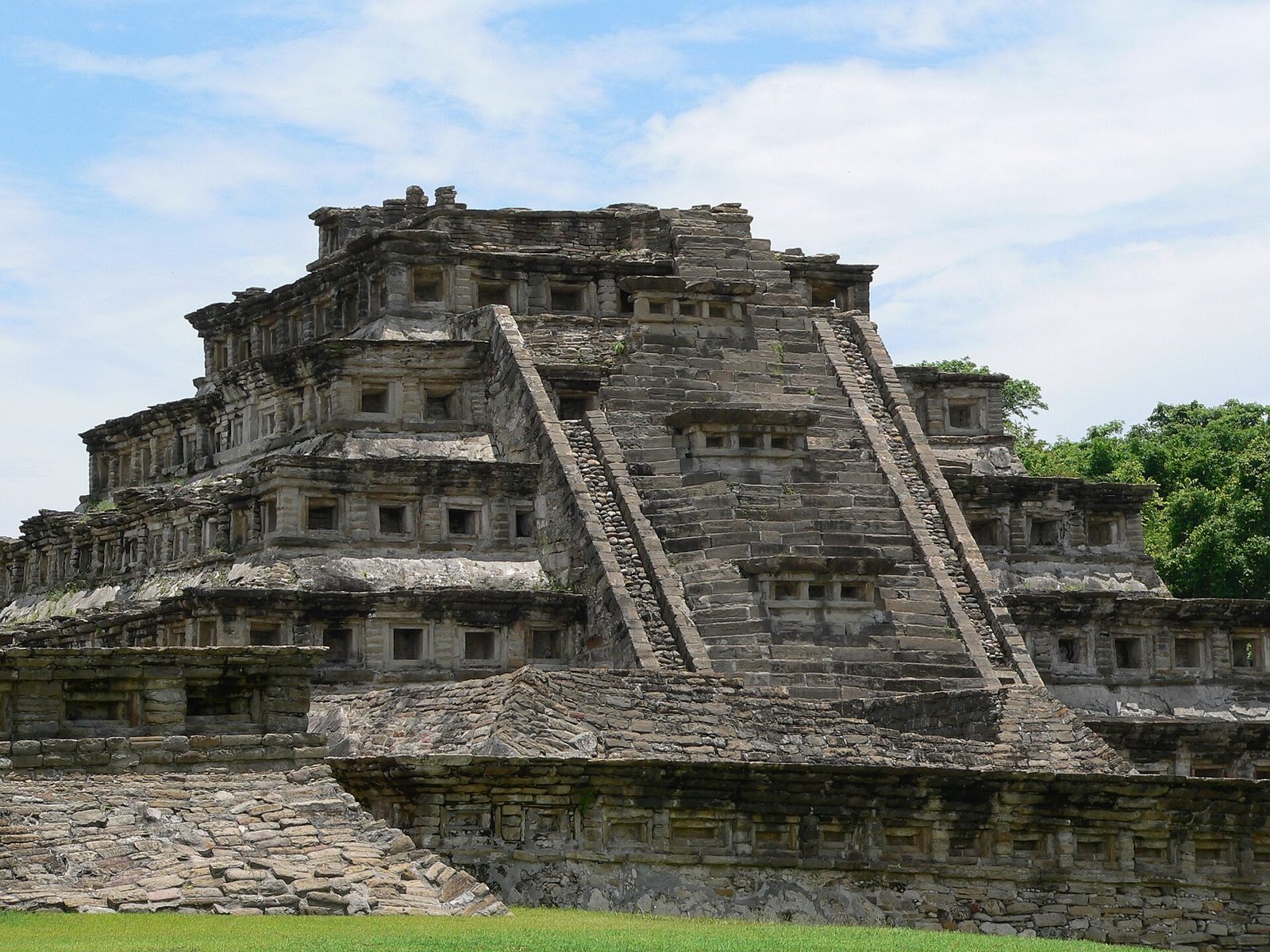
Also known as the Pyramid of Papantla and the Temple of the Niches, this structure has a square plan measuring about 35 metres on each side and rises through seven stepped levels. It was built chiefly from carefully cut flagstones, some estimated to weigh about eight metric tons. Stones around the niches were fitted with little lime and earth mortar. Stucco once covered the structure and provided a base for paint.
Each level combines a sloping wall with an upright panel. The niches are capped by projecting triangular cornices. The pyramid was originally dark red, with black-painted niches that emphasized their shadows. Its original design included 365 niches, not counting those added below the eastern staircase, which was a later addition. Tablets framed by serpent-dragons stood at the summit.
The deep niches imitate caves, understood as passages to the underworld. Despite the total of 365, the pyramid’s ritual purpose was not primarily calendrical. Popular belief held that each niche contained an idol, but archaeological work ruled out that interpretation. Remains of beeswax candles were found on the first level as late as the mid-twentieth century. Flowers and candles were traditional offerings at sacred caves and springs in Mexico.
The temple once standing atop the pyramid was destroyed. Sculpture attributed to it survives mainly in fragments; larger panels show the rain deity, or a ruler dressed as that deity, in ritual or mythological scenes. Stepped-fret patterns decorate the stairway sides and may once have been blue. Two large upright stone monuments probably stood at the top of the stairs. One is almost intact and is displayed in the site museum. Round stones with central holes found east of the pyramid may have held banners. The pyramid’s interior is filled with rock and earth held in place by its sloping outer walls, and a smaller buried structure with sloping levels but no niches lies beneath it.
Buildings 2 and 4
Buildings 2 and 4 flank the Pyramid of the Niches. Both are small, temple-like platforms. Building 4 contains a smaller, older structure that may be among the earliest buildings at El Tajín.
Building 5
Near the Pyramid of the Niches, Building 5 occupies the centre of a pyramid complex. A truncated pyramid rises from a platform covering more than 3,000 square metres. The niche-lined first level is reached by a single western staircase or a double staircase on the east. A second eastern double staircase leads to the summit, where a temple once stood; two platforms decorated with stepped frets remain there.
A tall, column-like sculpture stood between the two eastern stairways on the pyramid’s first level. It had been thrown down from the summit and broken in antiquity, then reassembled by archaeologists where it was found. The figure appears to be an allegorical seated person with a severed upper torso and a skull for a head, holding a serpent-like form. Scrolls on the body may represent sacrificial blood, and the sculpture resembles carved stone yokes from Veracruz. Smaller buildings around the pyramid were intended to complement it. A structure on the northeast side was destroyed by an old path through the area.
Tajín Chico
Tajín Chico extends north-northwest from the older city and climbs a hill in several levels. Extensive fill helped create this elevated complex of palaces and civic buildings, with relatively few temples. It was once thought to be a separate but related site; it is now understood as part of the city centre. Its former name remains in use.
Building C
Building C was not a temple, and its exact function is uncertain. It may have been used by priests or rulers receiving visitors and petitioners. Its roof covered more than 150 square metres. Two rooms stood on the west, while the main room opened east through five piers. Stepped frets cover the exterior and create the appearance of niches. Their inner surfaces were painted dark red and their outer surfaces light blue; cloud-like scroll designs decorated the broad eastern stairway.
Building B
Building B was a two-storey residential palace. A divided entrance stairway led from the plaza to a room about 9.8 by 7.3 metres. Six pillars made of stone and cement divided the room and supported the upper floor. The pillars were thickened over time to strengthen them. A narrow stairway led to the more spacious upper floor, which also had columns. A thick cement roof and a cement slab between the floors completed the structure.
Building A
Building A has two levels and stands over older structures buried when the area was filled. Some buttresses have been damaged by settling where the buried structures did not provide support. Its lower level is a solid base rather than a series of rooms, with large rectangular panels that appear to have been painted red. The elaborate entrance is on the south side. A corridor runs around the upper level, which contains rooms and surviving mural fragments. Yellow, blue, red, and black appear in the paintings and in the stepped-fret and scroll designs. Two connected rooms lie on each side of the building.
The façade combines a false stairway and stepped-fret balustrades capped by niches with a real central stairway that rises beneath an arch. Blue and yellow scrollwork once decorated the false stairs. Although the building resembles the Pyramid of the Niches, that resemblance does not establish a relationship between them.
Building of the Columns
The Building of the Columns occupies the highest part of Tajín Chico and belongs to one of El Tajín’s last building complexes. It stands on a terrace shaped along natural contours and extended with filled ground. A passageway connects it to a structure called the Annex or Building of the Tunnels. A large plaza with low structures lies behind the buildings.
Stone discs were stacked to form the columns on the building’s east façade, whose carved scenes honour the ruler 13 Rabbit. Most column remains are displayed in the site museum. A cement roof arched over the porch between the columns and the inner rooms. Inside, an inner courtyard was decorated with stepped frets and painted symbols on stone and cement.
Other pyramids and civic buildings
Building 3, or the Blue Temple
Building 3, also called the Blue Temple, is a seven-level pyramid. Its gently sloping walls are divided into panels of varying widths. Six benches on the stairway and the tops of its balustrades were probably added later; apart from these, the structure has no niches. A large breach in its unreconstructed north side was made by looters before guards protected the site. No sculpture or remains of the summit temple are known.
Cement was applied to the building several times, with each layer painted blue. Paint survives on part of the stairway and on the east side facing Building 23. A connection between the blue color and the rain deity has been proposed, but further evidence does not support it.
Building 23
Beside the Blue Temple, Building 23 dates to a late phase of El Tajín. Its five levels have nearly vertical faces and no niches. The original stairway was destroyed and rebuilt in its present form, with a central support wall holding back the fill behind the stairs. The steps consist of lime, sand, and clay without a stone core; inside, the fill is loose stone, mainly rounded river boulders. Stepped projections at the summit, where a temple stood, resemble European medieval battlements.
Building 15
South of Buildings 3 and 23, Building 15 has been only partly excavated and appears to have served a civic function. It faces west. Stairs on its eastern and western sides lead to the second level; the third begins with a wall of niches and has no visible stairs. Large niches decorate the lower levels and the top of the stairway divider, above a row of seven panels. An older panel lay beneath the fourth panel, and deeper excavation revealed an earlier damaged structure buried below the visible building. Building 15 is thought to be El Tajín’s last structure built with niches.
Ballcourts
North Ballcourt
The North Ballcourt is probably among the oldest structures at El Tajín. It is about 27 metres long, unusually short, with vertical walls built from three layers of large flagstones. Six carved panels portray ritual scenes, and an ornamental frieze runs along each wall. Parts of the panels and friezes are worn or incomplete.
The four panels at the ends depict ballgame rituals and appeals to the gods; the central panels show the gods responding or carrying out rites. Images of different forms of the pulque deity appear above the end panels, and three panels show a ruler on a throne. Another depicts a figure dressed as an eagle seated in a vessel, probably containing pulque, with a woman and a man beside it. On the deteriorated north-central panel, two cross-legged figures appear, one on a throne and one beside a vessel. Intertwined serpents between them form what appears to be a ballgame marker. The friezes feature interlocking scroll figures centred on heads and eyes; many have feathered headdresses or reptilian features, while some appear human.
South Ballcourt
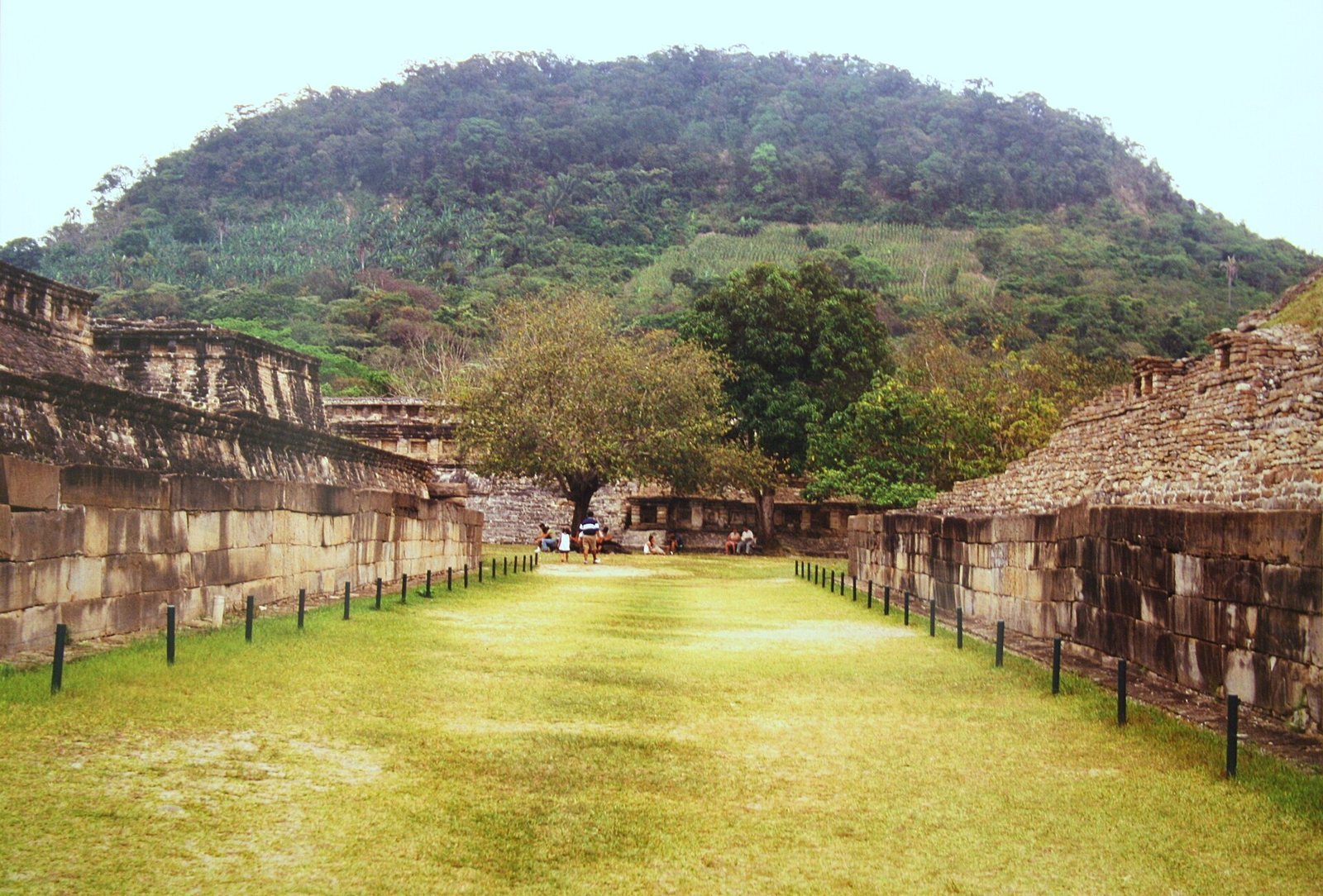
The South Ballcourt is aligned approximately east–west and measures about 60 metres long by 10.5 metres wide. Its vertical walls are made from stones weighing as much as ten tons, many brought from outside the valley. Six panels were carved at the corners and centres of the two walls. End panels show the game, while the central panels depict the gods’ responses. The sculpted panels remain largely intact and present the game, its ceremonies and sacrifices, and divine rites. Spectators could watch from Buildings 5 and 6 or from stands along one side.
The southeast panel depicts an opening ritual. An elaborately dressed participant receives a bundle of spears as a death deity rises from a vessel of liquid, perhaps pulque. Glyphs identify the deity with Venus. On the southwest panel, a participant reclines on a couch as two musicians play a turtle-shell drum and clay rattles. An eagle-dressed figure dances, a skeletal deity flies overhead, and the death deity rises from liquid.
On the northwest panel, two ballgame participants have speech scrolls, and one carries a large knife. Intertwined slashes and a ball appear between them. Both wear protective and ritual equipment resembling stone yokes, palmas, and hachas known from elite burials. Two figures watch from behind, one with a deer’s head, while the death deity appears above. The northeast panel shows the game’s conclusion and a participant about to be decapitated: one figure restrains him while another holds a knife to his neck. Speech scrolls and a skeletal deity also appear.
The north-central panel depicts the ritual continuing in the afterlife. A temple holds the rain and wind deities above a vessel of liquid. The sacrificed player, restored whole, points to the vessel while addressing the rain deity, and a reclining chacmool, a sculpted figure associated with offerings, guards the liquid. A glyph indicating the mythical origin of pulque and an image of its deity identify the drink being requested. In the south-central scene, the player has received pulque and the vessel contains less liquid; a rabbit represents the Moon. The rain deity performs self-sacrifice with a spike, and blood falls into the vessel to replenish the drink.
The eastern valley and Great Xicalcoluihqui
Great Xicalcoluihqui
The valley floor east of Tajín Chico contains numerous structures, many of them unexcavated or difficult to reach; two have been partly explored. The Great Xicalcoluihqui is an enclosure covering about 12,000 square metres, with an outline shaped like a giant stepped fret. It contains two or three small ballcourts. Its slender sides are formed by sloping platforms with freestanding niches resembling those of the Pyramid of the Niches. More than one hundred niches are interrupted by entrances.
Great Ballcourt
The Great Ballcourt stands at the northwest corner of the Great Xicalcoluihqui, at the base of Tajín Chico. About 65 metres long, it is the largest ballcourt at El Tajín. Its sides are vertical.
Museum and carved sculpture
Site museum
The site museum stands near the southern entrance. Its enclosed gallery holds smaller finds, including objects from the Pyramid of the Niches, while a roofed area displays large fragments of stone sculpture. An altar from Building 4 is a large carved stone slab showing four standing figures arranged in pairs. Intertwined serpents between the pairs represent a ballgame marker.
The roofed area contains fragments from the Building of the Columns, some partly reassembled. Their carvings show a procession associated with 13 Rabbit. A name glyph identifies the ruler, seated on a wooden throne with his feet on a severed head. A sacrificial victim appears before him, while warriors lead captives by the hair. An attendant is identified by the glyph name 4 Axe.