Strumica Fortress: A Medieval Stronghold in North Macedonia
Site at a Glance
- Popularity
- Medium
- Country
- North Macedonia
- Primary era
- Medieval
- Eras represented
- Stone Age, Bronze Age, Classical, Medieval, Early Modern
- Civilizations
- Byzantine, Kingdom of Macedon, Ottoman, Roman, Serbian
- Site type
- Military
- Remains
- Castle
On this page23 sections
History
Strumica Fortress occupies a hill overlooking its namesake city in North Macedonia. The medieval stronghold probably took shape in the late eleventh or early twelfth century, during a period of renewed Byzantine strength, and became a strategically important fortified center in medieval Macedonia. The hill’s archaeological record spans nearly seven millennia, from prehistory to modern military use.
Prehistory and ancient settlement
The earliest continuous settlement began in the first half of the fifth millennium BC, during the Chalcolithic, or Copper Age. A second phase started toward the end of the third millennium BC in the Early Bronze Age and continued into the Middle Bronze Age. Early Iron Age finds are scattered; the hill may have been a point from which migrating groups moved onward toward settlements in the Aegean.
Use of the hill resumed toward the end of the fifth century BC as an urban settlement grew below it, beneath the site of modern Strumica. Its inhabitants were probably Paeonians, an ancient people who lived in parts of the region north of Macedon. The area came under the ancient Macedonian state early in the fourth century BC. Amyntas III probably began its conquest, and Philip II and his son Alexander III, known as Alexander the Great, brought it fully under Macedonian control.
In the fifth and fourth centuries BC, the plateau probably served as a sanctuary for religious activity by people from the settlement below. Later occupation continued through the Hellenistic period, the era following Alexander’s conquests, when Greek culture spread and successor kingdoms emerged, and into Roman rule. Construction on the hill diminished under the Roman Republic and Early Empire. Roman-period buildings were later demolished, probably during the Gothic-Herulian devastation of 268/269, which affected cities across this part of the Balkans.
Late antique fortress
A substantial fortification was built in the late third or early fourth century AD. During late antiquity, the transition from the Roman imperial world to the early medieval period, it served as both a military stronghold and a refuge for people from the city below. Its stores of water and food could sustain those sheltering there for months.
The fortress probably remained in use until the 580s, when it was likely abandoned. The hill’s history from the seventh through the tenth century is uncertain. A medieval occupation layer formed in the late tenth and early eleventh centuries, and the earlier fortification was probably used again during the wars of Samuel.
Medieval stronghold
The precise date when the medieval fortress was built is unknown. It probably dates to the late eleventh or early twelfth century, during the Komnenian restoration, a period of renewed Byzantine political and military strength. The empire sought to reinforce its defenses in the region amid threats involving Crusaders and groups such as the Uzes, Pechenegs, and Cumans. The concentration of Byzantine troops nearby toward the end of the eleventh century is consistent with this proposed date.
Activity reached a peak under the regional lords Dobromir Hrs and Strez in the late twelfth and early thirteenth centuries. The region then saw repeated conflicts and changes of ruler. Conditions stabilized after the restoration of the Byzantine Empire in 1261. Hrelya briefly occupied the area in the fourteenth century, and it was under Serbian rule from 1332 until near the end of that century.
The fortress housed a military garrison alongside civilians engaged in everyday work. Ottoman forces took control of the region in the spring of 1395. The stronghold then lost strategic importance as it lay well within the empire, though it retained a defensive role during the fifteenth century. Ottoman forces repaired and strengthened regional fortresses, and the Strumica garrison added or adapted buildings. In the sixteenth century, its garrison numbered about ten.
Ottoman decline and modern use
Evliya Çelebi, a seventeenth-century Ottoman travel writer, visited Strumica in 1670 and described the fortress as abandoned and crumbling. He noted that only a few martolos, Ottoman auxiliary guards recruited in the Balkans, remained there, without a permanent army or houses.
By the late nineteenth and early twentieth centuries, local legends and traditions had gathered around the ruins. The popular name Czar’s Towers probably became established around this time. In notes made from March 16 to 18, 1913, Bulgarian scholar Bogdan Filov described the central tower and two towers beside the western entrance.
The hill was used for military purposes during the Balkan Wars, World War I, and World War II. Finds point to brief occupations, probably reflecting the hill’s strategic position. In November 1944, a German unit stationed at the fortress controlled three entrances to the city. An earthquake in the Valandovo area in March 1931 probably brought down most of the southwest tower; the remaining portion was demolished near the end of World War II, leaving its base.
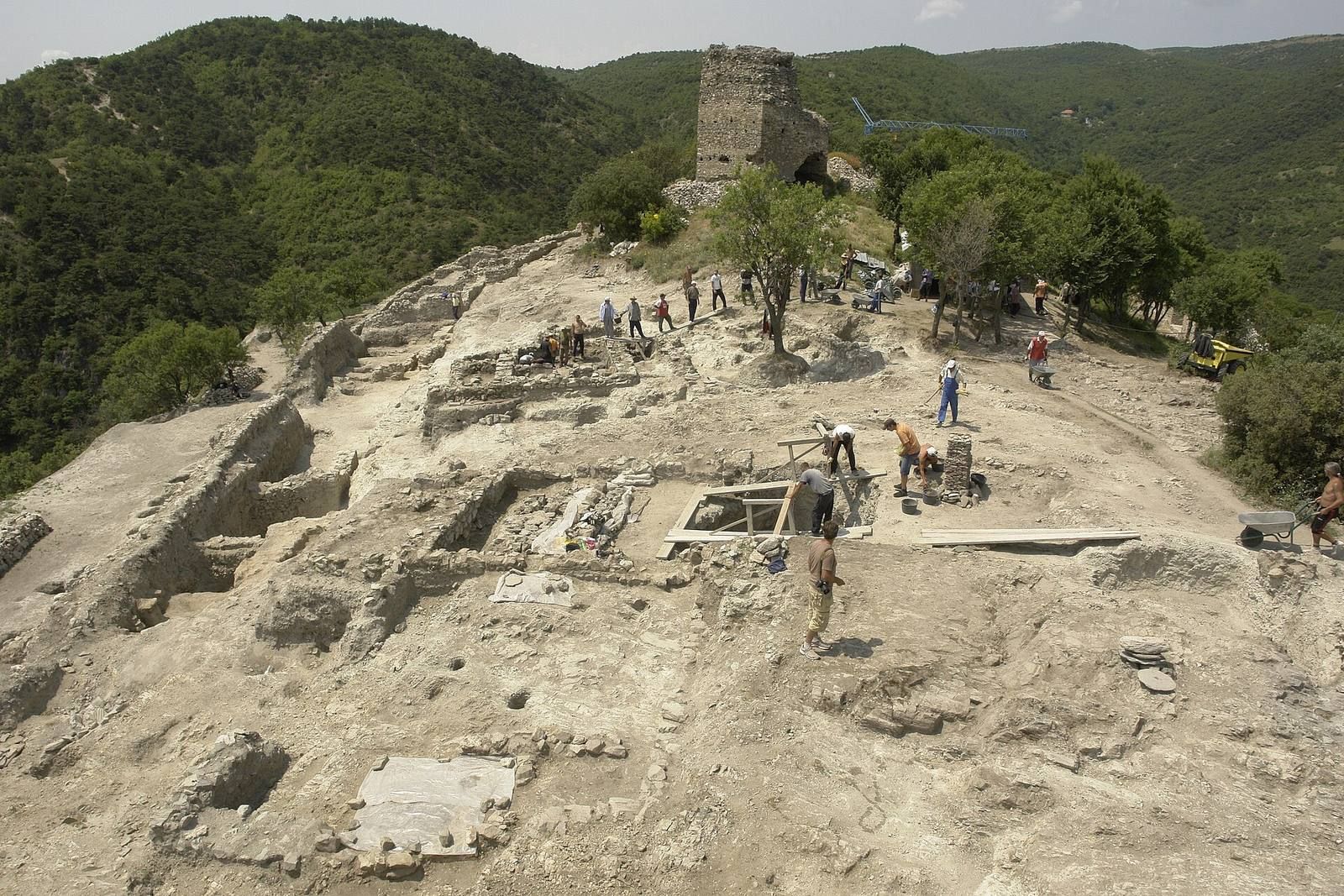
During the interwar years, residents visited the fortress during the first three days of Great Lent, the principal Eastern Christian fasting season before Easter. They shared food left from the meal associated with the local observance called Trimeri. The custom continued after the war and gradually disappeared by the mid-1950s. Archaeological investigation and conservation in the first decades of the twenty-first century renewed interest in the site and restored parts of the medieval fortress.
Remains
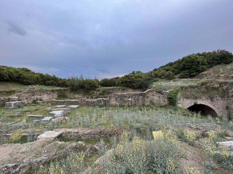
The archaeological complex occupies a hill about 450 metres above sea level. Its summit is an irregular, elongated oval plateau measuring about 230 metres east to west and 80 metres north to south, with an area of roughly 1.2 hectares. The medieval enclosure covered about 1.15 hectares and had a perimeter of approximately 550 metres. The fortress follows the saddle-shaped summit of an eastern spur of the Elenica hills. Steep gullies descend from the northwest and southeast sides toward torrents at the foot of the hill. Landslides on the eastern, northern, and northwestern slopes have carried away parts of the fortifications. South Hill, about 150 metres to the south, is also part of the archaeological complex.
Prehistoric and ancient remains
Chalcolithic settlement
The Chalcolithic settlement extended across a terrace on the southeastern slope, the edges of the northwestern plateau, and South Hill. An elevated central area was surrounded by lower terraces. Houses stood around the plateau and on the southeastern slope, while livestock were probably kept in central enclosures. Some excavated structures were partly cut into a terrace. Their above-ground walls appear to have been made from woven branches coated with clay, and their roofs were probably built from branches, reeds, and straw.
Finds include human-shaped figurines, small ritual tables, amulets, spindle weights, and objects of uncertain use. Pottery was decorated with graphite paint and incised lines. An awl found in place is the oldest metal tool discovered at the site. Other objects point to pottery, stone, and possibly metal working, alongside tools made from stone, flint, bone, and horn.
Bronze and Iron Age occupation
Early Bronze Age buildings occupied terraces cut into the southeastern slope, with two phases of use. Middle Bronze Age structures stood on separate terraces, most cut into the rock. They were built above ground and were probably timber-framed; at least one had an apse, a recess at the end of a building. Middle Bronze Age pottery includes vessels with wishbone-shaped handles and examples decorated with geometric incisions. Early Iron Age finds include bowls with fluted rims, jugs bearing hatched hanging triangles, and portable ovens.
Hilltop pits
Five large pits, aligned northeast to southwest, date from the late fifth and early fourth centuries BC. They were cut into bedrock, were circular in plan and pear-shaped in section, and vary in size and depth. Material accumulated in them until almost the end of the fourth century BC. The largest, Pit 5, is 5.4 metres wide and 4 metres deep. A rectangular rock-cut feature beside it is physically connected to the pit. The pits may have been used in rituals.
Hellenistic buildings and finds
Hellenistic-period remains occur on the southeastern and northwestern plateaus. The earliest substantial buildings were made of dry masonry, stone laid without mortar; a later, hastily built phase belongs to the period of Roman rule. Remains of large storage jars lay near the buildings beneath the medieval defensive wall. One building contained a ceramic lamp with a raised floral design and black glaze, dated to the third or second century BC.
Other finds include a ceramic altar model, terracotta figures of Cybele and Hermes, coins including issues from independent Macedonian city mints, and gold earrings bearing a lion’s head and a human head described as African. A ring decorated with a woman’s head was also found.
Roman buildings
Roman-period remains include a few buildings and fragments of walls. Several rectangular structures, made from stone and mud, survive in a ruined condition and were damaged by later construction. They may have been residences or food-storage buildings. Finds from Roman layers include a bronze figure of Mercury, jewellery, everyday objects, stamped pottery, and a funerary medallion whose inscription refers to a priest of Artemis.
Late antique remains
Defenses and cemetery
Substantial late antique defensive walls have been identified at several points around the plateau. A large cemetery occupies the South Hill sector. It was probably established after the fortification was built, and burials continued there until the first half of the fifth century.
Medieval fortress
Enclosure and entrances
The medieval enclosure had an elongated oval plan, with its longer sides running northeast to southwest. At least five towers, and possibly as many as seven, strengthened the perimeter; landslides make the total uncertain. Three towers defended the western entrance, spaced about a javelin’s throw apart, and a deep ditch cut into the ground protected the approach. A southeastern tower formed the southern side of another entrance, which was probably fitted with a drawbridge.
Surviving towers
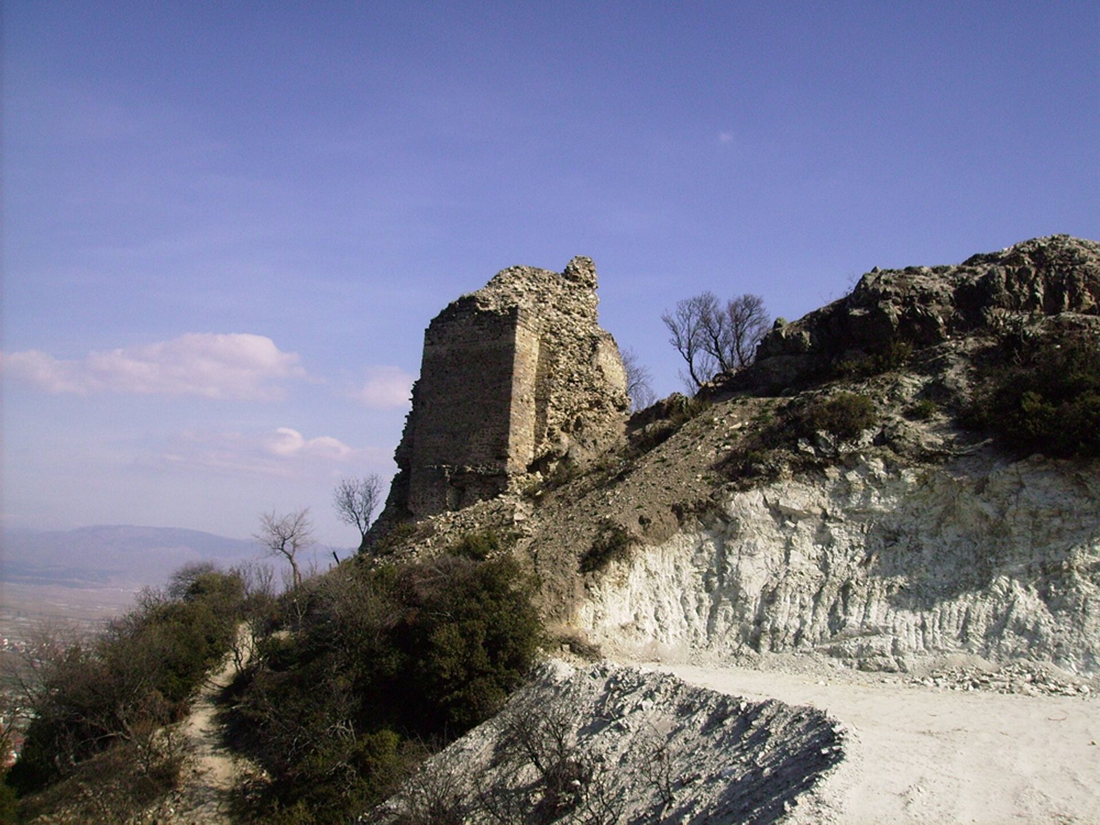
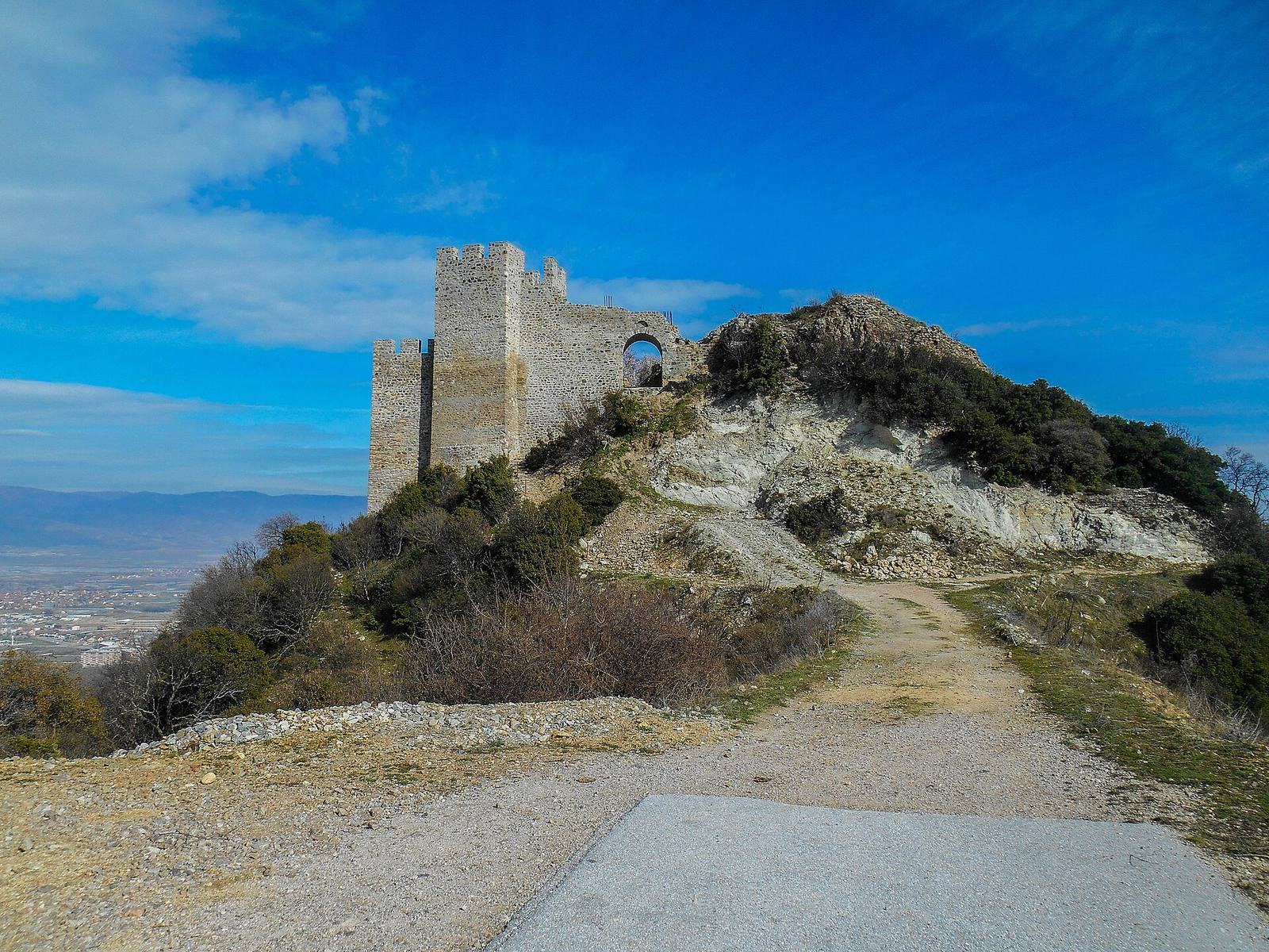
Four tower remains have been identified along the northern side, with a round tower on the eastern side. Two towers in the western section were restored during the twelfth and fourteenth centuries. The most intact tower is probably from the twelfth century. Its exterior is an elongated hexagon with sharp projecting corners, while its interior is rectangular and divided across several storeys. It contained a water reservoir. The tower measures about 5.5 by 12.5 metres externally; its walls are roughly 3 metres thick, and its highest surviving wall is about 9 metres tall. Some surviving tower remains are assigned to the period of the Serbian noble Constantine Dragaš Dejanović.
Central tower and water storage
The fortress’s largest medieval building stood near its center. This defensive and command tower contained the commander’s rooms and stores for food and weapons, with a water-storage tank in the basement. A smaller building immediately to its west, coated with waterproof plaster, was probably a service cistern.
Residential and service buildings
Garrison housing occupied the southeastern plateau. A fortified residence for the commander may have stood against the southeastern defensive wall. Other residences and a large structure interpreted as either a cistern or granary lay in the center of the plateau. West of the church, buildings served for housing and food storage; a cistern with a well stood nearby. Workshops and smaller associated buildings may have occupied the northwestern plateau, where another cistern collected rainwater.
Church
A church on the fortress’s northern side dates to the thirteenth or early fourteenth century. It had a single-nave plan and a chapel added later on its southern side, and probably served the garrison. A cross depicting a saint and inscribed with the name George was found in front of the altar area, suggesting that the church may have been dedicated to Saint George. Dozens of graves containing human remains and jewellery lay beside it. The church shows evidence of burning, and part of it was demolished when an electrical substation was installed.
Ottoman-period and nearby remains
Ottoman buildings and finds
Two rectangular buildings on the southeastern plateau belong to the Ottoman-period occupation. They may have housed members of the garrison or served religious or administrative purposes. Finds from Ottoman-period layers include pottery, rings, coins mostly identified as akçes, Ottoman coins, and lead projectiles for firearms, including flintlock guns and rifles.
Small church
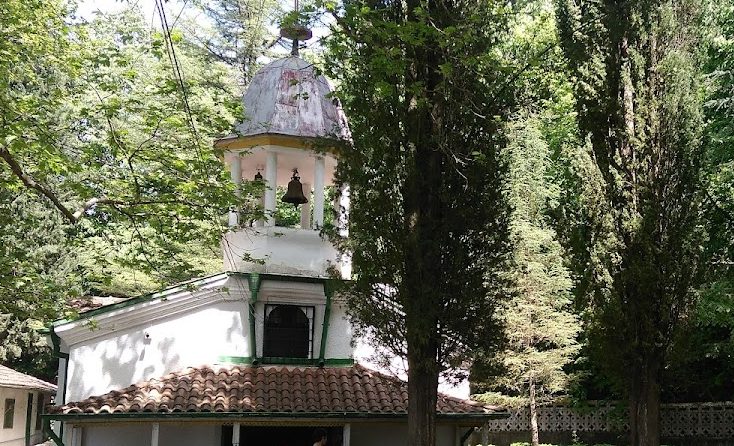
A small building known as the small church stands on the western slope, about 50 metres below the fortress.