Entremont: The Fortified Center of the Salyes
Site at a Glance
- Popularity
- Medium
- Country
- France
- Primary era
- Classical
- Eras represented
- Classical
- Civilizations
- Celtic
- Site type
- Military
- Remains
- Fortified Town
On this page18 sections
History
Entremont was the fortified center of the Salyes, a people of mixed Celtic and Ligurian background, on the Puyricard plateau near Aix-en-Provence, France. It served as the military heart of their confederation. The urban settlement took shape in the second century BC, during the period before Roman control of southern Gaul.
Foundation and expansion
Urban life began around 180–170 BC, later than at some other early fortified settlements in the region. The first defensive wall was built around 175 BC, and the initial settlement occupied about one hectare. Estimates of its population range from 2,000 to 5,000, with about 2,500 a more cautious figure.
Around 150 BC, the settlement expanded north into a second district. This growth was brief, and the population did not remain at its earlier level after the Roman capture. Entremont was linked to a regional exchange network in which Arles was a trading hub and goods also came through Massalia, the ancient Greek city at modern Marseille. About 99 percent of the coins found at Entremont were struck at Massalia, while exchange also relied substantially on barter.
Roman conquest and abandonment
The Salyes’ conflict with Massalia gave Rome a pretext to intervene. Marcus Fulvius Flaccus campaigned against them in 125–124 BC, before command passed to Caius Sextius Calvinus. Diodorus Siculus describes Salyes troops gathering at a town he does not name, often identified as Entremont. They may have intended to obstruct the Roman advance across the Aix plain.
Roman forces captured Entremont in 123 BC. The Salyes king, Teutomalios, fled to the Allobroges, a Celtic people of southeastern Gaul, with Salyes princes. His flight may have taken place amid the unrest that followed the attack rather than during the capture itself. Fighting between Rome and the Salyes continued: Livy places Sextius’s final victory during his later command, while Strabo and Ammianus Marcellinus also describe continued conflict.
In 122 BC, Sextius founded the fortified post of Aquae Sextiae at thermal springs below the plateau. It developed into the Roman city from which Aix-en-Provence grew. Some people left Entremont for the new settlement, while others stayed on the plateau under close Roman garrison control for another 20–30 years. Entremont was finally abandoned around 100–90 BC. A later military defeat, dated between about 110 and 90 BC, may also have contributed to its decline.
The name and archaeological recovery
The settlement’s ancient name is unknown. The name Entremont appears in medieval forms such as Antremons and the Latin Intermontes. Its origin is uncertain. It may be connected with the Tramonto family, which owned a tower on the hill’s southern slope, while a document from 1233 uses the form Intermundo. Isidore Gilles later proposed a derivation from Monte rotonde.
Cultivation and stone quarrying damaged the site during the nineteenth century. Three reused blocks carved with heads and horsemen were noticed in 1817 and transferred first to the Méjanes Library, then to the museum in Aix. The plateau was initially thought to be Roman; in the 1830s, it was associated with the Salyes. In 1839, Étienne-Michel de Loqui proposed that the settlement had been founded before 150 BC and destroyed in 124 BC. A farmer found a block carved with four joined heads in 1877; it entered the Aix museum in 1903. Michel Clerc discussed the site’s importance in 1916.
German forces requisitioned the plateau in 1943 and uncovered sculptures while building a camp. After the war, a military aviation radar station occupied the site. In 1946, archaeologist Fernand Benoit began systematic excavations with Robert Ambard, work that continued until Benoit’s death in 1969. His team concentrated on the first settlement, while test excavations elsewhere traced the western wall and indicated two sieges in the late second or early first century BC. In 1957, Benoit proposed that the upper settlement housed an aristocracy led by a king and that the lower district was more popular in character. He also suggested, without establishing it, that a royal palace might have stood above.
The state acquired the entire site in 1961, and the military left the plateau in December 1972. Later work increasingly emphasized conservation. Martine Willaume excavated the open-air Quarter 29 between 1981 and 1991, the southern secondary gate was fully cleared in 1992, and work led by Jean-Jacques Dufraigne restored the ancient rainwater-drainage system in 1999. The last excavation campaign took place in 2009. Surveys led by Ian Armit’s British team in 2010–2011 refined the plan of unexcavated areas; about one quarter of the settlement has been excavated. A 2021 synthesis placed the settlement’s end around 100–90 BC and described growing inequalities in wealth. Parts of the site entered France’s supplementary list of historic monuments in 1946 and 1947, and designated sections were classified as historic monuments in 1980.
Remains
The 3.5-hectare site occupies the southern end of the Puyricard plateau, whose summit reaches 367 metres above sea level. The triangular plateau slopes gently north and ends in cliffs above the Arc valley to the south. Its northern approach was fortified. Entremont overlooks the ancient Heraclean Way, a route running east–west through Provence along the Arc valley; across the valley lay the Salyes settlements of Test-de-l’Ost and Baou-Roux, near Massalian outposts. The underlying lower Miocene limestone contains flint nodules and supplied building stone, while softer limestone in the south was suitable for carving. Plant analysis indicates that the plateau was treeless before settlement.
Fortifications and settlement plan
Habitat 1
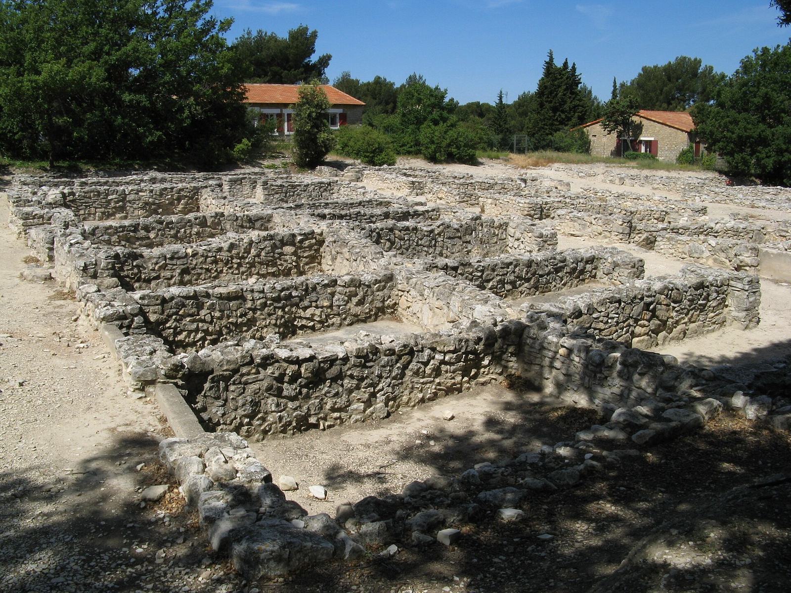
Habitat 1, traditionally called the upper settlement, had a roughly parallelogram-shaped plan and covered about one hectare. Steep ground bounded it to the south and west. Erosion has altered the remains along the plateau edge. Its defensive wall consisted of roughly dressed blocks bonded with clay, and the entrance is thought to have been on the western side.
The settlement’s regular blocks measured about 24 by 10.5 metres. Most were divided lengthwise into two rows of seven rooms, although some internal walls were removed to create larger spaces. A second storey is possible but unproven; a staircase on Street 17 may have served a neighboring house. Streets were about three metres wide, with earth surfaces broad enough for carts. Successive layers raised the street levels, and house thresholds were raised in turn to keep rainwater out.
Habitat 2
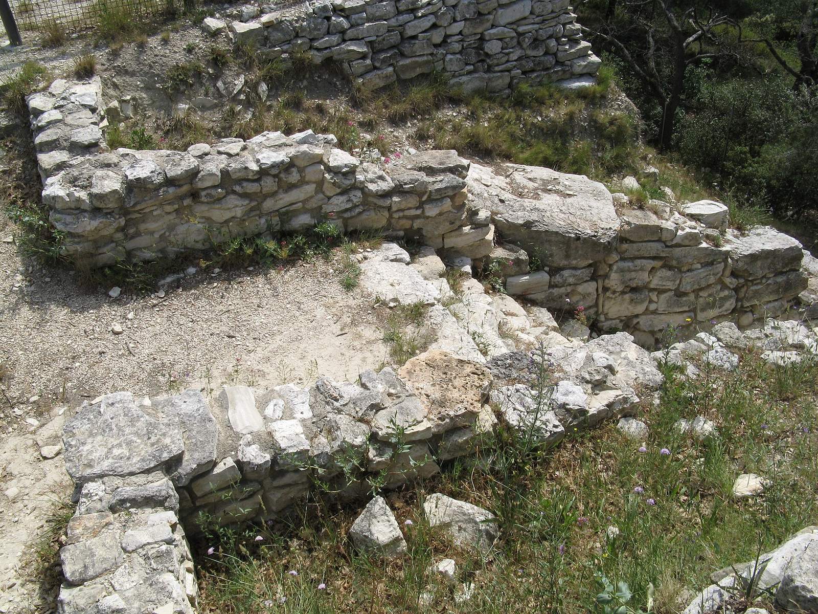
The northern extension brought the settlement to its full area of about 3.5 hectares. Its northern wall ran for 380 metres, stood about 6–7 metres high, and measured 3.25 metres thick. Towers about 8–9 metres high were spaced at intervals of 18.5 metres. A section of the wall and its rectangular towers survived the settlement’s destruction. Because the fortification impeded natural drainage, channels carried rainwater away.
Habitat 2 retained the roughly 24-metre block module, but its houses were larger, with as many as five rooms. The perimeter street measured about 4–5.1 metres across, while other streets ranged from 2.5 to 4.2 metres. A small secondary gate on the southern side opened onto a passage and rising staircase. An open area on the western edge may have been a square. Beside it stood a small building interpreted as a ritual chapel and a separate structure containing statues of seated heroes holding human trophies.
Sanctuary and human-head display
Early sanctuary blocks
A sanctuary may have occupied the plateau before the town, perhaps from the first Iron Age. Its pillars and lintels were cut from stone quarried at Bibémus, east of Aix. These blocks were later reused in the second settlement and possibly the first; their reuse is attested from around 500 BC. They bear engravings, raised carvings, and recesses shaped like human heads, and some may once have been painted. An early phase of activity, placed between the fifth and early second centuries BC, has been interpreted as strongly focused on worship and offerings.
The purpose of the head-shaped recesses remains disputed. They may have held the skulls, or parts of the skulls, of defeated enemies, or they may have been associated with community heroes. Engraved ears of wheat, understood as symbols of renewal, have been used to support the second interpretation.
Portico of the Skulls
A building between two towers in the upper settlement is associated with the display of human heads. Known as the Portico of the Skulls, or the hall supported by posts, it had a lower-level room about 21 by 6 metres. A bench made from ancient stone slabs laid flat ran along the rear wall, and wooden posts divided the facade. One block was engraved with twelve human heads and a snake. The original carved block is in the Granet Museum, and a cast is displayed at the site.
Excavations in the hall recovered about fifteen human skulls, some pierced by large iron nails that may have fixed them in place for display. Fragmented human remains from the hall, Quarter 12, the path along the facade, and finds made in 1986–1987 lay among building floors, tools, and animal bones. One skull belonged to a man over forty. Whether the heads were those of enemies or members of the community remains unsettled.
Domestic and productive areas
Quarter 29
Quarter 29 differed from the settlement’s regular blocks. It was an open-air area used for domestic and craft refuse. Excavation recovered numerous glass beads, bronze scraps, and animal bones, offering a picture of discarded materials from household and working life.
Oil production and workshops
Entremont contains evidence of oil production with lever-and-counterweight presses. Quarter 3 may have held as much as 3,000 litres of oil, and a press counterweight was found in Room 8 of Quarter 11. Other working areas include hearths that may have been used to smoke meat or fish, an oven, and a smithy. Excavations also revealed workshops, storerooms, and work spaces.
Pottery and everyday objects
Locally made pottery was hand-built in a distinctive style without the usual Celtic characteristics. Most vessels and large transport jars were imports from Italy, Spain, Greece, and Carthage, reaching the settlement through Massalia. A black-glazed cup found by Benoit in 1968 carries an inscription read uncertainly as ‘Bal(omarios?) Mardius’. It has been interpreted as evidence of contact with Latin-speaking neighbors in Entremont’s final years.
Finds also include iron sickles, tongs, and knives; spindle whorls, weights used to spin thread; bronze ladles; rings; brooches; and coloured-glass beads. Together with the workshops and storage areas, these objects attest to varied domestic and craft activities across the settlement.
Stone sculptures and reliefs
Statues
Entremont has yielded the largest known group of stone sculpture from pre-Roman Gaul. Fragments of about two dozen statues include elite men and Salyes women in formal dress. At least three figures show seated women wearing fringed cloaks that cover their heads. Many of the male figures are warriors seated cross-legged, with armour reaching to mid-thigh, sometimes a neck ring, a sword at the right side, and one or more severed heads resting on their knees. Their heads vary, with elaborate hairstyles, diadems, or curled hair. Most of the sculptures are held at the Granet Museum in Aix-en-Provence.
The statues were carved in the third or very early second century BC and probably brought to Entremont around the middle of the second century BC, possibly as rural communities moved into the town from older local sanctuaries. They are made from fine-grained local limestone. Their carved details imitate some effects of woodwork, while drilled curls reflect Greek sculptural practice and the weapons and ornaments are Celtic. The surviving pieces were broken in antiquity; some fragments were later reused in paving the road to Habitat 2.
Relief-carved blocks
Architectural blocks carry reliefs of severed heads, head-shaped recesses, horsemen, and other figures. Interpretations of the statues differ: they may represent heroized ancestors, or aristocrats displaying status, military strength, and authority. These carvings, together with the scattered statue fragments, form a substantial record of Salyes sculpture and its varied imagery.