Capidava: A Roman Fort on the Danube Frontier
Site at a Glance
- Popularity
- High
- Country
- Romania
- Primary era
- Classical
- Eras represented
- Classical, Medieval
- Civilizations
- Byzantine, Roman
- Site type
- Military
- Remains
- Fort
On this page10 sections
History
Capidava was a Geto-Dacian fortified center and later a Roman fort and civil-military settlement on the Danube in Dobruja, Romania. Under Trajan, Rome established a small fort there to control a river crossing in preparation for the Dacian Wars. Capidava subsequently served as a frontier post and regional center.
Geto-Dacian settlement and Roman expansion
The name Capidava comes from the Getic word dava, meaning a settlement, and is interpreted as “curved fortified settlement.” The precise relationship between the indigenous settlement and the later Roman fort is uncertain. A La Tène settlement, belonging to an Iron Age culture, occupied the site of the modern village from the fifth to the second centuries BC. Another interpretation places the settlement that gave the fort its name elsewhere nearby, perhaps destroyed during construction of the Roman fort. Geto-Dacian remains and scattered Roman vessel fragments have also been found at Zaval Valley, about 4 km south.
Archaeologist Vasile Pârvan identified Capidava with the power center of Dapyx, a Getic king. The Roman historian Cassius Dio recounts that Dapyx retreated to a fortress after the Roman general Marcus Licinius Crassus defeated him in 28 BC. Pârvan proposed that this fortress stood at the later Roman site, drawing in part on a local inscription, but the identification remains an interpretation.
Roman forces reached the Danube in AD 14, when Aelius Catus led an expedition across the river against the Dacians and their Sarmatian allies. The advance reached Durostorum, while northern Dobruja remained under the Sapaei, a people allied with Rome. After their kingdom ended in AD 46, Rome probably placed small garrisons in former Dacian settlements along the river, possibly including Capidava. Campaigns launched from Moesia under Domitian did not lead to the systematic strengthening of the frontier. In preparation for the Dacian Wars, Trajan established a small fort on the Capidava cliff, likely garrisoned by the Cohors I Ubiorum, a Roman military unit.
Roman frontier and civic center
After Rome conquered Dacia, Capidava grew into a military station with a civilian population that included Dacians, Bessians, a Thracian people, and Roman citizens. Farmers lived in nearby villages and rural estates, while veterans settled in civilian communities associated with the military base or perhaps in the nearby Getic settlement. Pârvan considered Capidava to have become Romanized by about AD 130–150. Inscriptions nevertheless preserve Dacian names, including Tsinna and Tsiru.
The district brought together an indigenous civic community, a settlement connected with the military base, and rural settlements and estates. Capidava also functioned as a customs station, and an official serving under the provincial governor is attested there. An inscription from Ulmetum names the Capidava district and C. Iulius Quadratus as a five-year local magistrate and local leader. The settlement was probably a vicus, or community, though that identification partly depends on whether two inscriptions refer to the same man.
The Cohors I Ubiorum was later replaced by Cohors I Germanorum civium Romanorum, although the date of the change is unknown. Detachments from Legio XI Claudia and Legio I Italica also served at the fort. Later records associate Capidava with units from Legio II Herculia and Legio I Iovia, as well as cavalry formations including the Cuneus equitum Solensium. The site appears in ancient route and administrative records: the Antonine Itinerary gives its name, while the Peutinger map places it on the road between Axiopolis and Carsium. A milestone at Seimenii Mici gives the distance from Axiopolis as 18,000 Roman feet, or 27 km, supporting the identification.
Late Roman and Byzantine phases
The fort remained in use through the third century, until Gothic attacks destroyed it during the second half of that century. It was rebuilt under the Roman emperors Aurelian and Probus, then reconstructed on the same plan in the early fifth and early sixth centuries. Capidava became an episcopal seat in the late Roman period. In the sixth century, attacks by Slavs and Avars around 580–581 were followed by a reduced fort in the southern quarter, operating from about 594/595 to 612/613 or somewhat later. The site was then abandoned.
Byzantine occupation resumed in the tenth century, with civilians living inside the fortifications. In spring 1036, a Pecheneg invasion devastated the region and destroyed the fortifications at Capidava and Dervent. Capidava’s final destruction is placed by the middle of the eleventh century. In the wider region, Byzantium accepted Pechenegs led by Kegen as treaty allies in 1046; the Byzantine emperor Isaac I Komnenos reconquered Dobruja in 1059.
Archaeological investigation
In the late nineteenth and early twentieth centuries, Captain Mihai Ionescu-Dobrogeanu and archaeologist Grigore Tocilescu described the fort and collected antiquities nearby. Before the First World War, Pârvan surveyed the ruins and commissioned a plan from Pamfil Polonic Sr. Excavations began in 1924, followed by systematic investigations from 1925 under Grigore Florescu, who directed the work until 1960. Excavation campaigns took place in 1926 and 1927; work was interrupted from 1949 to 1954. Later research also examined the area around the military baths.
Remains
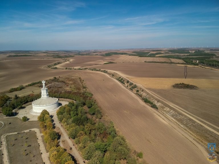
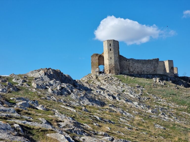
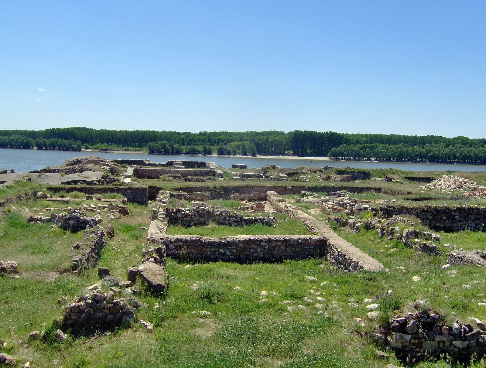
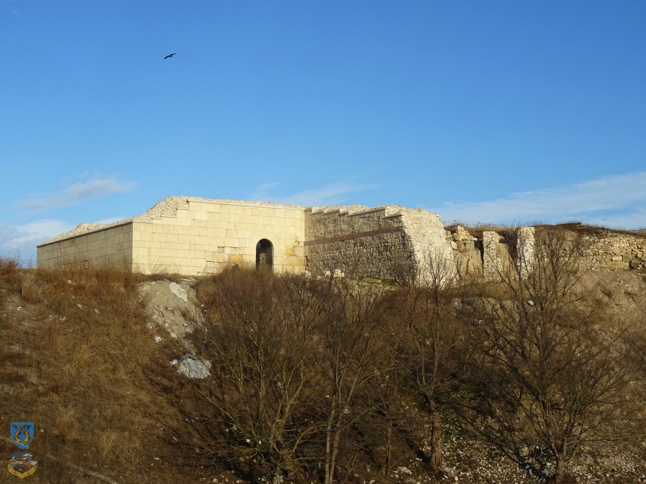
The fort occupied a high rock above the Danube’s right bank. A natural ditch began at the river and curved around the northeastern side of the rock, nearly reaching the settlement’s eastern corner. The rectangular fort was aligned northwest to southeast and measured about 105 by 127 m, covering 1.33 hectares. The later fortified settlement occupied about 1.5 hectares. Its walls were more than 2 m thick and 5–6 m high. Seven towers, each originally more than 10 m high, comprised three rectangular towers, two quarter-circle towers, and two horseshoe-shaped towers; foundations remain for the horseshoe examples. Limestone quarrying in the 1920s damaged the western corner and much of the southwestern side. Remains in the south include foundations of the defensive wall and later fort, together with the line of the defensive ditch.
Gates and river port
A gate about 2.5 m wide stood on the southeastern side, connecting the fort with the surrounding area. The main southern gate and adjacent buildings have been excavated. On the southwestern side, an opening from a tower led toward the Danube and the port. The port’s wharf is now below water; storage rooms and other structures occupied the upper terrace. The port served the Classis Flavia Moesica, the Roman fleet associated with the Danube frontier and based at Noviodunum.
Buildings and military baths
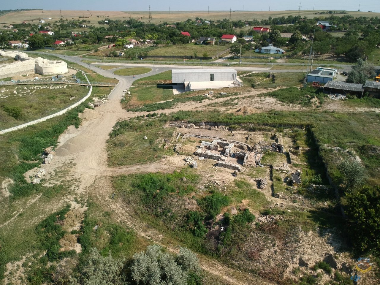
Excavations have uncovered the Roman main gate and neighboring buildings, a guard building used as a storehouse, the late Roman headquarters, barracks from late Roman and Romano-Byzantine phases, and a small church dating to the early sixth century. Their remains preserve successive building phases. Outside the fort to the southeast, the military baths associated with the earliest fort stood about 100 m east of it, in an area where habitation and burial remains from different periods overlap. Construction began in the first decade of the second century with contributions from Legio XI Claudia. The complex was extended and repaired in later decades; roof-tile stamps date one phase to the reign of Caracalla, around 248–250, after the Scythian War.
Burial grounds and settlement buildings
A cemetery of burial mounds extended east and northeast of the fortified settlement. It contained richly furnished cremation burials, while more modest graves lay farther south. Within the settlement, several buildings were arranged around a private square and included porches, access ways, and drainage channels. Of eight recorded types of building products, including coarse pottery, bricks, roof tiles, and drainpipes, three remained.
Byzantine settlement and finds
More than 340 sunken-floor houses have been identified within the walls from the ninth- to eleventh-century occupation. A wall of stone and earth, built over the older fortification, strengthened this settlement. Archaeological phases distinguish six episodes of destruction and rebuilding and seven occupation levels over roughly 200–250 years. Estimates suggest that each level held more than 100 houses, generally 12–16 m² each, and a population of about 700–1,000.
Finds include pottery vessels, amphorae, clay buckets, jars, bowls, lamps, and objects made from metal, bone, glass, stone, and clay. Nearly 50 inscribed monuments comprise 25 funerary stones, along with altars and honorific or votive monuments. Fifteen sculptural pieces include capitals, a hand, a column shaft, a leg, a serpent, and an eagle. A funerary stone belonging to the Cocceius family carries a relief of the Thracian horseman, a recurring ancient mounted figure. The so-called Quadratus grave depicts a plough drawn by oxen. A locally made pitcher found in 1969 bears a cross, the Greek alphabet, and the name Petre, which some Romanian historians interpret as Romanian. Coins from the site date to the reigns of the Byzantine rulers John I Tzimiskes, Basil II, Constantine VIII, and Theodora.