Quelepa: A Lenca Residential, Ceremonial, and Political Center in El Salvador
Site at a Glance
- Popularity
- Medium
- Country
- El Salvador
- Primary era
- Classical
- Eras represented
- Classical, Medieval
- Civilizations
- Unclassified
- Site type
- City
On this page19 sections
History
Quelepa was a Lenca residential, ceremonial, and political center in San Miguel, El Salvador, occupied from around 200 BC to about AD 1000. The Lenca are an Indigenous people historically associated with eastern El Salvador and parts of Honduras. Archaeologists divide Quelepa’s occupation into the Uapala phase (about 200 BC to AD 200), the Shila phase (AD 200 to 600), and the Lepa phase (AD 600 to 1000).
Uapala phase
During the Uapala phase, occupation extended across much of the site, with particular activity in the higher northern part of the East Group. Quelepa maintained exchange with central and western El Salvador, the Guatemalan lowlands, and western, southern, and eastern Honduras. Its pottery traditions have been linked to a proposed Uapala ceramic sphere, an archaeological grouping of communities connected by shared pottery styles. That tradition showed influences from the Providencia-Miraflores sphere of Kaminaljuyú and from western El Salvador.
Usulután pottery, decorated with patterns made using a negative or batik technique, formed a major part of Uapala ceramics. The Izalco Usulután group accounted for about 59.9 percent of the pottery noted for the phase. Other vessels included unpainted San Esteban ware and red-painted Placitas ware. Pinos and Santa Tecla wares, both from western El Salvador, also reached the site through exchange.
Shila phase
In the Shila phase, Quelepa’s exchange with western and central El Salvador and the wider Maya region declined. The eruption of Ilopango, a volcano in El Salvador, around AD 539 severed trade connections extending into Mesoamerica. Exchange instead turned toward central Honduras and other regions to the north and east. This shift coincided with a locally distinctive cultural florescence and increased building activity, which may reflect population growth rather than stagnation.
Shila pottery included local Moncagua ware, which was unpainted, and red-painted Sirama ware. Pottery derived from Izalco Usulután included unpainted Tongolona and Chaparrastique wares, together about 62.2 percent of the phase’s ceramics, as well as red-painted Comacarán and Hato Nuevo wares. These vessels shared a paste distinct from the pastes of earlier Usulután pottery and coarse wares. Their paste and surface coating were less hard and durable than earlier examples. This decline in production and decoration quality may reflect the disruption of older exchange networks. The closest ceramic similarities were with southern Honduras, including Los Naranjos and Copán, though parallels also occur at Chalchuapa and in the Guatemalan lowlands.
Lepa phase
The Lepa phase brought substantial changes in settlement and ceremonial life. Ceremonial activity shifted toward the West Group, while much of the East Group was abandoned. Burials became concentrated near the western acropolis and were associated with domestic remains. Ceramic deposits previously placed in relation to building axes and platform corners were no longer part of the pattern.
Lepa pottery included everyday wares, knobbed censers, and fine-paste vessels. Unpainted Obrajuelo ware made up about 38.1 percent of the ceramics, while red-painted Sirama ware continued from the previous phase. Obrajuelo had a finer, more consistent paste and was often more polished than Moncagua. The coarser knobbed censers belonged to the Lolotique group. Fine-paste pottery included Quelepa Taishuat and Guayabal; the Quelepa group, about 39.6 percent of the ceramics, became the main ware in place of pottery derived from Usulután. Its vessels had a white surface coating, sometimes with decoration in several colors.
The origins of these fine-paste wares remain debated. E. Wyllys Andrews considered them to lack local precedents and to resemble styles from the Maya lowlands and Gulf-coast Veracruz, while Fabio Amador considered development within the region possible. Other traded Lepa wares included polychrome Campana, probably from central El Salvador, and Tecomatal, probably from the Comayagua Valley. Toward the end of occupation, Quelepa and Campana wares declined, Delirio fine-paste pottery appeared, and Los Llanitos ware became more common. Plomizo and Nicoya wares also appeared as markers of the Terminal Classic and Early Postclassic.
The pronounced changes of the Lepa phase have prompted the hypothesis that newcomers gained power at Quelepa. Andrews proposed origins on the Gulf of Mexico coast or at an intermediary center. Another interpretation favors Lenca groups from the Comayagua Valley, linked with Maya-influenced communities in the Ulúa Valley. Ulúa-style pottery is scarce at Quelepa, although the Tecomatal group has strong affinities with it. Ulúa pottery occurs more abundantly at other contemporary sites in eastern El Salvador.
Decline and abandonment
The decline of Quelepa coincided with the Late Classic collapse of Maya cities, including Copán and Tikal, and with a shrinking population at the site. Quelepa was abandoned around AD 950 to 1000, near the beginning of the Early Postclassic. Its abandonment has been linked to the arrival in El Salvador of the Pipil, a Nahuatl-speaking people associated with that period, but this proposed connection does not establish that Pipil communities occupied Quelepa.
Some Mexican-associated traits may have reached Quelepa near the end of its occupation. One possible route was indirect, through Cara Sucia, a site associated with the Cotzumalhuapa tradition of southern Guatemala and with Gulf-coast connections. Direct transmission from Nahuatl-speaking populations has been considered less likely. Cara Sucia was in its late Tamasha phase and may have been destroyed around AD 950, possibly during the arrival of Nahuatl-speaking groups. The name Quelepa is translated from Lenca as stone jaguar and may refer to the Jaguar Altar.
Early accounts and archaeological work
Atilio Peccorini published the first brief description of Quelepa in 1913 and interpreted a walled platform as a fortress. Herbert Spinden mentioned the site in 1915, and Peccorini published a further description in 1926. That year, Samuel K. Lothrop visited to acquire ceramics for the Museum of the American Indian in New York and listed Quelepa under the alternative name Mayacaquin. Antonio Sol, then director of El Salvador’s National Department of History, visited in 1929.
Pedro Armillas directed the first excavation in 1949, focusing on Structure 3. The work was left incomplete, and its results were not published, although Armillas’s field notes later passed to E. Wyllys Andrews. Andrews led the principal excavations from 1967 to 1969. A 1976 legislative decree declared Quelepa a National Archaeological Monument, though the site remained effectively unprotected as recently as 2005.
Remains
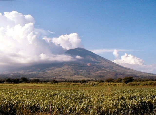
About 40 structures occupy roughly 0.5 square kilometres along a stretch of about one kilometre beside the San Esteban River, a tributary of the Río Grande de San Miguel. The archaeological area lies on the river’s north bank at elevations of about 160 to 180 metres, and every structure is within 500 metres of the water. Pottery remains and isolated mounds extend as far as three kilometres from the core toward Moncagua. Quebrada Agua Zarca, a small stream, separates the site into East and West Groups, which have distinct architectural styles and were probably built in different periods, with the West Group likely later.
East Group
Most East Group structures follow a north-south alignment and stand near the edges of broad artificial terraces that rise from the river toward the base of a hill range. Long cut-stone slabs, laid horizontally, face the terraces and create level building surfaces. The group’s main area and its largest buildings lie near the center. Near its western edge, a large rectangular platform supports architectural remains and was once almost enclosed by walls, now badly eroded. Structure 9 stands at the platform’s southern end. An earlier platform beneath Structure 8 was made from talpetate, a hard local volcanic-ash deposit, and mud mortar.
Structure 3
Structure 3 is Quelepa’s largest building, standing 11 metres east of Structure 4 on the third terrace from the river. The two step pyramids face south toward the terrace edge. The terrace face is about four metres high and, like the approach ramps, was faced with blocks of volcanic tuff, rock formed from consolidated volcanic ash. Two slab-paved ramps cross the terrace, aligned with the access ramps of the respective pyramids and rising at about 13 degrees.
The ramp approaching Structure 3 extends 9.1 metres from the terrace edge. It narrows from 12.1 metres across at its lower southern end to 10.9 metres where it reaches the terrace in front of the pyramid’s access ramp. Structure 3’s base was faced with large, finely cut blocks, and builders levelled the tuff terrace surface before construction. The pyramid was probably eight tiers high. Its lowest tier measured 48 by 32.3 metres, while the uppermost measured about 22.3 by 9.1 metres. The base originally rose about 9.7 to 9.8 metres. Lower tiers were roughly 1.1 to 1.3 metres high, the fourth about 1.7 metres, and their horizontal depth about 1.6 to 1.8 metres, compared with about 2.5 metres for the upper tiers.
The pyramid is oriented about five degrees east of north, roughly ten degrees different from Structure 4. Its southern corners are slightly wider than right angles, and the south façade projects outward to meet the access ramp, a form interpreted as making the building appear larger. The ramp was originally stone-faced and 6.4 metres wide. Its surviving section projects 8.8 metres from the pyramid and ends eight metres short of the terrace edge; its original length is estimated at about 24 to 25 metres. The incline increased from about 18.5 degrees at the base to 28 degrees higher up.
Blocks on the lower tiers measured as much as 150 by 70 by 30 centimetres and weighed more than a tonne. Smaller upper blocks could be carried by one person. The walls were probably plastered, and the upper surfaces paved. Burnt fragments of wattle-and-daub, a woven framework coated with earth or mud, occur across the pyramid’s surface, sides, and base. They are the remains of a perishable building, probably a temple, that stood on the summit. The south face and ramp are badly eroded, with damage accelerated by excavations.
At least three offerings lay beneath the summit floor. Offering 2 placed a large stone disc over a large cylindrical jade bead. Offering 3 contained pottery and a large grey-green river pebble, while Offering 4 consisted of an inverted bowl decorated in several colors. A further large deposit lay beneath the upper part of the ramp. It contained two large stone discs, each with a four-legged ceramic vessel above it and three stone balls, 18 to 20 centimetres across, arranged beneath in a triangle. A large tubular jade bead lay under each disc. The deposit also included two vessels placed one inside the other with charcoal between them; a large inverted vessel over a bowl containing five jadeite beads and a nephrite axe, both hard minerals used for carved objects; traces of red pigment, probably cinnabar; and another bowl with a small piece of charcoal.
Structure 4
Structure 4 is the smaller and earlier of the two pyramids. Its base measures 34.5 by 18.8 metres and is aligned just under five degrees west of north. The building probably had two tiers. The recessed upper tier measures 27.2 by 15.3 metres; the lower tier is 2.6 metres high, while the upper tier was originally estimated at 3.2 metres and has since been reduced. The platform’s total height is about 5.8 metres.
Its south-facing access ramp is 11.9 metres long, 5.4 metres wide, and rises at an estimated 27-degree angle. It projects 6.3 metres beyond the pyramid base. Excavation showed that the ramp was made of compacted clay and that the pyramid was packed with unworked stones; both were built at the same time. Rough blocks of volcanic tuff, set in mud, face the pyramid beneath a mortar coating five to seven centimetres thick. The mortar may once have been painted, although that interpretation is unconfirmed. Burnt wattle-and-daub around the base points to the burning of a perishable upper building, probably a temple. Seven offering deposits contained Early Classic pottery vessels, jade beads, and an onyx bowl.
West Group
The West Group’s buildings stand on artificial terraces, generally aligned north to south. Its main ceremonial area includes a small acropolis, an elevated ceremonial complex, arranged around a rectangular plaza resembling a sunken court or playing field. About 15 small, heavily eroded structures surround the plaza, most on the terrace. A narrow platform on the terrace’s northeast side supported a long, low building, and another similar building stands on the acropolis’s east side. The terrain descends steeply toward the river south of the group.
Structure 19, the ballcourt
Structure 19 is an I-shaped court about 110 metres north of the acropolis, oriented north to south. It was used for the Mesoamerican ballgame, a ritual and competitive game played on formal courts. One side of its playing area is formed by a mound 31 metres long and 2.25 metres high; the opposing side is the face of a terrace. Low, narrow walls running east to west bound the court at its northern and southern ends. The sides probably originally stood about 4.5 metres high.
Two large stone slabs lay at the center of the playing area, supporting a broken sandstone disc measuring 28 by 4.5 centimetres, probably a court marker. Seasonal runoff has buried the court beneath more than two metres of soil.
Structure 23
Structure 23 is a Late Classic, single-level platform near the edge of a high terrace, closing the west side of a small plaza. It measures 8.8 by 6.8 metres and is 2.5 metres high, with vertical sides. Its 1.9-metre-wide stairway projects three metres westward. The use of stairs rather than the ramp form found at earlier buildings accompanies a facing of poorly worked stone. Earth, mud, and rock fill make up the platform and stairway.
Burnt wattle-and-daub, mortar fragments, and red-painted stucco were found around the base. These materials suggest a perishable upper building, probably a temple, although the stucco’s origin is uncertain. A rough altar occupies the angle between the stairway’s south wall and the platform’s west wall. Offering 23, probably deposited when the structure was built, contained three ceramic vessels, including one shaped to depict a figure and painted red.
Structure 28
Structure 28 stands six metres south of Structure 23. The badly eroded platform is 1.5 metres high, and its architectural style suggests a Late Classic date. A 25-centimetre layer of burnt wattle-and-daub mixed with pottery fragments covered its base, probably the remains of a perishable upper building.
Structure 29
Structure 29 is an irregularly aligned, three-tiered pyramid platform built over a similar earlier building called Structure 29-sub. Its base measures 17.2 by 14.1 metres. It stood 3.5 metres high at excavation, with an estimated original height of about 4.1 metres. Its tiers were approximately 0.7, 1.8, and 1.6 metres high. A west-side stairway projects one metre from the base. The facing consists of uneven stones set irregularly in mud mortar and covered with a thick, uneven mortar coat.
Offering 22, found in front of Structure 29-sub, contained three ceramic discs stacked together, a large obsidian knife, a piece of hematite, a piece of dusty orange clay, and 43 obsidian flakes. Obsidian is volcanic glass. Near Structure 29’s southeast corner, Offering 24 lay beneath a stone slab measuring 39 by 69 centimetres. It comprised three interlaced U-shaped stone yokes, two carved palmas, stone objects associated with the ballgame, and a sculpted stone axe. The larger palma measures 49 by 16.5 centimetres and depicts a seated deity, probably Ehecatl, a Mesoamerican wind deity. The smaller, measuring 23.5 by 13.5 centimetres, represents a feathered serpent. Their style is Late Classic, and they resemble examples from Veracruz.
Stone monuments and other finds
Jaguar Altar
The Late Preclassic Jaguar Altar is a single block of stone measuring 314 by 297 centimetres and 85 centimetres high. A carved feline, probably a jaguar, appears on one face, and relief sculpture covers all four sides. A square hollow in the upper surface is 39 centimetres deep and measures 140 by 160 centimetres. The altar was found 235 metres north-northwest of Structure 29 and 102 metres northeast of the ballcourt, near the edge of a terrace four to five metres high.
Its original position is uncertain. The area around and beneath it had been looted before excavation, and a broken-off corner was never recovered, perhaps because the monument was moved. The altar is now in the National Museum of Anthropology Dr. David J. Guzmán in San Salvador.
Other altars
Altar 2, found on Structure 9, is roughly circular and has a square hollow carved into its upper face. It measures 84 by 70 centimetres and is 46 centimetres high. Like the Jaguar Altar, it is now in the National Museum of Anthropology Dr. David J. Guzmán. Altar 3 survives as a fragment found in 1970 a few metres east of Structure 36 in the West Group.
Excavated and reported objects
Material associated with Quelepa includes obsidian tools, grinding stones, griddles, flutes, and ocarinas containing rolling balls. Stanley Boggs reported wheeled figurines or toys. Together with the ballgame objects, some of these finds have been interpreted as evidence of connections with Veracruz and the Gulf coast.
Cultivation on the archaeological land continues to erode the remains. Stone facing removed from Structure 3’s ramp after the 1949 excavation was reused as building material in San Miguel.