Kit’s Coty House: An Early Neolithic Chambered Long Barrow in Kent
Site at a Glance
- Popularity
- High
- Country
- United Kingdom
- Primary era
- Stone Age
- Eras represented
- Stone Age, Modern
- Civilizations
- British
- Site type
- Burial
- Remains
- Burial Mound
On this page7 sections
History
Early Neolithic setting
Kit’s Coty House is a ruined chambered long barrow on Blue Bell Hill near Aylesford in Kent, United Kingdom. Pastoralist communities built it around 4000 BCE, during the Early Neolithic, as part of the regional group known as the Medway Megaliths. A chambered long barrow is an elongated earthen mound with a burial chamber at one end; monuments of this kind often served as collective tombs.
Farming had spread to Britain from continental Europe shortly before the monument was built. Across Britain, the period from about 4500 to 3800 BCE saw communities move away from an earlier hunter-gatherer way of life, although the relative roles of migration and adopting farming practices remain uncertain. Kent’s position near the continent and the Thames estuary made it a likely point of contact. The origins of the Medway monuments’ builders are unknown, and proposed architectural connections to several parts of Europe do not establish a precise place of origin. It is also uncertain whether the monuments were built in sequence or at the same time, or whether they all served the same purpose.
Antiquarian accounts and local traditions
Kit’s Coty House appears in John Twyne’s work, written around 1550 and published in 1590, and in William Camden’s Britannia of 1586. Camden recorded a tradition identifying the chamber as the tomb of Catigern, a semi-legendary British prince said to have died at the Battle of Aylesford in 455. Antiquaries visited the monument in 1590; John Stow described it in 1592, and William Lambarde did so in 1596. Camden gave a fuller account after observing the site himself, in the expanded English edition of Britannia published in 1610. Thomas Philipot repeated the identification with Catigern in 1659.
John Aubrey included the monument in his unpublished Monumenta Britannica, accompanied by a drawing by Thomas Gale. Samuel Pepys had seen the site before William Stukeley visited in 1722, sketched it, and published four engravings. One print showed the chamber, its mound, and the General’s Tombstone. Around 1783, James Douglas arranged for digging on the monument’s western side and made a watercolour of the work. George Payne described nearby scattered megaliths in 1893, suggesting they might have belonged to another destroyed monument. In 1924, O. G. S. Crawford included Kit’s Coty House among the Medway Megaliths.
Other accounts attached different stories to the site. In 1722, Hercules Ayleway recorded a local belief that Kit’s Coty House and Lower Kit’s Coty House commemorated rival kings of Kent who died in battle. A tale recorded in 1946 said that three witches on Blue Bell Hill built the chamber and that a fourth helped set its capstone. A proposed explanation of the name connects it with the Ancient British forms kaitom and later keiton, said to mean forest, giving the suggested sense Tomb in the Forest.
Protection, damage, and later use
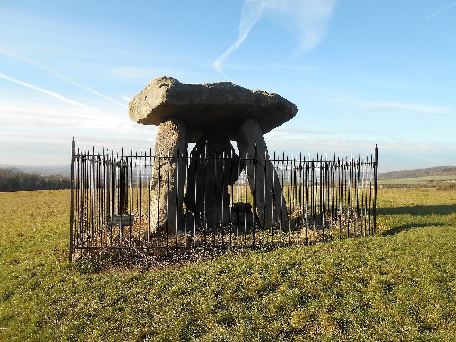
On the advice of Augustus Pitt-Rivers, the first Inspector of Ancient Monuments, the site became one of the early ancient British remains protected by the state. It was designated a scheduled ancient monument in 1885, and iron railings were installed around the stone monument several years later. Ploughing continued to affect the earthwork outside the enclosure. English Heritage is now the site’s owner.
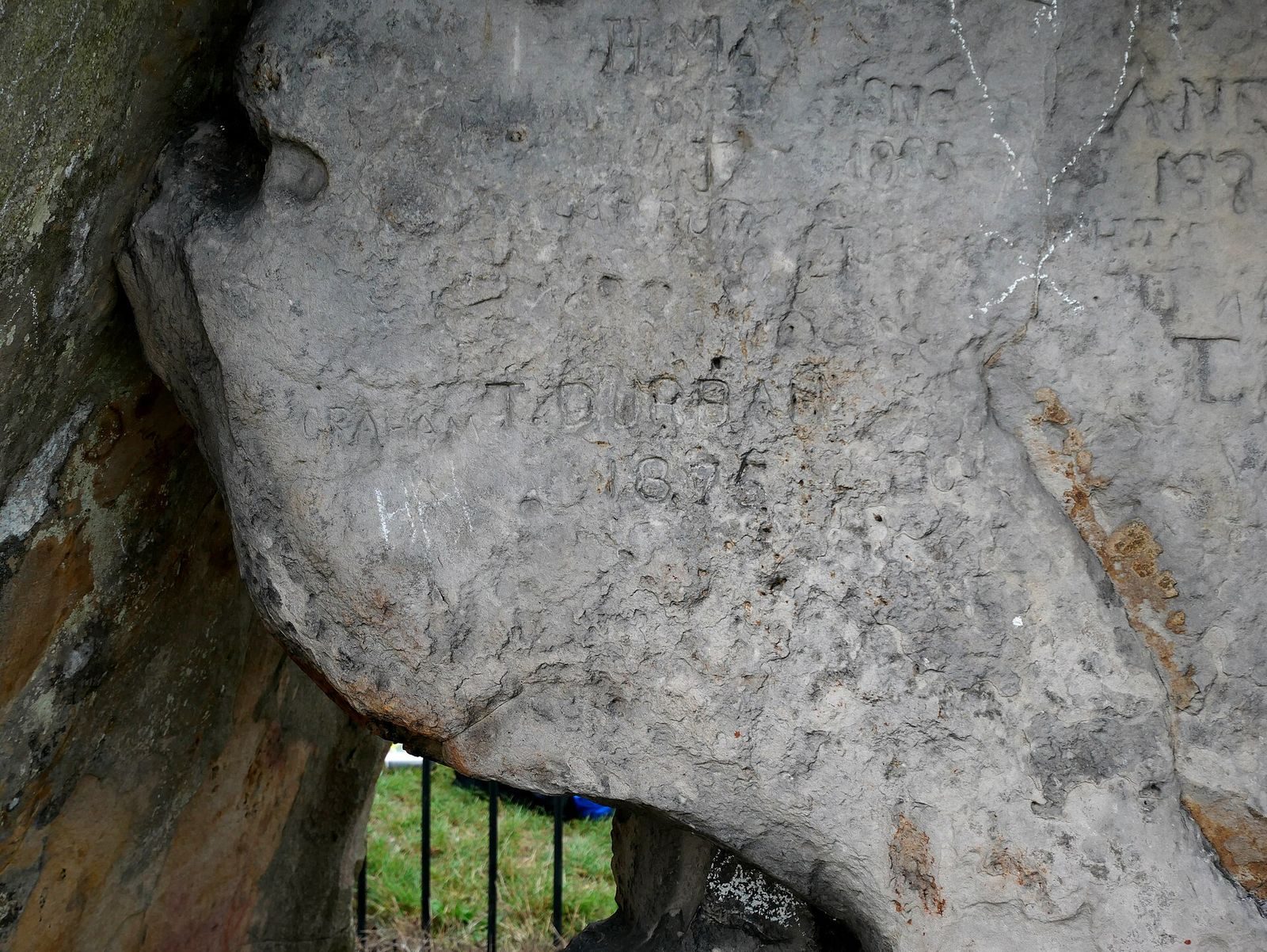
Ploughing and vandalism damaged the monument. The megalith at the western end known as the General’s Tombstone was destroyed in 1867 and may have been part of the barrow; a side stone was taken away in 1947. Farmers also moved exposed stones into nearby woodland, where a heap remained visible into the mid-twentieth century before disappearing. Thomas Wright examined the site in 1854, investigations took place in nearby fields in 1936, and digging at the monument followed in 1956. The Kent Archaeological Rescue Unit surveyed it in January 1981. Research among modern Druids in 2014 found that ceremonies had taken place at the monument. Druidry is a modern Pagan movement drawing on ancient Druid traditions; this activity does not establish an unbroken practice from prehistory.
Remains
The monument’s main features follow an east–west line, with a long, narrow earthen mound and the stone chamber at its eastern end. Its surviving entrance is formed from upright stones supporting a horizontal capstone. This arrangement follows the general plan found among the Medway long barrows, whose chambers were made from large sarsen blocks selected and transported locally.
Setting and mound
Kit’s Coty House stands on Blue Bell Hill, on the eastern side of the River Medway, near Little Kit’s Coty House and the Coffin Stone. It belongs to the eastern cluster of the Medway Megaliths, which also includes Smythe’s Megalith and the White Horse Stone, along with stones that may have belonged to chambered tombs. The group’s western cluster includes Coldrum Long Barrow, Addington Long Barrow, and Chestnuts Long Barrow. The clusters lie along the Medway where it cuts through the North Downs, about 8–10 kilometres apart.
A survey in 1981 measured the mound at about 70 metres long and 1 metre high. Timothy Champion estimated that it may originally have measured about 80 metres in length and 11–15 metres in width. Ploughing has largely flattened the mound and its flanking ditches, though aerial photographs still show them. Dark soil suggests a possible broad ditch on the southern side. In 1956, digging around the southern part of the monument encountered a silted ditch and several stones pressed into the silt during a partial collapse. Kerbstones may have been dragged away or buried beneath the ditches as the mound was reduced.
Stone chamber and finds
The surviving entrance has an H-shaped outline, formed by three upright sarsen stones carrying a horizontal capstone. Sarsen is a hard, naturally occurring sandstone found in Kent; the chamber stones are described as fine-grained crystalline sandstone. The entrance gives an indication of the chamber’s scale, whose interior may once have reached about 3 metres in height. The front part of the chamber has been lost, and a stone façade may have stood beside the entrance.
Worn pottery sherds have been found in the barrow soil. During his 1854 examination, Wright found pottery beneath the stones, while Neolithic pottery was recovered from nearby fields in 1936. In 1897, John Evans recorded finding a probably Neolithic, leaf-shaped arrowhead near the monument. The shared east–west alignment and eastern chamber of the Medway long barrows suggest strong regional cohesion, while differences in their forms, including Kit’s Coty House’s long, narrow mound, may reflect changes and adaptations during their use.