Tell Jemmeh: A Strategic Bronze and Iron Age Settlement in Israel
Site at a Glance
- Rating
- 4.3
- Popularity
- Low
- Country
- Israel
- Primary era
- Bronze Age
- Eras represented
- Stone Age, Bronze Age, Iron Age, Classical, Medieval
- Civilizations
- Assyrian, Byzantine, Canaanite, Egyptian, Philistine, Ptolemaic
- Site type
- City
On this page17 sections
History
Tell Jemmeh is a major ancient settlement near Re’im in southern Israel, on the southern coastal plain near the northwestern Negev. Built and occupied by successive Canaanite, Philistine, Assyrian, and Hellenistic communities, it stood near the Besor River and the meeting point of the Besor and Gerar streams. Its history extends from the fourth millennium BCE to the beginning of the second century BCE, when the mound was finally deserted.
Early settlement and the Bronze Age
The first settlement was established by hunter-farmers during the Chalcolithic period, the Copper Age transitional between the Neolithic and Bronze Ages. This community remained for about two centuries before the site was abandoned for more than a millennium. Tell Jemmeh was resettled around 1800 BCE, during Middle Bronze Age II, and occupation then continued through the Middle and Late Bronze Ages, the Iron Age, the Assyrian period, and the Hellenistic period.
During Late Bronze Age II, when Egypt controlled Canaan, Tell Jemmeh reached its greatest importance. The settlement is generally identified with Yursa, a Canaanite city named in Egyptian records and in the Amarna Letters, diplomatic and administrative texts written mainly in Akkadian cuneiform during the reign of the Egyptian pharaoh Akhenaten. Egyptian records list Yursa among the cities conquered by Thutmose III during his campaign against a Canaanite revolt around 1468 BCE. The city is described as having rebelled against Egyptian rule.
Yursa appears again in two Amarna Letters dated approximately 1350 to 1330 BCE. Its ruler, Pu-Ba’lu, corresponded with the Egyptian king, and the city occupied an important position on the route linking Egypt with the Fertile Crescent. Benjamin Mazar proposed that Tell Jemmeh was also Yarda, mentioned by Josephus, and Orda, known from Byzantine-period documents. The identification with Yursa is now generally accepted. Its strategic position and petrographic analysis linking two letters from Pu-Ba’lu to the region support that conclusion.
The site was initially identified with biblical Gerar by W. J. Phythian-Adams, who investigated it in 1922. Flinders Petrie accepted that interpretation after excavating there in 1926 and 1927, but Mazar later challenged it.
Philistine and Iron Age occupation
The Philistines conquered Tell Jemmeh around 1175 BCE. The settlement seems to have become dependent on Gaza, one of the major Philistine cities, and Philistine occupation continued through the twelfth and eleventh centuries BCE. During the Iron Age, communities occupied the site from the tenth through the eighth centuries BCE and built at least two successive systems of fortifications.
In the seventh century BCE, the region came under the control of the Neo-Assyrian Empire, which ruled large parts of the Near East. Tell Jemmeh is identified with Arsa, a city mentioned in Neo-Assyrian inscriptions. Esarhaddon, the Assyrian king, is said to have captured Arsa in 679 BCE and deported its king, Asuhili, to Nineveh. A military camp was probably established at Tell Jemmeh to defend the Assyrian frontier and to support campaigns against Egypt in 674, 671, and 669 BCE.
Assyrian control continued after Esarhaddon’s death, during the reign of his successor Ashurbanipal. The principal Assyrian building was probably abandoned when Assyria withdrew from the region rather than destroyed in an attack.
Hellenistic and later history
At the beginning of the Hellenistic period, the Ptolemaic Kingdom controlled the region. The Ptolemies were the dynasty founded by Ptolemy I, the Macedonian general who took control of Egypt after Alexander the Great’s death. Tell Jemmeh became a major center for storing grain, while settlement spread into areas around the mound. The tell itself was deserted at the beginning of the second century BCE.
Later occupation was concentrated in a lower settlement south of the mound. Byzantine-period remains were found south and east of Tell Jemmeh, while the surrounding area was inhabited by the Bedouin tribe of Arab al-Jubarat during the Ottoman period. In late 1516, during the Ottoman-Mamluk war, Ottoman cavalry defeated Mamluk forces in a battle at Khan Yunis near Tell Jemmeh.
Archaeological investigation
Phythian-Adams made the first investigation in 1922, and Petrie excavated a large part of the western area in 1926 and 1927. A Smithsonian Institution expedition directed by Gus W. Van Beek worked at the site during nine seasons from 1970 to 1978 and returned four times between 1982 and 1990. The excavations produced evidence supporting the identification with Yursa and with Arsa, and recovered four seventh-century BCE ostraca, fragments of pottery bearing short written texts.
Remains
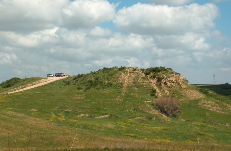
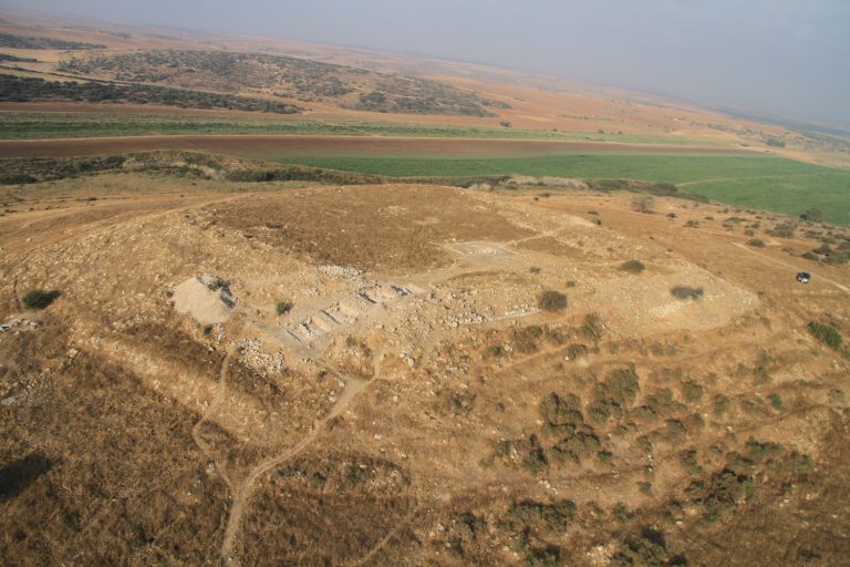
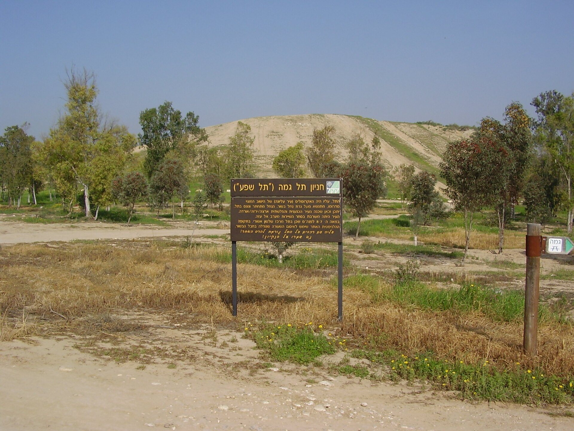
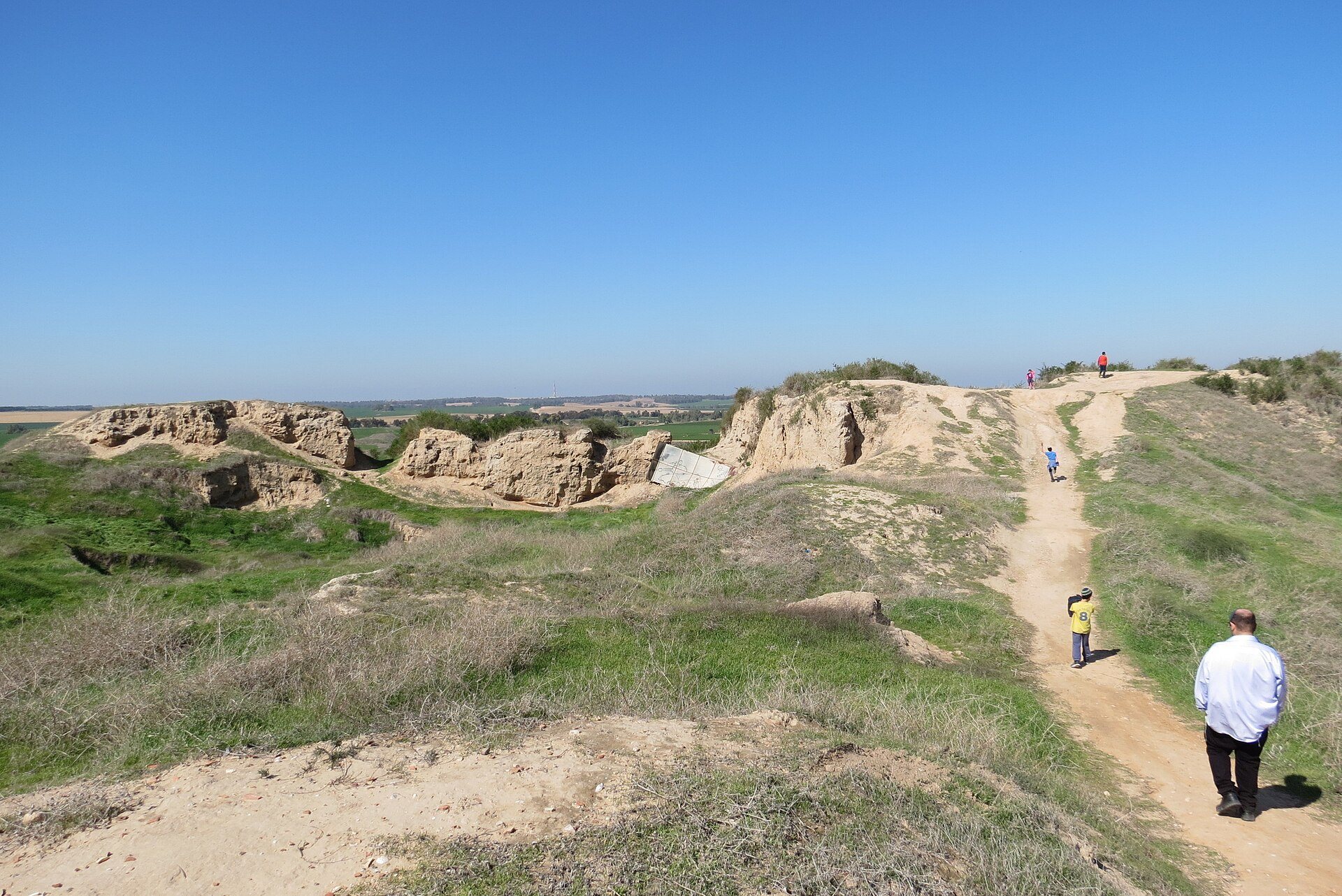
Tell Jemmeh is an artificial mound formed by successive settlements, standing above agricultural plains on the southern bank of the Besor River. It covers about 43 dunams, approximately 12 acres. The mound is described as about 23 meters high, while the natural hill has also been reported as roughly 45 meters high with around 18 meters of accumulated cultural layers. Most of the construction used sun-dried mudbrick, and the mound survives in a ruined condition.
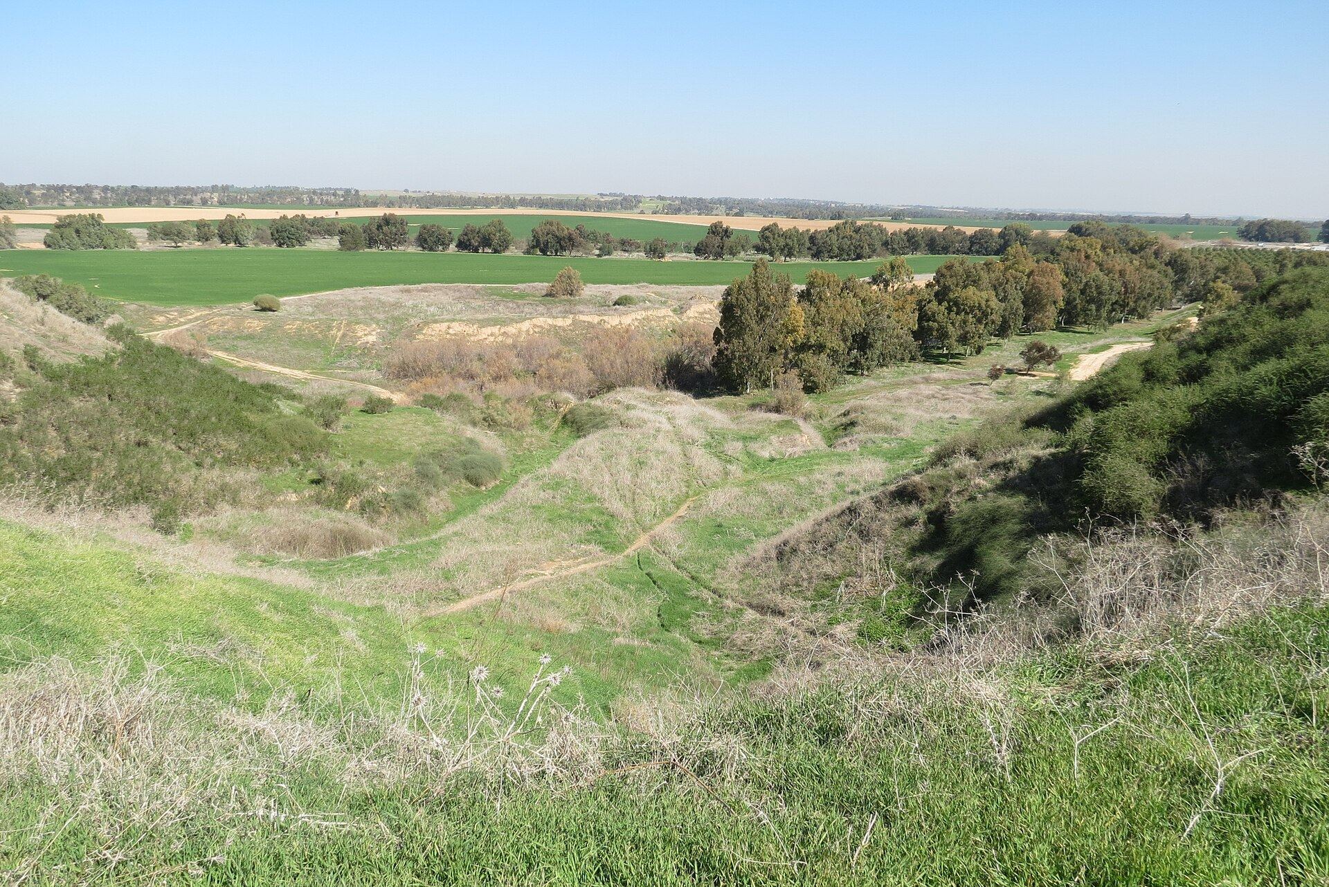
The river has repeatedly changed course, and flooding on the northern side continues to erode the mound. The local loess, a fine wind-deposited sediment vulnerable to flooding, intensifies this erosion. The inhabitants probably relied on spring water from the nearby Besor stream. Tell Jemmeh forms one of three major archaeological sites along the Besor Stream, together with Tell el-Far’ah and Tell el-Ajjul. The sites are about 10 kilometers apart and could communicate by signal fires, an arrangement interpreted as evidence that the area formed a border zone.
Chalcolithic and Middle Bronze Age remains
Early settlement features
The Chalcolithic settlement left a series of pits cut into undisturbed soil. These have been interpreted as possible huts or storage facilities. Associated pottery belongs to the Beersheba culture, a Chalcolithic archaeological tradition identified in the northern Negev and nearby regions.
Middle Bronze Age structures and finds
Three construction phases belong to the Middle Bronze Age. Finds from this period include a bull-headed zoomorphic vessel in the Tel el-Yahudiyeh tradition, a Middle Bronze Age ceramic style known for distinctive animal-shaped vessels, along with Cypriot vessels and a small cylinder seal bearing cuneiform. Two equid burials were also found. One animal was identified from its teeth as a donkey, while the other was too young for identification by species. The site is reported as the first in the country where donkey burials were found.
Late Bronze Age and Philistine remains
Late Bronze Age buildings
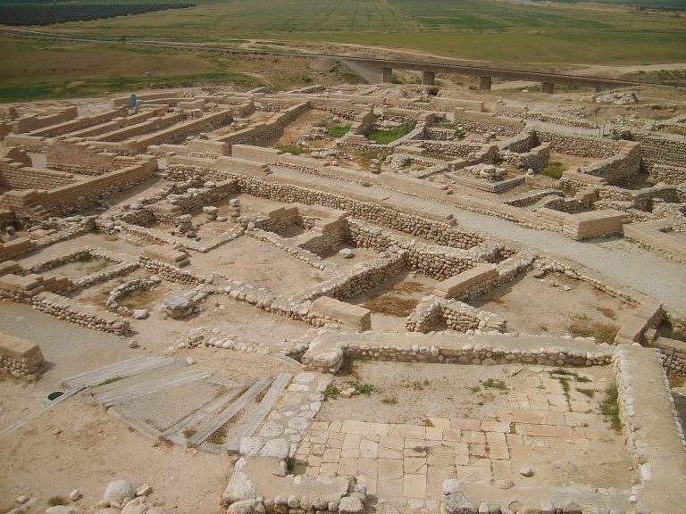
Late Bronze Age II remains comprise eight construction phases and represent the settlement’s largest occupation. A large thirteenth-century BCE building, probably a palace, consisted of a courtyard and adjoining rooms. The courtyard contained a bath lined with plaster and had a plastered floor. A drain carried water from the bath to an external sewage pit.
Other Late Bronze Age finds include locally made pottery, fragments decorated with deer and birds, and three scarabs. These small amuletic or seal objects bear the name or emblem of a king who worshipped the Egyptian god Ptah. The remains of an Egyptian governor’s residence were found at the foot of the tell.
Philistine workshops
The Philistine settlement included groups of rooms and a large pottery kiln. The kiln is the only Philistine pottery kiln found in Israel and contained numerous Philistine pottery fragments. Its size and construction indicate advanced technology for the period.
Iron Age fortifications
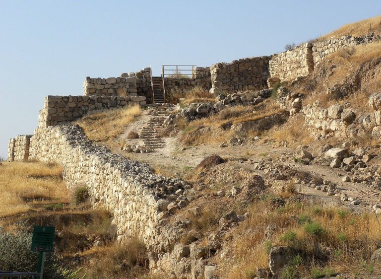
Four-room houses were built mainly on the western side of the site during the tenth to eighth centuries BCE. At least two fortification systems belong to this period. The better-preserved eighth-century wall is a casemate wall, a defensive structure made from two parallel walls joined by cross-walls that create enclosed chambers within its thickness.
Assyrian administrative building
A large Assyrian building dates approximately from 679 to 630 BCE. Its roof used a self-supporting mudbrick arch. The preserved structure measures about 12.5 by 10 meters, although its original length is unknown because earlier excavation and erosion removed part of it. At least six rooms survived, including three long, large rooms and three short, smaller ones, all with paved floors.
The building follows an Assyrian Reception Suite Type F plan and has been interpreted as the residence of a military governor or general. The Assyrians constructed a new casemate wall over the destroyed eighth-century wall. Finds from the building include a deposit of palace ceramics, a silver earring with an ivory setting, and other objects from the Assyrian period.
Hellenistic and Byzantine remains
Hellenistic structures and storage
Hellenistic remains include a large building and a substantial fortress. Imported Greek pottery helped establish the date of this phase. Grain-storage installations belonged to the Ptolemaic period, when the principal settlement shifted from the mound into the surrounding areas.
Byzantine settlement south and east of the mound
Excavations south and east of the tell uncovered Byzantine structural remains, a water reservoir, a tabun, or traditional domed oven, and vessels including jars, bowls, and cooking pots. These remains belong to the later settlement that developed around the mound after the tell itself had ceased to be occupied.