Crow Canyon Archaeological District: Navajo Pueblitos and Rock Art in New Mexico
Site at a Glance
- Rating
- 4.6
- Popularity
- Very Low
- Country
- United States
- Primary era
- Early Modern
- External website
- Open
- Eras represented
- Early Modern
- Civilizations
- Unclassified
- Site type
- Military
- Remains
- Fort
On this page10 sections
History
Crow Canyon Archaeological District is an archaeological landscape in New Mexico, United States, within Dinétah, the traditional homeland of the Navajo people. Covering approximately 3,200 acres (1,300 hectares) in Rio Arriba and San Juan counties, it preserves evidence of Ancient Pueblo occupation and later Navajo habitation, including the Dinétah phase (AD 1500–1630) and the Gobernador phase (AD 1650–1777).
Ancient Pueblo and Navajo occupation
Earlier Ancient Pueblo communities used the canyon before later Navajo settlement. Ancient Pueblo peoples were ancestral communities associated with archaeological traditions whose descendants include the modern Pueblo peoples of New Mexico and Arizona. During the local culture’s period of florescence, approximately 5,000 people lived in the canyon. Later occupation belonged to Navajo communities and included habitation associated with the Dinétah and Gobernador phases.
Defensive use in the eighteenth century
During the eighteenth century, Navajo communities built small defensive structures known as pueblitos. The Spanish word means “little village,” but in Dinétah it refers to a small stone-and-earth refuge, often placed on a boulder, mesa, or protected canyon position. Crow Canyon’s pueblito formed part of a wider network of defensive and communication sites. Its elevated setting allowed communities to warn one another of approaching raids.
The pueblitos developed amid conflict involving the Navajo, Utes, and Spanish colonial forces. The Pueblo Revolt of 1680 was an uprising by Pueblo communities against Spanish colonial rule in New Mexico. After Spain reestablished control in 1692, some Pueblo groups moved from the Rio Grande Valley into areas occupied by the Navajo. The pueblitos also provided refuge for people fleeing Spanish colonial oppression.
Crow Canyon pueblito was inhabited on or about AD 1723. Tree-ring dating of its construction wood identified pinyon and juniper from the surrounding area, but did not establish a conclusive construction date. Regional research associates masonry pueblitos with the period of Ute attacks, while the archaeological evidence does not correspond neatly to chronologies based on Puebloan immigration or the Spanish Conquest.
Defensive use continued until approximately 1780. Attacks and a prolonged drought then forced the Navajo to abandon these sites and retreat farther south and west.
Research and preservation
Archaeological research has included extensive tree-ring analysis, including regional work by Ronald Towner and a study published in 1997. Crow Canyon Archaeological Center, established in 1983, is associated with archaeological research in the area. The district became a New Mexico State Register of Cultural Properties site in 1973 and was added to the National Register of Historic Places in 1974.
Remains
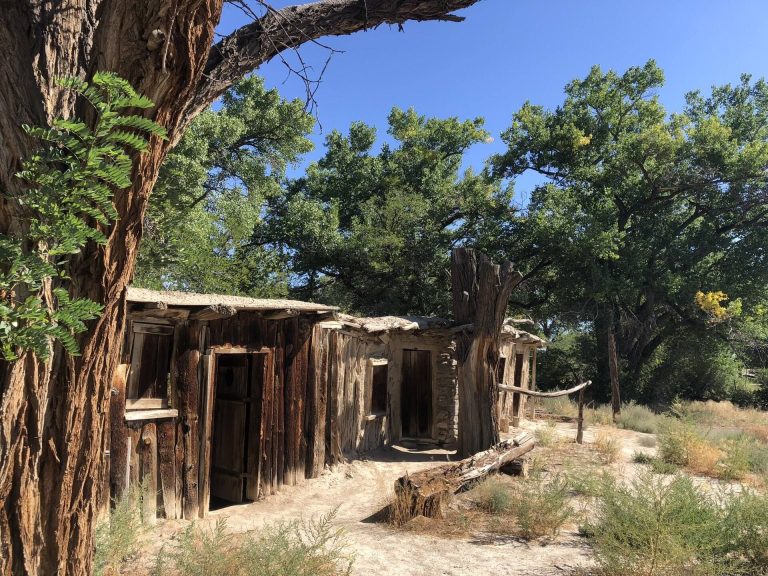
Crow Canyon is a remote, semiarid landscape of low desert terrain, high sandstone cliffs, deep canyons, mesas, and irregular formations shaped by wind and water erosion. The surviving remains include rock art, a defensive pueblito, domestic and storage features, pottery, stone artifacts, and evidence connected with earlier Ancient Pueblo settlement.
Rock art
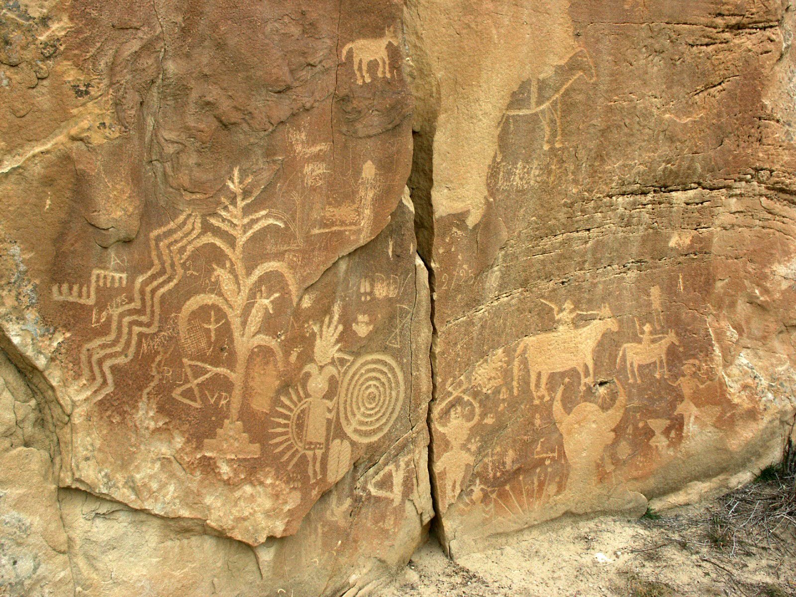
The south-facing canyon wall contains 44 rock-art panels with clusters of hundreds of petroglyphs. The panels include earlier Ancient Pueblo imagery and Navajo images dating from the sixteenth, seventeenth, and eighteenth centuries. Their subjects include animals, plants, corn, bows and arrows, spears, warriors, hunting scenes, supernatural beings, and scenes interpreted as representations of everyday Navajo life, creation traditions, and religious or ceremonial practices.
Some images are interpreted as male shamans or deities. One figure has feathers on its back, horns, and a staff, while another wears a headdress and carries a bow and rattle. A further figure, rendered in a geometric Navajo style, is interpreted as a female deity. Buffalo and elk pierced by arrows express hunting themes, while corn stalks rising from rain clouds emphasize the importance of corn. The imagery has been compared with Navajo ceremonial sand paintings.
The carvings appear to have been made with stone, bone, wood, or possibly knives and other sharp metal tools. Analysis of paint residues indicates the use of locally available mineral and plant materials. The petroglyphs have retained their integrity despite environmental conditions in the canyon and the effects of tourism.
Defensive and domestic structures
Crow Canyon pueblito
Crow Canyon pueblito stands below the canyon’s south ridge. It consisted of four rooms and a detached room positioned on top of a large boulder for defense and observation. The ruin is slightly more than six feet high, with very steep sides that strengthened its defensive character. Its west wall has completely collapsed, while partial wall remains survive at ground level.
Hogans, sweat lodges, and storage areas
Other remains include roof beams, eight forked-pole hogans, two sweat lodges, and several areas used for grain storage. A hogan is a traditional Navajo dwelling or associated structure, commonly formed from a timber framework with an earthen covering. These features provide physical evidence of habitation and daily activity around the defensive structure.
Pottery and earlier settlement remains
Pottery assemblages and worked-stone artifacts include Dinétah gray, Gobernador polychrome, Acoma Red, and Jemez Black-on-white wares. Acoma Red and Jemez Black-on-white indicate cultural and artistic contributions from other Pueblo communities.
Remains associated with earlier Ancient Pueblo settlements also occur in the area. Analysis of satellite imagery has been interpreted as revealing remnants of a road network attributed to these communities. The roads are described as approximately 9 meters wide and extending for distances of up to 300 kilometers, linking settlements across a region of about 600 kilometers along the line of the 108th meridian.