San Andrés, El Salvador: Maya Capital of the Zapotitán Valley
Site at a Glance
- Rating
- 4.5
- Popularity
- Medium
- Country
- El Salvador
- Primary era
- Medieval
- Eras represented
- Iron Age, Classical, Medieval, Early Modern
- Civilizations
- Maya, Spanish
- Site type
- City
On this page16 sections
History
San Andrés is a pre-Columbian Maya archaeological site and former Maya capital in the Zapotitán Valley of El Salvador, near Opico. Its securely described occupation extends from the Middle Preclassic period, around 900–400 BC, through the Early Postclassic period, around AD 900–1200. During its height in the Late Classic period, around AD 600–900, the settlement was the political, economic, and religious center of the valley, with strong connections to Copán, a major Maya center in present-day western Honduras.
Early settlement and the Preclassic period
Occupation at San Andrés began around 900 BC, probably as an agricultural settlement. Activity may have started even earlier, during the Early Preclassic period, but the clearest early phase belongs to the Middle Preclassic period. In the Late Preclassic period, San Andrés remained an agricultural village without monumental architecture. Cultivation fields from this period have been identified, while El Cambio was probably the principal center of the Zapotitán Valley.
The settlement’s location placed it within a broad former lake basin between Lake Coatepeque and the San Salvador volcano. The valley covered approximately 540 square kilometers and included other settlements such as Joya de Cerén, Chanmico, El Chahüite, Nuevo Lourdes Poniente, and Chuchucato. San Andrés lay between the Sucio and Agua Caliente Rivers, while the former Lake Zapotitán, an important water source before it was drained, was about 6 kilometers away.
Volcanic eruptions and renewed construction
Activity at San Andrés declined during the Early Classic period, around AD 200–600. The settlement was affected by the Tierra Blanca Joven eruption of the Ilopango caldera, a large volcanic depression formed by a major eruption, probably between AD 420 and 540. The resulting tephra, or airborne volcanic ash and fragmented volcanic material, varies across the site from absent to approximately 0.52 meters thick. Occupation resumed within probably a few decades, and earlier ceramic traditions continued after the eruption.
Between the Ilopango eruption and the later Loma Caldera eruption, builders used several construction methods. These included compacted earth and ash, rammed earth, stone revetments, and earth cores covered with stone or plaster. The use of earth cores faced with stone was unusual in western and central El Salvador and may reflect influence from Copán or Quelepa.
The Loma Caldera eruption, dated approximately to AD 660, buried the settlement of Joya de Cerén. At San Andrés, the period that followed brought large-scale monumental construction. The Acropolis and the principal buildings of the North Plaza were built or expanded during the Late Classic period, around AD 600–900. This transformation made San Andrés the dominant center of the Zapotitán Valley.
Late Classic political center
During the Late Classic period, San Andrés exercised political, economic, and religious authority over the valley’s other settlements. The valley may have supported between 40,000 and 100,000 inhabitants. Connections with Copán, the Guatemalan Highlands, Petén, and Belize are reflected in architecture, ceramics, and exchange networks that also extended toward eastern El Salvador.
The construction of the Acropolis involved ritual deposits and probable sacrifices. Finds from excavations in the early 1940s included human sacrifices, ceramic vessels, censers, and carved sculptures representing two serpents, a parrot, a frog, and a human figure. These practices helped express local identities, formalize social distinctions, and concentrate political authority at the center.
San Andrés’ political importance declined toward the end of the Late Classic period. The site probably collapsed and was abandoned during the ninth century, in the wider period of political change known as the Maya collapse. The Acropolis may have been burned during this process. The El Boquerón eruption, dated approximately to AD 1000, later covered the abandoned settlement with ash. Erosion beneath the ash indicates that the main structures had already stood abandoned for some time, so the eruption was probably not the original cause of abandonment.
Early Postclassic reoccupation
San Andrés was briefly reoccupied as a residential settlement between approximately AD 900 and 1200. The new occupants probably came from areas in present-day Mexico and may have been associated with Nahua populations. They repaired portions of the Acropolis and Structure 5 with talpetate blocks, a local term for cut volcanic tuff, and built Structure 11.
The material culture of this reoccupation belongs to the Guazapa phase, an Early Postclassic cultural phase associated particularly with Cihuatán and Las Marías. It includes Banderas polychrome pottery related to the Mixteca-Puebla tradition, a widespread Mesoamerican artistic and ceramic tradition known for painted vessels and ritual imagery. By the end of the Early Postclassic period, probably in the thirteenth century, San Andrés was completely abandoned. This took place as Cihuatán and Las Marías were attacked and burned, further Nahua migrations occurred, and the Lordship of Cuzcatlán began to form.
Colonial hacienda and archaeological investigation
After the Spanish conquest, the ruins became part of a colonial hacienda devoted to cattle raising and indigo production. The hacienda acquired the name San Andrés, which became the modern name of the archaeological site. Its indigo-processing works were buried by the 1658 eruption of El Playón and preserved almost intact. The hacienda was offered for sale in June 1855 by its owner, Cruz Rodríguez of Santa Ana.
On June 19, 1885, the San Andrés Agreement was signed at the hacienda. It ended the war between the army led by General Francisco Menéndez and the government headed at that time by José Rosales.
The first archaeological investigations took place in 1940, when John Dimick worked at the site with Stanley Boggs among his assistants. Later research focused mainly on the monumental center, while the residential area received less attention. Jorge Mejía, working under Stanley Boggs, exposed a trench in front of Structure 3 in 1978. Paul Amaroli reexamined it with tunneling methods in 2007. Research led by Óscar Camacho in the 2010s clarified the Acropolis’ construction systems, while investigations directed by Akira Ichikawa in the late 2010s examined Structure 5 and related building sequences.
San Andrés and other pre-Columbian sites were declared National Archaeological Monuments under Legislative Decree No. 508 of May 6, 1976. The Government of El Salvador inaugurated the San Andrés Archaeological Park in 1996. The park incorporates the monumental center, the colonial indigo works, and a site museum.
Remains
The archaeological site covers approximately 3 square kilometers, while the associated area including smaller surrounding sites has been estimated at about 10 square kilometers. Its monumental center contains 17 structures arranged in two principal zones, the Acropolis, corresponding to the former South Plaza, and the North Plaza, also called the Great Plaza. Most final construction phases used molded adobe blocks covered with a cement-like mortar and finished with three layers of plaster made from mud, earth, lime, crushed rock, and volcanic gravel or black pumice.
The residential area is estimated to have contained approximately 1,200 structures. The surviving evidence indicates that these buildings had varied functions, including houses, kitchens, storage buildings, and communal structures. Cultivation and looting have severely damaged many of them, while investigations have concentrated more heavily on the monumental center.
The Acropolis
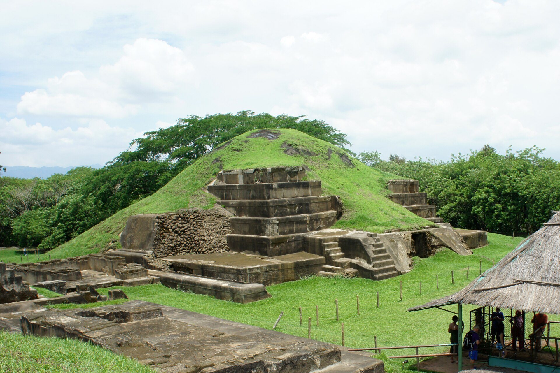
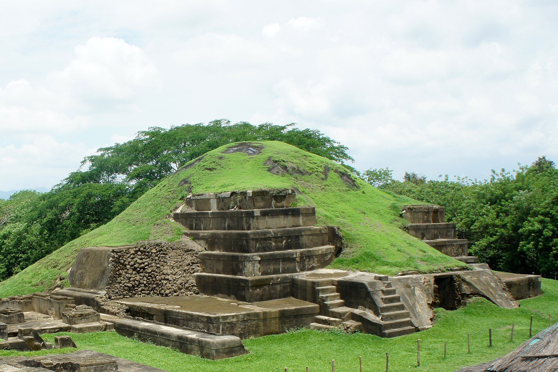
The Acropolis was built over an earlier open plaza after occupation resumed following the Ilopango eruption. Its construction required an estimated 500,000–600,000 molded adobe blocks. Their varying sizes suggest that they were produced in different locations, and some may have been obtained as tribute from communities subject to San Andrés. Builders laid the blocks in courses with several centimeters of mud mortar to compensate for differences in size.
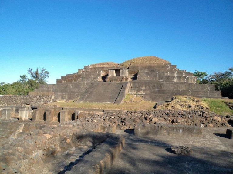
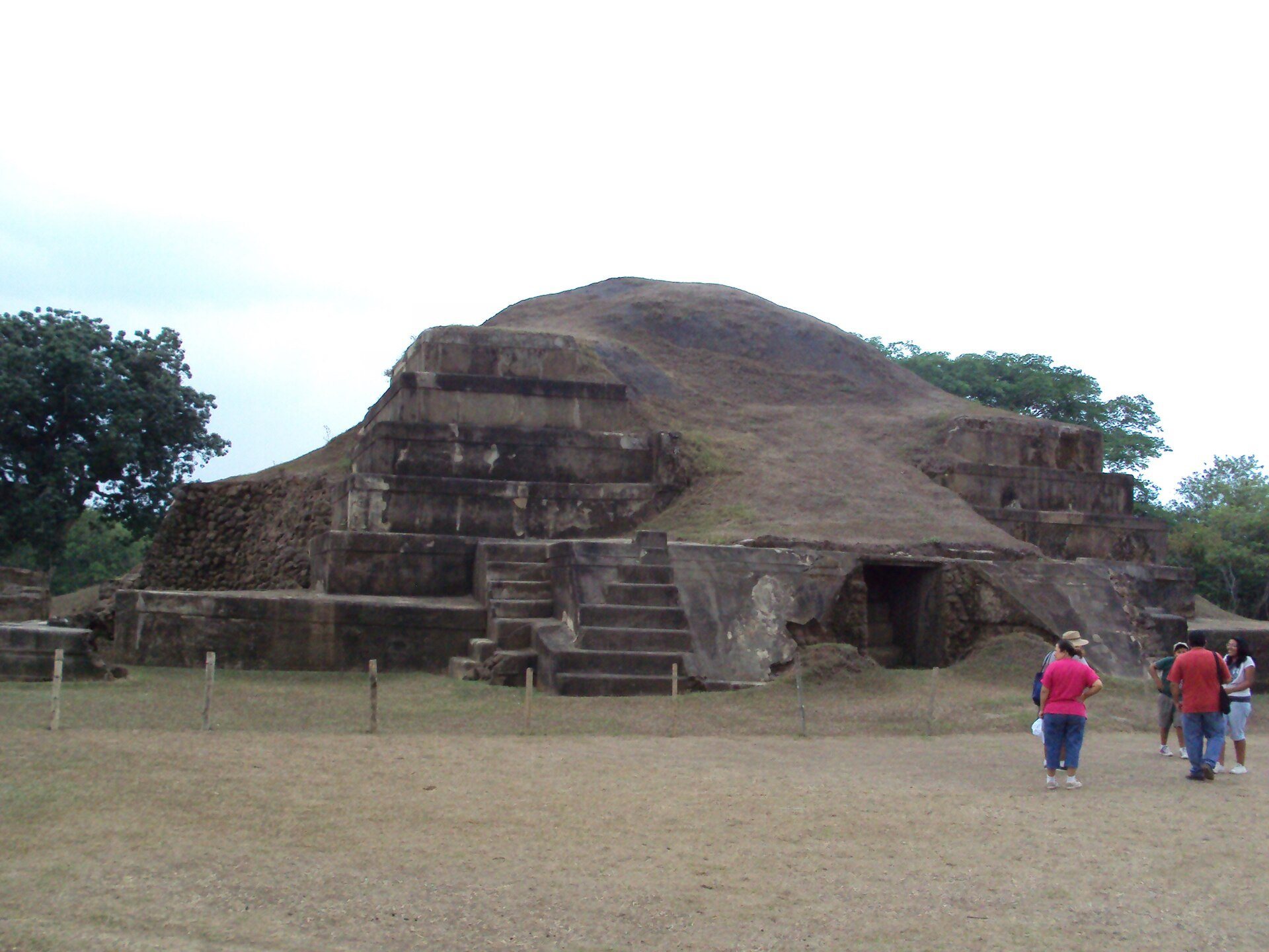
The elevated, restricted complex measures approximately 100 square meters and rises 4 meters above its surrounding level. It contained the principal ceremonial and political buildings of the site. Four successive construction systems have been identified. The earliest, dating between the Ilopango and Loma Caldera eruptions, used earth cores covered with stone or mortar. Later systems used adobe cores with mortar plaster, while Structure 7 employed an earth core faced with cut volcanic tuff.
Structures 1 through 4
Structure 1, the principal pyramid, stands at the southern end of the Acropolis and rises approximately 17 meters above its base. Structures 2, 3, and 4 form a line along its eastern side. Each pyramid probably supported a temple. The buildings passed through four detected construction stages and generally had prominent cornices that appear to have been double cornices. Structure 1 also carried modeled decoration consisting of bands of circles.
Structures 1B and 2B are attached buildings between the eastern pyramids. Their earth construction was faced with cut tuff blocks. They may have served as temples, shrines, or residences for priests. A trench in front of Structure 3 exposed the depth of the original plaza and preserved the building’s original stairway within the adobe fill. The trench also produced the skull of a high-status male whose forehead had been intentionally reshaped and whose teeth contained inlays. He was probably captured during a conflict and sacrificed.
Structures 13 through 17
A lower extension behind Structures 2, 3, and 4 contains Structure 13, a small ceremonial building with three construction stages. It is asymmetrical along its east-west axis, standing slightly higher on the west, and may have been leveled to connect with Structure 3.
Structures 16 and 17 form an L-shaped group of rooms along the northern and western sides of the Acropolis. Known as the residential chambers, they probably served as residences and meeting rooms for the rulers and represent the last palaces of San Andrés. Two of these palaces have been reconstructed.
Structures 14 and 15 are small buildings near the center of the Acropolis. They probably served as a house and a kitchen during the Early Postclassic period, after the site’s collapse and the departure of the earlier elite from the Acropolis.
Structure 7
Structure 7 lies south of the Acropolis and is a ceremonial building with two construction stages. Both stages were faced with carved tuff, or talpetate, making it one of the few entirely stone-built structures at San Andrés. Its form is also distinctive because it lacks the upper molding found on other buildings and resembles stepped structures at Copán. These features provide architectural evidence for Copán’s influence in the region.
An offering placed in Structure 7 contained an eccentric flint, a deliberately shaped ceremonial stone object, probably from present-day Belize; a vessel belonging to the Petén Pulido ceramic group from present-day Petén or Belize; a stingray spine associated with autosacrifice, the ritual drawing of an individual’s blood; Spondylus princeps shells, valued in ancient Mesoamerica for ritual and elite use; and other materials. The deposit follows patterns associated with Maya elite offerings and connects the building with Maya religious practices.
The North Plaza
The North Plaza, or Great Plaza, measures approximately 124 meters from east to west and 105 meters from north to south. Its floor consists of about 3 centimeters of mortar and slopes northward, probably to manage rainwater drainage. The plaza is considered to have functioned as a marketplace. Four elongated buildings, Structures 6, 8, 9, and 10, occupy the plaza. They measure approximately 30–50 meters in length, 10–15 meters in width, and 3 meters in height, and may have served as elite residences.
Structure 5, La Campana
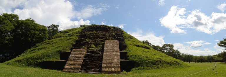
Structure 5 bounds the North Plaza on the north. It is the site’s tallest and one of its oldest buildings. Its unfinished excavated form resembles a bell, giving it the name La Campana, or “the Bell.” The main facade faces west, and a temple probably once stood at the summit.
The complex consists of a large platform, a stepped pyramid, and a smaller building called Structure 5A. The platform and pyramid have vertical wall bodies with cornices. Built mainly from molded adobe blocks and mortar plaster, the final complex reached approximately 20 meters in total height. The platform measures about 77 meters from north to south, 67 meters from east to west, and 7 meters high. It has two construction stages using adobe blocks and mortar. Earlier interpretations proposed two western stairways, but later research indicates that the platform probably had a single stairway on its southern side.
The pyramid above the platform measures approximately 35 meters from north to south, 40 meters from east to west, and 13 meters high. It has a western stairway and at least three construction stages. During the Late Classic period, it was the largest structure in the Zapotitán Valley. Four successive construction systems have been identified in Structure 5: compacted earth and ash, rammed earth, an earth-and-ash core faced with cut stone, and an adobe core covered with mortar plaster. The earliest system formed the oldest known monumental structure at San Andrés.
The molded adobe blocks in the final complex vary from approximately 46–69 centimeters long, 23–36 centimeters wide, and 12–15 centimeters high. After the El Boquerón eruption, builders placed cut-stone blocks at the pyramid’s southwest corner, probably as an Early Postclassic repair.
Structure 6
Structure 6 stands on the southeastern side of the North Plaza and has attached elements connecting it with Structure 5 and the Acropolis. It measures approximately 50 meters long, 15 meters wide, and 3 meters high. Five stepped bodies form its sides, each approximately 0.5–0.7 meters high. Their terraces are generally 0.5–0.6 meters wide, while the uppermost terrace is about 0.9 meters wide and may have served as a walkway along the summit.
At least four rectangular rooms stood on the summit. Their lengths range from approximately 4.7–8.3 meters and their widths from 1.8–2.2 meters. Their entrances faced the plaza, indicating the principal facade. Structure 6 passed through two construction stages. The first used adobe walls with mud plaster treated by direct heat, while the final stage employed adobe walls covered with mortar plaster.
Structures 11 and 12
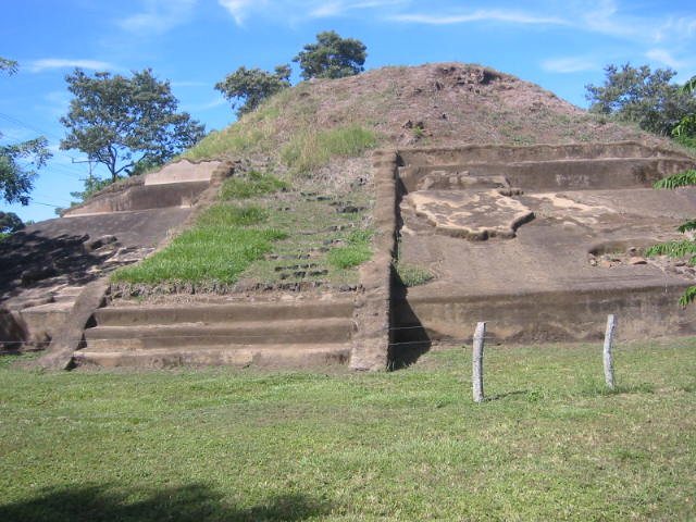
Structures 11 and 12 lie west of Structure 5 and are also known as Mound B and Mound A. Structure 11 measures approximately 25 by 15 meters and stands at least 1.40 meters high. Built with volcanic tuff, or talpetate, it dates to the Early Postclassic period because it rises above ash from the approximately AD 1000 El Boquerón eruption. Its construction belongs to the later residential reoccupation of San Andrés.
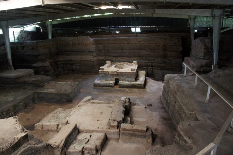
Colonial indigo works
The colonial indigo-processing works associated with San Andrés were preserved beneath deposits from the 1658 El Playón eruption. The excavated production area forms part of the archaeological park alongside the monumental center and site museum, linking the surviving Maya remains with the later colonial use of the landscape.