Shivta: An Ancient Nabataean and Byzantine Settlement in Israel
Site at a Glance
- Rating
- 4.7
- Popularity
- Low
- Country
- Israel
- Primary era
- Medieval
- External website
- Open
- Eras represented
- Classical, Medieval
- Civilizations
- Byzantine, Nabataean
- Site type
- City
On this page20 sections
History
Shivta is an ancient Nabataean and Byzantine settlement in the Negev Desert of Israel, founded probably during the 1st century AD and developed chiefly during the Byzantine period. Nabataeans, an ancient Arabian-speaking kingdom known for desert agriculture and water management, were present in the area by the 1st century BC. Shivta formed part of the desert network associated with the Incense Route, although its economy relied mainly on farming rather than long-distance commerce.
Nabataean beginnings
The foundation of Shivta has been placed either late in the reign of the Nabataean king Obodas III, who ruled from 30 to 9 BC, or during the reign of his son Aretas IV, who ruled from 9 BC to AD 40. The earliest exposed buildings date from the 1st century, but the extent of the settlement during its first four centuries remains uncertain. The town was also known as Sobata and Subeita. Two papyri from nearby Nessana preserve the names As-Subajta and Sobata, while the modern Hebrew name Shivta was adopted in the early 1950s.
Shivta was not located beside a major caravan route. Its growth instead depended on agriculture, animal husbandry, and horse breeding. Farmers cultivated grapes, figs, olives, legumes, dates, pomegranates, apricots, nuts, barley, wheat, and carob. During the 4th and 5th centuries, agricultural expansion encouraged population growth and the creation of new districts. The settlement gradually took on an agricultural and monastic character, with churches serving religious, public, administrative, and economic purposes as well as receiving pilgrims.
Byzantine development
The Byzantine period refers here to the era when the eastern Roman Empire governed the region, especially from the 4th to the 7th centuries. Shivta reached its greatest development in the 6th century, during the reign of Justinian I. Its three churches belonged to a Christian settlement whose prosperity rested on managed water supplies and intensive cultivation. The first Byzantine settlement may have been established late in the 5th century, although the chronology of the town’s earliest Byzantine phase remains debated.
The agricultural landscape extended beyond the town. The Lavan valley provided about 500 hectares of farmland, while channels, dams, terraces, and irrigation works collected runoff from a catchment exceeding 197 square kilometres. These installations allowed farming in a region without natural springs. Shivta’s position within the Negev desert network therefore depended on the coordinated use of rainfall, storage facilities, and cultivated land rather than on a nearby permanent watercourse.
Islamic-period occupation and decline
Muslim rule began at Shivta around AD 636–638, after the Arab conquest of the region. A small Muslim community lived alongside the Christian population and built a mosque beside the southern church. The mosque did not substantially damage the basilica, although its prayer niche blocked the church’s former northern entrance. It is the only known surviving structure associated with Shivta’s Islamic-period occupation.
Shivta declined after the conquest and was probably abandoned during the 8th or 9th century. Later activity included an Armenian graffito in the southern church, dated by its letter forms to the 9th–11th centuries, and a 9th-century Kufic inscription on the northern church complex. Kufic was an early angular style of Arabic writing. The settlement subsequently remained in ruins.
Rediscovery and archaeological study
Ulrich Jasper Seetzen visited Shivta in 1805 but identified it incorrectly as Avdat. Edward H. Palmer examined the ruins on 17 February 1870 and associated them incorrectly with the biblical site of Zephath, or Hormah. Alois Musil visited in 1901. In 1905, a team from the École Biblique et Archéologique Française de Jérusalem identified a Byzantine cemetery, tombs with inscriptions from the late 4th century, and an inscription from the reign of Aretas IV.
C. Leonard Woolley and T. E. Lawrence surveyed Shivta in January 1914, producing a town plan and drawings of its churches and houses. Aerial photographs taken in 1916 broadly confirmed their plan. Archaeological work by Harris Dunscombe Colt and teams connected with New York University and the British School of Archaeology in Jerusalem continued during the 1930s until 1938. A fire at the expedition house destroyed records, equipment, archaeological decoration, and many finds, while Colt’s results were never published. The excavation record was consequently seriously compromised.
The site was cleared and made more accessible between 1958 and 1960 under Israel’s nature and national-parks authorities, in work associated with Michael Avi-Yonah. Later research examined the churches, architecture, agricultural economy, ecology, mapping, and water-management system. Artur Segal carried out limited excavations from 1979 to 1982, Josef Szereszewski investigated the northern church in 1985, and Tsvika Tsuk conducted a detailed study of the water system in 2000 and 2001. Shivta became part of the UNESCO World Heritage property “Incense Route, Desert Cities in the Negev” in 2005, together with Haluza, Avdat, and Mamshit.
Remains
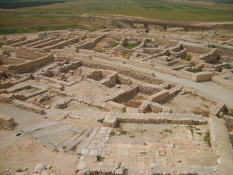
Byzantine Shivta covered approximately 8 hectares. Its built area measured about 80,762 square metres, with a perimeter of approximately 1,597 metres, a north to south length of about 390 metres, and a maximum width of about 290 metres. The settlement occupied an almost level area shaped by three very gentle slopes. Its irregular elliptical plan widened toward the north and south and narrowed near the centre, reflecting expansion from an earlier southern nucleus toward the north.
Town layout and water management
Streets and boundaries
Shivta had no formal defensive wall. Instead, buildings around the perimeter were joined so that their outer walls created a continuous boundary between the settlement and the desert. About nine generally unpaved streets followed the existing buildings rather than a single grid. Most were 4 to 5 metres wide, while the streets in the south were narrower. The main route ran north from the southern entrance past the southern church, the double reservoir, the governor’s house, and the central church toward a northern square.
Some routes were more regular than others. The road running northwest from the governor’s house was straight and consistently wide at least as far as the area north of the central church. Another regular route led from the northern square toward the northwestern edge of the settlement. Houses, public buildings, stables, workshops, water installations, wine presses, bath facilities, and squares occupied the spaces between these routes. Approximately 340 rooms were counted in the residential area, and some houses may have had two or three storeys.
Reservoirs and cisterns
Because Shivta had no natural springs, its water system collected and stored rainfall. Two large central reservoirs held approximately 1,500 cubic metres between them. Channels carried runoff from roofs, streets, and squares into public reservoirs and cisterns. When one cistern filled, overflow passed through connected channels into another, including a cistern beneath the narthex of the southern church. A narthex is an entrance vestibule attached to a church.
Private houses generally had one or more cisterns. Rainwater reached them through terracotta pipes built into the walls. This household system complemented the public reservoirs and connected the domestic buildings with the wider organization of the town’s water supply.
Houses and agricultural installations
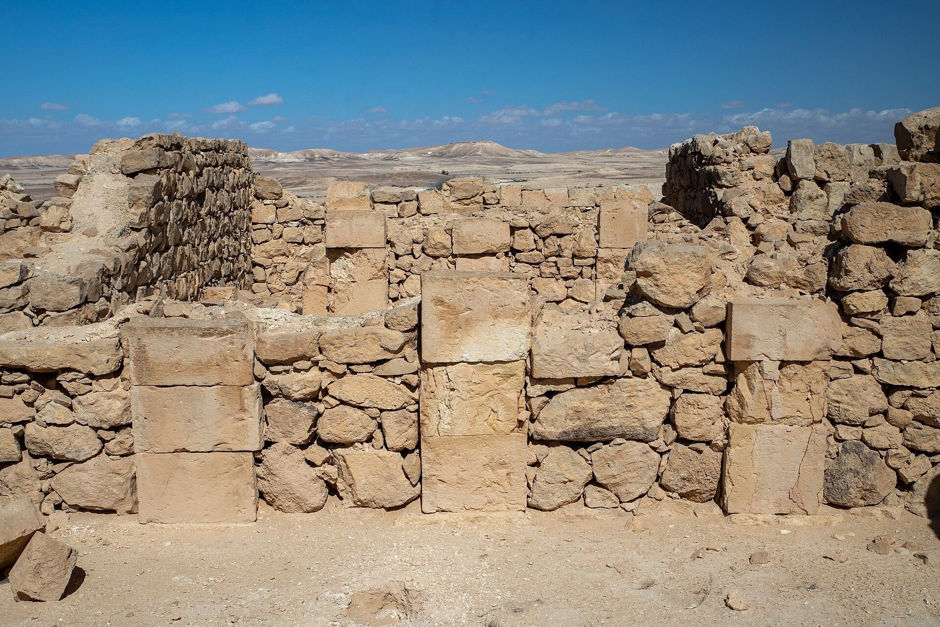
Residential buildings usually consisted of rooms arranged around an internal courtyard. Their outer walls generally had no windows facing the streets. The settlement’s buildings were constructed mainly from local limestone, while softer stone was used for arched elements. Timber was used sparingly, chiefly for interior cupboards and shelves. Private houses commonly had stone-vaulted roofs, whereas the churches used more wood.
Outside the built-up area, channels, dams, terraces, and irrigation works supported cultivation in the Lavan valley. A reconstructed Byzantine-period farm beside the approach road is used for experimental study of ancient irrigation, sowing, harvesting, and cultivation. The crops examined include grapes, figs, olives, pomegranates, apricots, nuts, and carob.
Churches and Christian complexes
Southern church
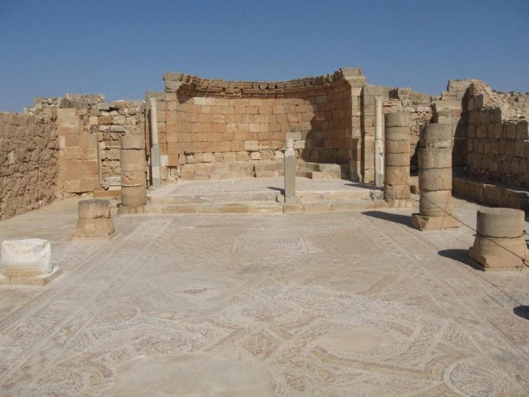
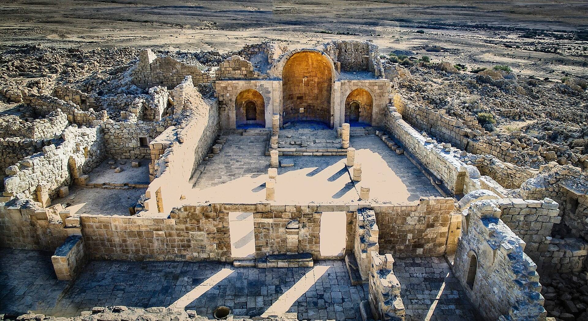
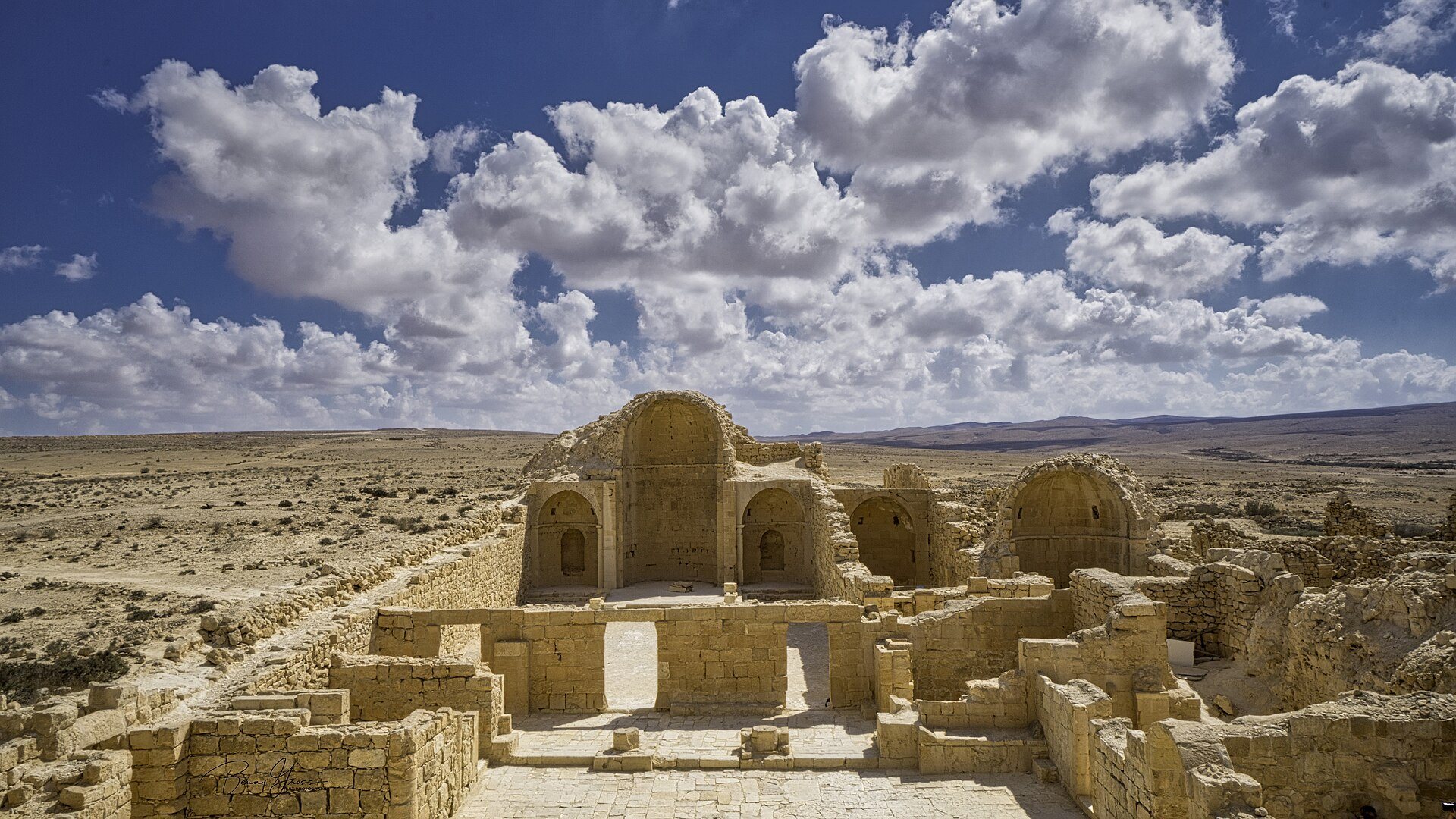
The southern church, probably Shivta’s oldest, was built in the 5th century on slightly raised ground. It was a three-aisled basilica, a longitudinal church divided into a central nave and side aisles, measuring approximately 19 by 14 metres. Its central apse, a rounded sanctuary end, was flanked by rectangular side rooms. The building had no atrium, or open forecourt, and its narthex opened directly onto the street above a municipal cistern.
A cross-shaped baptistery, a space or installation used for Christian baptism, was carved from a single block of stone. An inscription near the entrance refers to frequent pilgrim visits. Another inscription dates an annex to AD 415–430, while a further inscription records the paving of the southern aisle in AD 639 or 640, during the tenure of Bishop George and the archdeacon and steward Peter.
The side rooms beside the apse, known as pastophoria, were later converted into smaller apses containing reliquaries. Pastophoria were small rooms used for liturgical preparation or the storage of sacred objects. Their arrangement has been interpreted as evidence for the veneration of saints and martyrs, although the precise nature of any associated community remains uncertain.
The upper part of the southern apse once carried a wall painting probably representing the Transfiguration of Christ. The painted area measured approximately 2.5 by 2 metres. More colour and detail survive in its northern part, while the southern section preserves only traces. The fragment was removed from the church and transferred to the Rockefeller Museum in Jerusalem.
Central church
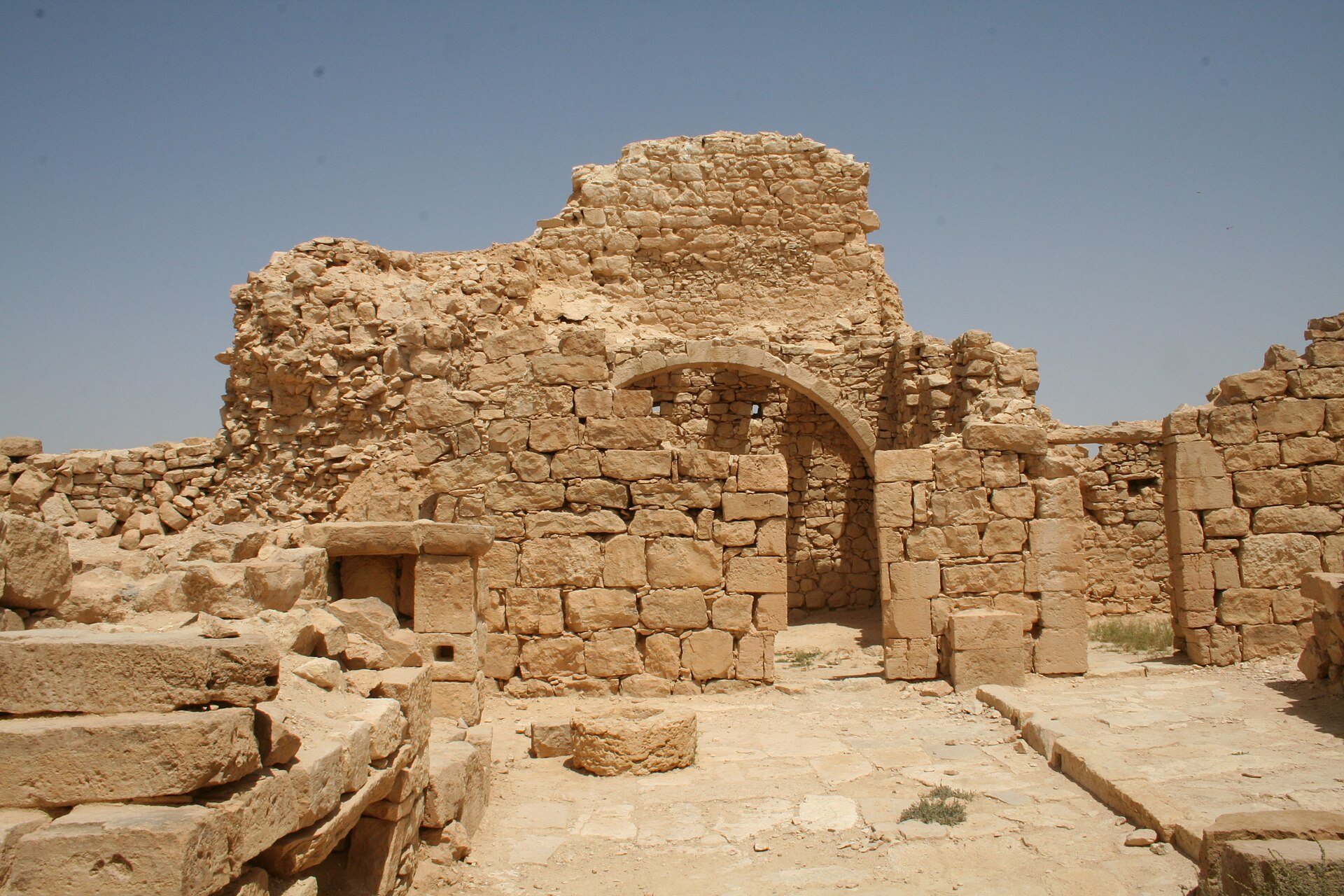
The central church was built in the 5th or 6th century and was probably the youngest of Shivta’s three churches. It was a three-aisled basilica roughly 17 to 18 metres long and 14 metres wide, with three apses and a narrow atrium or entrance vestibule with three arches. The church was built beside an existing street and above a cistern that continued to function after construction. Its inlet lay inside the church.
Buildings beside the side apses may have served monastic purposes. A decorated entrance and Christian symbols on the lintel suggest that the church may later have been converted into a monastery. Towers associated with the central complex may have provided refuge during periods of danger, although the building’s exact function is not established. An inscription found there invokes Saint Stephen.
Northern church and monastery
The northern church, also called the Church of Saint George, stood at the settlement’s northern edge beside a small square. It was a three-aisled basilica approximately 20 metres long and 15 metres wide, with a narthex and an atrium measuring about 12 by 10 metres. The church formed part of a monastery containing more than 40 rooms, including residential rooms, corridors, a possible dining room, a chapel, a baptistery, and an upper storey reached by stairs from the atrium.
Parts of the complex had marble-faced walls and floors. Its economic buildings included a grape press. The atrium contained a large cistern and a column interpreted either as a stylite’s column, associated with an ascetic who lived on a raised platform or column, or as part of a monument to a holy monk. Residential rooms bordered the western side, while the northern wall carried mosaics.
The church had three apses. The side apses and a chapel were added or altered in the 6th century, and the chapel preserved a mosaic. Burials in the church and atrium date from AD 506–646, while burials in the baptistery date from AD 614–679. Fragmentary wall paintings survive in the baptistery. One fragment shows a young male face, probably Christ, and another shows a wider haloed face, possibly John the Baptist, in what may be part of a 6th-century scene of Christ’s baptism in the Jordan.
A 9th-century Kufic inscription containing invocations to God was written on the plaster of the northern atrium wall and the northern narthex exedra. An exedra is a recessed or curved architectural space. The inscription belongs to the period after Shivta’s main settlement had declined.
Mosque
The mosque beside the southern church was a modest structure with a small courtyard leading to a trapezoidal prayer hall. Its mihrab, a niche indicating the direction of prayer toward Mecca, was inserted into the wall separating the mosque from the Christian baptistery. This alteration blocked the former northern entrance to the church while leaving the basilica substantially intact.
Residential, civic, and industrial areas
Large houses and governor’s house
A large house of approximately 400 square metres is sometimes called the Pool House. Another building, sometimes called the Stable House, preserves a staircase and stables. Both structures were built during the late Nabataean period and remained in use during the Byzantine period.
The building known as the governor’s house stood south of the central church beside a small irregular square formed by the meeting of streets. Its associated three-storey tower and public-looking construction led to its conventional identification as a governor’s residence, although its exact function is uncertain. Its surviving southern wall is approximately 5 metres high.
Workshops, baths, and commercial spaces
A workshop quarter of about 750 square metres adjoined the northern church and may have formed part of the church-monastery complex. Excavated facilities included pottery and dyeing workshops. Another area contained baths and approximately 36 commercial spaces arranged around a square, linking production and exchange with the settlement’s religious and residential buildings.
Wine presses
Three wine presses have been identified at Shivta. One near the northern church consisted of a treading basin, a terracotta pipe, a square collecting tank, and a settling basin. Another was found near the modern parking area. Together, the presses provide physical evidence for large-scale grape processing within the agricultural economy.
Mitspe Shivta
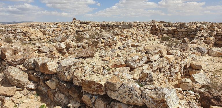
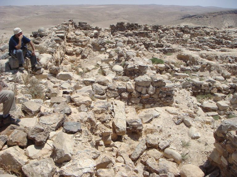
The ruins of a separate monastic complex known as Mitspe Shivta lie about 6 kilometres from the main settlement. Its entrance led across an open area to a building approximately 12 by 14.5 metres whose function is unknown. Nearby were a simple prayer hall measuring about 18.2 by 6.6 metres, with an apse 1.9 metres deep, partly rock-cut rooms interpreted as monks’ cells, and other incompletely excavated structures.
Mitspe Shivta dates from the late Byzantine period. It has been interpreted variously as a monastery, a superior’s residence, a guesthouse, or a desert way station. Its possible identification with a shelter for travellers and hermits mentioned by the anonymous Piacenza Pilgrim, a 6th-century Christian traveller in the Holy Land and eastern Mediterranean, remains uncertain.