America’s Stonehenge: An Archaeological Site in Salem, New Hampshire
Site at a Glance
- Rating
- 4.4
- Popularity
- Medium
- Country
- United States
- Primary era
- Classical
- External website
- Open
- Eras represented
- Classical
- Civilizations
- Unclassified
- Site type
- Civic
- Remains
- Monument
On this page16 sections
History
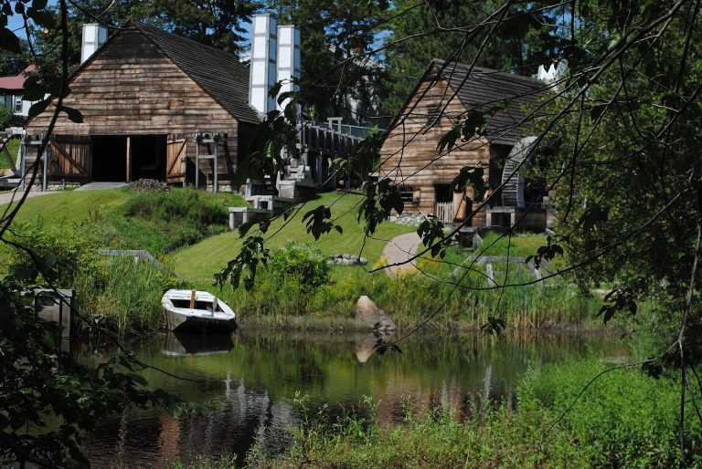
America’s Stonehenge is a privately owned archaeological site and open-air attraction at 105 Haverhill Road in Salem, New Hampshire, United States. Occupying roughly 30 acres, it contains large rocks, stone structures, caves, and archaeological features shaped by activity over many periods. Radiocarbon analysis places human occupation in the surrounding area about 4,000 years ago, while another interpretation dates charcoal pits to approximately 2000–173 BC. The present arrangement, however, reflects quarrying and extensive later movement of stones rather than a securely reconstructed ancient monument.
Early occupation and Indigenous evidence
The site’s early history remains difficult to establish because stones were quarried, relocated, and rearranged. Charcoal from the area has produced dates extending back about 4,000 years, and a separate interpretation places charcoal pits between approximately 2000 and 173 BC. Archaeological finds include Native American tools and pottery. In 1982, an excavation of a large stone in a quarry north of the main site recovered hundreds of stone chips and flakes. The research team interpreted this material as waste from stone-tool manufacture consistent with Indigenous American techniques, although the material could not be dated.
Other evidence points to later Indigenous activity. The remains of a wigwam were found in the area, and two nearby fire pits date to about 2,000 years ago. A canoe dating to approximately 300 years ago is preserved in the site museum. These finds provide evidence for human use of the area, but they do not establish that the present stone arrangements were created during any one ancient period.
Colonial and nineteenth-century history
Quarrying substantially altered the landscape, and many stones were moved during the nineteenth century. Some may have been transported to Lawrence, Massachusetts, for dam construction and street paving, although that attribution remains uncertain. Many surviving stones carry drill marks associated with quarrying after about 1830.
Jonathan Pattee lived in the woods between 1826 and 1848 and reportedly used caves at the site for storage. Pattee and his son Seth have also been associated with a tradition that they operated an Underground Railroad station. The Underground Railroad was the informal nineteenth-century network that helped enslaved people escape from the American South. This association remains an interpretation rather than an established conclusion, although shackles linked to the tradition are kept in the museum.
Local farmers may have assembled or modified some of the stones during the eighteenth and nineteenth centuries. That possibility, together with quarrying and later relocation, has made it difficult to separate older features from more recent changes.
Goodwin’s Mystery Hill
William Goodwin, an insurance executive, acquired the property in 1937. He first called it Mystery Hill, a name that remained official until 1982. The phrase “America’s Stonehenge” had appeared in a newspaper article during the 1960s, but the later renaming was intended to distinguish the site from roadside oddity attractions and to present it as an ancient archaeological place.
Goodwin promoted the theory that medieval Irish religious figures known as the Culdees had occupied the site before Columbus. The Culdees were associated with Irish monastic communities, but their alleged presence here has not been confirmed by archaeological evidence. Goodwin moved and rearranged stones to fit this interpretation, substantially complicating the site’s archaeological history. The site has not been connected archaeologically with Stonehenge in England, and New Hampshire Historical Marker No. 72 refers to it as Mystery Hill.
Related theories have proposed that the stones formed an astronomical calendar or observatory capable of indicating lunar and solar events. These interpretations remain unverified. The theory of a pre-Columbian Irish settlement was also linked to the tradition of St. Brendan, an Irish Christian priest associated with a legendary Atlantic voyage, but archaeological evidence has not confirmed such an occupation. Claims of Phoenician, Ogham, or other Old World inscriptions were advanced by Barry Fell, a marine biologist and amateur epigraphist. His interpretations have been widely regarded as pseudoarchaeological.
Preservation, interpretation, and public controversy
Robert Stone leased the property in 1950, purchased it in 1956, and began restoration and preservation work. In 1958, he established an open-air museum at the site. David Stewart-Smith, who served as director of restoration at Mystery Hill, led the 1982 quarry excavation under the supervision of the New Hampshire state archaeologist.
Competing interpretations continued to attract public attention. A 1977 television program proposed a Minoan origin, while a 2002 program included archaeologist Curtis Runnels rejecting the theory that ancient Celts built the structures. Runnels also rejected the Celtic interpretation more broadly. The proposed European connections involve Celts, Phoenicians, Minoans, and the Culdees, but none has been archaeologically demonstrated at the site. Bronze Age artifacts have not been found there, and a European artifact from that period has not been found elsewhere in the New World.
H. P. Lovecraft visited Mystery Hill sometime between 1928 and the 1930s. The site is popularly said to have inspired his story “The Dunwich Horror,” but the chronology of his visit places it too late to have influenced the 1929 story. In 2019, the site was vandalized with power tools. On March 4, 2021, New Hampshire State Police arrested Mark L. Russo and charged him with criminal mischief after QAnon-related inscriptions were etched into the so-called sacrificial table.
Remains
The surviving site consists of large rocks and stone structures scattered across roughly 30 acres in Salem. Its physical arrangement combines natural and worked stone, quarry areas, caves, archaeological deposits, and features altered by nineteenth-century quarrying and later relocation. William Goodwin and others moved stones while attempting to restore them to positions they believed were original, so the present layout reflects both earlier activity and modern reconstruction.
Quarry and archaeological features
North quarry megalith
A quarry containing a large stone lies north of the main area. Excavation around the megalith produced hundreds of stone chips and flakes, interpreted by the research team as waste from the manufacture of stone tools using Indigenous techniques. The material could not be dated, so the excavation supports an interpretation of tool production without fixing the age of the quarry activity.
Wigwam area and fire pits
The remains of a Native American wigwam were found in the area, and a replica now stands beside the trail. Two associated fire pits date to about 2,000 years ago. Together with the Native American tools and pottery recovered at the site, these features provide physical evidence of Indigenous use of the landscape.
Caves and underground chambers
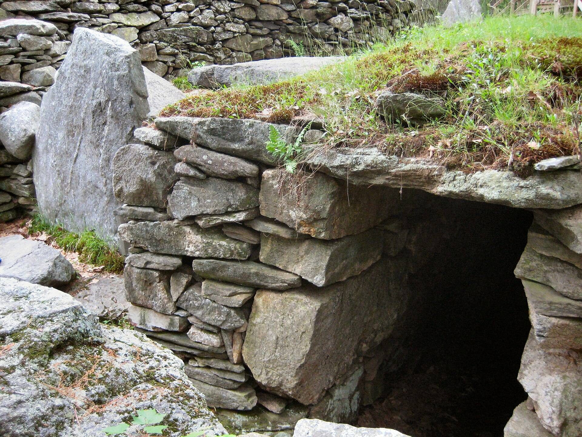
Caves or underground chambers form another part of the site. In 1907, they were described as still intact and were associated with Jonathan Pattee’s reported use of the area for storage between 1826 and 1848. The associated tradition concerning the Underground Railroad is represented in the museum by shackles connected with the claim.
Stone structures and disputed interpretations
The sacrificial stone
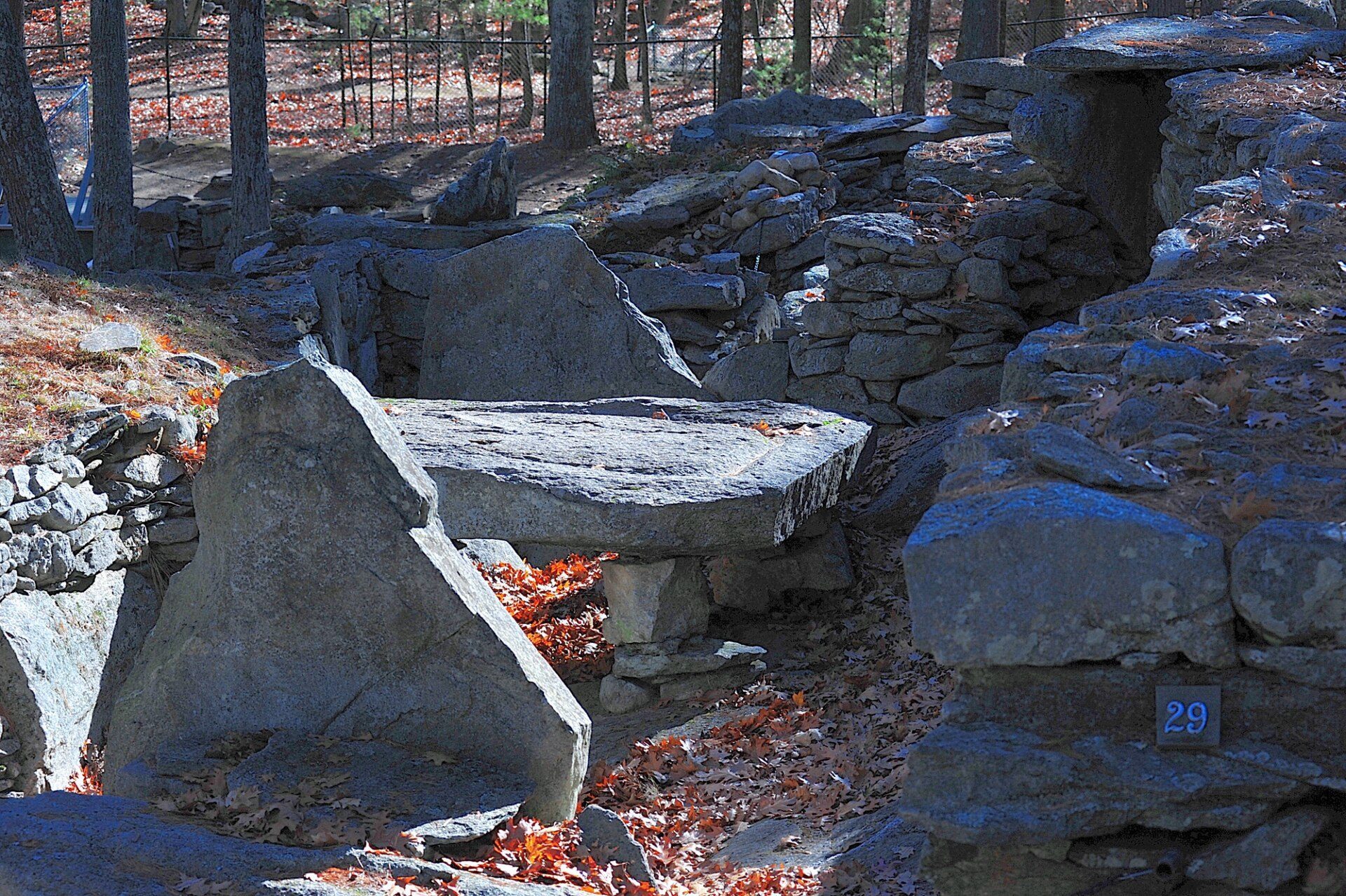
The so-called sacrificial stone is a flat slab weighing about 4.5 tons and measuring approximately 9 feet long by 6 feet wide. Four stone supports hold it above the ground, and a groove runs around its edge. Some interpretations describe the groove as a channel for sacrificial blood. Other interpretations identify the slab as a lye-leaching stone, a farm installation used to draw alkaline lye from wood ash for soapmaking, or as the bedstone of a cider press whose grooves collected cider. Comparable lye-leaching stones were used on colonial farms in New England.
Marked stones
Some stones carry marks that Barry Fell interpreted as Phoenician, Ogham, or related inscriptions. Ogham was an early medieval writing system associated mainly with Ireland and Britain. Other explanations identify the marks as plow traces, quarrying damage, natural cracks, or scratches. Because stones were moved from their earlier positions, their original archaeological context has been disturbed, making the marks difficult to date or interpret.
Museum collections and surrounding area
Displayed objects
The site museum contains Native American tools and pottery, a canoe dating to approximately 300 years ago, and shackles associated with the alleged Underground Railroad tradition. These objects represent different periods of use and interpretation at the site, rather than a single continuous cultural complex.
Recreational landscape
The archaeological area forms part of a broader recreational setting that includes snowshoe trails and an alpaca farm. These present-day uses occupy the same roughly 30-acre property as the stone features, quarry, caves, and archaeological remains.