Cañada de la Virgen: An Otomi-Associated Archaeological Center in Mexico
Site at a Glance
- Rating
- 4.7
- Popularity
- Medium
- Country
- Mexico
- Primary era
- Medieval
- Eras represented
- Medieval
- Civilizations
- Toltec
- Site type
- Religious
- Remains
- Sanctuary
On this page13 sections
History
Cañada de la Virgen is an Otomi-associated pre-Hispanic archaeological complex near San Miguel de Allende in Guanajuato, Mexico. Built by Toltec-Chichimec groups after the decline of Teotihuacan, it developed around AD 530–540 and flourished within the central Laja River basin until about AD 1050. Its design connected ritual activity, agriculture, hunting, gathering, exchange, and the observation of celestial cycles.
Regional Development and Foundation
The settlement emerged within a region shaped by earlier cultural traditions. The Chupícuaro tradition disappeared around AD 350, while the Sunken Patio tradition continued approximately from AD 350 to 900. The latter was associated with advanced agriculture, monumental pyramidal buildings, and the expansion of cultivation into new areas. Cañada de la Virgen formed part of a larger social organization linked to the Toltec political system and to settlements established along the central Laja basin.
Its main period of activity extended from about AD 540 to 1050. The settlement occupied the northern frontier of Mesoamerica and maintained connections with other Mesoamerican regions through exchange. People used the surrounding semi-desert environment for farming, hunting, and gathering. The location and arrangement of the complex were selected in relation to agricultural needs, religious beliefs, and astronomical cycles.
Toltec Expansion and Abandonment
The decline of Cañada de la Virgen began around AD 900. Surface plumbate ceramics, a distinctive high-fired Mesoamerican pottery type useful for dating occupations and tracing exchange, associate its final occupation with the period of maximum Toltec expansion. Other interpretations place the site within a phase of proto-Toltec expansion between approximately AD 900 and 1000, rather than connecting its abandonment with the collapse of Tula around AD 1200.
The complex was abandoned by approximately AD 1040–1050. In later centuries, the surrounding region became associated with Chichimec groups, including the Guachichiles, Guamares, Copuces, Guaxabanes, Pames, and Otomi. Earlier inhabitants had created a settlement whose religious and calendrical system centered on the Moon, Sun, and Venus. The complex probably served as an astronomical and religious center, with observations helping to identify periods important for agriculture, hunting, and gathering.
Archaeology and Protection
Mexico’s National Institute of Anthropology and History, the federal institution responsible for archaeological research, conservation, and heritage protection, registered Cañada de la Virgen in 1985. Looting and vandalism led to partial restoration work in 1989, when intervention was required to prevent the southwest corner of Complex A from collapsing and to stabilize its upper bodies.
Initial excavation began in 1995, followed by official archaeological excavation in 2002. Research and protection have continued through cooperation between the National Institute of Anthropology and History and local authorities. The complex opened to the public on February 15, 2011, while access remained controlled because the archaeological land is privately owned.
Remains
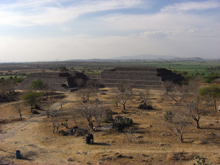
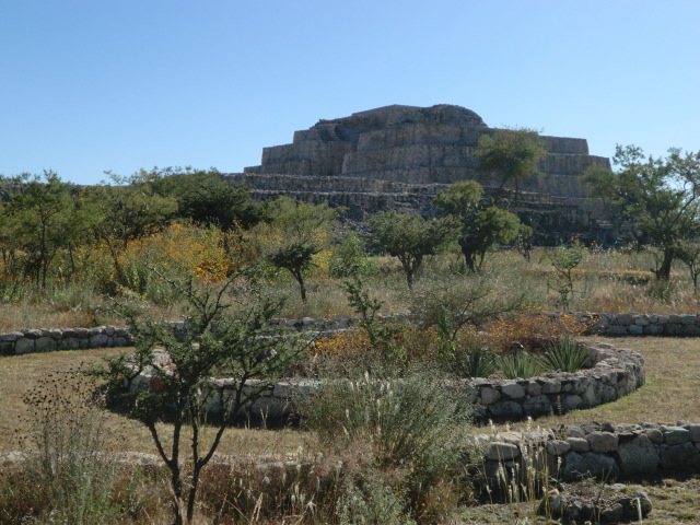
Cañada de la Virgen covers approximately 12 hectares on a plateau in the central Laja River basin. The builders created an artificially filled surface with an inclination of about 18 degrees. Seven monumental structures of different sizes and forms are arranged in five architectural groups, with sunken patios, plazas, esplanades, a ballgame area, and a ceremonial road approximately 1 kilometre long. The principal axis runs east to west, relating the buildings to the rising and setting of the Sun and Moon, while the complex’s position provided a visual domain over the river basin.
Astronomical Complexes
Complex A, House of the Thirteen Heavens
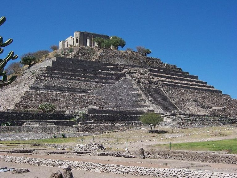
Complex A is the principal astronomical group. It includes a sunken patio, a pyramidal basement more than 15 metres high, platforms on the east, north, and south sides, a main esplanade, side annexes, a closed patio, a southern esplanade, and a road. The sunken patio may have functioned as a water mirror, allowing priests to observe the sky and interpret celestial events connected with agricultural cycles.
The Moon’s movement across the pyramid corresponded to notches and other architectural points associated with stages of the lunar calendar and periods around the solstices. The pyramidal basement has six stepped bodies. At the summit, remains of an upper building include central and side patios, with a central staircase dividing the upper structure into two sections.
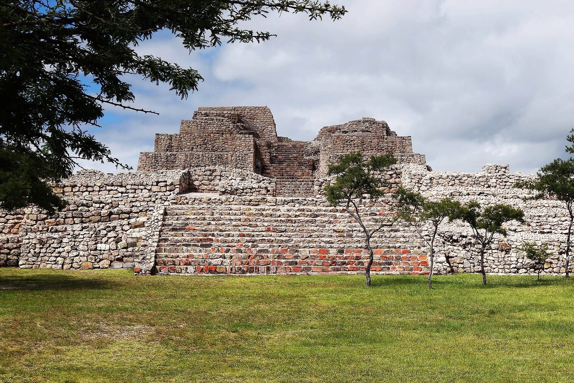
Stone walls in the upper building were coated with plaster and stucco made from lime and sand. Paint residues show red oxide during the penultimate occupation and ochre during the final occupation. The upper area includes the Red Temple and an abstract mural of horizontal red and black bands, interpreted as an allusion to day and night. A room near the southwest corner preserves evidence of the building, while much of the northwest corner was lost after dynamite damage in the late 1940s.
Funerary discoveries from Complex A have supported studies of cranial deformation, burial practices, ancestral veneration, and rituals associated with the foundation of the settlement.
Complex B, House of the Longest Night
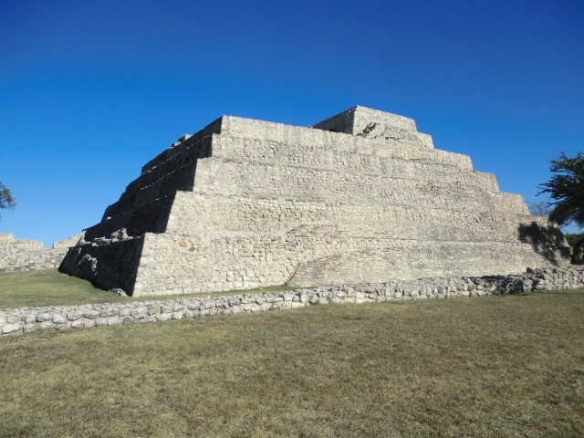
Complex B occupies the central area of the site. Its elements include a pyramidal basement, a sunken patio, platforms, an upper building, and an elevated western esplanade forming part of the main plaza. The upper building is displaced toward the south rather than centered on the plaza. Its basement is asymmetrical, faces southwest, and has rooms along the southern sides of its walls. This arrangement is also known from the Yucatec Puuc area.
A cross-shaped substructure probably served public and ritual purposes. Another road may have extended from the southern side of the basement toward a different part of the ravine surrounding the complex. Fragments of a stone anthropomorphic sculpture found in the patio may represent the head and left foot of a person from northern Mesoamerica during the Postclassic period.
Additional Architectural Groups
Complex D
Complex D stands in the northern part of the site. Its lower bodies are rectangular, while its upper bodies are circular, producing a mixed plan that is rare among structures in the region.
Complex E
Complex E lies south of the other groups. Its stepped pyramidal basement forms a patio open to the south. A stonework fragment at the northeast corner may belong to a frieze or a jamb.
The Principal Plaza
The principal plaza lies west of the central structures and includes Basements A and B. Basement A is the largest and most complex of these elements, incorporating a stepped pyramid, stairways, an upper temple, central and side patios, an esplanade, and an avenue.
Materials, Production, and Finds
Furnaces in the northeastern area indicate the exploitation of local limestone deposits. Excavations have also recovered pottery vessels, metates, seeds, metals, and human remains. These materials complement the architectural evidence for a settlement that combined food production, craft activity, ritual practice, and regional interaction.
The pyramidal basements, patios, plazas, esplanades, and long avenue were built on a monumental scale. Their arrangement joins the east-west axis, celestial observation, agricultural timing, and the surrounding Laja River basin within a single planned complex.